


Summary
Ackworth is a city in Warren County, Iowa, United States. The population was 115 at the 2020 census.[3]
Ackworth, Iowa | |
|---|---|
 | |
| Coordinates: 41°21′51″N 93°28′20″W / 41.36417°N 93.47222°W | |
| Country | |
| State | |
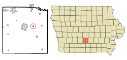
| County | Warren |
| Area | |
| • Total | 0.55 sq mi (1.43 km2) |
| • Land | 0.55 sq mi (1.43 km2) |
| • Water | 0.00 sq mi (0.00 km2) |
| Elevation | 863 ft (263 m) |
| Population (2020) | |
| • Total | 115 |
| • Density | 209.09/sq mi (80.70/km2) |
| Time zone | UTC-6 (CST) |
| • Summer (DST) | UTC-5 (CDT) |
| ZIP code | 50001 |
| Area code | 515 |
| FIPS code | 19-00235 |
| GNIS feature ID | 2393878[2] |
History edit
Ackworth was laid out in 1874. The community most likely was named after the Ackworth School, in England.[4] In 1878, the Chicago, Burlington and Quincy Railroad was extended to the town.[5] Ackworth was incorporated in 1881.[6]
Geography edit
According to the United States Census Bureau, the city has a total area of 0.29 square miles (0.75 km2), all of it land.[7]
Demographics edit
| Year | Pop. | ±% |
|---|---|---|
| 1900 | 134 | — |
| 1910 | 119 | −11.2% |
| 1920 | 95 | −20.2% |
| 1930 | 82 | −13.7% |
| 1940 | 67 | −18.3% |
| 1950 | 95 | +41.8% |
| 1960 | 77 | −18.9% |
| 1970 | 111 | +44.2% |
| 1980 | 83 | −25.2% |
| 1990 | 66 | −20.5% |
| 2000 | 85 | +28.8% |
| 2010 | 83 | −2.4% |
| 2020 | 115 | +38.6% |
| Total Population for Iowa's Incorporated Places: 1850-2000 Source: | ||

Ackworth is part of the Des Moines–West Des Moines Metropolitan Statistical Area.
2010 census edit
As of the census[9] of 2010, there were 83 people, 33 households, and 26 families residing in the city. The population density was 286.2 inhabitants per square mile (110.5/km2). There were 38 housing units at an average density of 131.0 per square mile (50.6/km2). The racial makeup of the city was 100.0% White. Hispanic or Latino of any race were 1.2% of the population.
There were 33 households, of which 30.3% had children under the age of 18 living with them, 69.7% were married couples living together, 9.1% had a female householder with no husband present, and 21.2% were non-families. 21.2% of all households were made up of individuals, and 9.1% had someone living alone who was 65 years of age or older. The average household size was 2.52 and the average family size was 2.92.
The median age in the city was 44.7 years. 21.7% of residents were under the age of 18; 2.3% were between the ages of 18 and 24; 27.6% were from 25 to 44; 28.8% were from 45 to 64; and 19.3% were 65 years of age or older. The gender makeup of the city was 51.8% male and 48.2% female.
2000 census edit
As of the census[10] of 2000, there were 85 people, 31 households, and 27 families residing in the city. The population density was 284.8 inhabitants per square mile (110.0/km2). There were 32 housing units at an average density of 107.2 per square mile (41.4/km2). The racial makeup of the city was 98.82% White, 1.18% from other races. Hispanic or Latino of any race were 1.18% of the population.
There were 31 households, out of which 41.9% had children under the age of 18 living with them, 74.2% were married couples living together, 16.1% had a female householder with no husband present, and 9.7% were non-families. 9.7% of all households were made up of individuals, and 3.2% had someone living alone who was 65 years of age or older. The average household size was 2.74 and the average family size was 2.89.
Age spread: 23.5% under the age of 18, 7.1% from 18 to 24, 32.9% from 25 to 44, 24.7% from 45 to 64, and 11.8% who were 65 years of age or older. The median age was 38 years. For every 100 females, there were 97.7 males. For every 100 females age 18 and over, there were 91.2 males.
The median income for a household in the city was $32,500, and the median income for a family was $38,438. Males had a median income of $30,625 versus $26,875 for females. The per capita income for the city was $17,478. There were 10.3% of families and 6.5% of the population living below the poverty line, including 13.3% of under eighteens and none of those over 64.
References edit
- ^ "2020 U.S. Gazetteer Files". United States Census Bureau. Retrieved March 16, 2022.
- ^ a b U.S. Geological Survey Geographic Names Information System: Ackworth, Iowa
- ^ a b "2020 Census State Redistricting Data". census.gov. United states Census Bureau. Retrieved August 12, 2021.
- ^ Savage, Tom (August 2007). A Dictionary of Iowa Place-Names. University of Iowa Press. p. 20. ISBN 978-1-58729-759-5.
...inspired by the largest Quaker school in England at the time, called Ackworth.
- ^ The History of Warren County, Iowa: Containing a History of the County, Its Cities, Towns, &c, Volume 1. Higginson Book Company. 1879. p. 506.
- ^ "List of Incorporated Cities" (PDF). Iowa Secretary of State. Retrieved January 9, 2020.
- ^ "US Gazetteer files 2010". United States Census Bureau. Archived from the original on July 2, 2012. Retrieved May 11, 2012.
- ^ "Census of Population and Housing". Census.gov. Retrieved June 4, 2015.
- ^ "U.S. Census website". United States Census Bureau. Retrieved May 11, 2012.
- ^ "U.S. Census website". United States Census Bureau. Retrieved January 31, 2008.