


Summary
Appledore is a village and civil parish[2] in the Ashford District of Kent, England. The village centre is on the northern edge of the Romney Marsh, 12 miles (19 km) south-west of Ashford town.[3] The northerly part of this village is Appledore Heath.
| Appledore | |
|---|---|
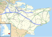
 Appledore Location within Kent | |
| Area | 12.46 km2 (4.81 sq mi) |
| Population | 832 (Civil Parish 2021)[1] |
| • Density | 67/km2 (170/sq mi) |
| OS grid reference | TQ956295 |
| Civil parish |
|
| District | |
| Shire county | |
| Region | |
| Country | England |
| Sovereign state | United Kingdom |
| Post town | ASHFORD |
| Postcode district | TN26 |
| Dialling code | 01233 |
| Police | Kent |
| Fire | Kent |
| Ambulance | South East Coast |
| UK Parliament | |
History edit
The name Appledore comes from the Old English apuldre (meaning apple tree) and is first recorded in the 10th century.[4] Although a Brythonic origin is more likely (given the widespread survival of Brythonic names in Kent) e.g. from or connected with "dwr/dor" meaning water.
Appledore was once a port on the estuary of the River Rother. Famously, the greater part of the Danish army (280 ships - 5000 men) wintered at Appledore in 892–93, before moving into Wessex and suffering defeat at the hands of the Saxons led by King Alfred's son Edward the Elder at Farnham in Surrey. The defeated Danes fell back to Benfleet in Essex where they were again defeated in battle. The importance of Appledore as a port diminished suddenly in the 13th-century when two great storms - the first on 4 February 1287 and again sometime the following December - caused the river Rother to change its course; the village street now leads down to the Royal Military Canal. A French raid in 1380 resulted in the burning of the church: it was later rebuilt. The village was permitted to hold a market in the main street by Edward II. In 1804, when there was threat of invasion by Napoleon the Royal Military Canal was built: Appledore stands on its northern bank.[5] The Rhee Wall, a 13th-century waterway, was built to carry silt away from the eastern part of the Romney Marsh; it runs from Appledore to New Romney.
In film, the media and literature edit
Appledore was the setting for A. A. Milne's famous verse poem, "The Knight Whose Armour Didn't Squeak". Milne lived 29 miles (47 km) west in Hartfield, Sussex.
The fictional village of Plummergen, in the "Miss Seeton" series of crime novels by Heron Carvic, is based on Appledore.[6]
Appledore features in the series Darling Buds of May.
Religion edit
The medieval parish church is dedicated to Saints Peter and Paul.[7]
Transport edit
The B2080 is a local road connecting Appledore with Tenterden and Brenzett, where it meets the A259 South Coast Trunk Road. The Royal Military Road follows the canal southwest from Appledore to Rye.[8]
The Marshlink Line railway line runs between Ashford International and Hastings via Appledore railway station, which is around 1.5 miles (2.4 km) from the village.[9] The line reduces from dual to single track beyond the station towards Rye and Hastings.[10]
Education edit
St Augustine of Canterbury Catholic Primary School is located in the area.
Parkwood edit

Parkwood is an 80-acre (320,000 m2) woodland 5 miles (8.0 km) east south east of Tenterden near Appledore.
A car park is along the Woodchurch Road, heading north from Appledore towards Brattle.
It is managed by Kent County Council's Country Parks service.[11] It is noted for its bluebells in spring and for nightingales. There are woodland walks and panoramic views over Appledore and Romney Marshes.
The woodland is frequently coppiced for various timber uses. Including oak thinnings being used in Shorne Woods Country Park's new visitor centre, as the window and roof joinery.[12]
The wood, is surrounded by three other woods, Great Heron Wood (to the North), Little Heron Wood (to the East) and Butness Wood (further to the East).
References edit
- ^ Key Statistics; Quick Statistics: Population Density United Kingdom Census 2021 Office for National Statistics
- ^ "Appledore Kent".
- ^ Mills, Stephen. "Whoops, the requested page was not found - Ashford Borough Council".
- ^ "Appledore Kent - (Danes invade England) - an English Village (UK)". Archived from the original on 14 April 2010. Retrieved 8 April 2010.
- ^ Historical notes Archived April 11, 2010, at the Wayback Machine
- ^ Booktrail to Plummergen with Miss Seeton[1]
- ^ Appledore parish church Archived May 15, 2006, at the Wayback Machine
- ^ "Tenant Guide to Houses for Rent in Ashford Kent". www.evolutionproperties.co.uk.
- ^ White, H.P. (1976). Forgotten Railways : Vol 6 – South-East England. David & Charles. p. 97. ISBN 0-946537-37-2.
- ^ Gray, Adrian (1990). South Eastern Railway. Middleton Press. p. 211. ISBN 978-0-906-52085-7.
- ^ "Parkwood Picnic Site". Archived from the original on 5 March 2012. Retrieved 10 July 2012.
- ^ "Shorne Wood's Sweet chestnut cruck frame -".
External links edit
 Media related to Appledore, Kent at Wikimedia Commons
- KentGuide's comprehensive page about Appledore
- Appledore in the Domesday Book