


Summary
Boyle (/ˈbɔɪl/; Irish: Mainistir na Búille[8]) is a town in County Roscommon, Ireland. It is located at the foot of the Curlew Mountains near Lough Key in the north of the county. Carrowkeel Megalithic Cemetery, the Drumanone Dolmen and the lakes of Lough Arrow and Lough Gara are also close by. As of 2016[update], the population of the town was 2,568.[1]
Boyle
Mainistir na Búille | |
|---|---|
Town | |
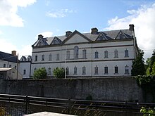
 Market Square | |
 Boyle Location in Ireland | |
| Coordinates: 53°58′23″N 8°18′04″W / 53.973°N 8.301°W | |
| Country | Ireland |
| Province | Connacht |
| County | County Roscommon |
| Government | |
| • Dáil Éireann | Sligo–Leitrim |
| • EU Parliament | Midlands–North-West |
| Elevation | 83 m (272 ft) |
| Population | 2,568 |
| Time zone | UTC±0 (WET) |
| • Summer (DST) | UTC+1 (IST) |
| Eircode routing key | F52 |
| Telephone area code | +353(0)71 |
| Irish Grid Reference | G797019 |
| Year | Pop. | ±% |
|---|---|---|
| 1813 | 2,272 | — |
| 1821 | 3,407 | +50.0% |
| 1831 | 3,433 | +0.8% |
| 1841 | 3,235 | −5.8% |
| 1851 | 2,727 | −15.7% |
| 1861 | 3,098 | +13.6% |
| 1871 | 3,347 | +8.0% |
| 1881 | 2,994 | −10.5% |
| 1891 | 2,464 | −17.7% |
| 1901 | 2,477 | +0.5% |
| 1911 | 2,691 | +8.6% |
| 1926 | 2,323 | −13.7% |
| 1936 | 1,727 | −25.7% |
| 1946 | 2,071 | +19.9% |
| 1951 | 1,934 | −6.6% |
| 1956 | 1,835 | −5.1% |
| 1961 | 1,739 | −5.2% |
| 1966 | 1,789 | +2.9% |
| 1971 | 1,939 | +8.4% |
| 1981 | 2,252 | +16.1% |
| 1986 | 2,383 | +5.8% |
| 1991 | 2,197 | −7.8% |
| 1996 | 2,222 | +1.1% |
| 2002 | 2,205 | −0.8% |
| 2006 | 2,522 | +14.4% |
| 2011 | 2,588 | +2.6% |
| 2016 | 2,568 | −0.8% |
| 2022 | 2,915 | +13.5% |
| [1][2][3][4][5][6][7] | ||
History edit
Early history edit
On 15 August 1599, the Battle of Curlew Pass between English and Irish forces was fought in the Curlew mountains during the Nine Years' War, between an English force under Sir Conyers Clifford and a native Irish force led by Aodh Ruadh Ó Domhnaill (Red Hugh O'Donnell). The English were ambushed and routed while marching through a pass in the Curlew Mountains, with the English forces suffering heavy casualties. Losses by allied Irish forces were not recorded. The Queen's principal secretary, Sir Robert Cecil, rated this defeat (and the simultaneous defeat of Harrington in Wicklow) as the two heaviest blows suffered by the English in Ireland.[citation needed]
Boyle suffered hardship during the famine years (1847–49). The following quote from the novel Woodbrook is one example: A retired herd, Mick Maxwell, speaking to Thompson about his grandfather during the famine, related the following: 'when his grandfather, the only man strong enough, brought fifty and sixty corpses on a barrow, one by one, two miles from Cootehall near his home to the graveyard at Ardcarne'.[citation needed]
19th century edit
In 1859, Fraser's Ireland described Boyle as including a "sessions-house [courthouse], hospitals, schools, the houses and offices for the agents of the Lorton Estate, the police barracks, Church, Methodist chapel, public garden". The entry also noted the "preservation of the fine ruins of the Abbey of Boyle, one of the most interesting of all our ecclesiastical structures", and that the town was "one of the principal towns of County Roscommon, and carries on a considerable retail trade in the supply of necessaries for the surrounding district".[9]
By 1881 Slater's directory reported the town had a dispensary, three banks, three hotels and two newspapers. Boyle also had a post office, 40 grocery shops, 25 pubs (sixteen of which were also groceries), 12 bakeries and an assortment of businesses including fire insurance companies, booksellers, ironmongers and hardware stores, butchers, an auctioneer and churches for both Protestants and Catholics.[citation needed]
20th century edit
In 1917, Sinn Féin won their first ever seat in parliament for the constituency of Roscommon North, centred on Boyle, with the election of George Noble Plunkett. Plunkett's son, Joseph Mary Plunkett, had been executed by the British in May 1916 for his association with the 1916 Rising. Michael Collins campaigned on the candidate's behalf, as did Michael O'Flanagan, later to become President of Sinn Féin. A plaque on the courthouse, on The Crescent in Boyle, commemorates this. This was the first by-election following the Easter Rising of 1916 and it was crucial that the democratic mandate be obtained by Sinn Féin.[citation needed]
Landmarks edit
King House edit
King House is an early Georgian mansion located in the centre of the town and was restored in 1989 after some years of neglect, including surviving potential demolition for a car park.[10] The house was built for Sir Henry King (d. 1839) MP, 3rd. Lord Kingston, between 1720 and 1740, whose family were one of the most wealthy in Ireland. It was subsequently home to Edward King, 1st Earl of Kingston. The design is attributed to William Halfpenny (d. 1755) who was an assistant to Edward Lovett Pearce.[11]
The large U-shaped house may incorporate walls from an earlier 17th century house which was burnt.[12] It is unusual in Ireland for the 'big house' to be located in the town, as most houses are situated in a demesne. It is also unusual for the floors to be vaulted. Perhaps, according to Rev. Daniel Beaufort, this is a response to the earlier fire.[citation needed]
Since 1810, when the King Family moved to Rockingham, the house had been used as a military barracks. Throughout the nineteenth century, it was the home of the Connaught Rangers, adapted as a barracks for twelve officers and 260 soldiers. On the foundation of the Irish Free State in 1922, the newly formed Irish National Army took possession of the house and it was renamed Dockery Barracks in honour of a commanding officer killed in Boyle during the Civil War.
Roscommon County Council purchased the building in 1987 and began a restoration project in 1989 following years of neglect. Using artisans and local craftsmen who employed traditional techniques and materials, the three floors and basement were restored. Included in the restoration were the main entrance gallery with its tripartite windows and original fireplace, the vaulted ceilings on all floors, and the main salon which is in use again as a venue for recitals and banquets. The other rooms in the house are used for temporary exhibitions and these are open to visitors. In The Kings of Connaught exhibition, visitors are led through a series of tableaux. The displays, ranging all over the floors, cover four main themes: The Kingdom of Connaught - from the earliest recorded times showing the importance of the clans and their kings; The King Family - meet the families who lived in the house from Sir John King who came to Boyle in 1603 to the fascinating accounts of life, both for the family and the staff, at Rockingham Estate (now Lough Key Forest Park); The Restoration - a room left partially restored so that visitors can see the fabric of the house.
Boyle Abbey edit

The Cistercian abbey was founded in the 12th century under the patronage of the local ruling family, the MacDermotts and is one of the best preserved in Ireland.[citation needed] It was colonised from Mellifont in 1161. The building of the chancel and the transepts with their side-chapels probably began shortly after this date, though the lancet windows in the east gable were inserted in the 13th century.
There is a combination of rounded and pointed arches in the transepts and crossing. The existing large square tower formed part of the church from the beginning, though it was raised in height at a later stage. The five eastern arches of the nave and their supporting pillars were built at the end of the 12th century, and have well-preserved capitals typical of the period.[citation needed] Although built at the same time, the arches of the northern side of the nave are different in type and have differently shaped columns and capitals. The three westernmost arches in the south arcade which have leafed and figured capitals were built after 1205, as was the west wall before the church was finally consecrated in 1218.
Nothing remains of the cloister, but on the eastern side, there are two doorways of c.1200, now blocked up. On the west side, there is a two-storey gatehouse, which acts as an interpretative centre. The rest of the buildings surrounding the cloister are largely 16th or 17th century. The Abbey was one of the most important in Connacht,[citation needed] and was invaded by Richard de Burgo, Maurice Fitzgerald, and Justiciar, in 1235. In 1659, the Cromwellians occupied the monastery and did a great deal of destruction. Though damaged during the 17th and 18th centuries when it was used to accommodate a military garrison, Boyle Abbey is one of the best preserved structures of its type,[citation needed] and attracts thousands of visitors per year.[citation needed] A restored gatehouse 16th/17th century vintage houses an exhibition. The Abbey is now a national monument in state care.
There is a Sheela na gig hidden above one of the central Romanesque arches. It can be seen from ground level, just at the top of the column, where the arch begins.
Lough Key Forest Park edit

Situated off the N4 is Lough Key Forest Park, a parkland area that has a visitor centre and activity facilities, including Boda Borg, a puzzle solving activity centre which is a Swedish concept originally unique to Sweden but now has locations in Ireland and the United States.[13] The park covers 800 acres (3.2 km2), and was formerly part of the Rockingham estate. This was the seat of the Stafford-King-Harman[14] family who at the end of the nineteenth century held over 30,000 acres (120 km2) in north County Roscommon and County Sligo. Rockingham House was designed by John Nash in the early 19th century for the English landlord John King. It had a domed front and 365 windows.[citation needed]
Rockingham House was suspiciously destroyed by fire in 1957, after which it was taken over by the Irish Land Commission. Declared as unsafe in 1970, it was demolished. The tunnels to Rockingham House are still accessible to this day.[citation needed] A viewing tower was built in 1973. In the town park, known locally as the Pleasure Grounds behind King House stood a statue of William of Orange. This was pulled down and destroyed by locals in 1945, though the base of the statue remains.[15]
There are several islands on Lough Key. Castle Island is among the better known islands, while Trinity Island contains the ruins of a chapel, linked to the Cistercian monastery in the town. There are two trees growing on the island with interlinked branches, said to mark the graves of Una Bhan Mac Diarmid and Tomás Láidir Mac Coisdealbhaigh, two ill-fated lovers, celebrated in the poem Una Bhan.[citation needed]
Other places of interest edit

Abbeytown bridge is a five-arch stone bridge across the Boyle River close to the abbey. Originally built in the late 12th Century, it is one of the oldest surviving stone bridges in Ireland.[16] It has been widened but still carries a 5-ton load.
The Drumanone dolmen (portal tomb) is just west of the town. It is a site of Irish and European historic archaeological significance.[citation needed] This Dolmen located outside Boyle, is an example of a portal dolmen and was built before 2000 BC. The capstone of the tomb, 4.5m x 3m wide, is one of the largest to be seen in Ireland.[citation needed] Drumanone Dolmen has portal stones more than 2m high and a doorstone about 2m high. The capstone is about 4m square and has slipped back to cover the polygonal chamber. The sides of the chamber are each composed of a single stone. It is located in pasture land approximately 300m north of the Boyle River.

The 'Gaelic Chieftain' is a large sculpture overlooking the Curlew Pass just outside Boyle town, and commemorates the Battle of Curlew Pass.[17]
Transport edit
Boyle railway station opened on 3 December 1862.[18] Boyle lies on the railway line from Dublin to Sligo, and the N4 Dublin-Sligo main road skirts the town. The town is linked to the River Shannon navigation system via the Boyle canal, the Boyle River and Lough Key. The town was once on the N4 national primary road from Dublin to Sligo but was bypassed in 1999. It is connected to the N4 by the R294 regional road (which also connects it to Ballina, County Mayo) and the N61 national secondary road which links Boyle to Athlone via Roscommon.

Boyle has a Locallink bus service to Roscommon three times daily.
Local government edit
Boyle was previously administered by town commissioners. After becoming a town council in 2002,[19] and in common with all other town councils in Ireland, it was abolished under the Local Government Reform Act 2014.[20] At the 2019 Roscommon County Council election, Boyle and its surrounding area formed a six-seat local electoral area.[21]
People edit
Boyle is the birthplace of actress Maureen O'Sullivan (Jane in the Tarzan movies), writer Patrick Chapman, Suffragette and women's rights campaigner Margaret Cousins, physician Robert Cryan, and hometown of actor and comedian Chris O'Dowd. O'Dowd filmed segments of his comedy Moone Boy in the town during 2012 and 2013. Neville Knott, interior designer and television personality also lives locally,[22] and orchestral conductor Michael Bowles (1909–1998) grew up in Boyle.[citation needed]
The writer John McGahern grew up near Boyle and Boyle is mentioned in several of his books. In his novel The Dark, a scene is played out in the dining room of the former Royal Hotel,[23] overlooking the river.
Singer John Reilly lived in Boyle, and is credited by Christy Moore as a source of several well-known folk standards.[citation needed] Other local recording artists include The Grehan Sisters, who hosted Christy Moore's first broadcast as a guest on their BBC radio series.[citation needed] London-born John Carty is an Irish traditional musician and has lived in Boyle since 2003.[citation needed]
Caitlín Ní Thoirbheird was a Conradh na Gaeilge activist and Irish language educator in the early 20th century. She spent her life in Boyle.[24]
Arts festival edit
Boyle Arts Festival is a summer event and has been held since 1990 - with the 2016 event billed as the 27th festival.[25] Events include an art exhibition of works by contemporary Irish artists, classical and traditional music, poetry, drama, lectures and children's events.[26]
See also edit
References edit
- ^ a b c "Census 2016 Sapmap Area: Settlements Boyle". Central Statistics Office (Ireland). Archived from the original on 23 July 2018. Retrieved 22 July 2018.
- ^ "Census for post 1821 figures". Archived from the original on 9 March 2005. Retrieved 1 April 2008.
- ^ "Histpop - The Online Historical Population Reports Website". www.histpop.org. Archived from the original on 7 May 2016.
- ^ "Northern Ireland Statistics and Research Agency - Census Home Page". Archived from the original on 17 February 2012. Retrieved 3 November 2011.
- ^ Lee, JJ (1981). "On the accuracy of the Pre-famine Irish censuses". In Goldstrom, J. M.; Clarkson, L. A. (eds.). Irish Population, Economy, and Society: Essays in Honour of the Late K. H. Connell. Oxford, England: Clarendon Press.
- ^ Mokyr, Joel; O Grada, Cormac (November 1984). "New Developments in Irish Population History, 1700-1850". The Economic History Review. 37 (4): 473–488. doi:10.1111/j.1468-0289.1984.tb00344.x. hdl:10197/1406. Archived from the original on 4 December 2012.
- ^ "F1015: Population and Average Age by Sex and List of Towns (number and percentages), 2022". Census 2022. Central Statistics Office. April 2022. Retrieved 29 June 2023.
- ^ "Mainistir na Búille/Boyle". Placenames Database of Ireland. Government of Ireland - Department of Arts, Heritage and the Gaeltacht and Dublin City University. Archived from the original on 23 July 2018. Retrieved 23 July 2018.
- ^ Handbook for travellers in Ireland, descriptive of its scenery, towns, seats, antiquities etc. by James Fraser. (Dublin, 1859),
- ^ "Building of the Month - February 2013 King House". National Inventory of Architectural Heritage. February 2013. Archived from the original on 15 August 2017. Retrieved 29 December 2016.
- ^ "King House, Boyle, Co. Roscommon". History Ireland. September 2013. Archived from the original on 11 September 2015. Retrieved 17 August 2015.
- ^ Mark Bence-Jones, Burke's Guide to Country Houses
- ^ "Boda Borg - Locations". Archived from the original on 8 July 2011. Retrieved 1 September 2009.
- ^ Edward Robert King-Harman
- ^ Whelan, Y. (2002). "The construction and destruction of a colonial landscape: Monuments to British monarchs in Dublin before and after independence" (PDF). Journal of Historical Geography. 28 (4): 508–533. doi:10.1006/jhge.2002.0441. Archived from the original (PDF) on 12 January 2011.
- ^ "Creative crossings". The Irish Times. 6 December 2003. Archived from the original on 29 December 2016. Retrieved 29 December 2016.
There are several unproven claims to the country's oldest surviving stone bridge, notably Abbeytown bridge near Boyle, Co Roscommon, possibly built around 1200, and still in use
- ^ "Boyle TM | Gaelic Chieftain".
- ^ "Boyle station" (PDF). Railscot - Irish Railways. Archived (PDF) from the original on 26 September 2007. Retrieved 7 September 2007.
- ^ Local Government Act 2001, 6th Sch.: Local Government Areas (Towns) (No. 37 of 2001, 6th Sch.). Enacted on 21 July 2001. Act of the Oireachtas. Retrieved from Irish Statute Book on 3 August 2022.
- ^ Local Government Reform Act 2014, s. 24: Dissolution of town councils and transfer date (No. 1 of 2014, s. 24). Enacted on 27 January 2014. Act of the Oireachtas. Retrieved from Irish Statute Book on 21 May 2022.
- ^ County of Roscommon Local Electoral Areas and Municipal Districts Order 2018 (S.I. No. 631 of 2018). Signed on 19 December 2018. Statutory Instrument of the Government of Ireland. Archived from the original on 2 February 2019. Retrieved from Irish Statute Book on 11 September 2020.
- ^ "Peep beyond Neville's hall door". Irish Independent. 13 January 2002. Archived from the original on 29 December 2021. Retrieved 6 January 2013.
- ^ News, Shannonside (8 May 2019). "Demolition works begins on Royal Hotel site in Boyle". Shannonside. Archived from the original on 8 May 2019. Retrieved 14 January 2020.
{{cite web}}:|last=has generic name (help) - ^ "NÍ THOIRBHEIRD, Caitlín (1891–1969)". ainm.ie (in Irish). Archived from the original on 20 November 2017. Retrieved 6 February 2021.
- ^ "Varied programme of events announced for Boyle Arts Festival". Roscommon Daily. 19 June 2016. Archived from the original on 30 December 2016. Retrieved 29 December 2016.
programme for the 27th annual Boyle Arts Festival was launched
- ^ Boyle Arts Festival
External links edit
- "Real Boyle" website
- "Boyle Today" website