


Summary
Engaru (遠軽町, Engaru-chō) is a town in the Okhotsk subprefecture of Hokkaido, Japan. The name comes from the Ainu place name Inkar-us-i ("overlook-always doing-place"), meaning a lookout point.[1][2]
Engaru
遠軽町 | |
|---|---|
Town | |
 The town view from Gambōiwa | |
 Flag  Emblem | |
 Location of Engaru in Hokkaido (Okhotsk Subprefecture) | |
 Engaru Location in Japan 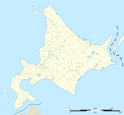 Engaru Location in Hokkaido | |
| Coordinates: 44°4′N 143°32′E / 44.067°N 143.533°E | |
| Country | Japan |
| Region | Hokkaido |
| Prefecture | Hokkaido (Okhotsk Subprefecture) |
| District | Mombetsu |
| Area | |
| • Total | 1,332.32 km2 (514.41 sq mi) |
| Population (September 30, 2016) | |
| • Total | 20,757 |
| • Density | 16/km2 (40/sq mi) |
| Time zone | UTC+09:00 (JST) |
| City hall address | 1-1 1 Jō-Kita 3chōme, Engaru-chō, Hokkaido 099-0403 |
| Climate | Dfb |
| Website | engaru |
| Symbols | |
| Flower | Sunflower |
| Tree | Sargent's cherry |
On October 1, 2005, the towns of Ikutahara and Maruseppu, and the village of Shirataki, all from Monbetsu District merged into the expanded town of Engaru.[3] As of September 2016, the town has an estimated population of 20,757.[4] The total area is 1,332.32 square kilometres (514.41 sq mi),[5] making it the fifth largest municipality in Hokkaido.[6]
Engaru is known as the place where Aikido originated, in the Shirataki area.[7] It is also where the largest cosmos flower park in Japan is located. An Upper Paleolithic site at Shirataki Site Group is the source of some Yubetsu technique stone blades dating from approximately 13,000 years ago.
History edit
- 1869: Current town area was part of the Wakayama Domain (or Kishū Domain) jurisdiction.[8] There were expanses of plains.
- 1896: The Church of Christ in Japan established the Hokkaido Comrades Education Association, and planned a Christian university at Engaru.[2][9]
- 1897: On 7 May, the first immigrant party[2][8] of the Hokkaido Comrades Education Association arrived in Engaru, the first party to immigrate at Engaru. But the final construction of the university's plan did not materialize.[2][8][9]
- 1919: The village of Engaru is split off from Kamiyūbetsu (now the town of Yūbetsu).[8]
- 1925: The village of Ikutahara split off, becoming its own town in 1934.[8]
- 1934: Engaru becomes a town.[8]
- 1946: The villages of Maruseppu (later becoming a town) and Shirataki are split off.[8]
- 2005: The towns of Engaru, Ikutahara, Maruseppu, and the village of Shirataki merge to form the new town of Engaru.[3]
Notable geography edit
- Mountains: Mt. Murii, 1,876 metres (6,155 ft); Mt. Hirayama, 1,771 metres (5,810 ft); Mt. Shiyūbetsu, 1,688 metres (5,538 ft); Mt. Chitokaniushi, 1,446 metres (4,744 ft); Mt. Kitami-Fuji, 1,306 metres (4,285 ft)
- Major rivers: Yūbetsu River; Ikutahara River; Maruseppu River; Setose River; Shanafuchi River; Murii River
- Waterfalls: Yamabiko no Taki, Rokumei no Taki, Jūsan no Taki, Shirataki
- Others: Gambōiwa (瞰望岩), a rocky hill made of underwater lava of andesitic (hyaloclastite) which was spewn out from an underwater volcano in the Miocene Epoch of the Neogene Period in the Cenozoic Era (about 7 million years ago) with volcanic sandstone conglomerate. The top of the cliff is about 78 metres (256 ft) high.
Industry edit
The major industries are commercial forestry, wood processing, and agriculture.
In the past, Engaru Station was the intersection of the Nayoro Main Line (closed in 1989) and the Sekihoku Main Line. It had an important position in business and overall development.
Climate edit
According to the Köppen climate classification, Engaru has a humid continental climate (Dfb) with warm, rainy summers and extremely snowy, long, and cold winters.
| Climate data for Engaru, Hokkaido (1991−2020 normals, extremes 1978−present) | |||||||||||||
|---|---|---|---|---|---|---|---|---|---|---|---|---|---|
| Month | Jan | Feb | Mar | Apr | May | Jun | Jul | Aug | Sep | Oct | Nov | Dec | Year |
| Record high °C (°F) | 9.8 (49.6) |
12.0 (53.6) |
20.0 (68.0) |
30.9 (87.6) |
37.7 (99.9) |
36.9 (98.4) |
36.4 (97.5) |
36.6 (97.9) |
33.3 (91.9) |
27.8 (82.0) |
22.8 (73.0) |
16.6 (61.9) |
37.7 (99.9) |
| Mean daily maximum °C (°F) | −2.3 (27.9) |
−1.6 (29.1) |
3.0 (37.4) |
10.6 (51.1) |
17.3 (63.1) |
20.6 (69.1) |
24.2 (75.6) |
25.2 (77.4) |
21.7 (71.1) |
15.4 (59.7) |
7.5 (45.5) |
0.2 (32.4) |
11.8 (53.3) |
| Daily mean °C (°F) | −8.0 (17.6) |
−7.7 (18.1) |
−2.4 (27.7) |
4.6 (40.3) |
10.7 (51.3) |
14.6 (58.3) |
18.6 (65.5) |
19.7 (67.5) |
15.7 (60.3) |
9.0 (48.2) |
2.2 (36.0) |
−5.0 (23.0) |
6.0 (42.8) |
| Mean daily minimum °C (°F) | −14.7 (5.5) |
−15.2 (4.6) |
−8.7 (16.3) |
−1.4 (29.5) |
4.4 (39.9) |
9.4 (48.9) |
14.0 (57.2) |
15.3 (59.5) |
10.4 (50.7) |
3.3 (37.9) |
−2.8 (27.0) |
−10.8 (12.6) |
0.3 (32.5) |
| Record low °C (°F) | −29.2 (−20.6) |
−29.5 (−21.1) |
−26.2 (−15.2) |
−18.1 (−0.6) |
−5.0 (23.0) |
−0.6 (30.9) |
3.7 (38.7) |
5.6 (42.1) |
0.7 (33.3) |
−5.2 (22.6) |
−16.6 (2.1) |
−23.9 (−11.0) |
−29.5 (−21.1) |
| Average precipitation mm (inches) | 53.4 (2.10) |
34.0 (1.34) |
34.6 (1.36) |
42.4 (1.67) |
56.1 (2.21) |
66.3 (2.61) |
109.3 (4.30) |
135.9 (5.35) |
123.1 (4.85) |
88.2 (3.47) |
55.0 (2.17) |
62.3 (2.45) |
870.6 (34.28) |
| Average snowfall cm (inches) | 144 (57) |
119 (47) |
103 (41) |
26 (10) |
2 (0.8) |
0 (0) |
0 (0) |
0 (0) |
0 (0) |
0 (0) |
25 (9.8) |
112 (44) |
531 (209) |
| Average precipitation days (≥ 1.0 mm) | 10.7 | 9.7 | 9.8 | 9.2 | 9.5 | 9.8 | 11.1 | 11.8 | 11.0 | 10.1 | 10.1 | 10.8 | 123.6 |
| Average snowy days (≥ 3 cm) | 14.6 | 13.1 | 12.4 | 3.0 | 0.2 | 0 | 0 | 0 | 0 | 0 | 2.6 | 11.9 | 57.8 |
| Mean monthly sunshine hours | 85.1 | 102.2 | 141.6 | 165.4 | 174.7 | 156.9 | 150.0 | 142.9 | 155.2 | 148.0 | 111.3 | 89.7 | 1,626.3 |
| Source: Japan Meteorological Agency[10][11] | |||||||||||||
Gallery edit
-
 Gambōiwa
 -
 View from Gambōiwa
 -
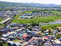
 Town area in front of Engaru Station
 -
 Preserved forest railway locomotive at Maruseppu
 -
 Setose Spa
 -
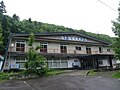
 Ikutahara Spa "North King"
 -
 Kita-Taisetsu ski area
 -
 Hokkaido Prefectural Engaru High School


Sister cities edit
 Bastos, São Paulo, Brazil
 Moirans-en-Montagne, Jura, France
Notable people edit
- Morihei Ueshiba (1883 - 1969) the founder of Aikido, leading Kishū Settlers Group at Shirataki area from Tanabe[7]
- Yoshikazu Yasuhiko (born 1947) animator, manga artist, and character designer of 1979-1980 TV series Mobile Suit Gundam[12][13]
- Tomonori Kogawa (born 1950) animator, and animation director of 1980 TV series Space Runaway Ideon[14]
- Masami Tanaka (born 1979) a former swimmer[15]
See also edit
- Engaru Shimbun - the regional newspaper
References edit
- ^ "瞰望岩(がんぼういわ)" Archived 2016-12-21 at the Wayback Machine Engaru Town Hall
- ^ a b c d "遠軽町百年史" Engaru Town Hall, August 1998
- ^ a b "遠軽町の沿革" Archived 2015-08-25 at the Wayback Machine Engaru Town Hall
- ^ "人口・世帯・動態(平成25年度)" Archived 2017-02-07 at the Wayback Machine Engaru Town Hall
- ^ "位置・面積" Archived 2019-04-27 at the Wayback Machine Engaru Town Hall
- ^ "全国都道府県市区町村別面積調" Archived 2013-01-22 at the Wayback Machine Geospatial Information Authority of Japan, 2011
- ^ a b "合気道開祖・植芝盛平翁(Aikido Founder・Morihei Ueshiba)" Archived 2013-06-13 at the Wayback Machine Tanabe City Hall
- ^ a b c d e f g "旧遠軽町の沿革" Archived 2016-06-19 at the Wayback Machine Engaru Town Hall
- ^ a b "日本キリスト教会北海道中会遠軽教会" The Church of Christ in Japan
- ^ "平年値(年・月ごとの値)". Japan Meteorological Agency. Retrieved 11 August 2013.
- ^ "観測史上1〜10位の値(年間を通じての値)". Japan Meteorological Agency. Retrieved 11 August 2013.
- ^ "安彦良和-Writerprofile" 安彦良和-WORLD
- ^ "ガンダム遠軽(だいち)に立て!!~町職員から広がるまちづくり~ - 第34回兵庫自治研集会 第8分科会 都市(まち)と地方の再生とまちづくり" Archived 2013-08-18 at archive.today All-Japan Prefectural and Municipal Workers Union, October 2012
- ^ "北海道の遠軽町が「ガンダム」で街おこし" Hokkaido Shimbun, 23 June 2011
- ^ "田中 雅美プロフィール" Archived 2013-05-01 at archive.today Sankei, co.
External links edit
- Official Website (in Japanese)
- Taiyo-no-Oka Engaru Park Official Website (in English)