


Summary
Mendip is a local government district in the English county of Somerset. The Mendip district covers a largely rural area of 285 square miles (738 km2)[1] ranging from the Mendip Hills through on to the Somerset Levels. It had a population of approximately 110,000 in 2014.[1][2] The administrative centre of the district is Shepton Mallet.

In the United Kingdom, the term listed building refers to a building or other structure officially designated as being of special architectural, historical or cultural significance; Grade II* structures are those considered to be "particularly significant buildings of more than local interest".[3] Listing was begun by a provision in the Town and Country Planning Act 1947. Once listed, severe restrictions are imposed on the modifications allowed to a building's structure or its fittings. In England, the authority for listing under the Planning (Listed Buildings and Conservation Areas) Act 1990 rests with Historic England, a non-departmental public body sponsored by the Department for Digital, Culture, Media and Sport; local authorities have a responsibility to regulate and enforce the planning regulations.[4]
There are 209 Grade II* listed buildings in Mendip. The list includes a large number of churches, some of which are Norman. Several buildings are associated with the church, particularly the Anglican Glastonbury Abbey and Wells Cathedral along with the Benedictine Downside Abbey. Many of the rest of the buildings are urban or rural houses ranging in date from the 12th to 19th centuries. Trade in the area is represented by market crosses and the Anglo-Bavarian Brewery. Shepton Mallet Prison and a village lock-up are also included in the list. The oldest is the Church of St Mary, Laverton, while the most recent is Mells War Memorial by Sir Edwin Lutyens.
Buildings edit
| Name | Location | Type | Completed [note 1] | Grid ref.[note 2] Geo-coordinates |
Entry number [note 3] | Image | Ref. |
|---|---|---|---|---|---|---|---|
| Abbey Gatehouse | Glastonbury | Porters lodge | Mid 14th century | ST4989738881 51°08′49″N 2°43′04″W / 51.146986°N 2.717655°W |
1345446 |  More images |
[5] |
| Abbots Sharpham and Sharpham Park Farmhouse | Sharpham | Farmhouse | 18th century | ST4669037428 51°08′01″N 2°45′48″W / 51.133632°N 2.763283°W |
1345069 |  More images |
[6] |
| Alice Street Farmhouse | Wanstrow | Farmhouse | Late 17th century | ST7243542795 51°11′01″N 2°23′45″W / 51.183714°N 2.395763°W |
1345299 |  Upload Photo |
[7] |
| Almshouses and Chapel of St Mary Magdalene's Hospital | Glastonbury | Almshouse | c.1310 | ST4988238661 51°08′42″N 2°43′04″W / 51.145007°N 2.717839°W |
1057909 |  More images |
[8][9] |
| Anglo Trading Estate | Shepton Mallet | Brewery | 1864 | ST6161443734 51°11′30″N 2°33′02″W / 51.19153°N 2.550677°W |
1296561 |  More images |
[10] |
| Argyle House | Frome | House | 1768–1769 | ST7765247895 51°13′47″N 2°19′17″W / 51.229801°N 2.321442°W |
1057828 |  |
[11] |
| Babington House | Babington | Country house | 17th century | ST7087350907 51°15′24″N 2°25′08″W / 51.256576°N 2.418772°W |
1177567 |  More images |
[12] |
| Barclays Bank | Wells | House | c. 1453 | ST5500645796 51°12′35″N 2°38′44″W / 51.209587°N 2.64549°W |
1383011 |  More images |
[13] |
| Barn 35 metres to North-East of Nunney Castle | Nunney | Barn | c. 1500 | ST7369745782 51°12′38″N 2°22′41″W / 51.210632°N 2.377928°W |
1058267 |  |
[14] |
| Bellerica Farmhouse | Witham Friary | Farmhouse | 16th century | ST7215839183 51°09′04″N 2°23′58″W / 51.151222°N 2.399445°W |
1175208 | Upload Photo |
[15] |
| Berkley House | Berkley | Country house | Mid 18th century | ST8113149380 51°14′36″N 2°16′18″W / 51.24328°N 2.271697°W |
1058192 | Upload Photo |
[16] |
| Boathouse | Lullington | Boat house | Mid 18th century | ST7816151046 51°15′29″N 2°18′52″W / 51.258153°N 2.314346°W |
1174399 | Upload Photo |
[17] |
| Bowlish House | Shepton Mallet | House | 1732 | ST6125843959 51°11′37″N 2°33′21″W / 51.193529°N 2.555796°W |
1058419 |  More images |
[18] |
| Bradley House | West Bradley | Country house | 16th or 17th century | ST5582836925 51°07′48″N 2°37′57″W / 51.129888°N 2.632631°W |
1058794 |  |
[19] |
| Bridge Farmhouse | Butleigh | Farmhouse | 14th century | ST5226033636 51°06′00″N 2°40′59″W / 51.100029°N 2.68318°W |
1175640 | Upload Photo |
[20] |
| Brookside Farm | Lullington | Farmhouse | Mid 18th century | ST7757753446 51°16′47″N 2°19′22″W / 51.279711°N 2.322866°W |
1295843 | Upload Photo |
[21] |
| Cathedral Green House | Wells | Row house | Pre 17th century | ST5503545822 51°12′35″N 2°38′42″W / 51.209823°N 2.645078°W |
1382892 | Upload Photo |
[22] |
| Charlton Viaduct | Shepton Mallet | Railway viaduct | 1874 | ST6279843548 51°11′24″N 2°32′01″W / 51.189936°N 2.533716°W |
1058414 |  More images |
[23] |
| Christ Church | Frome | Church | 1817–1818 | ST7733547865 51°13′46″N 2°19′34″W / 51.229518°N 2.32598°W |
1057853 |  More images |
[24] |
| Christ Church | Rode | Church | 1824 | ST8062954153 51°17′10″N 2°16′45″W / 51.28618°N 2.279148°W |
1058062 |  More images |
[25] |
| Church of All Saints | Downhead | Church | 14th century | ST6917046189 51°12′51″N 2°26′34″W / 51.214064°N 2.442768°W |
1174065 |  More images |
[26] |
| Church of All Saints | Rodden, Selwood | Church | 1640 | ST7988147719 51°13′42″N 2°17′22″W / 51.228301°N 2.28951°W |
1058893 | Upload Photo |
[27] |
| Church of St Andrew | Holcombe | Church | Late Saxon or Early Norman | ST6688050734 51°15′17″N 2°28′34″W / 51.254802°N 2.475974°W |
1058677 |  More images |
[28] |
| Church of St Andrew | West Bradley | Church | 19th century | ST5578636874 51°07′46″N 2°38′00″W / 51.129427°N 2.633224°W |
1058795 |  More images |
[29] |
| Church of St George | Whatley | Church | 14th century | ST7340247603 51°13′37″N 2°22′56″W / 51.226992°N 2.382286°W |
1058258 |  More images |
[30] |
| Church of St Hugh | Charterhouse, Priddy | Church | 1908 | ST5013155663 51°17′52″N 2°43′00″W / 51.297897°N 2.71665°W |
1307304 |  More images |
[31] |
| Church of St James | Milton Clevedon | Church | Rebuilt 1790 | ST6645637788 51°08′18″N 2°28′51″W / 51.138372°N 2.480836°W |
1059161 |  More images |
[32] |
| Church of St James the Less | Foxcote, Hemington | Church | Early 18th century | ST7155555570 51°17′55″N 2°24′34″W / 51.298539°N 2.409372°W |
1058709 |  More images |
[33] |
| Church of St John The Baptist | Chilcompton | Church | 19th century | ST6469752410 51°16′11″N 2°30′27″W / 51.26974°N 2.50742°W |
1345096 |  More images |
[34] |
| Church of St Katherine | East Woodlands, Selwood | Church | c. 1712 | ST7898244151 51°11′46″N 2°18′08″W / 51.196186°N 2.302174°W |
1175821 |  More images |
[35] |
| Church of St Lawrence | Westbury-sub-Mendip | Church | 1887 | ST4996048704 51°14′07″N 2°43′05″W / 51.235313°N 2.718127°W |
1178326 |  More images |
[36] |
| Church of St Leonard | Butleigh | Church | Mid 19th century | ST5200333922 51°06′09″N 2°41′13″W / 51.102579°N 2.686888°W |
1058773 |  More images |
[37] |
| Church of St Leonard | Farleigh Hungerford | Church | 1443 | ST7999357423 51°18′56″N 2°17′18″W / 51.315561°N 2.288452°W |
1174661 |  More images |
[38] |
| Church of St Mary | Berkley | Church | 1751 | ST8111249404 51°14′37″N 2°16′19″W / 51.243495°N 2.27197°W |
1295976 |  More images |
[39] |
| Church of St Mary | Chesterblade, Evercreech | Church | 12th century | 51°10′09″N 2°29′10″W / 51.16903°N 2.486246°W | 1222368 |  More images |
[40] |
| Church of St Mary | Laverton, Lullington | Church | 11th century | ST7781452997 51°16′32″N 2°19′10″W / 51.275683°N 2.31944°W |
1366309 |  More images |
[41] |
| Church of St Mary | Wanstrow | Church | 15th century | ST7127541717 51°10′26″N 2°24′44″W / 51.173963°N 2.412273°W |
1174955 |  More images |
[42] |
| Church of St Mary | Cloford, Wanstrow | Church | 15th century | ST7263443983 51°11′40″N 2°23′35″W / 51.194405°N 2.393007°W |
1295509 |  More images |
[43] |
| Church of St Mary | Lottisham, West Bradley | Church | 1876 | ST5703135060 51°06′48″N 2°36′55″W / 51.113211°N 2.615217°W |
1058792 |  More images |
[44] |
| Church of St Mary and St John | Lamyatt | Church | 13th century | ST6612636190 51°07′26″N 2°29′07″W / 51.123983°N 2.485401°W |
1344874 |  More images |
[45] |
| Church of St Mary Magdalene | Upton Noble | Church | 12th century | ST7129339451 51°09′13″N 2°24′43″W / 51.153589°N 2.411834°W |
1174889 |  More images |
[46] |
| Church of St Mary The Virgin | Ston Easton | Church | 11th century | ST6238153453 51°16′44″N 2°32′27″W / 51.27897°N 2.540726°W |
1295301 |  More images |
[47] |
| Church of St Michael | Dinder | Church | 14th century | ST5751644601 51°11′57″N 2°36′34″W / 51.199035°N 2.609418°W |
1345121 |  More images |
[48] |
| Church of St Michael | Stoke St Michael | Church | c. 1400 | ST6644446977 51°13′16″N 2°28′55″W / 51.220995°N 2.481868°W |
1173964 |  More images |
[49] |
| Church of St Peter | Lydford-on-Fosse | Church | 1846 | ST5646331882 51°05′05″N 2°37′23″W / 51.084593°N 2.622946°W |
1175052 |  More images |
[50] |
| Church of St Peter | North Wootton | Church | 14th or 15th century | ST5637741808 51°10′26″N 2°37′31″W / 51.173836°N 2.625379°W |
1175106 |  More images |
[51] |
| Church of St Philip and St James | Norton St Philip | Church | 14th century | ST7721755726 51°18′01″N 2°19′41″W / 51.300197°N 2.328174°W |
1345373 |  More images |
[52] |
| Church of St Thomas | Wells | Church | 1856–1857 | ST5560346168 51°12′47″N 2°38′13″W / 51.212979°N 2.63699°W |
1383153 |  More images |
[53] |
| Church of St Thomas A Beckett | Pylle | Church | 1868 | ST6070638334 51°08′34″N 2°33′47″W / 51.142914°N 2.563078°W |
1175680 |  More images |
[54] |
| Church of the Blessed Virgin Mary | Emborough | Church | 18th century | ST6144051358 51°15′36″N 2°33′14″W / 51.26007°N 2.55399°W |
1177590 |  More images |
[55] |
| Church of the Holy Trinity | Binegar | Church | Norman | ST6153749454 51°14′35″N 2°33′09″W / 51.242956°N 2.552395°W |
1058641 |  More images |
[56] |
| Church of the Holy Trinity | Frome | Church | 1837 | ST7719648349 51°14′02″N 2°19′41″W / 51.233865°N 2.328002°W |
1174175 |  More images |
[56] |
| Churchyard Cross | East Pennard | Cross | 15th century | ST5968637468 51°08′06″N 2°34′39″W / 51.135056°N 2.577561°W |
1345215 |  |
[57] |
| Churchyard Cross in Churchyard, Church of St Aldhelm | Doulting | Cross | 15th century | ST6461443153 51°11′11″N 2°30′28″W / 51.1865°N 2.507692°W |
1345192 |  |
[58] |
| Churchyard Cross in Churchyard, South of Church of St Bartholemew | Cranmore | Cross | 14th century | ST6683043319 51°11′17″N 2°28′34″W / 51.188126°N 2.476002°W |
1058529 |  |
[59] |
| Claver Morris House | Wells | House | 1699 | ST5520946114 51°12′45″N 2°38′33″W / 51.212462°N 2.642624°W |
1383173 |  More images |
[60] |
| Congregational Chapel | Trudoxhill | Chapel | 1699 | ST7492143784 51°11′34″N 2°21′37″W / 51.192722°N 2.360265°W |
1345311 |  |
[61] |
| Conservative Club | Wells | House | c. 1453 | ST5501145798 51°12′35″N 2°38′44″W / 51.209605°N 2.645418°W |
1383013 |  |
[62] |
| Court Farmhouse | Wookey | Farmhouse | 18th century | ST5180445714 51°12′31″N 2°41′29″W / 51.208588°N 2.691313°W |
1058584 | Upload Photo |
[63] |
| Cranmore Hall, walling and gazebo, now part of All Hallows School | Cranmore | House | 17th century | ST6815843744 51°11′31″N 2°27′25″W / 51.192024°N 2.457038°W |
1058533 | Upload Photo |
[64] |
| De Salis House and De Salis Cottage | Wells | House | Late 14th century | ST5521046150 51°12′46″N 2°38′33″W / 51.212786°N 2.642614°W |
1383171 |  More images |
[65] |
| Ditcheat House or Ditcheat Manor | Ditcheat | House | Early 17th century | ST6257336370 51°07′31″N 2°32′10″W / 51.12538°N 2.536186°W |
1275484 |  More images |
[66] |
| Doulting Manor and stables (Previously listed as The Vicarage) | Doulting | House | Early 18th century | ST6457243158 51°11′12″N 2°30′30″W / 51.186543°N 2.508294°W |
1221290 | Upload Photo |
[67] |
| Dovecote | Norton St Philip | Dovecote | 15th century | ST7713255925 51°18′07″N 2°19′46″W / 51.301983°N 2.329406°W |
1174418 |  |
[68] |
| Downside School | Stratton-on-the-Fosse | School | c. 1700 | ST6553150716 51°15′16″N 2°29′43″W / 51.25456°N 2.495302°W |
1295086 |  More images |
[69] |
| Dwelling at right angles to Rear of No 3; Wall and Gate Piers The Abbey The Grange | Beckington | House | c. 1620 | ST8004451716 51°15′51″N 2°17′15″W / 51.264247°N 2.2874°W |
1345319 | Upload Photo |
[70] |
| Former Church of St Michael | Trudoxhill | Church | c. 1857 | ST7799240227 51°09′39″N 2°18′58″W / 51.160865°N 2.316101°W |
1058275 |  More images |
[71] |
| Former St Michael's Roman Catholic Church | Shepton Mallet | Church | 1804 | ST6165343393 51°11′18″N 2°33′00″W / 51.188467°N 2.550083°W |
1345271 |  |
[72] |
| Former Village Reading Room | Witham Friary | Dovecote | c. 1300 | ST7445441081 51°10′06″N 2°22′00″W / 51.168396°N 2.366755°W |
1175244 | Upload Photo |
[73] |
| Fountain House | Frome | House | 1818 | ST7710948279 51°14′00″N 2°19′45″W / 51.233232°N 2.329244°W |
1057829 | Upload Photo |
[74] |
| Gazebo 20 m north of No 13 Bath Road | Beckington | Gazebo | 18th century | ST8004651998 51°16′00″N 2°17′15″W / 51.266783°N 2.287387°W |
1345296 |  |
[75] |
| Gazebo and attached stables, 10 m south west of No 1 (Rode Mill House) | Rode | Gazebo | Late 18th century | ST8026954294 51°17′15″N 2°17′04″W / 51.287436°N 2.284318°W |
1175487 | Upload Photo |
[76] |
| Glastonbury Abbey Precinct Wall from No.2 Silver Street to Abbey Gatehouse | Glastonbury | Precinct wall | 15th century | ST4996338916 51°08′50″N 2°43′00″W / 51.147307°N 2.716717°W |
1392856 |  More images |
[77] |
| Gloucester Lodge | Lullington | Lodge | Early 19th century | ST7862651854 51°15′56″N 2°18′28″W / 51.265436°N 2.307731°W |
1295783 |  More images |
[78] |
| Grey Gables | Pilton | House | 15th century | ST5935740834 51°09′55″N 2°34′58″W / 51.165298°N 2.582644°W |
1058805 | Upload Photo |
[79] |
| Grottoes, 350 metres south west of rear of The Chantry | Whatley | Grotto | c. 1830 | ST7193546603 51°13′05″N 2°24′12″W / 51.21793°N 2.403216°W |
1345304 | Upload Photo |
[80] |
| Group of 7 monuments in churchyard, adjacent to nave, Church of St Peter and St Paul | Kilmersdon | Gravestone | 1680 | ST6959952419 51°16′12″N 2°26′14″W / 51.270105°N 2.437157°W |
1058693 | 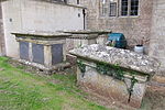 |
[81] |
| Hapsford House | Great Elm | House | Early 19th century | ST7594649692 51°14′45″N 2°20′46″W / 51.245889°N 2.345996°W |
1174202 |  |
[82] |
| Hassage Manor | Norton St Philip | House | Mid 17th century | ST7522255733 51°18′01″N 2°21′24″W / 51.300176°N 2.356789°W |
1115353 | Upload Photo |
[83] |
| Her Majestys Prison and Perimeter Wall | Shepton Mallet | Boundary wall | 1610 | ST6212643639 51°11′27″N 2°32′36″W / 51.19071°N 2.543341°W |
1058425 |  More images |
[84] |
| Higher Southtown Farmhouse | West Pennard | Farmhouse | 16th century | ST5579337792 51°08′16″N 2°38′00″W / 51.137681°N 2.633237°W |
1058800 |  |
[85] |
| Ivythorn Manor | Street | Clerical dwelling | Medieval | ST4806534304 51°06′20″N 2°44′35″W / 51.105669°N 2.743182°W |
1176171 | Upload Photo |
[86] |
| Jacoby Cottage | Glastonbury | House | Medieval | ST5045539067 51°08′55″N 2°42′35″W / 51.148707°N 2.709704°W |
1345431 | Upload Photo |
[87] |
| Kilmersdon Lodges, gate piers and gates | Kilmersdon | Lodge | Early 19th century | ST7066152290 51°16′08″N 2°25′19″W / 51.269001°N 2.421924°W |
1307411 |  |
[88] |
| Kings Head Hotel | Wells | Inn | Late 18th century | ST5485945710 51°12′32″N 2°38′51″W / 51.208802°N 2.647583°W |
1382974 |  More images |
[89] |
| Langham House and attached stables | Rode | Country house | 1792 | ST8045254238 51°17′13″N 2°16′54″W / 51.286938°N 2.281691°W |
1345390 | 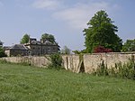 More images |
[90] |
| Lock-Up | Mells | Lock up | 17th century | ST7261248983 51°14′22″N 2°23′37″W / 51.239363°N 2.393705°W |
1058320 |  |
[91] |
| Lottisham Manor | West Bradley | House | Late 16th century | ST5748134331 51°06′24″N 2°36′31″W / 51.10669°N 2.608703°W |
1308193 | 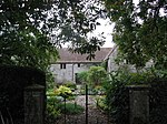 |
[92] |
| Lych Gate, flanking walls and gates on north side of Church of St Peter and St Paul | Kilmersdon | Church | 1900 | ST6958552445 51°16′13″N 2°26′14″W / 51.270338°N 2.43736°W |
1058695 |  |
[93] |
| Manor Cottages | Lullington | House | 17th century | ST7783953166 51°16′38″N 2°19′09″W / 51.277203°N 2.319093°W |
1366310 |  |
[94] |
| Manor Farmhouse | Emborough | Farmhouse | Medieval | ST6139651328 51°15′35″N 2°33′17″W / 51.259797°N 2.554617°W |
1345124 |  |
[95] |
| Manor Farmhouse | Lullington | Farmhouse | 17th century | ST7783753005 51°16′33″N 2°19′09″W / 51.275755°N 2.319111°W |
1058171 | Upload Photo |
[96] |
| Manor Farmhouse | Selwood | Farmhouse | Early 17th century | ST7769543947 51°11′39″N 2°19′14″W / 51.194303°N 2.32058°W |
1176081 | Upload Photo |
[97] |
| Manor Farmhouse | Wanstrow | House | 1633 | ST7104641695 51°10′26″N 2°24′56″W / 51.173754°N 2.415547°W |
1174987 | Upload Photo |
[98] |
| Manor Farmhouse | Coxbridge, West Pennard | Farmhouse | 17th century | ST5417236553 51°07′35″N 2°39′22″W / 51.126413°N 2.656247°W |
1345050 |  More images |
[99] |
| Manor Farmhouse | Whatley | Farmhouse | c. 1700 | ST7338647635 51°13′38″N 2°22′57″W / 51.227279°N 2.382518°W |
1058259 | 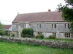 |
[100] |
| Manor Farmhouse Manor House | Wanstrow | House | 17th century | ST7104641695 51°10′26″N 2°24′56″W / 51.173754°N 2.415547°W |
1058285 | Upload Photo |
[101] |
| Manor Farmhouse and attached dwelling | Stratton-on-the-Fosse | Farmhouse | Early 18th century | ST6663051718 51°15′49″N 2°28′47″W / 51.263635°N 2.479648°W |
1178338 | Upload Photo |
[102] |
| Manor Farmhouse and forecourt wall | Upper Milton, St Cuthbert Out | Farmhouse | 19th century | ST5459547352 51°13′25″N 2°39′06″W / 51.223545°N 2.651571°W |
1058604 |  |
[103] |
| Manor House | Pilton | House | 17th century | ST5954342178 51°10′39″N 2°34′48″W / 51.177396°N 2.580136°W |
1058822 | Upload Photo |
[104] |
| Manor House | Stoke St Michael | Manor house | c. 1700 | ST6641946917 51°13′14″N 2°28′56″W / 51.220454°N 2.48222°W |
1345263 |  |
[105] |
| Manor House, gates and gate piers adjoining to west | Nunney | House | c. 1720 | ST7360245743 51°12′37″N 2°22′45″W / 51.210277°N 2.379285°W |
1174502 | Upload Photo |
[106] |
| Market Cross | Nunney | Market cross | c. 1100 | ST7374245763 51°12′38″N 2°22′38″W / 51.210463°N 2.377282°W |
1058301 |  More images |
[107] |
| Market Cross | Shepton Mallet | Market cross | c. 1500 | ST6189043651 51°11′27″N 2°32′48″W / 51.190803°N 2.546719°W |
1058383 |  More images |
[108] |
| Marston House | Marston Bigot | House | c. 1650 | ST7573045232 51°12′21″N 2°20′56″W / 51.205777°N 2.348787°W |
1174802 |  More images |
[109] |
| Mellifont Abbey, boundary walls and gate piers | Wookey | Country house | 1753–1765 | ST5181845816 51°12′34″N 2°41′28″W / 51.209506°N 2.691127°W |
1180119 | Upload Photo |
[110] |
| Mells Village Hall | Mells | Village hall | 14th century | ST7287449133 51°14′27″N 2°23′24″W / 51.240724°N 2.389964°W |
1058313 |  More images |
[111] |
| Melrose House | Frome | House | c. 1700 | ST7745048148 51°13′55″N 2°19′28″W / 51.232068°N 2.324351°W |
1057747 | Upload Photo |
[112] |
| Mendip House and boundary walls to road Welshmill House and boundary walls to road | Frome | House | c. 1790 | ST7779348503 51°14′07″N 2°19′10″W / 51.235273°N 2.319461°W |
1057740 | Upload Photo |
[113] |
| Merfield House | Rode | House | c. 1810 | ST7992353604 51°16′52″N 2°17′21″W / 51.281219°N 2.289241°W |
1345393 | Upload Photo |
[114] |
| Monastery of St Gregory the Great, Downside Abbey with Petre Cloister | Stratton-on-the-Fosse | Abbey | 1873 | ST6546850804 51°15′19″N 2°29′46″W / 51.255347°N 2.496213°W |
1295178 | 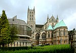 More images |
[115] |
| Monmouth Chambers | Frome | House | Late 17th century | ST7760948050 51°13′52″N 2°19′19″W / 51.231193°N 2.322068°W |
1057818 | Upload Photo |
[116] |
| Newbury House | Coleford | Country house | Early 18th century | ST6994050522 51°15′11″N 2°25′56″W / 51.253066°N 2.432109°W |
1175636 |  More images |
[117] |
| 25 Keyford | Frome | House | 18th century | ST7766147426 51°13′32″N 2°19′17″W / 51.225584°N 2.321284°W |
1057796 | Upload Photo |
[118] |
| 4, Cheap Street | Frome | House | Late 16th century | ST7767848018 51°13′51″N 2°19′16″W / 51.230908°N 2.321078°W |
1057840 |  |
[119] |
| 11, Cheap Street | Frome | House | 17th century | ST7770547980 51°13′50″N 2°19′14″W / 51.230567°N 2.320689°W |
1057842 | Upload Photo |
[120] |
| 14–16, Willow Vale | Frome | House | c. 1720 | ST7798348148 51°13′56″N 2°19′00″W / 51.232088°N 2.316718°W |
1058465 | Upload Photo |
[121] |
| 21, Wine Street | Frome | House | c. 1730–1750 | ST7739447945 51°13′49″N 2°19′31″W / 51.23024°N 2.325141°W |
1058467 | Upload Photo |
[122] |
| 13, Bridge Street | Frome | House | Early–mid 18th century | ST7779148259 51°13′59″N 2°19′10″W / 51.233079°N 2.319474°W |
1345465 | Upload Photo |
[123] |
| 16 and 17, Stony Street | Frome | House | c. 1688 | ST7760248027 51°13′52″N 2°19′20″W / 51.230986°N 2.322167°W |
1345534 | Upload Photo |
[124] |
| 6, New Street | Mells | House | c. 1470 | ST7279549244 51°14′30″N 2°23′28″W / 51.241718°N 2.391104°W |
1174360 |  |
[125] |
| 9, New Street | Mells | House | c. 1470 | ST7278549206 51°14′29″N 2°23′28″W / 51.241376°N 2.391244°W |
1174367 | Upload Photo |
[126] |
| 4, New Street | Mells | House | c. 1470 | ST7277849254 51°14′31″N 2°23′29″W / 51.241808°N 2.391348°W |
1295803 | Upload Photo |
[127] |
| 6 And 8, High Street | Rode | House | 18th century | ST8029853779 51°16′58″N 2°17′02″W / 51.282806°N 2.283874°W |
1058091 |  |
[128] |
| 8, Market Place | Shepton Mallet | House | Early to mid 17th century | ST6194343620 51°11′26″N 2°32′45″W / 51.190527°N 2.545958°W |
1058457 |  More images |
[129] |
| 6, High Street | Wells | House | 16th century | ST5494845763 51°12′33″N 2°38′47″W / 51.209286°N 2.646316°W |
1382951 |  |
[130] |
| 8, High Street | Wells | House | 15th century | ST5494845753 51°12′33″N 2°38′47″W / 51.209196°N 2.646315°W |
1382953 |  |
[131] |
| 3, Market Place | Wells | House | c. 1453 | ST5499245781 51°12′34″N 2°38′44″W / 51.209451°N 2.645688°W |
1383006 |  |
[132] |
| 5, Market Place | Wells | House | c. 1453 | ST5499745785 51°12′34″N 2°38′44″W / 51.209487°N 2.645617°W |
1383008 |  |
[133] |
| 7, Market Place | Wells | House | c. 1453 | ST5499645798 51°12′35″N 2°38′44″W / 51.209604°N 2.645633°W |
1383009 |  |
[134] |
| 13, Market Place | Wells | House | c. 1453 | ST5501845797 51°12′35″N 2°38′43″W / 51.209597°N 2.645318°W |
1383015 |  |
[135] |
| 15, Market Place | Wells | House | c. 1453 | ST5502445800 51°12′35″N 2°38′43″W / 51.209624°N 2.645233°W |
1383017 |  |
[136] |
| 17, Market Place | Wells | House | c. 1453 | ST5502745806 51°12′35″N 2°38′43″W / 51.209679°N 2.64519°W |
1383019 |  |
[137] |
| 19, Market Place | Wells | House | c. 1453 | ST5503545805 51°12′35″N 2°38′42″W / 51.20967°N 2.645076°W |
1383020 |  |
[138] |
| 21, Market Place | Wells | House | c. 1453 | ST5504145807 51°12′35″N 2°38′42″W / 51.209689°N 2.64499°W |
1383021 |  |
[139] |
| 23, Market Place | Wells | House | c. 1453 | ST5504445817 51°12′35″N 2°38′42″W / 51.209779°N 2.644948°W |
1383022 |  |
[140] |
| 25, Market Place | Wells | House | c. 1453 | ST5505145816 51°12′35″N 2°38′41″W / 51.20977°N 2.644848°W |
1383023 |  |
[141] |
| 7, Sadler Street | Wells | House | 15th century | ST5495045778 51°12′34″N 2°38′47″W / 51.209421°N 2.646289°W |
1383081 |  More images |
[142] |
| 12, Sadler Street | Wells | House | c. 1800 | ST5497545801 51°12′35″N 2°38′45″W / 51.20963°N 2.645934°W |
1383086 |  |
[143] |
| 3 And 5, St Thomas Street | Wells | House | 14th century | ST5527946023 51°12′42″N 2°38′30″W / 51.21165°N 2.64161°W |
1383128 |  More images |
[144] |
| 23, The Liberty | Wells | House | 1819 | ST5521846067 51°12′43″N 2°38′33″W / 51.21204°N 2.642489°W |
1383176 |  More images |
[145] |
| Norwood Park Farmhouse | Glastonbury | Abbots summer palace | 1480 | ST5255438982 51°08′53″N 2°40′47″W / 51.148121°N 2.679687°W |
1296421 | Upload Photo |
[146] |
| Old Bowlish House | Shepton Mallet | House | 17th century | ST6124344015 51°11′39″N 2°33′22″W / 51.194032°N 2.556016°W |
1172927 |  More images |
[147] |
| Old Farmhouse | West Pennard | Farmhouse | 15th century | ST5405138959 51°08′53″N 2°39′30″W / 51.148037°N 2.658284°W |
1175898 | Upload Photo |
[148] |
| Old Pump House | Glastonbury | House | 17th century | ST4989638679 51°08′43″N 2°43′04″W / 51.14517°N 2.717641°W |
1296477 |  More images |
[149] |
| Orangery and walled garden at rear of Ammerdown House | Kilmersdon | Orangery | c. 1793 | ST7115252768 51°16′24″N 2°24′54″W / 51.273324°N 2.414925°W |
1345115 | Upload Photo |
[150] |
| Orchardlea House, forecourt walls and gates | Lullington | House | 1856 | ST7771451286 51°15′37″N 2°19′15″W / 51.260294°N 2.320767°W |
1058140 |  More images |
[151] |
| Outbuilding, about 30 m west of Higher Southtown Farmhouse | West Pennard | House | Early 17th century | ST5576337803 51°08′16″N 2°38′01″W / 51.137778°N 2.633667°W |
1175928 | Upload Photo |
[152] |
| Parish Church of St John the Baptist | Frome | Church | 12th century | ST7770747909 51°13′48″N 2°19′14″W / 51.229929°N 2.320656°W |
1345441 |  More images |
[153] |
| Park House | Mells | House | 18th century | ST7132248682 51°14′12″N 2°24′44″W / 51.236593°N 2.412159°W |
1058296 | Upload Photo |
[154] |
| Park House | Shepton Mallet | House | c. 1700 | ST6121944090 51°11′41″N 2°33′23″W / 51.194705°N 2.556368°W |
1172922 | Upload Photo |
[155] |
| Polydor House | Wells | House | 16th century | ST5501946045 51°12′43″N 2°38′43″W / 51.211827°N 2.645335°W |
1383163 |  More images |
[156] |
| Pylle Manor and attached walled garden at rear | Pylle | House | 17th century | ST6076938264 51°08′32″N 2°33′44″W / 51.142289°N 2.56217°W |
1058786 |  |
[157] |
| Retaining walls and associated garden features on south and east sides of Ammerdown House | Kilmersdon | Boundary wall | 17th century | ST7118252677 51°16′21″N 2°24′52″W / 51.272507°N 2.414488°W |
1177422 | Upload Photo |
[158] |
| Ritchie Hall | Wells | School | 1884 | ST5504646078 51°12′44″N 2°38′42″W / 51.212126°N 2.644953°W |
1383166 |  |
[159] |
| Rockfield House and service buildings | Nunney | House | c. 1805 | ST7339145550 51°12′31″N 2°22′56″W / 51.208531°N 2.382291°W |
1058309 | Upload Photo |
[160] |
| Rodden Manor | Selwood | House | Late 16th century | ST7961147573 51°13′37″N 2°17′36″W / 51.226979°N 2.293368°W |
1058894 | Upload Photo |
[161] |
| Rode Mill House | Rode | House | Late 18th century | ST8025654321 51°17′16″N 2°17′04″W / 51.287678°N 2.284506°W |
1058061 | Upload Photo |
[162] |
| Southfield House | Rode | House | 17th century | ST8034153798 51°16′59″N 2°17′00″W / 51.282978°N 2.283258°W |
1058092 | Upload Photo |
[163] |
| St Algars Farmhouse | Selwood | Farmhouse | 14th century | ST7876841945 51°10′35″N 2°18′18″W / 51.176342°N 2.305106°W |
1058902 |  More images |
[164] |
| St Cuthbert's Lodge and attached walls and gate piers | Wells | House | Early 18th century | ST5467245787 51°12′34″N 2°39′01″W / 51.20948°N 2.65027°W |
1382940 |  More images |
[165] |
| Stables to Ston Easton Park | Ston Easton | Stable | c. 1769 | ST6243354087 51°17′05″N 2°32′24″W / 51.284674°N 2.540048°W |
1295250 | Upload Photo |
[166] |
| Stables, about 40 metres west of Standerwick Court | Beckington | Stable | 18th century | ST8156351106 51°15′32″N 2°15′56″W / 51.258814°N 2.265598°W |
1173876 | Upload Photo |
[167] |
| Standerwick Court | Beckington | House | 18th century | ST8163451123 51°15′32″N 2°15′52″W / 51.258969°N 2.264581°W |
1173869 | Upload Photo |
[168] |
| The Abbey Retreat House | Glastonbury | House | 1830 | ST5024238861 51°08′49″N 2°42′46″W / 51.146836°N 2.712721°W |
1167617 |  More images |
[169] |
| The Ancient Gate House Hotel | Wells | Hotel | 1451 | ST5494945843 51°12′36″N 2°38′47″W / 51.210005°N 2.646312°W |
1383093 |  More images |
[170] |
| The Castle | Beckington | House | Early 17th century | ST7999451502 51°15′44″N 2°17′17″W / 51.262321°N 2.288104°W |
1296202 |  More images |
[171] |
| The Cedars | Wells | House | c. 1758 | ST5514546123 51°12′45″N 2°38′37″W / 51.212538°N 2.643541°W |
1383170 |  More images |
[172] |
| The Cedars and garden wall | Beckington | House | 17th century | ST8005651951 51°15′59″N 2°17′14″W / 51.266361°N 2.287241°W |
1173480 | Upload Photo |
[173] |
| The Chantry | Whatley | House | c. 1826 | ST7199246965 51°13′16″N 2°24′09″W / 51.221187°N 2.402428°W |
1058254 | Upload Photo |
[174] |
| The Chantry The Hermitage | Frome | House | Late 17th century | ST7764947852 51°13′46″N 2°19′17″W / 51.229414°N 2.321483°W |
1345487 | Upload Photo |
[175] |
| The Court House | Frome | House | c. 1700 | ST7775948017 51°13′51″N 2°19′12″W / 51.230902°N 2.319918°W |
1173467 | Upload Photo |
[176] |
| The Crown Hotel | Wells | Hotel | Late 16th century | ST5501045752 51°12′33″N 2°38′44″W / 51.209192°N 2.645427°W |
1383007 |  More images |
[177] |
| The Dean's Lodging | Wells | House | 1610 | ST5522446042 51°12′43″N 2°38′33″W / 51.211816°N 2.6424°W |
1383178 |  |
[178] |
| The Falconry, Lodge Farm | Norton St Philip | Farmhouse | 14th or 15th century | ST7967558020 51°19′15″N 2°17′35″W / 51.320918°N 2.293049°W |
1345341 | Upload Photo |
[179] |
| The Iron Gates | Frome | House | c. 1696 | ST7774248010 51°13′51″N 2°19′13″W / 51.230838°N 2.320161°W |
1345516 |  More images |
[180] |
| The Jolliffe Arms and Nos 235 and 236 | Kilmersdon | House | Early 18th century | ST6957252404 51°16′12″N 2°26′15″W / 51.269968°N 2.437543°W |
1058660 |  More images |
[181] |
| The Jolliffe Column and terraced base | Kilmersdon | Column | 1853 | ST7181152170 51°16′05″N 2°24′20″W / 51.26798°N 2.405431°W |
1058687 | Upload Photo |
[182] |
| The Manor House | Croscombe | House | 15th century | ST5892744312 51°11′48″N 2°35′21″W / 51.19654°N 2.589192°W |
1058823 | Upload Photo |
[183] |
| The Manor House | Upton Noble | House | c. 1600 | ST7164239392 51°09′11″N 2°24′25″W / 51.153076°N 2.406839°W |
1345277 | Upload Photo |
[184] |
| The Manor House and attached wall to rear | Pilton | Abbots summer palace | 1235–1252 | ST5880340755 51°09′52″N 2°35′26″W / 51.164548°N 2.590558°W |
1175218 |  |
[185] |
| The Manor House, forecourt wall with piers and steps | Kilmersdon | House | 1674 | ST6943252260 51°16′07″N 2°26′22″W / 51.268666°N 2.439537°W |
1345103 | Upload Photo |
[186] |
| The Market Cross | Wells | Market cross | c. 1797 | ST5499445763 51°12′33″N 2°38′44″W / 51.209289°N 2.645657°W |
1383027 |  More images |
[187] |
| The Music School and attached walls | Wells | House | 13th century | ST5511045946 51°12′39″N 2°38′38″W / 51.210944°N 2.64402°W |
1382905 |  More images |
[188] |
| The Old Almshouse | Wells | Almshouse | 1436 | ST5460945703 51°12′31″N 2°39′04″W / 51.208719°N 2.651161°W |
1382942 |  More images |
[189] |
| The Old Chapel | Croscombe | House | Late 14th century | ST5906144462 51°11′52″N 2°35′14″W / 51.197898°N 2.587292°W |
1174728 | Upload Photo |
[190] |
| The Old Manse | Beckington | House | 17th century | ST8008051919 51°15′58″N 2°17′13″W / 51.266074°N 2.286895°W |
1345333 | Upload Photo |
[191] |
| The Old Parsonage | Walton, Somerset | Clerical dwelling | 15th century | ST4611236288 51°07′24″N 2°46′17″W / 51.123327°N 2.771372°W |
1058723 | Upload Photo |
[192] |
| The Old Vicarage | Frome | Vicarage | 1744 | ST7780847871 51°13′47″N 2°19′09″W / 51.229591°N 2.319207°W |
1345519 | Upload Photo |
[193] |
| The Priest House and adjoining range, Farleigh Hungerford Castle | Farleigh Hungerford | Farmhouse | 17th century | ST8014357629 51°19′03″N 2°17′11″W / 51.317418°N 2.286312°W |
1058118 |  More images |
[194] |
| The Priory (also known as The Abbey) | Ditcheat | House | 1473 | ST6235436143 51°07′24″N 2°32′21″W / 51.123325°N 2.539292°W |
1275470 |  More images |
[195] |
| The Rib | Wells | House | Mid 15th century | ST5522645940 51°12′39″N 2°38′32″W / 51.210899°N 2.642359°W |
1383106 |  More images |
[196] |
| The Talbot Inn | Mells | Inn | c. 1470 | ST7275549207 51°14′29″N 2°23′30″W / 51.241384°N 2.391674°W |
1058314 |  More images |
[197] |
| Thomas Jolliffe Monument in churchyard, about 50 metres south east of Church of St Peter and St Paul | Kilmersdon | Gravestone | 1918 | ST6964652412 51°16′12″N 2°26′11″W / 51.270044°N 2.436483°W |
1177784 |  |
[198] |
| Tower House | Wells | House | Early 14th century | ST5518845983 51°12′41″N 2°38′34″W / 51.211283°N 2.642908°W |
1383103 |  More images |
[199] |
| Town Hall, including wall with steps to street | Glastonbury | Wall | 1818 | ST4991538873 51°08′49″N 2°43′03″W / 51.146916°N 2.717397°W |
1057904 | 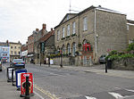 More images |
[200] |
| Unidentified Monument in churchyard about 4 metres south of south chapel Church of St Leonard | Rodney Stoke | Chest tomb | 15th century | ST4823449840 51°14′43″N 2°44′35″W / 51.245372°N 2.743011°W |
1058593 | Upload Photo |
[201] |
| Village Cross adjacent to entrance of and in churchyard, Church of St Mary | Meare | Cross | 15th century | ST4553141662 51°10′18″N 2°46′50″W / 51.171591°N 2.780488°W |
1058751 | Upload Photo |
[202] |
| Village Cross adjacent to The Bull Terrier | Croscombe | Cross | 14th century | ST5904044346 51°11′49″N 2°35′15″W / 51.196854°N 2.587579°W |
1058863 | 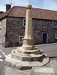 |
[203] |
| Village Cross to west of Church of St Peter | Evercreech | Cross | 15th century | ST6490038683 51°08′47″N 2°30′11″W / 51.146326°N 2.503163°W |
1059174 |  |
[204] |
| Wall around grounds of Glastonbury Abbey and Abbey Retreat House, including the gate way on Chilkwell Street | Glastonbury | Boundary wall | 19th century | ST5033238759 51°08′45″N 2°42′41″W / 51.145927°N 2.71142°W |
1345438 |  More images |
[205] |
| Walling enclosing garden of Doulting Manor including gateway with piers, and gazebo | Doulting | Boundary wall | 19th century | ST6451143095 51°11′10″N 2°30′33″W / 51.185973°N 2.50916°W |
1058519 | Upload Photo |
[206] |
| War Memorial | Mells | War memorial | c. 1920 | ST7291649151 51°14′27″N 2°23′22″W / 51.240888°N 2.389364°W |
1058315 | 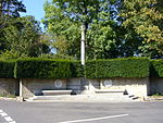 More images |
[207] |
| West Compton House, forecourt wall and piers on roadside | West Compton, Pilton | Farmhouse | 17th century | ST5939742245 51°10′41″N 2°34′56″W / 51.177988°N 2.582232°W |
1345021 | Upload Photo |
[208] |
| West Lodge | Frome | House | 1778–1780 | ST7725747954 51°13′49″N 2°19′38″W / 51.230315°N 2.327103°W |
1296444 | Upload Photo |
[209] |
| Westholme House | Pilton | House | Mid to late 18th century | ST5776141425 51°10′14″N 2°36′20″W / 51.170496°N 2.605538°W |
1345043 | Upload Photo |
[210] |
| Whitchurch Farmhouse | Ston Easton | Farmhouse | c. 1140 | ST6344053553 51°16′48″N 2°31′32″W / 51.279938°N 2.525554°W |
1345104 |  |
[211] |
| Wick Farmhouse | Norton St Philip | Farmhouse | 17th century | ST7873857214 51°18′49″N 2°18′23″W / 51.313636°N 2.306447°W |
1058113 |  |
[212] |
| Wiltshires Barton | Frome | House | Early 18th century | ST7725848247 51°13′59″N 2°19′38″W / 51.23295°N 2.327108°W |
1295877 | Upload Photo |
[213] |
See also edit
Notes edit
- ^ The date given is the date used by Historic England as significant for the initial building or that of an important part in the structure's description.
- ^ Sometimes known as OSGB36, the grid reference is based on the British national grid reference system used by the Ordnance Survey.
- ^ The "List Entry Number" is a unique number assigned to each listed building and scheduled monument by Historic England.
References edit
- ^ a b "A Portrait of Mendip". Mendip District Council. Retrieved 21 October 2017.
- ^ "Community Profile Mendip District". Somerset Intelligence. Retrieved 2 January 2018.
- ^ "Listed Buildings". Historic England. Retrieved 23 August 2017.
- ^ "Planning (Listed Buildings and Conservation Areas) Act 1990 (c. 9)". Ministry of Justice. Archived from the original on 18 April 2010. Retrieved 17 December 2007.
- ^ Historic England. "Abbey Gatehouse, Including The Porters' Lodge (1345446)". National Heritage List for England.
- ^ Historic England. "Abbots Sharpham Sharpham Park Farmhouse (1345069)". National Heritage List for England.
- ^ Historic England. "Alice Street Farmhouse (1345299)". National Heritage List for England.
- ^ Historic England. "Almshouses And Chapel Of St Mary Magdalene's Hospital (1057909)". National Heritage List for England.
- ^ Historic England. "Part of the Hospital of St Mary Magdalene, Magdalene Street (1020789)". National Heritage List for England.
- ^ Historic England. "Anglo Trading Estate (1296561)". National Heritage List for England.
- ^ Historic England. "Argyle House (1057828)". National Heritage List for England.
- ^ Historic England. "Babington House (1177567)". National Heritage List for England.
- ^ Historic England. "Barclays Bank (1383011)". National Heritage List for England.
- ^ Historic England. "Barn 35 Metres To North-East Of Nunney Castle (1058267)". National Heritage List for England.
- ^ Historic England. "Bellerica Farmhouse (1175208)". National Heritage List for England.
- ^ Historic England. "Berkley House (1058192)". National Heritage List for England.
- ^ Historic England. "Boathouse (1174399)". National Heritage List for England.
- ^ Historic England. "Bowlish House (1058419)". National Heritage List for England.
- ^ Historic England. "Bradley House (1058794)". National Heritage List for England.
- ^ Historic England. "Bridge Farmhouse (1175640)". National Heritage List for England.
- ^ Historic England. "Brookside Farm (1295843)". National Heritage List for England.
- ^ Historic England. "Cathedral Green House (1382892)". National Heritage List for England.
- ^ Historic England. "Charlton Viaduct (1058414)". National Heritage List for England.
- ^ Historic England. "Christ Church (1057853)". National Heritage List for England.
- ^ Historic England. "Christ Church (1058062)". National Heritage List for England.
- ^ Historic England. "Church of All Saints (1174065)". National Heritage List for England.
- ^ Historic England. "Church of All Saints (1058893)". National Heritage List for England.
- ^ Historic England. "Church of St Andrew (1058677)". National Heritage List for England.
- ^ Historic England. "Church of St Andrew (1058795)". National Heritage List for England.
- ^ Historic England. "Church of St George (1058258)". National Heritage List for England.
- ^ Historic England. "Church of St Hugh (1307304)". National Heritage List for England.
- ^ Historic England. "Church of St James (1059161)". National Heritage List for England.
- ^ Historic England. "Church of St James The Less (1058709)". National Heritage List for England.
- ^ Historic England. "Church of St John The Baptist (1345096)". National Heritage List for England.
- ^ Historic England. "Church of St Katherine (1175821)". National Heritage List for England.
- ^ Historic England. "Church of St Lawrence (1178326)". National Heritage List for England.
- ^ Historic England. "Church of St Leonard (1058773)". National Heritage List for England.
- ^ Historic England. "Church of St Leonard (1174661)". National Heritage List for England.
- ^ Historic England. "Church of St Mary (1295976)". National Heritage List for England.
- ^ Historic England. "Church of St Mary (1222368)". National Heritage List for England.
- ^ Historic England. "Church of St Mary (1366309)". National Heritage List for England.
- ^ Historic England. "Church of St Mary (1174955)". National Heritage List for England.
- ^ Historic England. "Church of St Mary (1295509)". National Heritage List for England.
- ^ Historic England. "Church of St Mary (1058792)". National Heritage List for England.
- ^ Historic England. "Church of St Mary and St John (1344874)". National Heritage List for England.
- ^ Historic England. "Church of St Mary Magdalene (1174889)". National Heritage List for England.
- ^ Historic England. "Church of St Mary The Virgin (1295301)". National Heritage List for England.
- ^ Historic England. "Church of St Michael (1345121)". National Heritage List for England.
- ^ Historic England. "Church of St Michael (1173964)". National Heritage List for England.
- ^ Historic England. "Church of St Peter (1175052)". National Heritage List for England.
- ^ Historic England. "Church of St Peter (1175106)". National Heritage List for England.
- ^ Historic England. "Church of St Philip and St James (1345373)". National Heritage List for England.
- ^ Historic England. "Church of St Thomas (1383153)". National Heritage List for England.
- ^ Historic England. "Church of St Thomas A Beckett (1175680)". National Heritage List for England.
- ^ Historic England. "Church of the Blessed Virgin Mary (1177590)". National Heritage List for England.
- ^ a b Historic England. "Church of the Holy Trinity (1058641)". National Heritage List for England.
- ^ Historic England. "Churchyard Cross (1345215)". National Heritage List for England.
- ^ Historic England. "Churchyard Cross in Churchyard, Church of St Aldhelm (1345192)". National Heritage List for England.
- ^ Historic England. "Churchyard Cross in Churchyard, South of Church of St Bartholemew (1058529)". National Heritage List for England.
- ^ Historic England. "Claver Morris House (1383173)". National Heritage List for England.
- ^ Historic England. "Congregational Chapel (1345311)". National Heritage List for England.
- ^ Historic England. "Conservative Club (1383013)". National Heritage List for England.
- ^ Historic England. "Court Farmhouse (1058584)". National Heritage List for England.
- ^ Historic England. "Cranmore Hall, walling and gazebo, now part of All Hallows School (1058533)". National Heritage List for England.
- ^ Historic England. "De Salis House and De Salis Cottage (1383171)". National Heritage List for England.
- ^ Historic England. "Ditcheat House or Ditcheat Manor (1275484)". National Heritage List for England.
- ^ Historic England. "Doulting Manor and stables (Previously listed as The Vicarage) (1221290)". National Heritage List for England.
- ^ Historic England. "Dovecote (1174418)". National Heritage List for England.
- ^ Historic England. "Downside School (1295086)". National Heritage List for England.
- ^ Historic England. "Dwelling at right angles to Rear of No 3; Wall and Gate Piers The Abbey The Grange (1345319)". National Heritage List for England.
- ^ Historic England. "Former Church of St Michael (1058275)". National Heritage List for England.
- ^ Historic England. "Former St Michael's Roman Catholic Church (1345271)". National Heritage List for England.
- ^ Historic England. "Former Village Reading Room (1175244)". National Heritage List for England.
- ^ Historic England. "Fountain House (1057829)". National Heritage List for England.
- ^ Historic England. "Gazebo 20 metres to North of No 13 Bath Road (1345296)". National Heritage List for England.
- ^ Historic England. "Gazebo and attached stables, 10 metres south west of No 1 (Rode Mill House) (1175487)". National Heritage List for England.
- ^ Historic England. "Glastonbury Abbey Precinct Wall from No.2 Silver Street to Abbey Gatehouse (1392856)". National Heritage List for England.
- ^ Historic England. "Gloucester Lodge (1295783)". National Heritage List for England.
- ^ Historic England. "Grey Gables (1058805)". National Heritage List for England.
- ^ Historic England. "Grottoes, 350 metres south west of rear of The Chantry (1345304)". National Heritage List for England.
- ^ Historic England. "Group of 7 monuments in churchyard, adjacent to nave, Church of St Peter and St Paul (1058693)". National Heritage List for England.
- ^ Historic England. "Hapsford House (1174202)". National Heritage List for England.
- ^ Historic England. "Hassage Manor (1115353)". National Heritage List for England.
- ^ Historic England. "Her Majestys Prison and Perimeter Wall (1058425)". National Heritage List for England.
- ^ Historic England. "Higher Southtown Farmhouse (1058800)". National Heritage List for England.
- ^ Historic England. "Ivythorn Manor (1176171)". National Heritage List for England.
- ^ Historic England. "Jacoby Cottage (1345431)". National Heritage List for England.
- ^ Historic England. "Kilmersdon Lodges, gate piers and gates (1307411)". National Heritage List for England.
- ^ Historic England. "Kings Head Hotel (1382974)". National Heritage List for England.
- ^ Historic England. "Langham House and attached stables (1345390)". National Heritage List for England.
- ^ Historic England. "Lock-Up (1058320)". National Heritage List for England.
- ^ Historic England. "Lottisham Manor (1308193)". National Heritage List for England.
- ^ Historic England. "Lych Gate, flanking walls and gates on north side of Church of St Peter and St Paul (1058695)". National Heritage List for England.
- ^ Historic England. "Manor Cottages (1366310)". National Heritage List for England.
- ^ Historic England. "Manor Farmhouse (1345124)". National Heritage List for England.
- ^ Historic England. "Manor Farmhouse (1058171)". National Heritage List for England.
- ^ Historic England. "Manor Farmhouse (1176081)". National Heritage List for England.
- ^ Historic England. "Manor Farmhouse (1174987)". National Heritage List for England.
- ^ Historic England. "Manor Farmhouse (1345050)". National Heritage List for England.
- ^ Historic England. "Manor Farmhouse (1058259)". National Heritage List for England.
- ^ Historic England. "Manor Farmhouse (1058285)". National Heritage List for England.
- ^ Historic England. "Manor Farmhouse and attached dwelling (1178338)". National Heritage List for England.
- ^ Historic England. "Manor Farmhouse and forecourt wall (1058604)". National Heritage List for England.
- ^ Historic England. "Manor House (1058822)". National Heritage List for England.
- ^ Historic England. "Manor House (1345263)". National Heritage List for England.
- ^ Historic England. "Manor House, gates and gate piers adjoining to west (1174502)". National Heritage List for England.
- ^ Historic England. "Market Cross (1058301)". National Heritage List for England.
- ^ Historic England. "Market Cross (1058383)". National Heritage List for England.
- ^ Historic England. "Marston House (1174802)". National Heritage List for England.
- ^ Historic England. "Mellifont Abbey, boundary walls and gate piers (1180119)". National Heritage List for England.
- ^ Historic England. "Mells Village Hall (1058313)". National Heritage List for England.
- ^ Historic England. "Melrose House (1057747)". National Heritage List for England.
- ^ Historic England. "Mendip House and boundary walls to road Welshmill House and boundary walls to road (1057747)". National Heritage List for England.
- ^ Historic England. "Merfield House (1057747)". National Heritage List for England.
- ^ Historic England. "Monastery of St Gregory the Great, Downside Abbey with Petre Cloister (1295178)". National Heritage List for England.
- ^ Historic England. "Monmouth Chambers (1057818)". National Heritage List for England.
- ^ Historic England. "Newbury House (1175636)". National Heritage List for England.
- ^ Historic England. "25 Keyford (1057796)". National Heritage List for England.
- ^ Historic England. "4, Cheap Street (1057840)". National Heritage List for England.
- ^ Historic England. "11, Cheap Street (1057842)". National Heritage List for England.
- ^ Historic England. "14–16, Willow Vale (1058465)". National Heritage List for England.
- ^ Historic England. "21, Wine Street (1058467)". National Heritage List for England.
- ^ Historic England. "13, Bridge Street (1345465)". National Heritage List for England.
- ^ Historic England. "16 and 17, Stony Street (1345534)". National Heritage List for England.
- ^ Historic England. "6, New Street (1174360)". National Heritage List for England.
- ^ Historic England. "9, New Street (1174367)". National Heritage List for England.
- ^ Historic England. "4, New Street (1295803)". National Heritage List for England.
- ^ Historic England. "6 And 8, High Street (1058091)". National Heritage List for England.
- ^ Historic England. "8, Market Place (1058457)". National Heritage List for England.
- ^ Historic England. "6, High Street (1382951)". National Heritage List for England.
- ^ Historic England. "8, High Street (1382953)". National Heritage List for England.
- ^ Historic England. "3, Market Place (1383006)". National Heritage List for England.
- ^ Historic England. "5, Market Place (1383008)". National Heritage List for England.
- ^ Historic England. "7, Market Place (1383009)". National Heritage List for England.
- ^ Historic England. "13, Market Place (1383015)". National Heritage List for England.
- ^ Historic England. "15, Market Place (1383017)". National Heritage List for England.
- ^ Historic England. "17, Market Place (1383019)". National Heritage List for England.
- ^ Historic England. "19, Market Place (1383019)". National Heritage List for England.
- ^ Historic England. "21, Market Place (1383021)". National Heritage List for England.
- ^ Historic England. "23, Market Place (1383022)". National Heritage List for England.
- ^ Historic England. "25, Market Place (1383023)". National Heritage List for England.
- ^ Historic England. "7, Sadler Street (1383081)". National Heritage List for England.
- ^ Historic England. "12, Sadler Street (1383086)". National Heritage List for England.
- ^ Historic England. "3 And 5, St Thomas Street (1383128)". National Heritage List for England.
- ^ Historic England. "23, The Liberty (1383176)". National Heritage List for England.
- ^ Historic England. "Norwood Park Farmhouse (1296421)". National Heritage List for England.
- ^ Historic England. "Old Bowlish House (1172927)". National Heritage List for England.
- ^ Historic England. "Old Farmhouse (1175898)". National Heritage List for England.
- ^ Historic England. "Old Pump House (1296477)". National Heritage List for England.
- ^ Historic England. "Orangery and walled garden at rear of Ammerdown House (1345115)". National Heritage List for England.
- ^ Historic England. "Orchardlea House, forecourt walls and gates (1058140)". National Heritage List for England.
- ^ Historic England. "Outbuilding, about 30 m west of Higher Southtown Farmhouse (1175928)". National Heritage List for England.
- ^ Historic England. "Parish Church of St John the Baptist (1345441)". National Heritage List for England.
- ^ Historic England. "Park House (1058296)". National Heritage List for England.
- ^ Historic England. "Park House (1172922)". National Heritage List for England.
- ^ Historic England. "Polydor House (1383163)". National Heritage List for England.
- ^ Historic England. "Pylle Manor and attached walled garden at rear (1058786)". National Heritage List for England.
- ^ Historic England. "Retaining walls and associated garden features on south and east sides of Ammerdown House (1177422)". National Heritage List for England.
- ^ Historic England. "Ritchie Hall (1383166)". National Heritage List for England.
- ^ Historic England. "Rockfield House and service buildings (1058309)". National Heritage List for England.
- ^ Historic England. "Rodden Manor (1058894)". National Heritage List for England.
- ^ Historic England. "Rode Mill House (1058061)". National Heritage List for England.
- ^ Historic England. "Southfield House (1058092)". National Heritage List for England.
- ^ Historic England. "St Algars Farmhouse (1058902)". National Heritage List for England.
- ^ Historic England. "St Cuthbert's Lodge and attached walls and gate piers (1382940)". National Heritage List for England.
- ^ Historic England. "Stables to Ston Easton Park (1295250)". National Heritage List for England.
- ^ Historic England. "Stables, about 40 metres west of Standerwick Court (1173876)". National Heritage List for England.
- ^ Historic England. "Standerwick Court (1173869)". National Heritage List for England.
- ^ Historic England. "The Abbey Retreat House (1167617)". National Heritage List for England.
- ^ Historic England. "The Ancient Gate House Hotel (1383093)". National Heritage List for England.
- ^ Historic England. "The Castle (1296202)". National Heritage List for England.
- ^ Historic England. "The Cedars (1383170)". National Heritage List for England.
- ^ Historic England. "The Cedars and garden wall (1173480)". National Heritage List for England.
- ^ Historic England. "The Chantry (1058254)". National Heritage List for England.
- ^ Historic England. "The Chantry The Hermitage (1345487)". National Heritage List for England.
- ^ Historic England. "The Court House (1173467)". National Heritage List for England.
- ^ Historic England. "The Crown Hotel (1383007)". National Heritage List for England.
- ^ Historic England. "The Dean's Lodging (1383178)". National Heritage List for England.
- ^ Historic England. "The Falconry, Lodge Farm (1345341)". National Heritage List for England.
- ^ Historic England. "The Iron Gates (1345516)". National Heritage List for England.
- ^ Historic England. "The Jolliffe Arms and Nos 235 and 236 (1058660)". National Heritage List for England.
- ^ Historic England. "The Jolliffe Column and terraced base (1058687)". National Heritage List for England.
- ^ Historic England. "The Manor House (1058823)". National Heritage List for England.
- ^ Historic England. "The Manor House (1345277)". National Heritage List for England.
- ^ Historic England. "The Manor House and attached wall to rear (1175218)". National Heritage List for England.
- ^ Historic England. "The Manor House, forecourt wall with piers and steps (1345103)". National Heritage List for England.
- ^ Historic England. "The Market Cross (1383027)". National Heritage List for England.
- ^ Historic England. "The Music School and attached walls (1382905)". National Heritage List for England.
- ^ Historic England. "The Old Almshouse (1382942)". National Heritage List for England.
- ^ Historic England. "The Old Chapel (1174728)". National Heritage List for England.
- ^ Historic England. "The Old Manse (1345333)". National Heritage List for England.
- ^ Historic England. "The Old Parsonage (1058723)". National Heritage List for England.
- ^ Historic England. "The Old Vicarage (1345519)". National Heritage List for England.
- ^ Historic England. "The Priest House and adjoining range, Farleigh Hungerford Castle (1058118)". National Heritage List for England.
- ^ Historic England. "The Priory (also known as The Abbey) (1275470)". National Heritage List for England.
- ^ Historic England. "The Rib (1383106)". National Heritage List for England.
- ^ Historic England. "The Talbot Inn (1058314)". National Heritage List for England.
- ^ Historic England. "Thomas Jolliffe Monument in churchyard, about 50 metres south east of Church of St Peter and St Paul (1177784)". National Heritage List for England.
- ^ Historic England. "Tower House (1383103)". National Heritage List for England.
- ^ Historic England. "Town Hall, including wall with steps to street (1057904)". National Heritage List for England.
- ^ Historic England. "Unidentified Monument in churchyard about 4 metres south of south chapel Church of St Leonard (1058593)". National Heritage List for England.
- ^ Historic England. "Village Cross adjacent to entrance of and in churchyard, Church of St Mary (1058751)". National Heritage List for England.
- ^ Historic England. "Village Cross adjacent to The Bull Terrier (1058863)". National Heritage List for England.
- ^ Historic England. "Village Cross to west of Church of St Peter (1058863)". National Heritage List for England.
- ^ Historic England. "Wall around grounds of Glastonbury Abbey and Abbey Retreat House, including the gate way on Chilkwell Street (1345438)". National Heritage List for England.
- ^ Historic England. "Walling enclosing garden of Doulting Manor including gateway with piers, and gazebo (1058519)". National Heritage List for England.
- ^ Historic England. "War Memorial (1058315)". National Heritage List for England.
- ^ Historic England. "West Compton House, forecourt wall and piers on roadside (1345021)". National Heritage List for England.
- ^ Historic England. "West Lodge (1296444)". National Heritage List for England.
- ^ Historic England. "Westholme House (1345043)". National Heritage List for England.
- ^ Historic England. "Whitchurch Farmhouse (1345104)". National Heritage List for England.
- ^ Historic England. "Wick Farmhouse (1058113)". National Heritage List for England.
- ^ Historic England. "Wiltshires Barton (1295877)". National Heritage List for England.