


Summary
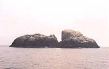
Sule Stack or Stack Skerry is an extremely remote island or stack in the North Atlantic off the north coast of Scotland. It is formed of Lewisian gneiss.[5]
| Meaning of name | Gannet Stack, from sùlaire (Scottish Gaelic for northern gannet), and Stack (originally Norse) Norse[1] |
|---|---|
| Location | |
 Sule Stack Sule Stack shown within Scotland | |
| OS grid reference | HX561179 |
| Coordinates | 59°01′N 4°31′W / 59.02°N 4.51°W |
| Physical geography | |
| Island group | North Atlantic |
| Area | 2.9 ha (7+1⁄4 acres) |
| Highest elevation | 36 m (118 ft) |
| Administration | |
| Sovereign state | United Kingdom |
| Country | Scotland |
| Council area | Orkney |
| Demographics | |
| Population | 0 |
| References | [2][3][4] |
Sule Stack lies 49 kilometres (26+1⁄2 nautical miles) north of the Scottish mainland, and 66 km (35+1⁄2 nmi) west of the Orkney mainland, at grid reference HX561179. Sule Stack's sole neighbour, Sule Skerry, lies 10 km (5+1⁄2 nmi) northeast and the remote islands of Rona and Sula Sgeir lie further to the west. Sule Stack and Sule Skerry are home to thousands of gannets and as a result are listed as a special protection area; the island falls within the administrative region of the Orkney Islands.
Bird species nesting on the stack include:[6]
- Razorbill Alca torda
- Atlantic puffin Fratercula arctica
- Fulmar Fulmarus glacialis
- Great black-backed gull Larus marinus
- Common shag Phalacrocorax aristotelis
- Black-legged kittiwake Rissa tridactyla
- Arctic tern Sterna paradisaea
- Northern gannet Morus bassanus
- Common guillemot Uria aalge
See also edit
References edit
Sources edit
- Haswell-Smith, Hamish (2004). The Scottish Islands. Edinburgh: Canongate. ISBN 978-1-84195-454-7.
- Kirton, S.R.; Hitchen, K. (1987). "Timing and style of crustal extension N of the Scottish mainland". In Coward, M.P.; Dewey, J.F.; Hancock, P.L. (eds.). Continental Extensional Tectonics. Special Publications. Vol. 28. London: Geological Society. pp. 501–510. ISBN 978-0-632-01605-1.
- National Records of Scotland (15 August 2013). "Appendix 2: Population and households on Scotland's Inhabited Islands" (PDF). Statistical Bulletin: 2011 Census: First Results on Population and Household Estimates for Scotland Release 1C (Part Two) (PDF) (Report). SG/2013/126. Retrieved 14 August 2020.
- Orkney (Mainland) (Map). 1:50,000. Landranger. Ordnance Survey. 2014. ISBN 9780319228128.
- Stewart, Malcolm (1 February 1938), "Notes on the Gannetries of Sule Stack and Sula Sgeir" (PDF), British Birds, 31 (9), Witherby & Co.: 282–294
- "Sule Skerry & Stack Skerry". European Environment Agency.
External links edit
59°01′26″N 4°30′30″W / 59.02382°N 4.50846°W