
KNOWPIA
WELCOME TO KNOWPIA

Yunak 
Summary
Yunak is a municipality and district of Konya Province, Turkey.[3] Its area is 2,101 km2,[4] and its population is 20,991 (2022).[2]
Yunak | |
|---|---|
District and municipality | |
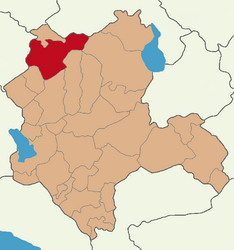 Map showing Yunak District in Konya Province | |
 Yunak Location in Turkey  Yunak Yunak (Turkey Central Anatolia) | |
| Coordinates: 38°49′02″N 31°44′08″E / 38.81722°N 31.73556°E | |
| Country | Turkey |
| Province | Konya |
| Government | |
| • Mayor | Ali Konak[1] (AKP) |
| Area | 2,101 km2 (811 sq mi) |
| Elevation | 1,080 m (3,540 ft) |
| Population (2022)[2] | 20,991 |
| • Density | 10.0/km2 (26/sq mi) |
| Time zone | UTC+3 (TRT) |
| Postal code | 42530 |
| Area code | 0332 |
| Website | www |
Composition edit
There are 42 neighbourhoods in Yunak District:[5]
- Altınöz
- Ayrıtepe
- Beşışıklı
- Böğrüdelik
- Çayırbaşı
- Cebrail
- Eğrikuyu
- Esentepe
- Eşme
- Fatih
- Hacıfakılı
- Hacıömeroğlu
- Harunlar
- Hatırlı
- Hursunlu
- İmamoğlu
- Karataş
- Karayayla
- Kargalı
- Kıllar
- Koçyazı
- Kurtuşağı
- Kuyubaşı
- Kuzören
- Meşelik
- Odabaşı
- Ortakışla
- Özyayla
- Piribeyli
- Saray
- Selçuk
- Sertler
- Sevinç
- Sinanlı
- Sıram
- Sülüklü
- Turgut
- Yavaşlı
- Yeni
- Yeşiloba
- Yeşilyayla
- Yığar
Climate edit
Yunak experiences a transitional continental and Mediterranean climate (Köppen: Csa/Dsa),[6] with hot, dry summers, and cold winters.[7]
| Climate data for Yunak (1991–2020) | |||||||||||||
|---|---|---|---|---|---|---|---|---|---|---|---|---|---|
| Month | Jan | Feb | Mar | Apr | May | Jun | Jul | Aug | Sep | Oct | Nov | Dec | Year |
| Mean daily maximum °C (°F) | 4.2 (39.6) |
6.3 (43.3) |
10.9 (51.6) |
16.1 (61.0) |
21.4 (70.5) |
26.0 (78.8) |
29.8 (85.6) |
29.7 (85.5) |
25.4 (77.7) |
19.0 (66.2) |
12.1 (53.8) |
6.0 (42.8) |
17.3 (63.1) |
| Daily mean °C (°F) | 0.1 (32.2) |
1.6 (34.9) |
5.5 (41.9) |
10.2 (50.4) |
15.2 (59.4) |
19.3 (66.7) |
22.6 (72.7) |
22.6 (72.7) |
18.7 (65.7) |
13.3 (55.9) |
7.0 (44.6) |
2.0 (35.6) |
11.6 (52.9) |
| Mean daily minimum °C (°F) | −3.2 (26.2) |
−2.1 (28.2) |
1.0 (33.8) |
5.3 (41.5) |
10.0 (50.0) |
13.6 (56.5) |
16.3 (61.3) |
16.4 (61.5) |
12.9 (55.2) |
8.7 (47.7) |
3.1 (37.6) |
−1.2 (29.8) |
6.8 (44.2) |
| Average precipitation mm (inches) | 39.28 (1.55) |
40.14 (1.58) |
47.69 (1.88) |
51.55 (2.03) |
51.13 (2.01) |
40.62 (1.60) |
13.72 (0.54) |
11.63 (0.46) |
16.61 (0.65) |
37.46 (1.47) |
39.52 (1.56) |
52.16 (2.05) |
441.51 (17.38) |
| Average precipitation days (≥ 1.0 mm) | 6.5 | 6.2 | 7.3 | 7.7 | 7.7 | 5.3 | 2.7 | 2.8 | 2.8 | 4.8 | 5.1 | 7.2 | 66.1 |
| Average relative humidity (%) | 77.6 | 71.8 | 63.7 | 58.7 | 56.7 | 53.3 | 46.0 | 46.6 | 48.7 | 59.1 | 66.8 | 77.0 | 60.5 |
| Source: NOAA[8] | |||||||||||||
References edit
- ^ "Başkan". Yunak Belediyesi.
- ^ a b "Address-based population registration system (ADNKS) results dated 31 December 2022, Favorite Reports" (XLS). TÜİK. Retrieved 19 September 2023.
- ^ Büyükşehir İlçe Belediyesi, Turkey Civil Administration Departments Inventory. Retrieved 19 September 2023.
- ^ "İl ve İlçe Yüz ölçümleri". General Directorate of Mapping. Retrieved 19 September 2023.
- ^ Mahalle, Turkey Civil Administration Departments Inventory. Retrieved 19 September 2023.
- ^ "Table 1 Overview of the Köppen-Geiger climate classes including the defining criteria". Nature: Scientific Data.
- ^ "Kar Örtülü Gün Sayısı" (PDF). MGM.
- ^ "World Meteorological Organization Climate Normals for 1991-2020 — Yunak". National Oceanic and Atmospheric Administration. Retrieved January 17, 2024.
External links edit
- District governor's official website (in Turkish)
- District municipality's official website (in Turkish)