


Summary
The 1972 United States presidential election in Montana took place on November 7, 1972, and was part of the 1972 United States presidential election. Voters chose four representatives, or electors to the Electoral College, who voted for president and vice president.
| ||||||||||||||||||||||||||
| ||||||||||||||||||||||||||
 County Results
| ||||||||||||||||||||||||||
| ||||||||||||||||||||||||||
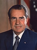

Montana strongly voted for the Republican nominee, President Richard Nixon, over the Democratic nominee, Senator George McGovern. Nixon won Montana by a margin of 20.08%, making Montana around 4% more Democratic than the nation at large; McGovern's vote share was 0.4% higher than it was nationally. This was the first time since 1928 that Sheridan County voted Republican. As of the 2020 U.S. presidential election, this is the last time Montana shifted in favor of the incumbent President's party, as in the 12 subsequent presidential elections after 1972, it would shift away from every incumbent President's party.
Results edit
| 1972 United States presidential election in Montana[1] | |||||
|---|---|---|---|---|---|
| Party | Candidate | Votes | Percentage | Electoral votes | |
| Republican | Richard Nixon (incumbent) | 183,976 | 57.93% | 4 | |
| Democratic | George McGovern | 120,197 | 37.85% | 0 | |
| American Independent | John G. Schmitz | 13,430 | 4.23% | 0 | |
| Totals | 317,603 | 100.00% | 4 | ||
Results by county edit
| County | Richard Milhous Nixon Republican |
George Stanley McGovern Democratic |
John George Schmitz American Independent |
Margin | Total votes cast | ||||
|---|---|---|---|---|---|---|---|---|---|
| # | % | # | % | # | % | # | % | ||
| Beaverhead | 2,460 | 71.99% | 775 | 22.68% | 182 | 5.33% | 1,685 | 49.31% | 3,417 |
| Big Horn | 2,148 | 56.17% | 1,552 | 40.59% | 124 | 3.24% | 596 | 15.59% | 3,824 |
| Blaine | 1,513 | 54.44% | 1,151 | 41.42% | 115 | 4.14% | 362 | 13.03% | 2,779 |
| Broadwater | 916 | 66.57% | 411 | 29.87% | 49 | 3.56% | 505 | 36.70% | 1,376 |
| Carbon | 2,378 | 61.91% | 1,292 | 33.64% | 171 | 4.45% | 1,086 | 28.27% | 3,841 |
| Carter | 726 | 73.86% | 218 | 22.18% | 39 | 3.97% | 508 | 51.68% | 983 |
| Cascade | 16,159 | 52.40% | 12,899 | 41.83% | 1,778 | 5.77% | 3,260 | 10.57% | 30,836 |
| Chouteau | 2,027 | 59.64% | 1,149 | 33.80% | 223 | 6.56% | 878 | 25.83% | 3,399 |
| Custer | 3,486 | 63.31% | 1,875 | 34.05% | 145 | 2.63% | 1,611 | 29.26% | 5,506 |
| Daniels | 973 | 61.82% | 570 | 36.21% | 31 | 1.97% | 403 | 25.60% | 1,574 |
| Dawson | 3,207 | 63.96% | 1,685 | 33.61% | 122 | 2.43% | 1,522 | 30.36% | 5,014 |
| Deer Lodge | 2,373 | 35.93% | 3,979 | 60.25% | 252 | 3.82% | -1,606 | -24.32% | 6,604 |
| Fallon | 1,034 | 64.46% | 531 | 33.10% | 39 | 2.43% | 503 | 31.36% | 1,604 |
| Fergus | 4,082 | 67.48% | 1,652 | 27.31% | 315 | 5.21% | 2,430 | 40.17% | 6,049 |
| Flathead | 10,417 | 60.72% | 5,412 | 31.55% | 1,327 | 7.73% | 5,005 | 29.17% | 17,156 |
| Gallatin | 10,663 | 66.28% | 5,096 | 31.68% | 329 | 2.05% | 5,567 | 34.60% | 16,088 |
| Garfield | 695 | 77.83% | 173 | 19.37% | 25 | 2.80% | 522 | 58.45% | 893 |
| Glacier | 2,143 | 56.11% | 1,469 | 38.47% | 207 | 5.42% | 674 | 17.65% | 3,819 |
| Golden Valley | 359 | 64.92% | 170 | 30.74% | 24 | 4.34% | 189 | 34.18% | 553 |
| Granite | 804 | 62.28% | 422 | 32.69% | 65 | 5.03% | 382 | 29.59% | 1,291 |
| Hill | 3,759 | 53.06% | 3,061 | 43.20% | 265 | 3.74% | 698 | 9.85% | 7,085 |
| Jefferson | 1,281 | 56.06% | 904 | 39.56% | 100 | 4.38% | 377 | 16.50% | 2,285 |
| Judith Basin | 961 | 59.54% | 557 | 34.51% | 96 | 5.95% | 404 | 25.03% | 1,614 |
| Lake | 4,172 | 62.09% | 2,260 | 33.64% | 287 | 4.27% | 1,912 | 28.46% | 6,719 |
| Lewis and Clark | 10,719 | 61.90% | 6,081 | 35.12% | 516 | 2.98% | 4,638 | 26.78% | 17,316 |
| Liberty | 808 | 65.43% | 365 | 29.55% | 62 | 5.02% | 443 | 35.87% | 1,235 |
| Lincoln | 3,276 | 52.77% | 2,402 | 38.69% | 530 | 8.54% | 874 | 14.08% | 6,208 |
| McCone | 854 | 58.29% | 562 | 38.36% | 49 | 3.34% | 292 | 19.93% | 1,465 |
| Madison | 1,780 | 68.78% | 669 | 25.85% | 139 | 5.37% | 1,111 | 42.93% | 2,588 |
| Meagher | 674 | 71.55% | 230 | 24.42% | 38 | 4.03% | 444 | 47.13% | 942 |
| Mineral | 706 | 49.75% | 659 | 46.44% | 54 | 3.81% | 47 | 3.31% | 1,419 |
| Missoula | 15,557 | 51.77% | 13,784 | 45.87% | 708 | 2.36% | 1,773 | 5.90% | 30,049 |
| Musselshell | 1,202 | 61.11% | 689 | 35.03% | 76 | 3.86% | 513 | 26.08% | 1,967 |
| Park | 3,771 | 63.89% | 1,923 | 32.58% | 208 | 3.52% | 1,848 | 31.31% | 5,902 |
| Petroleum | 232 | 71.38% | 87 | 26.77% | 6 | 1.85% | 145 | 44.62% | 325 |
| Phillips | 1,659 | 64.88% | 828 | 32.38% | 70 | 2.74% | 831 | 32.50% | 2,557 |
| Pondera | 1,890 | 57.41% | 1,215 | 36.91% | 187 | 5.68% | 675 | 20.50% | 3,292 |
| Powder River | 844 | 69.35% | 267 | 21.94% | 106 | 8.71% | 577 | 47.41% | 1,217 |
| Powell | 1,720 | 59.68% | 1,050 | 36.43% | 112 | 3.89% | 670 | 23.25% | 2,882 |
| Prairie | 685 | 68.57% | 303 | 30.33% | 11 | 1.10% | 382 | 38.24% | 999 |
| Ravalli | 4,611 | 61.83% | 2,480 | 33.25% | 367 | 4.92% | 2,131 | 28.57% | 7,458 |
| Richland | 2,645 | 61.51% | 1,438 | 33.44% | 217 | 5.05% | 1,207 | 28.07% | 4,300 |
| Roosevelt | 2,304 | 58.97% | 1,464 | 37.47% | 139 | 3.56% | 840 | 21.50% | 3,907 |
| Rosebud | 1,486 | 63.23% | 777 | 33.06% | 87 | 3.70% | 709 | 30.17% | 2,350 |
| Sanders | 1,779 | 54.72% | 1,197 | 36.82% | 275 | 8.46% | 582 | 17.90% | 3,251 |
| Sheridan | 1,500 | 53.96% | 1,197 | 43.06% | 83 | 2.99% | 303 | 10.90% | 2,780 |
| Silver Bow | 7,967 | 39.05% | 11,704 | 57.36% | 733 | 3.59% | -3,737 | -18.32% | 20,404 |
| Stillwater | 1,698 | 67.95% | 716 | 28.65% | 85 | 3.40% | 982 | 39.30% | 2,499 |
| Sweet Grass | 1,260 | 76.00% | 350 | 21.11% | 48 | 2.90% | 910 | 54.89% | 1,658 |
| Teton | 1,991 | 59.95% | 1,121 | 33.75% | 209 | 6.29% | 870 | 26.20% | 3,321 |
| Toole | 1,679 | 59.64% | 897 | 31.87% | 239 | 8.49% | 782 | 27.78% | 2,815 |
| Treasure | 377 | 65.68% | 176 | 30.66% | 21 | 3.66% | 201 | 35.02% | 574 |
| Valley | 3,210 | 60.02% | 1,973 | 36.89% | 165 | 3.09% | 1,237 | 23.13% | 5,348 |
| Wheatland | 761 | 57.39% | 445 | 33.56% | 120 | 9.05% | 316 | 23.83% | 1,326 |
| Wibaux | 390 | 55.48% | 283 | 40.26% | 30 | 4.27% | 107 | 15.22% | 703 |
| Yellowstone | 25,205 | 62.64% | 13,602 | 33.80% | 1,430 | 3.55% | 11,603 | 28.84% | 40,237 |
| Totals | 183,976 | 57.93% | 120,197 | 37.85% | 13,430 | 4.23% | 63,779 | 20.08% | 317,603 |
See also edit
References edit
- ^ David Leip. "1972 Presidential General Election Results – Montana". Dave Leip’s Atlas of U.S. Presidential Elections. Retrieved April 9, 2017.