


Summary
The 2010 Mindanao earthquakes occurred in the southern Philippines in the Moro Gulf. This was a complex sequence of events including three main events (a triplet earthquake) of Mw magnitude 7.3 or greater on the 23rd of July, and two significant aftershocks of magnitude 6.6 on the 24th and 29th. All of these were deep focus earthquakes, at depths from 565 km (351 mi) to 634 km (394 mi).[1][3][5] This resulted in minimal, but very widespread shaking at the surface, with a maximum intensity of IV (Moderately strong) on the PEIS scale; consequently there were no reports of casualties or damage.[12]
| UTC time | Triplet earthquake: |
|---|---|
| A: 2010-07-23 22:08:11 | |
| B: 2010-07-23 22:51:12 | |
| C: 2010-07-23 23:15:08 | |
| ISC event | |
| A: 15008002 | |
| B: 17178792 | |
| C: 15640291 | |
| D: 15009694 | |
| E: 600183837 | |
| USGS-ANSS | |
| A: ComCat | |
| B: ComCat | |
| C: ComCat | |
| D: ComCat | |
| E: ComCat | |
| Local date | July 24, 2010 |
| Magnitude | |
| A: Mwc7.3[1]mb6.4[2] | |
| B: Mwc7.5[3] Mw7.7, mb6.8[4] | |
| C: Mwc7.5[5] Mw7.4, mb6.8[6] | |
| D: Mwc 6.6[7] mb6.0[8] | |
| E: Mwc 6.6[9] | |
| Depth | A: 610 km[10] B: 585 km[4] C: 634 km[6] D: 565 km[8] E: 618 km[11] |
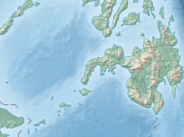
| Epicenter | 6°29′49″N 123°28′48″E / 6.497°N 123.480°E |
| Areas affected | Moro Gulf, Philippines |
| Max. intensity | |
| Aftershocks | D: 2010-07-24 05:35:01 E: 2010-07-29 07:31:56 |

Tectonic summary edit
The southern part of the Philippines lies above the complex collisional zone between the Philippine Sea Plate and the Sunda Plate. The convergence between these two plates of between 6–11 cm per year is accommodated by a series of smaller plates. One of these, the Molucca Sea Plate, is currently being subducted beneath both the Philippine Sea Plate and the Sangihe Microplate, causing it to have an inverted U-shape seismic zone. The earthquakes were caused by the continuing distortion of the Molucca Sea Plate.[13] These three quakes of similar magnitude occurring in such close proximity of each other location-wise and time-wise can be regarded as an example of a triplet earthquake.
Areas affected edit
These earthquakes occurred in Moro Gulf, off the island of Mindanao. The Mw 7.6 earthquake were felt in Philippines, Taiwan, and Malaysia. The Mw 7.4 earthquake were felt in Philippines, Brunei, Malaysia, and Indonesia.
See also edit
References edit
- Four earthquakes hit the Philippines in quick succession
- ^ a b ANSS. "Moro Gulf 2010a: M 7.3 — Moro Gulf, Mindanao, Philippines". Comprehensive Catalog. U.S. Geological Survey.
- ^ International Seismological Centre. ISC-EHB Bulletin. Thatcham, United Kingdom. [Event 15008002].
- ^ a b ANSS. "Moro Gulf 2010b: M 7.6 — Moro Gulf, Mindanao, Philippines". Comprehensive Catalog. U.S. Geological Survey.
- ^ a b ISC-EHB Event 17178792 [IRIS].
- ^ a b ANSS. "Moro Gulf 2010c: M 7.5 — Moro Gulf, Mindanao, Philippines". Comprehensive Catalog. U.S. Geological Survey.
- ^ a b ISC-EHB Event 15640291 [IRIS].
- ^ ANSS. "Moro Gulf 2010d: M 6.6 — Moro Gulf, Mindanao, Philippines". Comprehensive Catalog. U.S. Geological Survey.
- ^ a b ISC-EHB Event 15009694 [IRIS].
- ^ ANSS. "Moro Gulf 2010e: M 6.6 — Moro Gulf, Mindanao, Philippines". Comprehensive Catalog. U.S. Geological Survey.
- ^ ISC-EHB Event 15008002 [IRIS].
- ^ ANSS: Moro Gulf 2010e .
- ^ Philippine Institute of Volcanology and Seismology. "Annual Report 2010". Retrieved 25 May 2020.
- ^ USGS (26 July 2010). "M7.3, 7.6, 7.4 Moro Gulf, Mindanao, Philippines Earthquakes of 23 July 2010" (PDF). Retrieved 30 April 2012.
External links edit
- The International Seismological Centre has a bibliography and/or authoritative data for this event.