


Summary
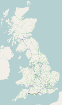
The A35 is a major road in southern England, connecting Honiton in Devon and Southampton in Hampshire. It is a trunk road for some of its length. Most of its route passes through Dorset and the New Forest. It originally connected Exeter and Southampton, the original A35 ran along what is now the A3052 joining the present road at Charmouth.
 | ||||
|---|---|---|---|---|
 | ||||
 At Kingston Russell Looking east along the road from Bridport to Dorchester | ||||
| Route information | ||||
| Length | 96.0 mi[1] (154.5 km) | |||
| Major junctions | ||||
| West end | 50°47′38″N 3°12′37″W / 50.7939°N 3.2102°W[2] | |||
| ||||
| East end | 50°56′25″N 1°22′41″W / 50.9404°N 1.3780°W | |||
| Location | ||||
| Country | United Kingdom | |||
| Primary destinations | Bridport Dorchester (Weymouth) Poole Bournemouth Southampton | |||
| Road network | ||||
| ||||
Route edit

Beginning in Honiton at the eastern junction with the A30 road,[2] the A35 travels in a roughly south-easterly direction past Axminster, Charmouth and Bridport. After Bridport, there is a 2-mile (3.2 km) section of dual carriageway, before it reaches its bypass around Dorchester. After Dorchester, there are approximately 8 miles (13 km) of dual carriageway, including the Puddletown bypass, until it reaches its roundabout with the A31 road at Bere Regis. Continuing roughly south-easterly still, it becomes dual carriageway again near Upton, before returning to a single carriageway through Poole and Bournemouth, apart from a small section of dual carriageway on Wessex Way. On reaching Christchurch, there is a dual-carriageway bypass. It then heads in a north-easterly direction through the New Forest, passing through Lyndhurst where it meets the A337 road (to Lymington). It continues through Ashurst and Totton, meeting the A36 road and M271 motorway at grade separated junctions. It then turns north-east, acting as the western part of Southampton's ring road, with the A27 road making up the eastern part. It terminates at Swaythling, on the northern outskirts of Southampton.
History edit
1922 - Road classification edit
The road number was created with the 1922 classification of roads in the United Kingdom. At that time its western terminus was on the then A30 in Heavitree, Exeter.[3] In 1966 the section from Charmouth to Exeter was de-trunked and renumbered to A3052, with the A35 directed over the former A373 to Honiton,[4] terminating at the then-new[5] A30 Honiton Bypass.[6] This added the narrow 220-foot (67 m) long Charmouth Tunnel to the route, built in 1832 to avoid the summit of Thistle Hill.[7]
1987/88 - Building of Dorchester and Bridport Bypasses edit
The A35 is a main route along England's south coast,[8] and was congested. To help solve the congestion, sections of the A35 were upgraded between Honiton and Poole. In 1969 the Ministry of Transport recorded the case for bypasses around Bridport and Dorchester.[9] The 2.4-mile (3.9 km) bypass to the south of Bridport opened almost two decades later in 1987,[10] followed by the 3.7-mile (6.0 km) bypass to the south of Dorchester[11] in 1988.
1990/91 - Building of Axminster and Charmouth Village Bypasses edit
Following the re-routing onto the former A373 road, a major traffic bottleneck was the town of Axminster. A much-desired southern bypass for the town was indefinitely postponed in 1980 by the then Parliamentary Under-Secretary of State for Transport, Kenneth Clarke.[12] The 3.65-kilometre (2.27 mi) project was eventually authorized by Act of Parliament in 1987,[8] with construction beginning in 1990 approximately following the line of a Roman road.[13] Charmouth village was bypassed in 1991, with the Charmouth Tunnel bypassed at the same time. The defunct tunnel was converted into a shooting range in 2010.[14]
1999 - Puddletown Bypass edit
The Puddletown dual carriageway bypass which opened in 1999 (together with the A30 Honiton-Exeter dualling) were financed under a Design, Build, Finance and Operate (DBFO) contract running from 1996 to 2026.[15]
2004-2007 - Road straightening between Slepe and Upton edit
An on-line straightening between Slepe and the Upton bypass was carried out in 2004, and the extension of the 50 miles per hour (80 km/h) speed limit west of Slepe by 1 mile (1.6 km) in 2007.
Bournemouth Centenary Way diversion edit
In Bournemouth, it has been diverted around the Sovereign Centre of Boscombe along Centenary Way resulting in a 1.9-mile (3.1 km) concurrency[16] with the A338; much of its former route is now pedestrianised.
Junction list edit
| County | Location | mi[1] | km | Destinations | Notes |
|---|---|---|---|---|---|
| Devon | Honiton | 0.0 | 0.0 | Western terminus | |
| 0.4 | 0.64 | A375 signed eastbound only; northern terminus of A375 | |||
| Axminster | 9.5 | 15.3 | To A3052, Axminster, and Sidmouth signed westbound only | ||
| Dorset | Charmouth | 14.2 | 22.9 | Eastern terminus of A3052 | |
| Bridport | 22.6 | 36.4 | B3162 signed westbound only; southern terminus of A3066 | ||
| Winterborne Monkton–Bradford Peverell–Dorchester boundary | 35.3 | 56.8 | Southern terminus of A37 | ||
| Winterborne Monkton–Winterborne Herringston–Dorchester boundary | 36.8 | 59.2 | Southern terminus of A354 concurrency | ||
| Winterborne Came–Dorchester boundary | 38.0 | 61.2 | Western terminus of A352 | ||
| Stinsford | 40.6 | 65.3 | Higher Bockhampton, Lower Bockhampton | Grade–separated junction | |
| Puddletown | 41.9 | 67.4 | Tolpuddle, Puddletown, Troy Town, Puddletown Forest | Grade–separated junction; Tolpuddle, Puddletown signed eastbound only, Puddletown Forest westbound only | |
| 43.0– 43.3 | 69.2– 69.7 | Grade–separated junction; Milborne St Andrew signed eastbound only, Puddletown westbound only; eastern terminus of A354 concurrency | |||
| Tolpuddle–Affpuddle and Turnerspuddle boundary | 46.3– 46.6 | 74.5– 75.0 | Warmwell, Crossways, Affpuddle, Briantspuddle, Milborne St Andrew, Tolpuddle | Grade–separated junction; Milborne St Andrew and Tolpuddle signed westbound only | |
| Bere Regis | 47.6 | 76.6 | Bere Regis, Milborne St Andrew | Grade–separated junction; eastbound exit and westbound entrance | |
| 48.9 | 78.7 | South-western terminus of A31 | |||
| Lytchett Minster | 56.2 | 90.4 | Swanage and Holton Heath signed westbound only; northern terminus of A351 | ||
| Upton | 57.7– 58.1 | 92.9– 93.5 | Grade–separated junction; western terminus of A350 concurrency | ||
| Upton–Poole boundary | 58.6– 58.8 | 94.3– 94.6 | Information signed westbound only; eastern terminus of A350 concurrency | ||
| Poole | 60.0 | 96.6 | To A348 and Canford Heath signed eastbound only; access only to A3049 east and from A3049 west | ||
| 62.1 | 99.9 | Southern terminus of A350 | |||
| 63.5 | 102.2 | Ashley Road (A3040 north) – Upper Parkstone, Wallisdown | Wallisdown signed eastbound only; southern terminus of A3040 | ||
| Bournemouth | 64.3 | 103.5 | Seamoor Road / The Avenue / Lindsay Road – Westbourne | Western terminus of A338 concurrency; southern terminus of A338 | |
| 65.6– 65.8 | 105.6– 105.9 | Grade–separated junction; Charminster and Winton signed eastbound only; southern terminus of A347 | |||
| 66.2 | 106.5 | Eastern terminus of A338 concurrency | |||
| 67.9 | 109.3 | Charminster and Winton signed eastbound only, Ringwood westbound only; eastern terminus of A3049 | |||
| 69.5 | 111.8 | South-eastern terminus of A3060 | |||
| Bournemouth–Christchurch boundary | 69.6– 69.8 | 112.0– 112.3 | Iford Bridge over River Stour | ||
| Christchurch | 73.0 | 117.5 | Western terminus of A337 | ||
| Hampshire | Burley | 78.5 | 126.3 | Burley | Grade–separated junction |
| Lyndhurst | 85.2– 85.4 | 137.1– 137.4 | Brief concurrency | ||
| Colbury–Totton boundary | 89.2– 89.4 | 143.6– 143.9 | |||
| Totton | 90.1 | 145.0 | |||
| 91.0 | 146.5 | Grade–separated junction; westbound exit and eastbound entrance; southern terminus of A36 | |||
| Southampton | 91.2– 91.5 | 146.8– 147.3 | Grade–separated junction; The Midlands, Portsmouth and Bournemouth signed eastbound only, The West westbound only; western terminus of A33 concurrency; southern terminus of M271; western terminus of A33 | ||
| 91.8– 92.0 | 147.7– 148.1 | A33 and City centre signed westbound only; eastern terminus of A33 concurrency | |||
| 92.9 | 149.5 | ||||
| 94.1– 94.7 | 151.4– 152.4 | ||||
| 96.0 | 154.5 | Eastern terminus | |||
1.000 mi = 1.609 km; 1.000 km = 0.621 mi
| |||||
Incidents edit
In May 2021, a sinkhole opened on the carriageway following emergency repairs to a pothole on the A35 Puddletown bypass near the junction for Troytown. The road was closed to allow remedial works to be carried out.[17]
In October 2021 the edge of the eastbound carriageway collapsed into a field where the A35 ascends an escarpment 1.1 miles (1.8 km) east of Honiton. Due to the complex ground conditions repairs took 8 months to complete with temporary signals controlling single-file traffic for that time.[18][19]
References edit
- ^ a b "Honiton, UK to 50-30 A35, Poole BH17 7AH, UK to Castle Hill, Poole BH14 0EN, United Kingdom to 66 Christchurch Rd, Bournemouth BH1 3PF, UK to Christchurch, United Kingdom to United Kingdom to Global Technology Centre, Southampton SO16 7PN, United Kingdom to Southampton SO16 2NR, UK". Google Maps. Retrieved 2 December 2023.
- ^ a b "A35, Honiton". Google Maps. Google, Inc. Retrieved 26 December 2022.
- ^ "Sheet 138 - Exeter". National Library of Scotland. Ordnance Survey. 1933. Retrieved 23 December 2022.
- ^ "Sheet 177 - Taunton and Lyme Regis - B Edition". National Library of Scotland. Ordnance Survey. 1970. Retrieved 23 December 2022.
- ^ "Honiton Bypass". Historic Hansard. UK Parliament. 15 June 1966. Retrieved 23 December 2022.
- ^ "Sheet 176 - Exeter - B Edition". National Library of Scotland. Ordnance Survey. 1967. Retrieved 23 December 2022.
- ^ "CHARMOUTH TUNNEL". Historic England. Historic England. Retrieved 23 December 2022.
- ^ a b "The Folkestone—Honiton Trunk Road A35 (Axminster Bypass and Slip Road) Order 1987". UK Government. 21 December 1987. Retrieved 23 December 2022.
- ^ "Dorchester, Bridport And Sherborne Bypasses". Historic Hansard. UK Parliament. 10 March 1969. Retrieved 26 December 2022.
- ^ "Bridport History". West Bay Websites. Retrieved 26 December 2022.
- ^ "Poundbury to Stinsford Roundabout". Google Maps. Google, Inc. Retrieved 26 December 2022.
- ^ "AXMINSTER (BYPASS)". Hansard. UK Parliament. 30 July 1980. Retrieved 23 December 2022.
- ^ Reed, S. (1990). "Axminster Bypass 1990: Trial Excavations on the Yarty Floodplain" (PDF). Archaeology Data Service Library. Exeter Archaeology: 4. doi:10.5284/1024107. Retrieved 23 December 2022.
- ^ Maslen, Adrianne (24 February 2010). "Charmouth: Rifle range plans for old tunnel near completion". Bridport News. Newsquest Media Group Ltd. Retrieved 26 December 2022.
- ^ "A30 Exeter to Bere Regis". Highways Agency. Archived from the original on 10 August 2012. Retrieved 7 January 2013.
- ^ "Branksome to Bournemouth". Google Maps. Google, Inc. Retrieved 26 December 2022.
- ^ Klein, Josie (11 May 2021). "A35 closed due to sink hole". The Dorset Echo. Retrieved 12 May 2021.
- ^ "A35 Landslip still causing delays six months on". BBC News. British Broadcasting Corporation. 28 March 2022. Retrieved 26 December 2022.
- ^ "Drivers advised to plan journeys as A35 landslip work begins". Midweek Herald. Newsquest Media Group Ltd. 27 June 2022. Retrieved 26 December 2022.
External links edit
- SABRE page on the A35