


Summary
Achlum (Dutch pronunciation: [ˈɑx.lʏm]) is a village in the Waadhoeke municipality of Friesland, Netherlands. It is approximately 7 km southwest of the city of Franeker.
Achlum | |
|---|---|
Village | |
 Achlum church | |
 Location in the Franekeradeel municipality | |
 Achlum Location in the Netherlands  Achlum Achlum (Netherlands) | |
| Coordinates: 53°8′57″N 5°29′5″E / 53.14917°N 5.48472°E | |
| Country | Netherlands |
| Province | Friesland |
| Municipality | Waadhoeke |
| Area | |
| • Total | 7.62 km2 (2.94 sq mi) |
| Elevation | 0.3 m (1.0 ft) |
| Population (2021)[1] | |
| • Total | 595 |
| • Density | 78/km2 (200/sq mi) |
| Postal code | 8806[1] |
| Dialing code | 0517 |
Achlum had about 629 inhabitants in January 2014.[3]
History edit
Before 2018, the village was part of the Franekeradeel municipality. The village has a church which dates from the 12th century and is placed atop a so-called terp mound. Around the year 1260 there was a priory of Augustinian nuns, a part of the Lúntsjerk monastery which was destroyed in 1530. At that time the prior in Achlum was rebuilt but in 1572 the Geuzen destroyed it again. In Achlum used to be a butter factory which processed the milk of local farmers to butter.
In 1811 a farmer from Achlum called Ulbe Piers Draisma established a mutual fire insurance. The insurance society was called Onderlinge Waarborgmaatschappij Achlum.
De Achlumer Molen is a smock mill in Achlum which has been restored to working order. The mill is listed as a Rijksmonument, number 15821.[4]

Community edit
Population edit
- 2009 - 635
- 2008 - 652
- 2005 - 663
- 2004 - 666
- 2003 - 664
- 2002 - 674
- 2001 - 679
- 2000 - 668
- 1999 - 652
- 1973 - 738
- 1969 - 796
- 1964 - 824
- 1959 - 881
- 1954 - 889
Notable residents edit
- Ulbe Piers Draisma (1785–1830)), founder of insurance company Achmea
Gallery edit
-
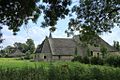 Farm in Achlum
 -
 Canal view
 -
 House in Achlum
 -
 House in Achlum


References edit
- ^ a b c "Kerncijfers wijken en buurten 2021". Central Bureau of Statistics. Retrieved 4 April 2022.
- ^ "Postcodetool for 8806KA". Actueel Hoogtebestand Nederland (in Dutch). Het Waterschapshuis. Retrieved 4 April 2022.
- ^ Aantal inwoners per buurt/dorp Archived 2012-08-12 at the Wayback Machine - Franekeradeel
- ^ "Tehnische Gegevens" (in Dutch). De Hollandsche Molen. Archived from the original on 8 October 2011. Retrieved 24 November 2011. (Click on "Technische Gegevens" to view.)