
KNOWPIA
WELCOME TO KNOWPIA

Agerola 
Summary
Agerola is a comune (municipality) in the Metropolitan City of Naples in the Italian region Campania, located about 35 km southeast of Naples. It is part of the Amalfi Coast.
Agerola | |
|---|---|
 | |
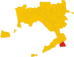 Agerola within the Province of Naples | |
Location of Agerola .mw-parser-output .locmap .od{position:absolute}.mw-parser-output .locmap .id{position:absolute;line-height:0}.mw-parser-output .locmap .l0{font-size:0;position:absolute}.mw-parser-output .locmap .pv{line-height:110%;position:absolute;text-align:center}.mw-parser-output .locmap .pl{line-height:110%;position:absolute;top:-0.75em;text-align:right}.mw-parser-output .locmap .pr{line-height:110%;position:absolute;top:-0.75em;text-align:left}.mw-parser-output .locmap .pv>div{display:inline;padding:1px}.mw-parser-output .locmap .pl>div{display:inline;padding:1px;float:right}.mw-parser-output .locmap .pr>div{display:inline;padding:1px;float:left}html.skin-theme-clientpref-night .mw-parser-output .od,html.skin-theme-clientpref-night .mw-parser-output .od .pv>div,html.skin-theme-clientpref-night .mw-parser-output .od .pl>div,html.skin-theme-clientpref-night .mw-parser-output .od .pr>div{background:#000;color:#fff}html.skin-theme-clientpref-night .mw-parser-output .locmap{filter:grayscale(0.6)}@media(prefers-color-scheme:dark){html.skin-theme-clientpref-os .mw-parser-output .locmap{filter:grayscale(0.6)}html.skin-theme-clientpref-os .mw-parser-output .od,html.skin-theme-clientpref-os .mw-parser-output .od .pv>div,html.skin-theme-clientpref-os .mw-parser-output .od .pl>div,html.skin-theme-clientpref-os .mw-parser-output .od .pr>div{background:#000;color:#fff}}  Agerola Location of Agerola in Italy  Agerola Agerola (Campania) | |
| Coordinates: 40°38′N 14°33′E / 40.633°N 14.550°E | |
| Country | Italy |
| Region | Campania |
| Metropolitan city | Naples (NA) |
| Frazioni | Bomerano, Campora, Pianillo, Ponte, San Lazzaro, Santa Maria |
| Government | |
| • Mayor | Tommaso Naclerio |
| Area | |
| • Total | 19.6 km2 (7.6 sq mi) |
| Elevation | 630 m (2,070 ft) |
| Population (30 April 2017)[2] | |
| • Total | 7,708 |
| • Density | 390/km2 (1,000/sq mi) |
| Demonym | Agerolesi |
| Time zone | UTC+1 (CET) |
| • Summer (DST) | UTC+2 (CEST) |
| Postal code | 80051 |
| Dialing code | 081 |
| Website | Official website |
Geography edit
The municipality of Agerola, situated close to the territory of the Amalfi Coast, contains the frazioni (subdivisions, mainly villages and hamlets) of Bomerano, Campora, Pianillo (communal seat), Ponte, San Lazzaro, and Santa Maria.
Agerola borders on the following municipalities Furore, Gragnano, Pimonte, Positano, Praiano, and Scala.
Twin towns edit
 San Salvatore Monferrato, Italy, since 2011
See also edit
References edit
External links edit
Wikimedia Commons has media related to Agerola.
- Official website