


Summary
Ahwahnee is a census-designated place[6] in Madera County, California, United States.[2] It is located 5.25 miles (8.4 km) west of Yosemite Forks,[7] at an elevation of 2,326 feet (709 m).[2] The population was 2,296 at the 2020 census.[3]
Ahwahnee, California | |
|---|---|
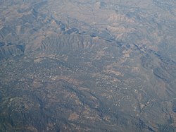 Aerial view of Ahwahnee | |
 Ahwahnee  Ahwahnee | |
| Coordinates: 37°21′56″N 119°43′35″W / 37.36556°N 119.72639°W | |
| Country | |
| State | |
| County | Madera |
| Area | |
| • Total | 11.54 sq mi (29.90 km2) |
| • Land | 11.54 sq mi (29.90 km2) |
| • Water | 0.00 sq mi (0.00 km2) 0% |
| Elevation | 2,326 ft (709 m) |
| Population | |
| • Total | 2,296 |
| • Density | 198.91/sq mi (76.80/km2) |
| Time zone | UTC-8 (Pacific (PST)) |
| • Summer (DST) | UTC-7 (PDT) |
| ZIP Code | 93601 |
| Area code | 559 |
| GNIS feature IDs | 256142;[4] 2628702[5] |
| FIPS code | 06-00478 |
Ahwahnee is hilly and located in the Sierra Nevada. The ZIP Code is 93601. The community is inside area code 559. It is part of the Madera–Chowchilla Metropolitan Statistical Area.
History edit
The Ahwahnee post office opened in 1893 to 1896.[7] The name, "Ahwahnee", is derived from the Southern Sierra Miwok word awwo, which in English means "mouth".[8] The Gertrude post office was transferred to and renamed "Ahwahnee" in 1900, closed in 1907, and re-opened in 1917.[7]
A massive wildfire in 1961, called the Harlow Fire, destroyed 50 of Ahwahnee's 60 buildings.[9] While the community as a whole recovered,[10] two Ahwahnee residents were killed in the fire when their car became stuck on an unpaved road as they fled.[11][12]
Demographics edit
| Census | Pop. | Note | %± |
|---|---|---|---|
| 2020 | 2,296 | — | |
| U.S. Decennial Census[13] | |||
2010 edit
At the 2010 census Ahwahnee had a population of 2,246. The population density was 224.1 inhabitants per square mile (86.5/km2). The racial makeup of Ahwahnee was 2,064 (91.9%) White, 6 (0.3%) African American, 30 (1.3%) Native American, 16 (0.7%) Asian, 0 (0.0%) Pacific Islander, 38 (1.7%) from other races, and 92 (4.1%) from two or more races. Hispanic or Latino of any race were 196 people (8.7%).[14]
The census reported that 2,240 people (99.7% of the population) lived in households, no one lived in non-institutionalized group quarters and 6 (0.3%) were institutionalized.
There were 898 households, 218 (24.3%) had children under the age of 18 living in them, 541 (60.2%) were opposite-sex married couples living together, 87 (9.7%) had a female householder with no husband present, 46 (5.1%) had a male householder with no wife present. There were 45 (5.0%) unmarried opposite-sex partnerships, and 21 (2.3%) same-sex married couples or partnerships. 170 households (18.9%) were one person and 105 (11.7%) had someone living alone who was 65 or older. The average household size was 2.49. There were 674 families (75.1% of households); the average family size was 2.81.
The age distribution was 421 people (18.7%) under the age of 18, 166 people (7.4%) aged 18 to 24, 396 people (17.6%) aged 25 to 44, 705 people (31.4%) aged 45 to 64, and 558 people (24.8%) who were 65 or older. The median age was 49.4 years. For every 100 females, there were 93.8 males. For every 100 females age 18 and over, there were 92.7 males.
There were 1,030 housing units at an average density of 102.8 per square mile, of the occupied units 711 (79.2%) were owner-occupied and 187 (20.8%) were rented. The homeowner vacancy rate was 4.2%; the rental vacancy rate was 6.9%. 1,737 people (77.3% of the population) lived in owner-occupied housing units and 503 people (22.4%) lived in rental housing units.
References edit
- ^ "2021 U.S. Gazetteer Files: California". United States Census Bureau. Retrieved June 24, 2022.
- ^ a b c U.S. Geological Survey Geographic Names Information System: Ahwahnee, California
- ^ a b "P1. Race – Ahwanee CDP, California: 2020 DEC Redistricting Data (PL 94-171)". U.S. Census Bureau. Retrieved June 24, 2022.
- ^ "Ahwahnee". Geographic Names Information System. United States Geological Survey, United States Department of the Interior.
- ^ "Ahwahnee Census Designated Place". Geographic Names Information System. United States Geological Survey, United States Department of the Interior.
- ^ U.S. Geological Survey Geographic Names Information System: Ahwahnee, California
- ^ a b c Durham, David L. (1998). California's Geographic Names: A Gazetteer of Historic and Modern Names of the State. Clovis, Calif.: Word Dancer Press. p. 739. ISBN 1-884995-14-4.
- ^ William Bright; Erwin Gustav Gudde (November 30, 1998). 1500 California Place Names: Their Origin and Meaning. University of California Press. p. 11. ISBN 978-0-520-21271-8. Retrieved January 20, 2012.
- ^ "Sierra Fire Kills 2, Burns Ahwahnee, Nipinnawasee". The Fresno Bee. July 12, 1961. pp. 1-A, 6-A. Archived from the original on March 29, 2024. Retrieved March 29, 2024 – via Newspapers.com.
- ^ Anthony, H.M. (July 14, 1967). "Mountain Residents Remember Holocaust Of 1961 Harlow Fire". Madera Tribune. p. 3. Archived from the original on April 5, 2024. Retrieved April 15, 2024 – via California Digital Newspaper Collection.
- ^ "20 Largest California Wildland Fires (By Structures Lost)". www.fire.ca.gov. California Department of Forestry and Fire Protection (Cal Fire). 2001. Archived from the original on October 31, 2001.
- ^ "Services Set For Fire Victims". Madera Tribune. July 13, 1961. Archived from the original on April 2, 2024. Retrieved April 2, 2024 – via California Digital Newspaper Collection.
- ^ "Census of Population and Housing". Census.gov. Retrieved June 4, 2016.
- ^ "2010 Census Interactive Population Search: CA - Ahwahnee CDP". U.S. Census Bureau. Archived from the original on July 15, 2014. Retrieved July 12, 2014.
- United States Census.