


Summary
Aigre (French pronunciation: [ɛɡʁ] ⓘ) is a commune in the Charente department in the Nouvelle-Aquitaine region of southwestern France.
Aigre | |
|---|---|
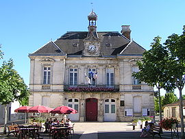 Town hall | |
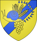
 Coat of arms | |
Location of Aigre .mw-parser-output .locmap .od{position:absolute}.mw-parser-output .locmap .id{position:absolute;line-height:0}.mw-parser-output .locmap .l0{font-size:0;position:absolute}.mw-parser-output .locmap .pv{line-height:110%;position:absolute;text-align:center}.mw-parser-output .locmap .pl{line-height:110%;position:absolute;top:-0.75em;text-align:right}.mw-parser-output .locmap .pr{line-height:110%;position:absolute;top:-0.75em;text-align:left}.mw-parser-output .locmap .pv>div{display:inline;padding:1px}.mw-parser-output .locmap .pl>div{display:inline;padding:1px;float:right}.mw-parser-output .locmap .pr>div{display:inline;padding:1px;float:left}html.skin-theme-clientpref-night .mw-parser-output .od,html.skin-theme-clientpref-night .mw-parser-output .od .pv>div,html.skin-theme-clientpref-night .mw-parser-output .od .pl>div,html.skin-theme-clientpref-night .mw-parser-output .od .pr>div{background:#000;color:#fff}html.skin-theme-clientpref-night .mw-parser-output .locmap{filter:grayscale(0.6)}@media(prefers-color-scheme:dark){html.skin-theme-clientpref-os .mw-parser-output .locmap{filter:grayscale(0.6)}html.skin-theme-clientpref-os .mw-parser-output .od,html.skin-theme-clientpref-os .mw-parser-output .od .pv>div,html.skin-theme-clientpref-os .mw-parser-output .od .pl>div,html.skin-theme-clientpref-os .mw-parser-output .od .pr>div{background:#000;color:#fff}}  Aigre  Aigre | |
| Coordinates: 45°53′42″N 0°00′40″E / 45.895°N 0.011°E | |
| Country | France |
| Region | Nouvelle-Aquitaine |
| Department | Charente |
| Arrondissement | Confolens |
| Canton | Charente-Nord |
| Intercommunality | Cœur de Charente |
| Government | |
| • Mayor (2020–2026) | Renaud Combaud[1] |
| Area 1 | 23.82 km2 (9.20 sq mi) |
| Population (2021)[2] | 1,597 |
| • Density | 67/km2 (170/sq mi) |
| Time zone | UTC+01:00 (CET) |
| • Summer (DST) | UTC+02:00 (CEST) |
| INSEE/Postal code | 16005 /16140 |
| Elevation | 60–151 m (197–495 ft) (avg. 68 m or 223 ft) |
| 1 French Land Register data, which excludes lakes, ponds, glaciers > 1 km2 (0.386 sq mi or 247 acres) and river estuaries. | |
The commune has been awarded one flower by the National Council of Towns and Villages in Bloom in the Competition of cities and villages in Bloom.[3]
Geography edit

Location and access edit
Aigre is located in the north-west of the Charente department 40 kilometres north of Angoulême. The town lies within the borders of the former provinces of Angoumois, Saintonge, and Poitou.
The department of Charente is not served by the French motorway network so access by the A10 autoroute is by National Route N10 at Exit ![]() 30 Poitiers-Sud in the north and by the former National Route N739 from Exit 34, Saint-Jean-d'Angely in the west.
30 Poitiers-Sud in the north and by the former National Route N739 from Exit 34, Saint-Jean-d'Angely in the west.
The commune is traversed by three former national roads: the D739 which connects Tonnay-Charente to Fontafie, the D736 which connects Ruffec to Saint-Fort-sur-le-Né, and the D737 which connects Nanteuil to Angouleme.[4]
The local railway station is Luxé station on the Paris-Bordeaux line. It is served by the TER Nouvelle-Aquitaine network and the TGV passes without stopping. The Saint-Angeau to Segonzac line once passed through Aigre.
The nearest airport is the Angoulême-Cognac Airport.[5]
Hamlets and localities edit
The main hamlets are L'Ouche and Saint-Méxant to the north-west. The commune has only a few isolated farms such as La Combe and Cessac and the subdivision of La Broussette and the Castle of Crève-Cœur in the west. In the south-east there are La Servanterie, the college zone of Reuclos and Aizef at their limits with Marcillac-Lanville are essentially joined to the urban core.[4]
Neighbouring communes and villages edit
Geology and terrain edit
The geology of the commune is limestone from the Jurassic period, part of the Aquitaine Basin as with all the northern half of Charente. The commune is on an Upper Jurassic area, specifically the Kimmeridgian. A small area of sandy soil dating from the Quaternary period covers the plateau in the south-west of the commune and alluvium (silt and clay) cover the Aume Valley on the north-eastern border. The oldest alluvium has accumulated in terraces mainly in the north of the commune.[6][7][8][9]
The south of the commune is a plateau. The Aume Valley is near the north-eastern border near the town. The highest point of the commune is at an altitude of 129m located on the south-eastern boundary (IGN marker). The lowest point is 62m located on the eastern boundary along the Aume at Aizef. The town is built in an old loop of the river and is 65m above sea level.[4]
Hydrography edit
Aigre is traversed by the river Aume which has its source in Bouin (Deux-Sèvres) and flows into the Charente river at Ambérac. The Aume passes through the town which is built mainly on the right bank.
The Aume divides into several branches, some of which pass through the old town.
There are also some fountains such as the Font du Geau at the foot of the Crève-Cœur Castle.[4]
Climate edit
Aigre has an oceanic Aquitaine climate but like all the department underwent Cyclone Lothar and Martin in 1999, and Cyclone Klaus in 2009, and a memorable flood in December 1982.
Toponymy edit
Aigre comes from the Latin Acriacis or villa Acriacii meaning that the village was built around the property of a rich Gallo-Roman named Acrius. At the end of the 13th century Aigre appears in the form Acriacis then Agria in the 17th century.[10]
History edit
There is mention of a church in the 13th century.
Nothing is left of a Castle located at a place called Saint-Mexant which was the subject of fortification works in 1472 except the dovecote, the enclosure, and the moat in 1906. The chapel built before 1706 has also been destroyed.[11]
Aigre belonged to the Lordship of Marcillac and was a very poor vicarage of the archpriest of Ambérac. It was vacant and annexed to Mons from the 15th century. In 1789, a priest for Aigre was finally provided. Marie de Medici stopped over in Aigre in 1619.
In the 16th century a large part of the population became part of the reformation and together with Marcillac formed a Protestant parish of the Synod of Poitou. Protestantism was prohibited in Marcillac in 1665 then on 31 March 1667 a decision of the grand Seneschal of Poitou ordered the closure of the Protestant place of worship in Aigre.[12]
On 1 January 2019, the former commune of Villejésus was merged into Aigre.[13]
Heraldry edit
 |
Blazon: Or, a bend sinister of azure charged with a bunch of grapes surmounted by an ear of corn at sinister 2 ears of wheat in bouquet, the whole of Or debruised at dexter by a snail the same shelled azure, the whole accompanied at sinister by 13 Gouttes set in an arc: 4 in chief azure, 3 on bend of Or, and 6 at sinister azure. |
Administration edit
This list is incomplete; you can help by adding missing items. (April 2021) |
List of Successive Mayors of Aigre[14]
| From | To | Name | Party | Position |
|---|---|---|---|---|
| 2001 | 2008 | Philippe Combaud | ind. | Insurer |
| 2008 | 2020 | Jean-Paul Ayrault | DVD | Agricultural technician |
| 2020 | 2026 | Renaud Combaud |
Taxation edit
Taxation is a rate of 16.05% on buildings, 49.81% on undeveloped land, 7.13% for residence tax, and business tax of 11.48% (2007 rates).
The Community of communes levies 2.61% on buildings, 6.06% on undeveloped land, 1.09% for residence tax, and business tax of 1.45%.
Twinning edit
Aigre has twinning associations with:[15]
 Fahrenkrug (Germany) since 1987.
Population edit
The inhabitants of the commune are known as Aigrinois or Aigrinoises in French.[16]
| Year | Pop. | ±% p.a. |
|---|---|---|
| 1968 | 1,681 | — |
| 1975 | 1,676 | −0.04% |
| 1982 | 1,657 | −0.16% |
| 1990 | 1,726 | +0.51% |
| 1999 | 1,685 | −0.27% |
| 2007 | 1,662 | −0.17% |
| 2012 | 1,639 | −0.28% |
| 2017 | 1,591 | −0.59% |
| Source: INSEE[17] | ||
Distribution of Age Groups edit
Percentage Distribution of Age Groups in Aigre and Charente Department in 2017
| Aigre | Charente | |||
|---|---|---|---|---|
| Age Range | Men | Women | Men | Women |
| 0 to 14 Years | 14.1 | 11.1 | 16.7 | 14.8 |
| 15 to 29 Years | 12.1 | 10.1 | 15.7 | 13.8 |
| 30 to 44 Years | 14.3 | 11.4 | 17.1 | 16.3 |
| 45 to 59 Years | 21.0 | 18.8 | 21.1 | 20.8 |
| 60 to 74 Years | 23.1 | 24.7 | 19.6 | 19.8 |
| 75 to 89 Years | 13.2 | 17.9 | 8.9 | 12.0 |
| 90 Years+ | 2.2 | 6.1 | 0.9 | 2.4 |
It is clear that the population is elderly, especially for women.
Economy edit
The Wheat mill, called the Moulin du Château dates from the 18th century and was converted in the 19th century to using the driving force of the water for the workshop for making Angelus liqueur.
Currently, it has become the Gautier distillery[19] which in 1990 employed 32 people at the plant and 20 in sales.[20]
Cognac Gautier joined the Berger group in 1975 which was itself taken over by the Marie Brizard group in 1995.
Facilities, services, and local life edit
Education edit
The secondary college of Osme hosts 180-200 students from the 6th to the 3rd divided into eight classes.[21]
Aigre also has a primary school with four classes.[22]
Services edit
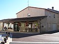
As the capital of the Canton, Aigre has a police station and a rescue centre.
-
 The Rescue Centre
 -
 The Tourist Information Centre


Sports edit
Cycling edit
The cycling track is located in the town. The club is called ACJAR[23] and they organize several amateur races in the north-west of Charente such as the Criterium of Villejésus and the Tour of Aigre country. In 2010, the club organized, with the French federation of wheelchair sports, the championship of France of for wheelchair cycling in the commune of Saint-Fraigne.
The town had already been traversed by the Tour de France but in 2009 for the first time it held the 1st stage in the 23rd Tour du Poitou-Charentes and the victory of Anthony Ravard on 25 August 2009. The start of the second stage took place the next day at Rouillac.
Bicycle touring has increased since the CC Aigrinois organized a biennial event called the Coco Trainaud whose last event was held on 15 May 2011. It is named after a former rider who has done a lot for local cycling.
Football edit
Soccer is a major sport in the commune with a club founded in 1902 that participated in the USFSA championship of Charentes before the First World War. Thereafter the club has long been at the regional level and was in 1968 the winner of the Challenge of the Central-West League.[24]
Sites and Monuments edit
Civil heritage edit
The commune has several sites that are registered as historical monuments:
- A House at l'Ouche (1793)
 [25]
[25] - A House at Rue de l'Eglise (19th century) [26]
- A House at 17 Rue de l'Eglise (15th century) [27]
- A House at Rue des Planches (19th century) [28]
- A Flour Mill at 28 Rue des Ponts (18th century) [29]
- A House at 2 Rue de la Servanterie (1774) [30]
- A House at RN 736 (19th century) [31]
- A Chateau at Saint Mexant (destroyed) (15th century) [32]
- Houses and Farms (15th, 18th-19th centuries) [33]
- A Chateau at Crève-Coeur (19th century) [34]
There are many registered historical objects in the commune, several of which are in private collections.[35]
Religious Heritage edit

The commune has two religious sites that are registered as historical monuments:
- A Chapel at Saint Mexant (17th century) [36]
- The Parish Church of Saint Pierre (1875). [37] The church was first built in 1620 then rebuilt in 1868 but collapsed in 1870 and was rebuilt again from 1874 to 1877. The bell tower spire was completed in masonry in 1882. The church contains a number of items that are registered as historical objects:
- A Bronze Bell called Marie Louise (1807)
 [38]
[38] - An Altar and Tabernacle (19th century) [39]
- An Altar and Tabernacle (19th century) [40]
- An Altar and Tabernacle (19th century) [41]
- 2 Stained glass windows: Saint Louis and Saint Radegonde (1876) [42]
- 3 Stained glass windows of people (1876) [43]
- A Portal (19th century) [44]
- A Bronze Bell called Marie Louise (1807)
Environmental heritage edit
Aigre is located on the Aume river.
-
 The canal
 -
 The Gardens
 -
 The Delicatessen


Notable People linked to the commune edit

- Bertrand Hériard Dubreuil, graduate of the Ecole Centrale de Lille, head of Ceras
- Louis Gustave Chauveaud (1859–1933), botanist and anatomist, born in Aigre
- Paul Flamand, founder of Editions du Seuil, born in Aigre
- Louis Gautier (1810–1884), Bonapartist politician, born in Aigre
- René François Gautier (1851–1936), politician, born in Aigre
See also edit
References edit
- ^ "Répertoire national des élus: les maires". data.gouv.fr, Plateforme ouverte des données publiques françaises (in French). 2 December 2020.
- ^ "Populations légales 2021". The National Institute of Statistics and Economic Studies. 28 December 2023.
- ^ Aigre in the Competition for Towns and Villages in Bloom Archived 2014-12-10 at the Wayback Machine (in French)
- ^ a b c d IGN Map on the Géoportail (in French)
- ^ Angouleme-Cognac Airport website Archived 2013-08-08 at the Wayback Machine (in French)
- ^ BRGM Map on Géoportail (in French)
- ^ Infoterre Visualiser, BRGM website (in French)
- ^ Notice on Matha, BRGM, 1986, Infoterre, consulted on 20 November 2011 (in French)
- ^ Notice on Mansle, BRGM, 1984, Infoterre, consulted on 13 November 2011 (in French)
- ^ Jean-Marie Cassagne and Stéphane Seguin, Origin of the names of towns and villages in Charente, Jean-Michel Bordessoules, 1998, 311 pages, p. 10, ISBN 2-913471-06-4 (in French)
- ^ Base Mérimée: IA00040743 Castle of Saint-Mexant, Ministère français de la Culture. (in French)
- ^ Dr. Joseph Mouclier, Some historical notes on the 82 communes of the Arrondissement of Ruffec - Vol. I, The town of Ruffec and the communes of the Canton of Aigre, - Local studies, January–February 1921, see: Aigre on charente.free (in French)
- ^ Arrêté préfectoral 28 September 2018, p. 4 (in French)
- ^ List of Mayors of France (in French)
- ^ National Commission for Decentralised cooperation (in French)
- ^ Le nom des habitants du 16 - Charente, habitants.fr
- ^ a b Évolution et structure de la population en 2017: Commune d'Aigre (16005)
- ^ Évolution et structure de la population en 2017: Département de la Charente (16)
- ^ The Cognac Gautier website (in French)
- ^ Base Mérimée: IA00066106 Moulin du Château, Ministère français de la Culture. (in French)
- ^ Collèges, Academic Inspection of Charente website, consulted on 20 March 2011 (in French)
- ^ Directory of Schools, Academic Inspection of Charente website, consulted on 20 March 2011 (in French)
- ^ Cyclist Association of Jarnac, Aigre, and Rouillac, consulted on 21 March 2010 (in French)
- ^ Football, Challenge Centre-Ouest (in French)
- ^ Ministry of Culture, Mérimée IA00040742 House at l'Ouche (in French)
- ^ Ministry of Culture, Mérimée IA00040915 House at Rue de l'Eglise (in French)
- ^ Ministry of Culture, Mérimée IA00040741 House at 17 Rue de l'Eglise (in French)
- ^ Ministry of Culture, Mérimée IA00040917 House at Rue des Planches (in French)
- ^ Ministry of Culture, Mérimée IA00066106 Flour Mill at 28 Rue des Ponts (in French)

- ^ Ministry of Culture, Mérimée IA00040740 House at 2 Rue de la Servanterie (in French)
- ^ Ministry of Culture, Mérimée IA00040916 House at RN 736 (in French)
- ^ Ministry of Culture, Mérimée IA00040743 Chateau at Saint Mexant (in French)
- ^ Ministry of Culture, Mérimée IA00040739 House at RN 736 (in French)
- ^ Ministry of Culture, Mérimée IA00040737 Chateau at Crève-Coeur (in French)
- ^ Base Palissy: Search for heritage in the commune, Ministère français de la Culture. (in French)
- ^ Ministry of Culture, Mérimée IA00040744 Chapel at Saint Mexant (in French)
- ^ Ministry of Culture, Mérimée IA00040738 Parish Church of Saint Pierre (in French)
- ^ Ministry of Culture, Palissy IM16001553 Bronze Bell called Marie Louise (in French)
- ^ Ministry of Culture, Palissy IM16001552 Altar and Tabernacle (in French)
- ^ Ministry of Culture, Palissy IM16001551 Altar and Tabernacle (in French)
- ^ Ministry of Culture, Palissy IM16001550 Altar and Tabernacle (in French)
- ^ Ministry of Culture, Palissy IM16001549 2 Stained glass windows: Saint Louis and Saint Radegonde (in French)
- ^ Ministry of Culture, Palissy IM16001548 3 Stained glass windows of people (in French)
- ^ Ministry of Culture, Palissy IM16001547 Portal (in French)
External links edit
- Aigre in the old National Geographic Institute website (in French)
- Aigre Country website (in French)
- Aigre on charente.ruffec.free.fr (in French)
- Aigre on the 1750 Cassini Map