


Summary
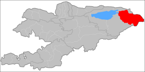
Ak-Suu (Kyrgyz: Ак-Суу району) is a district of Issyk-Kul Region in eastern Kyrgyzstan. The administrative center lies at the village Teploklyuchenka.[2] Its area is 9,917 square kilometres (3,829 sq mi),[3] and its resident population was 69,439 in 2021.[1]
Ak-Suu
| |
|---|---|
 | |
| Coordinates: 42°30′N 78°40′E / 42.500°N 78.667°E | |
| Country | Kyrgyzstan |
| Region | Issyk-Kul |
| Area | |
| • Total | 9,917 km2 (3,829 sq mi) |
| Population (2023)[1] | |
| • Total | 73,967 |
| • Density | 7.5/km2 (19/sq mi) |
| Time zone | UTC+6 (KGT) |
Geography edit
Located in Kyrgyzstan's eastern corner, the district borders in the north with the Almaty Region of Kazakhstan, and in the east, with the Aksu Prefecture of China's Xinjiang Uyghur Autonomous Region. Two of Kyrgyzstan's highest mountains, Jengish Chokusu (Victory Peak, or Pobeda Peak in Russian) and Khan Tengri, are located on these borders. Some 93% of the district is occupied by mountains and 7% - by valleys [4]
Climate edit
The average temperature in January is -8 °C in valleys and -26 °C - in mountains. In July, the average monthly temperature varies from +14 °C in valleys and 9 °C - in mountains. The minimum temperature drops to 40 °C below zero. The average high temperatures are from +30 °C in valleys and +15 °C - in mountains. The total precipitation is from 300 to 400 mm in valleys and from 500 to 600 mm - in mountains. The snow accumulation reaches 40 cm in valleys. The maximum expected wind speed (once in 20-year period) is 34 m/s.[4]
Demographics edit
The district population, as of 2021, was 69,439.[1] The population density was 7.0 people per square kilometer.
| Year | Pop. | ±% p.a. |
|---|---|---|
| 1970 | 44,361 | — |
| 1979 | 50,422 | +1.43% |
| 1989 | 56,889 | +1.21% |
| 1999 | 57,155 | +0.05% |
| 2009 | 63,686 | +1.09% |
| 2021 | 69,439 | +0.72% |
| Note: resident population; Source:[3][1] | ||
Ethnic composition edit
According to the 2009 Census, the ethnic composition (de jure population) of the Ak-Suu District was:[3]
| Ethnic group | Population | Proportion of Ak-Suu District population |
|---|---|---|
| Kyrgyzs | 56,369 | 88.5% |
| Russians | 2,884 | 4.5% |
| Kalmyks | 2,805 | 4.4% |
| Kazakhs | 916 | 1.5% |
| Uygurs | 201 | 0.3% |
| Tatars | 146 | 0.2% |
| Ukrainians | 125 | 0.2% |
| Uzbeks | 110 | 0.2% |
| Other groups | 130 | 0.2% |
Populated places edit

In total, Ak-Suu District includes 48 settlements in 14 rural communities (ayyl aymagy). Each rural community can consist of one or several villages. The rural communities and settlements in the Ak-Suu District are:[2][5]
- Ak-Bulung (seat: Ak-Bulung; incl. Ak-Bulak, Toktogul and Türgön)
- Ak-Chiy (seat: Ak-Chiy; incl. Kachybek, Kök-Jayyk, Kyzyl-Jar and Sovetskoye)
- Börü-Bash (seat: Börü-Bash; incl. Cherik)
- Boz-Uchuk (seat: Novovoznesenovka; incl. Boz-Uchuk and Ichke-Jergez)
- Chelpek (seat: Chelpek; incl. Burma-Suu and Tash-Kyya)
- Engilchek (seat: Engilchek, incl. Keng-Suu, Koyluu, Kurgak, May-Saz, Tash-Koroo and Echkili-Tash)
- Jyrgalang (seat: Jyrgalang)
- Kara-Jal (seat: Tegizchil; incl. Jangy-Aryk, Kara-Jal and Boz-Bulung)
- Karakol (seat: Karakol; incl. Cholpon)
- Kerege-Tash (seat: Sary-Kamysh; incl. Kerege-Tash, Kayyrma-Aryk, Novokonstantinovka and Pioner)
- Oktyabr (seat: Oktyabrskoye; incl. Jol-Kolot, Otuz-Uul and Üch-Kaynar)
- Otradnoye (seat: Otradnoye; incl. Orlinoye and Shapak)
- Tepke (seat: Tepke; incl. Jyldyz and Kurbu)
- Teploklyuchenka (seat: Teploklyuchenka; incl. Lesnoye)

Sary-
Kamysh
Tash
Chelpek
Suu
References edit
- ^ a b c d "Population of regions, districts, towns, urban-type settlements, rural communities and villages of Kyrgyz Republic" (XLS) (in Russian). National Statistics Committee of the Kyrgyz Republic. 2021. Archived from the original on 10 November 2021.
- ^ a b "Classification system of territorial units of the Kyrgyz Republic" (in Kyrgyz). National Statistics Committee of the Kyrgyz Republic. May 2021. pp. 9–10.
- ^ a b c "2009 population and housing census of the Kyrgyz Republic: Issyk-Kul Region" (PDF) (in Russian). National Statistics Committee of the Kyrgyz Republic. 2010. pp. 11, 16, 49.
- ^ a b Мониторинг, прогнозирование опасных процессов и явлений на территории Кыргызской Республики [Monitoring, forecasting of natural hazards in Kyrgyz Republic.] (in Russian). Ministry of Emergency Situations of Kyrgyz Republic.
- ^ Law 27 September 2012 No. 168 on the transformation of individual urban settlements of the Kyrgyz Republic and relating them to the category of village or city