


Summary
Alcala, officially the Municipality of Alcala, is a 3rd class municipality in the province of Cagayan, Philippines. According to the 2020 census, it has a population of 41,295 people.[3]
Alcala | |
|---|---|
| Municipality of Alcala | |
 Seal | |
 Map of Cagayan with Alcala highlighted | |
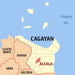
OpenStreetMap .mw-parser-output .locmap .od{position:absolute}.mw-parser-output .locmap .id{position:absolute;line-height:0}.mw-parser-output .locmap .l0{font-size:0;position:absolute}.mw-parser-output .locmap .pv{line-height:110%;position:absolute;text-align:center}.mw-parser-output .locmap .pl{line-height:110%;position:absolute;top:-0.75em;text-align:right}.mw-parser-output .locmap .pr{line-height:110%;position:absolute;top:-0.75em;text-align:left}.mw-parser-output .locmap .pv>div{display:inline;padding:1px}.mw-parser-output .locmap .pl>div{display:inline;padding:1px;float:right}.mw-parser-output .locmap .pr>div{display:inline;padding:1px;float:left}html.skin-theme-clientpref-night .mw-parser-output .od,html.skin-theme-clientpref-night .mw-parser-output .od .pv>div,html.skin-theme-clientpref-night .mw-parser-output .od .pl>div,html.skin-theme-clientpref-night .mw-parser-output .od .pr>div{background:#000;color:#fff}html.skin-theme-clientpref-night .mw-parser-output .locmap{filter:grayscale(0.6)}@media(prefers-color-scheme:dark){html.skin-theme-clientpref-os .mw-parser-output .locmap{filter:grayscale(0.6)}html.skin-theme-clientpref-os .mw-parser-output .od,html.skin-theme-clientpref-os .mw-parser-output .od .pv>div,html.skin-theme-clientpref-os .mw-parser-output .od .pl>div,html.skin-theme-clientpref-os .mw-parser-output .od .pr>div{background:#000;color:#fff}}  Alcala Location within the Philippines | |
| Coordinates: 17°54′11″N 121°39′20″E / 17.9031°N 121.6556°E | |
| Country | Philippines |
| Region | Cagayan Valley |
| Province | Cagayan |
| District | 1st district |
| Barangays | 25 (see Barangays) |
| Government | |
| • Type | Sangguniang Bayan |
| • Mayor | Cristina Antonio |
| • Vice Mayor | Joy C. Duruin |
| • Representative | Ramon C. Nolasco Jr. |
| • Electorate | 23,914 voters (2022) |
| Area | |
| • Total | 187.20 km2 (72.28 sq mi) |
| Elevation | 36 m (118 ft) |
| Highest elevation | 219 m (719 ft) |
| Lowest elevation | 5 m (16 ft) |
| Population (2020 census)[3] | |
| • Total | 41,295 |
| • Density | 220/km2 (570/sq mi) |
| • Households | 9,993 |
| Economy | |
| • Income class | 3rd municipal income class |
| • Poverty incidence | 14.66 |
| • Revenue | ₱ 185.3 million (2020) |
| • Assets | ₱ 406.3 million (2020) |
| • Expenditure | ₱ 133.9 million (2020) |
| • Liabilities | ₱ 73.28 million (2020) |
| Service provider | |
| • Electricity | Cagayan 1 Electric Cooperative (CAGELCO 1) |
| Time zone | UTC+8 (PST) |
| ZIP code | 3507 |
| PSGC | 021502000 |
| IDD : area code | +63 (0)78 |
| Native languages | Ibanag Ilocano Tagalog |
Alcala is home to the Saint Philomene Church, regarded as the widest church in the Cagayan Valley.
Alcala is the birthplace of Senator Melecio Arranz of 1st Senatorial District of the Philippines.
Alcala is 35 kilometres (22 mi) from Tuguegarao and 516 kilometres (321 mi) from Manila.
History edit
The indigenous tribes of the Ibanag people were the first settlers of modern-day Alcala. They called the area Fulay, literally meaning red, in its reference to the distinct red color of its soil. After two centuries of Spanish rule, Fulay was formally proclaimed as a township on 20 July 1789. However, it was not until 1843 when it was renamed Alcala, in honor of the governor general Francisco Paula de Alcala.[5]
Geography edit
Barangays edit
Alcala is politically subdivided into 25 barangays. Each barangay consists of puroks while some have sitios.
Climate edit
| Climate data for Alcala, Cagayan | |||||||||||||
|---|---|---|---|---|---|---|---|---|---|---|---|---|---|
| Month | Jan | Feb | Mar | Apr | May | Jun | Jul | Aug | Sep | Oct | Nov | Dec | Year |
| Mean daily maximum °C (°F) | 24 (75) |
25 (77) |
28 (82) |
30 (86) |
31 (88) |
31 (88) |
30 (86) |
30 (86) |
29 (84) |
28 (82) |
26 (79) |
24 (75) |
28 (82) |
| Mean daily minimum °C (°F) | 20 (68) |
20 (68) |
21 (70) |
22 (72) |
24 (75) |
24 (75) |
24 (75) |
24 (75) |
24 (75) |
23 (73) |
23 (73) |
21 (70) |
23 (72) |
| Average precipitation mm (inches) | 150 (5.9) |
106 (4.2) |
84 (3.3) |
48 (1.9) |
103 (4.1) |
115 (4.5) |
134 (5.3) |
156 (6.1) |
136 (5.4) |
240 (9.4) |
246 (9.7) |
300 (11.8) |
1,818 (71.6) |
| Average rainy days | 19 | 14.3 | 12.8 | 10.8 | 17.7 | 18.9 | 21.5 | 23.3 | 22.1 | 20.4 | 20.3 | 22.2 | 223.3 |
| Source: Meteoblue[6] | |||||||||||||
Demographics edit
|
| |||||||||||||||||||||||||||||||||||||||||||||||||||
| Source: Philippine Statistics Authority[7][8][9][10] | ||||||||||||||||||||||||||||||||||||||||||||||||||||
In the 2020 census, the population of Alcala, Cagayan, was 41,295 people,[3] with a density of 220 inhabitants per square kilometre or 570 inhabitants per square mile.
Economy edit
Alcala Milk Candy is a famous product of this municipality.
Government edit
Local government edit
Alcala, belonging to the first legislative district of the province of Cagayan, is governed by a mayor designated as its local chief executive and by a municipal council as its legislative body in accordance with the Local Government Code. The mayor, vice mayor, and the councilors are elected directly by the people through an election which is being held every three years.
Elected officials edit
| Position | Name |
|---|---|
| Congressman | Ramon C. Nolasco Jr. |
| Mayor | Cristina I. Antonio |
| Vice-Mayor | Joy C. Duruin |
| Councilors | Daniel A. Sumabat III |
| Josefina P. Te | |
| Edna D. Ventula | |
| Soledad M. Espejo | |
| Eliseo C. Vergara Jr. | |
| Roberto C. Viloria | |
| Napoleon J. Castillo Jr. | |
| Conrado A. Vergara Jr. |
Education edit
The Schools Division of Cagayan governs the town's public education system.[19] The division office is a field office of the DepEd in Cagayan Valley region.[20] The office governs the public and private elementary and public and private high schools throughout the municipality.
References edit
- ^ Municipality of Alcala | (DILG)
- ^ "2015 Census of Population, Report No. 3 – Population, Land Area, and Population Density" (PDF). Philippine Statistics Authority. Quezon City, Philippines. August 2016. ISSN 0117-1453. Archived (PDF) from the original on May 25, 2021. Retrieved July 16, 2021.
- ^ a b c Census of Population (2020). "Region II (Cagayan Valley)". Total Population by Province, City, Municipality and Barangay. Philippine Statistics Authority. Retrieved 8 July 2021.
- ^ "PSA Releases the 2018 Municipal and City Level Poverty Estimates". Philippine Statistics Authority. 15 December 2021. Retrieved 22 January 2022.
- ^ de Rivera Castillet, Ed. Cagayan Province and her People. Community Publishers.
- ^ "Alcala, Cagayan: Average Temperatures and Rainfall". Meteoblue. Retrieved 27 October 2018.
- ^ Census of Population (2015). "Region II (Cagayan Valley)". Total Population by Province, City, Municipality and Barangay. Philippine Statistics Authority. Retrieved 20 June 2016.
- ^ Census of Population and Housing (2010). "Region II (Cagayan Valley)" (PDF). Total Population by Province, City, Municipality and Barangay. National Statistics Office. Retrieved 29 June 2016.
- ^ Censuses of Population (1903–2007). "Region II (Cagayan Valley)". Table 1. Population Enumerated in Various Censuses by Province/Highly Urbanized City: 1903 to 2007. National Statistics Office.
{{cite encyclopedia}}: CS1 maint: numeric names: authors list (link) - ^ "Province of Cagayan". Municipality Population Data. Local Water Utilities Administration Research Division. Retrieved 17 December 2016.
- ^ "Poverty incidence (PI):". Philippine Statistics Authority. Retrieved December 28, 2020.
- ^ "Estimation of Local Poverty in the Philippines" (PDF). Philippine Statistics Authority. 29 November 2005.
- ^ "2003 City and Municipal Level Poverty Estimates" (PDF). Philippine Statistics Authority. 23 March 2009.
- ^ "City and Municipal Level Poverty Estimates; 2006 and 2009" (PDF). Philippine Statistics Authority. 3 August 2012.
- ^ "2012 Municipal and City Level Poverty Estimates" (PDF). Philippine Statistics Authority. 31 May 2016.
- ^ "Municipal and City Level Small Area Poverty Estimates; 2009, 2012 and 2015". Philippine Statistics Authority. 10 July 2019.
- ^ "PSA Releases the 2018 Municipal and City Level Poverty Estimates". Philippine Statistics Authority. 15 December 2021. Retrieved 22 January 2022.
- ^ "2019 National and Local Elections" (PDF). Commission on Elections. Retrieved March 10, 2022.
- ^ "History of DepED SDO Cagayan". DepED SDO Cagayan | Official Website of DepED SDO Cagayan. Retrieved March 13, 2022.
- ^ "DEPED REGIONAL OFFICE NO. 02". DepED RO2 | The official website of DepED Regional Office No. 02. Archived from the original on 2022-04-12. Retrieved 2022-03-12.
External links edit
- Philippine Standard Geographic Code
- Philippine Census Information