


Summary
Alcalde (Spanish for mayor) is a census-designated place (CDP) in Rio Arriba County, New Mexico, United States. The population was 285 at the 2010 census.[3]
Alcalde, New Mexico | |
|---|---|
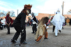 Los Matachines de Alcalde, 2013 | |
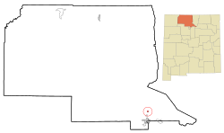 Location of Alcalde, New Mexico | |
 Alcalde, New Mexico Location in the United States | |
| Coordinates: 36°5′17″N 106°3′25″W / 36.08806°N 106.05694°W | |
| Country | United States |
| State | New Mexico |
| County | Rio Arriba |
| Area | |
| • Total | 0.52 sq mi (1.34 km2) |
| • Land | 0.52 sq mi (1.34 km2) |
| • Water | 0.00 sq mi (0.00 km2) |
| Elevation | 5,712 ft (1,741 m) |
| Population | |
| • Total | 310 |
| • Density | 600.78/sq mi (231.90/km2) |
| Time zone | UTC-7 (Mountain (MST)) |
| • Summer (DST) | UTC-6 (MDT) |
| ZIP code | 87511 |
| Area code | 505 |
| FIPS code | 35-02070 |
| GNIS feature ID | 0928680 |
Geography edit
According to the United States Census Bureau, the CDP has a total area of 0.5 square miles (1.3 km2), all land.[3]
Climate edit
| Climate data for Alcalde, New Mexico, 1991–2020 normals, extremes 1953–present | |||||||||||||
|---|---|---|---|---|---|---|---|---|---|---|---|---|---|
| Month | Jan | Feb | Mar | Apr | May | Jun | Jul | Aug | Sep | Oct | Nov | Dec | Year |
| Record high °F (°C) | 70 (21) |
73 (23) |
83 (28) |
88 (31) |
98 (37) |
101 (38) |
102 (39) |
100 (38) |
95 (35) |
90 (32) |
79 (26) |
68 (20) |
102 (39) |
| Mean maximum °F (°C) | 58.1 (14.5) |
64.7 (18.2) |
74.7 (23.7) |
80.9 (27.2) |
88.4 (31.3) |
95.6 (35.3) |
96.6 (35.9) |
93.6 (34.2) |
89.5 (31.9) |
81.7 (27.6) |
69.3 (20.7) |
58.4 (14.7) |
97.5 (36.4) |
| Mean daily maximum °F (°C) | 45.1 (7.3) |
51.0 (10.6) |
60.0 (15.6) |
67.4 (19.7) |
76.2 (24.6) |
86.0 (30.0) |
88.1 (31.2) |
85.6 (29.8) |
79.8 (26.6) |
68.7 (20.4) |
55.4 (13.0) |
44.5 (6.9) |
67.3 (19.6) |
| Daily mean °F (°C) | 30.2 (−1.0) |
35.3 (1.8) |
42.4 (5.8) |
49.6 (9.8) |
58.1 (14.5) |
67.1 (19.5) |
71.8 (22.1) |
69.6 (20.9) |
62.2 (16.8) |
50.3 (10.2) |
38.7 (3.7) |
29.8 (−1.2) |
50.4 (10.2) |
| Mean daily minimum °F (°C) | 15.3 (−9.3) |
19.6 (−6.9) |
24.8 (−4.0) |
31.9 (−0.1) |
39.9 (4.4) |
48.2 (9.0) |
55.4 (13.0) |
53.7 (12.1) |
44.6 (7.0) |
31.9 (−0.1) |
22.0 (−5.6) |
15.2 (−9.3) |
33.5 (0.8) |
| Mean minimum °F (°C) | 4.5 (−15.3) |
8.5 (−13.1) |
13.8 (−10.1) |
20.9 (−6.2) |
29.0 (−1.7) |
38.5 (3.6) |
46.5 (8.1) |
45.9 (7.7) |
33.5 (0.8) |
21.5 (−5.8) |
11.0 (−11.7) |
5.0 (−15.0) |
1.4 (−17.0) |
| Record low °F (°C) | −34 (−37) |
−12 (−24) |
4 (−16) |
11 (−12) |
18 (−8) |
32 (0) |
39 (4) |
34 (1) |
23 (−5) |
9 (−13) |
−11 (−24) |
−11 (−24) |
−34 (−37) |
| Average precipitation inches (mm) | 0.51 (13) |
0.39 (9.9) |
0.69 (18) |
0.70 (18) |
0.78 (20) |
0.78 (20) |
1.65 (42) |
1.75 (44) |
1.25 (32) |
1.14 (29) |
0.73 (19) |
0.73 (19) |
11.10 (282) |
| Average snowfall inches (cm) | 2.2 (5.6) |
1.5 (3.8) |
1.4 (3.6) |
0.3 (0.76) |
0.0 (0.0) |
0.0 (0.0) |
0.0 (0.0) |
0.0 (0.0) |
0.0 (0.0) |
0.6 (1.5) |
1.4 (3.6) |
3.3 (8.4) |
10.7 (27.26) |
| Average precipitation days (≥ 0.01 in) | 2.8 | 3.0 | 3.8 | 4.1 | 4.2 | 3.9 | 8.2 | 8.5 | 5.4 | 4.9 | 3.1 | 3.3 | 55.2 |
| Average snowy days (≥ 0.1 in) | 1.3 | 1.1 | 0.5 | 0.3 | 0.0 | 0.0 | 0.0 | 0.0 | 0.0 | 0.2 | 0.5 | 1.7 | 5.6 |
| Source 1: NOAA[4] | |||||||||||||
| Source 2: National Weather Service[5] | |||||||||||||
Demographics edit
| Census | Pop. | Note | %± |
|---|---|---|---|
| 2020 | 310 | — | |
| U.S. Decennial Census[6][2] | |||
At the 2000 census there were 377 people, 121 households, and 99 families in the CDP. The population density was 735.3 inhabitants per square mile (283.9/km2). There were 138 housing units at an average density of 269.2 per square mile (103.9/km2). The racial makeup of the CDP was 37.40% White, 0.27% African American, 1.59% Native American, 0.27% Asian, 54.64% from other races, and 5.84% from two or more races. Hispanic or Latino of any race were 89.12%.[7]
Of the 121 households 46.3% had children under the age of 18 living with them, 52.1% were married couples living together, 19.8% had a female householder with no husband present, and 17.4% were non-families. 16.5% of households were one person and 7.4% were one person aged 65 or older. The average household size was 3.12 and the average family size was 3.39.
The age distribution was 32.9% under the age of 18, 7.2% from 18 to 24, 32.1% from 25 to 44, 15.4% from 45 to 64, and 12.5% 65 or older. The median age was 31 years. For every 100 females, there were 95.3 males. For every 100 females age 18 and over, there were 99.2 males.
The median household income was $37,969 and the median family income was $38,250. Males had a median income of $31,375 versus $20,341 for females. The per capita income for the CDP was $13,656. About 10.7% of families and 12.6% of the population were below the poverty line, including 8.6% of those under age 18 and 13.6% of those age 65 or over.
Education edit
It is in Española Public Schools.[8] Alcalde has one elementary school, Alcalde Elementary. The comprehensive public high school is Española Valley High School.
Oñate Monument Center edit
The Oñate Monument Center located in Alcalde on New Mexico Highway 68.
See also edit
References edit
- ^ "ArcGIS REST Services Directory". United States Census Bureau. Retrieved October 12, 2022.
- ^ a b "Census Population API". United States Census Bureau. Retrieved October 12, 2022.
- ^ a b "2010 Census Gazetteer Files – Places: New Mexico". U.S. Census Bureau. Retrieved October 20, 2017.
- ^ "U.S. Climate Normals Quick Access – Station: Alcalde, NM". National Oceanic and Atmospheric Administration. Retrieved February 25, 2023.
- ^ "NOAA Online Weather Data – NWS Albuquerque". National Weather Service. Retrieved February 25, 2023.
- ^ "Census of Population and Housing". Census.gov. Retrieved June 4, 2016.
- ^ "U.S. Census website". United States Census Bureau. Retrieved January 31, 2008.
- ^ "2020 CENSUS - SCHOOL DISTRICT REFERENCE MAP: Rio Arriba County, NM" (PDF). U.S. Census Bureau. Retrieved July 30, 2021.
External links edit
- Abiquiu Online – Serving the Northern New Mexico Area
- Los Matachines – Alcalde, photo gallery