


Summary
Alfonso, officially the Municipality of Alfonso (Tagalog: Bayan ng Alfonso), is a 1st class municipality in the province of Cavite, Philippines. According to the 2020 census, it has a population of 59,306 people.[3]
Alfonso | |
|---|---|
| Municipality of Alfonso | |
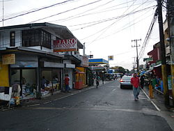 Downtown area | |
 Flag  Seal | |
| Nickname: Agro-Industrial Center of Upland Cavite | |
 Map of Cavite with Alfonso highlighted | |
OpenStreetMap .mw-parser-output .locmap .od{position:absolute}.mw-parser-output .locmap .id{position:absolute;line-height:0}.mw-parser-output .locmap .l0{font-size:0;position:absolute}.mw-parser-output .locmap .pv{line-height:110%;position:absolute;text-align:center}.mw-parser-output .locmap .pl{line-height:110%;position:absolute;top:-0.75em;text-align:right}.mw-parser-output .locmap .pr{line-height:110%;position:absolute;top:-0.75em;text-align:left}.mw-parser-output .locmap .pv>div{display:inline;padding:1px}.mw-parser-output .locmap .pl>div{display:inline;padding:1px;float:right}.mw-parser-output .locmap .pr>div{display:inline;padding:1px;float:left}html.skin-theme-clientpref-night .mw-parser-output .od,html.skin-theme-clientpref-night .mw-parser-output .od .pv>div,html.skin-theme-clientpref-night .mw-parser-output .od .pl>div,html.skin-theme-clientpref-night .mw-parser-output .od .pr>div{background:#000;color:#fff}html.skin-theme-clientpref-night .mw-parser-output .locmap{filter:grayscale(0.6)}@media(prefers-color-scheme:dark){html.skin-theme-clientpref-os .mw-parser-output .locmap{filter:grayscale(0.6)}html.skin-theme-clientpref-os .mw-parser-output .od,html.skin-theme-clientpref-os .mw-parser-output .od .pv>div,html.skin-theme-clientpref-os .mw-parser-output .od .pl>div,html.skin-theme-clientpref-os .mw-parser-output .od .pr>div{background:#000;color:#fff}}  Alfonso Location within the Philippines | |
| Coordinates: 14°08′16″N 120°51′19″E / 14.137894°N 120.855178°E | |
| Country | Philippines |
| Region | Calabarzon |
| Province | Cavite |
| District | 8th district |
| Founded | May 16, 1859 |
| Named for | Alfonso XII |
| Barangays | 32 (see Barangays) |
| Government | |
| • Type | Sangguniang Bayan |
| • Mayor | Randy A. Salamat |
| • Vice Mayor | Madona M. Pel |
| • Representative | Aniela Bianca D. Tolentino |
| • City Council | Members |
| Area | |
| • Total | 66.58 km2 (25.71 sq mi) |
| Elevation | 356 m (1,168 ft) |
| Highest elevation | 779 m (2,556 ft) |
| Lowest elevation | 27 m (89 ft) |
| Population (2020 census)[3] | |
| • Total | 59,306 |
| • Density | 890/km2 (2,300/sq mi) |
| • Households | 14,556 |
| Economy | |
| • Income class | 1st municipal income class |
| • Poverty incidence | 5.26 |
| • Revenue | ₱ 227 million (2020) |
| • Assets | ₱ 383.2 million (2020) |
| • Expenditure | ₱ 230.1 million (2020) |
| • Liabilities | ₱ 75.69 million (2020) |
| Service provider | |
| • Electricity | Manila Electric Company (Meralco) |
| Time zone | UTC+8 (PST) |
| ZIP code | 4123 |
| PSGC | 042101000 |
| IDD : area code | +63 (0)46 |
| Native languages | Tagalog |
| Website | www |
History edit
Alfonso was totally forested until the 17th century when a few pocket settlements sprouted. The town was originally part of Barrio Lumampong in the town of Indang. In the course of time, the pocket settlements grew into sitios and later on into barrios. The town became a separate district municipality from Indang on March 16, 1859 through the efforts of the community leaders Bonifacio Aveo and Felix del Mundo. The new town was called Alas-as for a period of seventeen years. The name refers to the pandan tree used for the construction of houses and bears sweet fruit. It was, eventually, named after King Alfonso XII of Spain, son of Isabella II. Alfonso was initially composed of the barrios of Taywanak, Pajo, Esperanza, Marahan, Matagbak, Sinaliw and Kaytitinga. Don Narciso Mojica was the capitan municipal of Alfonso at the outbreak of the Philippine Revolution. A few days after the Cry of Balintawak, on August 31, 1896, General Mariano Trias ordered the liquidation of all Spaniards in the municipality. In the bloody battle that followed, the leaders of the revolutionists were General Hipolito Rint, Captain Eriberto Cetro (Kapitan Berto) and Predencio Rolle (Tandang Doro).[5][6]
On October 15, 1903, the adjacent towns of Bailen and Mendez-Nuñes merged with Alfonso by virtue of Act No. 947 enacted by the Philippine Commission.[7] Both towns were later separated in 1915 to become independent once again.[8]
Geography edit
Alfonso is an upland town situated at the south-western portion of the Cavite province. It is 74 kilometers (46 mi) from Manila via Tagaytay. Magallanes bounds it on the west, Batangas province on the south, Mendez and Tagaytay on the east, General Aguinaldo on the north-west and Maragondon and Indang on the north-east.
Barangays edit
Alfonso is politically subdivided into 32 barangays.[9] Each barangay consists of puroks and some have sitios.
| PSGC | Barangay | Population | ±% p.a. | |||
|---|---|---|---|---|---|---|
| 2020[3] | 2010[10] | |||||
| 042101001 | Amuyong | 3.7% | 2,170 | 1,844 | 1.64% | |
| 042101002 | Barangay I (Pob.) | 0.9% | 529 | 549 | −0.37% | |
| 042101003 | Barangay II (Pob.) | 0.9% | 560 | 669 | −1.76% | |
| 042101004 | Barangay III (Pob.) | 2.1% | 1,236 | 1,296 | −0.47% | |
| 042101005 | Barangay IV (Pob.) | 2.3% | 1,345 | 1,323 | 0.17% | |
| 042101006 | Barangay V (Pob.) | 2.5% | 1,466 | 1,374 | 0.65% | |
| 042101007 | Buck Estate | 6.1% | 3,638 | 2,546 | 3.63% | |
| 042101008 | Esperanza Ibaba | 2.4% | 1,409 | 1,101 | 2.50% | |
| 042101009 | Kaytitinga I | 3.6% | 2,163 | 1,844 | 1.61% | |
| 042101010 | Luksuhin | 8.0% | 4,774 | 3,400 | 3.45% | |
| 042101011 | Mangas I | 4.1% | 2,421 | 2,174 | 1.08% | |
| 042101012 | Marahan I | 5.2% | 3,088 | 2,591 | 1.77% | |
| 042101013 | Matagbak I | 3.3% | 1,940 | 1,597 | 1.96% | |
| 042101014 | Pajo | 3.7% | 2,200 | 1,885 | 1.56% | |
| 042101016 | Sikat | 3.9% | 2,284 | 1,667 | 3.20% | |
| 042101017 | Sinaliw Malaki | 2.7% | 1,604 | 1,380 | 1.52% | |
| 042101018 | Sinaliw na Munti | 1.1% | 674 | 461 | 3.87% | |
| 042101019 | Sulsugin | 2.5% | 1,459 | 1,253 | 1.53% | |
| 042101020 | Taywanak Ibaba | 3.9% | 2,330 | 1,866 | 2.25% | |
| 042101021 | Taywanak Ilaya | 2.8% | 1,664 | 1,368 | 1.98% | |
| 042101022 | Upli | 4.2% | 2,520 | 1,819 | 3.31% | |
| 042101023 | Kaysuyo | 3.6% | 2,161 | 1,687 | 2.51% | |
| 042101024 | Luksuhin Ilaya | 3.4% | 2,023 | 1,634 | 2.16% | |
| 042101025 | Palumlum | 1.8% | 1,066 | 873 | 2.02% | |
| 042101026 | Bilog | 2.0% | 1,183 | 1,077 | 0.94% | |
| 042101027 | Esperanza Ilaya | 2.6% | 1,564 | 1,200 | 2.68% | |
| 042101028 | Kaytitinga II | 2.9% | 1,707 | 1,467 | 1.53% | |
| 042101029 | Kaytitinga III | 3.4% | 1,996 | 1,442 | 3.30% | |
| 042101030 | Mangas II | 2.5% | 1,482 | 940 | 4.66% | |
| 042101031 | Marahan II | 3.4% | 2,006 | 1,797 | 1.11% | |
| 042101032 | Matagbak II | 2.2% | 1,303 | 1,183 | 0.97% | |
| 042101033 | Santa Teresa | 2.3% | 1,341 | 1,260 | 0.62% | |
| Total | 59,306 | 48,567 | 2.02% | |||
Climate edit
| Climate data for Alfonso, Cavite | |||||||||||||
|---|---|---|---|---|---|---|---|---|---|---|---|---|---|
| Month | Jan | Feb | Mar | Apr | May | Jun | Jul | Aug | Sep | Oct | Nov | Dec | Year |
| Mean daily maximum °C (°F) | 26 (79) |
27 (81) |
29 (84) |
30 (86) |
29 (84) |
28 (82) |
26 (79) |
26 (79) |
26 (79) |
27 (81) |
27 (81) |
26 (79) |
27 (81) |
| Mean daily minimum °C (°F) | 17 (63) |
17 (63) |
18 (64) |
20 (68) |
21 (70) |
22 (72) |
22 (72) |
22 (72) |
21 (70) |
20 (68) |
19 (66) |
18 (64) |
20 (68) |
| Average precipitation mm (inches) | 11 (0.4) |
13 (0.5) |
14 (0.6) |
32 (1.3) |
101 (4.0) |
142 (5.6) |
208 (8.2) |
187 (7.4) |
175 (6.9) |
131 (5.2) |
68 (2.7) |
39 (1.5) |
1,121 (44.3) |
| Average rainy days | 5.2 | 5.0 | 7.4 | 11.5 | 19.8 | 23.5 | 27.0 | 25.9 | 25.2 | 23.2 | 15.5 | 8.3 | 197.5 |
| Source: Meteoblue[11] | |||||||||||||
Demographics edit
| Year | Pop. | ±% p.a. |
|---|---|---|
| 1903 | 5,780 | — |
| 1918 | 7,580 | +1.82% |
| 1939 | 9,797 | +1.23% |
| 1948 | 11,714 | +2.01% |
| 1960 | 17,477 | +3.39% |
| 1970 | 17,703 | +0.13% |
| 1975 | 20,623 | +3.11% |
| 1980 | 21,980 | +1.28% |
| 1990 | 28,944 | +2.79% |
| 1995 | 34,613 | +3.41% |
| 2000 | 39,674 | +2.97% |
| 2007 | 47,973 | +2.65% |
| 2010 | 48,567 | +0.45% |
| 2015 | 51,839 | +1.25% |
| 2020 | 59,306 | +2.68% |
| Source: Philippine Statistics Authority[12][10][13][14] | ||
In the 2020 census, the population of Alfonso, Cavite, was 59,306 people,[3] with a density of 890 inhabitants per square kilometre or 2,300 inhabitants per square mile.
Economy edit
Government edit
Local government edit

The following are the duly elected officials of Alfonso, Cavite for the term 2022–2025.
| Position | Official |
|---|---|
| Mayor | Randy A. Salamat (NUP) |
| Vice Mayor | Madona Mojica-Pel (NUP) |
| Sangguniang Bayan Members | Party |
|---|---|
| Rex A. Ferolino | NPC |
| Angelito S. Perea | NUP |
| Jorge Michael R. Peñano | NUP |
| Roberto R. Varias | NUP |
| Joselito H. Resurreccion | NUP |
| Renato V. Vidallon | NUP |
| Cynthia A. Peji | NUP |
| Erwin M. Signo | NUP |
| ABC President |
|---|
| Dante L. Pel |
| SK Federation President |
| Kystel Faye R. Alcazar |
References edit
- ^ Municipality of Alfonso | (DILG)
- ^ "2015 Census of Population, Report No. 3 – Population, Land Area, and Population Density" (PDF). Philippine Statistics Authority. Quezon City, Philippines. August 2016. ISSN 0117-1453. Archived (PDF) from the original on May 25, 2021. Retrieved July 16, 2021.
- ^ a b c d Census of Population (2020). "Region IV-A (Calabarzon)". Total Population by Province, City, Municipality and Barangay. Philippine Statistics Authority. Retrieved 8 July 2021.
- ^ "PSA Releases the 2018 Municipal and City Level Poverty Estimates". Philippine Statistics Authority. 15 December 2021. Retrieved 22 January 2022.
- ^ The Philippine Index, Millennium Edition, Vol. 1 No. 1
- ^ Lesho, Marivic; Sippola, Eeva (2018). "Toponyms in Manila and Cavite, Philippines". Vergleichende Kolonialtoponomastik Strukturen und Funktionen kolonialer Ortsbenennung. De Gruyter. pp. 317–332. ISBN 9783110608618.
- ^ Act No. 947 (15 October 1903), An Act Reducing the Twenty-Three Municipalities of the Province of Cavite to Eleven, retrieved June 17, 2023
- ^ The Philippine Index, Millennium Edition Vol. 1 No. 1
- ^ "Municipality of Alfonso". The Official Website of the Provincial Government of Cavite. Retrieved 5 April 2017.
- ^ a b Census of Population and Housing (2010). "Region IV-A (Calabarzon)" (PDF). Total Population by Province, City, Municipality and Barangay. National Statistics Office. Retrieved 29 June 2016.
- ^ "Alfonso: Average Temperatures and Rainfall". Meteoblue. Retrieved 12 May 2020.
- ^ Census of Population (2015). "Region IV-A (Calabarzon)". Total Population by Province, City, Municipality and Barangay. Philippine Statistics Authority. Retrieved 20 June 2016.
- ^ Censuses of Population (1903–2007). "Region IV-A (Calabarzon)". Table 1. Population Enumerated in Various Censuses by Province/Highly Urbanized City: 1903 to 2007. National Statistics Office.
{{cite encyclopedia}}: CS1 maint: numeric names: authors list (link) - ^ "Province of Cavite". Municipality Population Data. Local Water Utilities Administration Research Division. Retrieved 17 December 2016.
- ^ "Poverty incidence (PI):". Philippine Statistics Authority. Retrieved December 28, 2020.
- ^ "Estimation of Local Poverty in the Philippines" (PDF). Philippine Statistics Authority. 29 November 2005.
- ^ "2003 City and Municipal Level Poverty Estimates" (PDF). Philippine Statistics Authority. 23 March 2009.
- ^ "City and Municipal Level Poverty Estimates; 2006 and 2009" (PDF). Philippine Statistics Authority. 3 August 2012.
- ^ "2012 Municipal and City Level Poverty Estimates" (PDF). Philippine Statistics Authority. 31 May 2016.
- ^ "Municipal and City Level Small Area Poverty Estimates; 2009, 2012 and 2015". Philippine Statistics Authority. 10 July 2019.
- ^ "PSA Releases the 2018 Municipal and City Level Poverty Estimates". Philippine Statistics Authority. 15 December 2021. Retrieved 22 January 2022.
External links edit
- Profile: Alfonso, Cavite - Official Website of the Province of Cavite
- Profile: Alfonso, Cavite - DILG Calabarzon Region
- Philippine Standard Geographic Code
- Philippine Census Information