
KNOWPIA
WELCOME TO KNOWPIA

Alida, Kansas 
Summary
Alida is a ghost town in Smoky Hill township of Geary County, Kansas, United States.[1]
Alida, Kansas | |
|---|---|
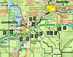 KDOT map of Geary County (legend) | |
 Alida  Alida | |
| Coordinates: 39°5′45″N 96°56′25″W / 39.09583°N 96.94028°W[1] | |
| Country | United States |
| State | Kansas |
| County | Geary |
| Founded | 1858 |
| Elevation | 1,142 ft (348 m) |
| Population | |
| • Total | 0 |
| Time zone | UTC-6 (CST) |
| • Summer (DST) | UTC-5 (CDT) |
| Area code | 785 |
| FIPS code | 20-01200 [1] |
| GNIS ID | 476498 [1] |
History edit
Alida was founded in 1858. It was razed in 1966-1967 during the construction of Milford Lake. The communities of Alida and Broughton were razed, while the cities of Wakefield and Milford were moved to higher ground. The population in 1910 was 48.
References edit
- ^ a b c d e "Alida, Kansas", Geographic Names Information System, United States Geological Survey, United States Department of the Interior
Further reading edit
External links edit
- Geary County maps: Current, Historic, KDOT