Allison Glacier (Heard Island)

Summary

Allison Glacier (53°04′S 73°24′E / 53.067°S 73.400°E / -53.067; 73.400) is an ice stream on the west side of Heard Island in the southern Indian Ocean. Allison Glacier flows from Big Ben massif down to the sea to the south of Cape Gazert.[6] To the north of Allison Glacier is Vahsel Glacier, whose terminus is at South West Bay, between Erratic Point and Cape Gazert. Immediately to the north of Vahsel Glacier is Schmidt Glacier, whose terminus is located between Mount Drygalski and North West Cornice. To the south of Allison Glacier is Abbotsmith Glacier, while Cape Gazert is immediately west.

Allison Glacier (Heard Island)
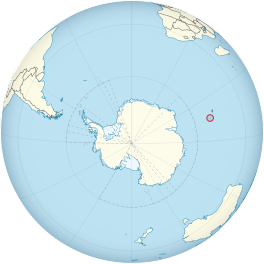
Location of Heard Island and McDonald Islands on the globe
Map showing the location of Allison Glacier (Heard Island)
Allison Glacier (Heard Island)
Typeice stream
LocationHeard Island
Territory of Heard Island and McDonald Islands
Australia
Coordinates53°04′S 73°24′E / 53.067°S 73.400°E / -53.067; 73.400
Thicknessapproximately 55 meters
Terminusimmediately south of Cape Gazert
StatusRetreating[1][2][3][4][5]
Discovery and naming edit

Allison Glacier was named after Ian Allison, an Australian glaciologist who carried out glaciological research in this area in 1971 for the Australian Antarctic Division during the French-Australian Antarctic Expedition.[6]

See also edit

References edit

  1. ^ Ian F. Allison; Peter L. Keage (1986). "Recent changes in the glaciers of Heard Island". Polar Record. 23 (144): 255–272. doi:10.1017/S0032247400007099. S2CID 130086301.
  2. ^ Andrew Ruddell (25 May 2010). "Our subantarctic glaciers: why are they retreating?". Glaciology Program, Antarctic CRC and AAD. Archived from the original on 2 October 2009. Retrieved 7 June 2010.
  3. ^ Quilty, P.G.; Wheller, G. (2000). "Heard Island and the McDonald Islands: A window into the Kerguelen Plateau (Heard Island Papers)". Pap. Proc. R. Soc. Tasm. 133 (2): 1–12.
  4. ^ Budd, G.M. (2000). "Changes in Heard Island glaciers, king penguins and fur seals since 1947 (Heard Island Papers)". Pap. Proc. R. Soc. Tasm. 133 (2): 47–60.
  5. ^ Douglas E. Thost; Martin Truffer (February 2008). "Glacier Recession on Heard Island, Southern Indian Ocean". Arctic, Antarctic, and Alpine Research. 40 (1): 199–214. doi:10.1657/1523-0430(06-084)[THOST]2.0.CO;2. S2CID 130245283. Archived from the original on 4 December 2012. Retrieved 7 June 2010.
  6. ^ a b "Allison Glacier". Australian Antarctic Data Centre.

Further reading edit

  • U. Radok; D. Watts (1975). "A synoptic background to glacier variations of Heard Island" (PDF). Snow and Ice (Proceedings of the Moscow Symposium, August 1971) (104 ed.). Wallingford, Oxfordshire, UK: International Association of Hydrological Sciences. pp. 42–56. Retrieved 7 June 2010.
  • Truffer, M.; Thost, D. & Ruddell, A. (2001). "The Brown Glacier, Heard Island: its morphology, dynamics, mass balance and climate setting". Antarctic CRC Research Report No. 24. Hobart, Tasmania: Cooperative Research Centre for the Antarctic and Southern Ocean Environment, University of Tasmania. pp. 1–27.
  • Kevin Kiernan; Anne McConnell (2002). "Glacier retreat and melt-lake expansion at Stephenson Glacier, Heard Island World Heritage Area" (PDF). Polar Record. 38 (207): 297–308. doi:10.1017/S0032247400017988. S2CID 37333655. Retrieved 7 June 2010.

External links edit

  • Click here Archived 11 February 2014 at the Wayback Machine to see a map of Heard Island and McDonald Islands, including all major topographical features
  • Australian Antarctic Division
  • Australian Antarctic Gazetteer
  • Composite Gazetteer of Antarctica
  • Australian Antarctic Names and Medals Committee (AANMC)
  • Scientific Committee on Antarctic Research (SCAR)

53°04′S 73°24′E / 53.067°S 73.400°E / -53.067; 73.400