


Summary
Alstonville is a town in northern New South Wales, Australia, part of the region known as the Northern Rivers. Alstonville is on the Bruxner Highway between the town of Ballina (13 km to the east) and city of Lismore (19 km to the west). The village of Wollongbar is 4 km to the west of Alstonville. Alstonville is the service centre of the area known as the Alstonville Plateau.
| Alstonville New South Wales | |||||||||
|---|---|---|---|---|---|---|---|---|---|
 Main Street | |||||||||
 Alstonville | |||||||||
| Coordinates | 28°51′S 153°26′E / 28.850°S 153.433°E | ||||||||
| Population | 5,182 (2021 census)[1] | ||||||||
| Postcode(s) | 2477 | ||||||||
| Elevation | 140 m (459 ft) | ||||||||
| Time zone | AEST (UTC+10) | ||||||||
| • Summer (DST) | AEDT (UTC+11) | ||||||||
| Location | |||||||||
| LGA(s) | Ballina Shire | ||||||||
| State electorate(s) | Ballina | ||||||||
| Federal division(s) | Page | ||||||||
| |||||||||
History edit
Europeans were first attracted to the area, known as the Big Scrub, in the 1840s by the plentiful supply of Red Cedar. It was not until 1865 that the first settlers selected land in the area, then known as the parish of Tuckombil. Some notable selections in the first five years include that of the Freeborn, Roberston, Graham, Newborn, Crawford, Mellis, and Newton families.[2] By 1883 Alstonville boasted two pubs, six stores, two black-smiths, nine sugar mills, and four saw mills.[2]
Sugar cane was an important industry to the early settlers, with many small mills operating across the district. These were later replaced by larger more efficient steam mills such as those erected in 1882[3] at Alstonville (owned by the Melbourne Sugar Company) adjacent to Maguires Creek and at Rous Mill adjacent to Youngman Creek. By 1896 the Rous mill boasted a light rail line to transport cane from Alstonville.[2] From the 1890s ownward, dairies became common across the area, later becoming the dominant industry for the first half of the 20th century. Due to lack of refrigeration, cream, not milk, was the product of interest, which was transported to local factories to be made into butter. The first butter factories were located at Wollongbah (1889), Rous (1889) and Teven Road (1890).[3] In 1900[2] the NSW Creamery Butter Company built the Alstonville factory near Maguires Creek, which was sometime later acquired by NORCO. After closing this building became a caravan factory, peanut factory, and finally a furniture factory, which is still open today.
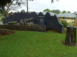
One notable former resident of Alstonville is Patrick Joseph Bugden who was awarded a Victoria Cross (the highest military decoration which can be awarded to a member of the armed forces of the Commonwealth). "Paddy" served as a member of the 31st Battalion AIF during the First World War.[4] The annual Anzac day parade starts at the Paddy Bugden Memorial, which is situated on Bugden Avenue.
Origin of the name edit
The village was originally known as "Duck Creek Mountain" after Duck Creek, which flows along the southern edge of town eventually merging with Emigrant Creek and the Richmond River. The name was given by the cedar cutters because of the abundance of wild duck on the upper tidal reaches of the creek.[3] In 1873, due to conflict of the original name with a different duck creek the first postmaster and owner of the general store John Perry proposed the name "Alstonville". Alstonville, also the name of the Perry farm, was derived from Alston the maiden name of his wife Annie Alston.[3]
Population edit
| Year | Pop. | ±% |
|---|---|---|
| 1966 | 576 | — |
| 1971 | 779 | +35.2% |
| 1976 | 1,457 | +87.0% |
| 1981 | 2,936 | +101.5% |
| 1986 | 3,266 | +11.2% |
| 1991 | 3,678 | +12.6% |
| 1996 | 4,725 | +28.5% |
| 2001 | 4,751 | +0.6% |
| 2006 | 5,006 | +5.4% |
| 2011 | 4,990 | −0.3% |
| 2016 | 5,066 | +1.5% |
| 2021 | 5,182 | +2.3% |
| Source: Australian Bureau of Statistics data.[5][6] | ||
In the 2021 Census, there were 5,182 people in the Alstonville urban centre. 84.3% of people were born in Australia. The next most common country of birth was England at 4.2%. 92.1% of people only spoke English at home. The most common responses for religion were No Religion 39.9%, Catholic 18.7% and Anglican 14.9%. [1]
Facilities edit
Crawford house, a pioneer house situated next to Elizabeth Ann Brown park is now a historical museum. Directly behind is the town's major shopping centre, Alstonville Plaza, which has a few specialty shops, and a major supermarket. The town has a post office but no longer has any bank.
Summerland Farm, previously known as the "Summerland House With No Steps", has been operating near Alstonville since 1971. A business of Aruma, formerly House with No Steps, Summerland Farm provides training and employment for in excess of 100 people with a disability in fields such as farming and hospitality. A must see tourist attraction, major distribution hub for regional farms and a working avocado and macadamia farm, Summerland Farm is one of the region's oldest and most successful tourism and horticulture businesses.
Alstonville has two stationed emergency services, Fire & Rescue NSW’ Station 204 and NSW Police.
Economy edit
An industrial estate is located in Russleton Park, with cement, macadamia processing and rural supplies dominating. In addition, numerous bus depots are located here, and there is a mail sorting facility. The industrial estate is located across the highway from Wollongbar; however, it is not a part of Wollongbar.
Schools edit
The town of Alstonville is home to two public and one private school: Alstonville Public School (state primary), St Joseph's School (Catholic primary) and Alstonville High School (state secondary). In 2016 the newly built Alstonville Preschool was opened, situated next to the Olympic Swimming Pool.
Transport edit
Transport between Alstonville and Wollongbar, is by either car, or foot/bike, as a path runs between Bulwinkel Park and the shopping centre at Wollongbar.
Bus services are limited. There are no buses into or out of Alstonville at night or on weekends. As a result, the area has experienced problems with petty crimes and public nuisances.
Transport issues edit
A bypass has been constructed for the Bruxner Highway to remove congestion and improve safety. Previously Alstonville traffic became unusually congested (for such a small-population town) because its main road was the main thoroughfare between Lismore and Ballina. All three schools (and bus stops for another three schools) are located in a bottleneck with only one entry/exit road; as a result, parking for all three schools is usually congested.
Sporting Teams on the Plateau edit
The area has many parks, including Geoff Watt Oval, the major sporting ground for Cricket, and Soccer, and Crawford Park, across the other side of the highway. This park is a second sporting ground for soccer.
- The Alstonville and District Football Club is the local Soccer Club, known as "Villa", and is uniformed with red and black.
- Wollongbar Alstonville Pioneers Rugby (WAR) is the local Rugby Union club, located at Wollongbar.
- Alstonville & District Cricket Club is Alstonville's only cricket team. Each year they have a team in the LJ Hooker League. They play at Geoff Watt Oval, Hill Park Oval & Gap Road
- Alstonville is also the home of FNC NSW Futsal at the Alstonville Entertainment Centre.
Interesting facts edit

Andesanthus lepidotus 'Alstonville' is a small tree grown in many parts of Australia for its brilliant display of purple flowers in autumn. This variety along with the dwarf variety 'Jules' was developed by Ken Dunstan a resident of Alstonville, hence the name.
The world's first commercial orchard of macadamia trees was planted in the early 1880s by Charles Staff at Rous Mill, on the Alstonville plateau, 7 km south west of the centre of town.
Media edit
Alstonville is serviced by a Christian radio station on FM 88.0 MHz, as well as the nearby local stations of 101.9 Paradise FM (Ballina),[7] and 100.9 ZZZ FM (Lismore).
Notable residents edit
- Rachael Beck, actress
- Doug Daley, rugby league player and administrator
- Nicholas Hamilton, actor
- Russell Strong, surgeon
- Brendan Drew, cricketer
References edit
- ^ a b Australian Bureau of Statistics (28 June 2022). "Alstonville". 2021 Census QuickStats. Retrieved 16 November 2023.
- ^ a b c d Alstonville Plateau Historical Society (2007). Milestones and Memories - Alstonville District. Goonellabah, N.S.W: APHS Press. pp. 360 p. ISBN 978-0-9775155-7-8.
- ^ a b c d Crawford, Foreman (1983). Duck Creek Mountain Now Alstonville. ISBN 0-9592431-0-0.
- ^ "Australians at War — Paddy Bugden won VC for his bravery". Australian Government Department of Veterans' Affairs. 1 August 2002. Archived from the original on 25 July 2008. Retrieved 25 March 2009.
- ^ "Statistics by Catalogue Number". Australian Bureau of Statistics. Retrieved 23 January 2024.
- ^ "Search Census data". Australian Bureau of Statistics. Retrieved 23 January 2024.
- ^ "Home - Paradise FM 101.9". Paradise FM. Retrieved 10 December 2017.
External links edit
- Ballina Shire Council
- Town information — Sydney Morning Herald
- Summerland House
- Alstonville High School
- Alstonville Preschool
- Alstonville Plateau Historical Society
- Northern Rivers Geology Blog - Alstonville Plateau