


Summary
Alterosa is a Brazilian municipality in the South of the state of Minas Gerais. According to latest data from IBGE (2020), its population is estimated to be 14,517. The inhabitants of the city usually travel to the nearest city, Alfenas, when they are in need of more sophisticated supplies.
Alterosa | |
|---|---|
 | |
 Flag  Coat of arms | |
 Location of Alterosa in Minas Gerais | |
 Alterosa Location in Brazil | |
| Coordinates: 21°15′S 46°08′W / 21.250°S 46.133°W | |
| Country | |
| Region | Southeast |
| State | |
| Founded | 17 December 1938 |
| Government | |
| • Mayor | Hermes de Souza Silva (PSB; –2020) |
| • Vice-mayor | Abimael |
| Area | |
| • Total | 366.101 km2 (141.352 sq mi) |
| Elevation | 848 m (2,782 ft) |
| Population (2020 [2]) | |
| • Total | 14,517 |
| Demonym | Alterosense |
| Website | www |
Alterosa was founded on 17 December 1938.
History edit
It is said that Alterosa was one of the first populated places in the South of Minas Gerais. By the year of 1700, the residents took notice of the small river that became known as Ribeirão São Joaquim. José Rodrigues Moreira, a Portuguese man coming from Espírito Santo, marked the development of the city. In that occasion, the people living there called the city São Joaquim da Serra Negra, due to the existence of a hill in the surroundings.
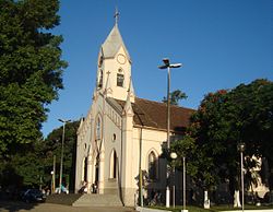
On 28 June 1850, a very influent Baron (Barão Silva) turned Alterosa to a municipality, after the building of a Parish.
The name Alterosa means "High Majesty".
Geography edit
Located in the margins of the Furnas Lake, the municipality of Alterosa belongs to the administrative region of Alfenas/Varginha.
It is situated in 21° 14’ 45’’ of the south latitude and 46º 08’ 30’’ of west longitude, in the South of the State of Minas Gerais. Areado is in the south of Alterosa, Alfenas in the east; Carmo do Rio Claro in the northeast, Conceição da Aparecida in the north, Nova Resende in the west and Monte Belo in the southwest. Temperatures range from 0° to 30º degrees Celsius. 75% of Alterosa's surface is undulated and 15% is mountainous.
Districts edit
The district of Cavacos is part of Alterosa.
Economy edit
Alterosa has 1.300 of rural properties, approximately 25 acres each. In general, Alterosa's activities include the production of milk, meat, coffee, corn, and most recently, potatoes.
Alterosa is one of the seventeen municipalities in Minas Gerais that has a Usina de Tratamento de Resíduos Urbanos, a company that takes care of the disposal of rubbish for the citizens.
Education edit

Schools edit
The Prefecture of Alterosa is responsible for the four Schools existing in the city, three of them being:
- E. E. Bolivar Boanerges da Silveira
- E. E. Deputado Jales Machado
- E. E. Martins de Andrada
Events edit
- February: Carnaval
- June: Festa Junina
- July: Festa do Peão
- August: Motorcycle owners communion
- December: City's birthday
Communication edit
Alterosa is home of two radio stations: Serra Negra FM 102, 7 and Boas Novas FM 87,9 (a Protestant radio station).
Financial Institutions edit
There are three banks in Alterosa: Banco do Brasil, Banco Bradesco and Cooperosa.
References edit
External links edit
- "Página da prefeitura".
- "Página da câmara".
- "Alterosa: Enciclopédia dos Municípios – IBGE" (PDF).
- "Banco de nomes geográficos do Brasil".[permanent dead link]