


Summary
Anamizu (穴水町, Anamizu-machi) is a town located in Hōsu District (formerly Fugeshi District), Ishikawa Prefecture, Japan. As of 30 September 2021[update], the town had an estimated population of 7,782 in 3,653 households, and a population density of 42 persons per km2.[1] The total area of the town was 183.21 square kilometres (70.74 sq mi).
Anamizu
穴水町 | |
|---|---|
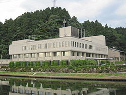 Anamizu Town Hall | |
 Flag  Emblem | |
 Location of Anamizu in Ishikawa Prefecture | |
 Anamizu | |
| Coordinates: 37°13′51.3″N 136°54′44.2″E / 37.230917°N 136.912278°E | |
| Country | Japan |
| Region | Chūbu Hokuriku |
| Prefecture | Ishikawa |
| District | Hōsu |
| Area | |
| • Total | 183.21 km2 (70.74 sq mi) |
| Population (September 30, 2021) | |
| • Total | 7,782 |
| • Density | 42/km2 (110/sq mi) |
| Time zone | UTC+9 (Japan Standard Time) |
| City symbols | |
| - Tree | Hiba |
| - Flower | Lilium japonicum |
| - Bird | Crested kingfisher |
| - Fish | Green pheasant |
| Phone number | 0768-62-1000 |
| Address | 174 Kawajima, Anamizu-machi, Hōsu-gun, Ishikawa-ken 927-0492 |
| Website | Official website |
Geography edit
Anamizu occupies the southeastern coastline of Noto Peninsula, facing the Sea of Japan on the east and south. Anamizu has a humid continental climate (Köppen Cfa) characterized by mild summers and cold winters with heavy snowfall. The average annual temperature in Anamizu is 13.5 °C. The average annual rainfall is 2,352 mm with September as the wettest month. The temperatures are highest on average in August, at around 25.8 °C, and lowest in January, at around 2.9 °C.[2]
Parts of the town are within the limits of the Noto Hantō Quasi-National Park.
Neighbouring municipalities edit
Demographics edit
Per Japanese census data,[3] the population of Anamizu has declined over the past 50 years.
| Year | Pop. | ±% |
|---|---|---|
| 1970 | 15,488 | — |
| 1980 | 14,044 | −9.3% |
| 1990 | 12,831 | −8.6% |
| 2000 | 11,267 | −12.2% |
| 2010 | 9,735 | −13.6% |
| 2020 | 7,890 | −19.0% |
History edit
The area around Anamizu was part of ancient Noto Province. During the Sengoku Period (1467–1568), the area was contested between the Hatakeyama clan, Uesugi clan and Maeda clan, with the area becoming part of Kaga Domain under the Edo period Tokugawa shogunate. Following the Meiji restoration, the area was organised into Fugeshi District, Ishikawa. The village of Anamizu was established on April 1, 1889, with the establishment of the modern municipalities system. It was raised to town status on August 10, 1903. Anamizu annexed the neighbouring villages of Shimazaki and Tobo on April 1, 1908; the villages of Kabuto and Sumiyoshi on March 31, 1954; and the village of Morohashi on March 10, 1955.
Anamizu and its surrounding area experienced the 2007 Noto earthquake on March 25, 2007,[4] and the 2024 Noto earthquake on 1 January 2024.[5] After the disaster, the survivors were housed in the municipal stadium named after sumo wrestler Endō, a native of Anamizu. Considered a local hero in his hometown, his sanshō trophies are displayed there.[6] On 6 February 2024, Endō was part of a delegation of wrestlers from the prefecture (along with Ōnosato, Kagayaki and former Tochinonada); charged with symbolically presenting Governor Hiroshi Hase with the sums raised during the January tournament and donations from the Sumo Association.[7]
Economy edit
The economy of Anamizu is based on agriculture and commercial fishing.
Education edit
Anamizu has two public elementary schools and one public middle school operated by the town government, and one public high school operated by the Ishikawa Prefectural Board of Education.
Transportation edit
Railway edit
Highway edit
Local attractions edit
- Anamizu's symbol is the Boramachi Yagura (ボラ待ちやぐら), a distinctive wooden fishing structure of which there is one in the Noto Bay on both the southern and northern borders of Anamizu town.
Events edit
- The last weekend in January is the Anamizu Oyster Festival (カキまつり). At this festival, guests can purchase oysters or other foods from stalls and cook them on grills near the center of the venue.[8] The venue changes every year but was held at the Anamizu Harbour Asunaro (穴水港湾あすなろ広場) in 2010.
- The third weekend in August is the celebration of Percival Lowell's contribution to astronomy and his time spent in the Noto peninsula. The main shopping street is lit with hundreds of candles and visitors can enjoy live music and food stalls.
- In the last week in October, the Anamizu Harvest Festival is celebrated. A few small stalls line the main shopping street in the town and visitors can enjoy some speciality foods.
- The Anamizu Town Festival (文化祭) is held the first weekend in November with events held all around the town, especially at the Noto Culture Centre.
References edit
- ^ "Official website of Anamizu Town" (in Japanese). Japan: Anamizu Town. Retrieved 12 May 2017.
- ^ Anamizu climate data
- ^ Anamizu population statistics
- ^ Horikawa, H., 2008. Characterization of the 2007 Noto Hanto, Japan, earthquake. Earth Planets Space 60, 1017-1022
- ^ "【被害状況 2月1日】石川県で240人死亡" (in Japanese). NHK. 1 February 2024. Retrieved 7 February 2024.
- ^ "幕内・遠藤が故郷の穴水町を慰問「逆に励まされた」 地元の相撲仲間とも再会「一緒に頑張りましょう」" (in Japanese). Sports Nippon. 7 February 2024. Retrieved 7 February 2024.
- ^ "遠藤、大の里ら石川県出身力士が能登半島地震の被災者を激励 馳浩知事に義援金" (in Japanese). Nikkan Sports. 6 February 2024. Retrieved 6 February 2024.
- ^ "Anamizu Oyster Festival". Thirty-six Views. 2014-02-22. Retrieved 2015-05-31.
External links edit
 Media related to Anamizu, Ishikawa at Wikimedia Commons
- Official website (in Japanese)