


Summary
Anamudi is a mountain located in Ernakulam district and Idukki district of the Indian state of Kerala. It is the highest peak in the Western Ghats (Sahyadri Mountain) and in South India, at an elevation of 2,695 metres (8,842 ft)[1] and a topographic prominence of 2,479 metres (8,133 ft).[2][4] The name Anamudi translates to "elephant mountain" a reference to the mountain's appearance.[5] Anamudi is the highest mountain in peninsular India as well as the largest mountain in Kerala.
| Anamudi | |
|---|---|
 A view of the Anamudi peak from the Naikolli Mala ridge | |
| Highest point | |
| Elevation | 2,695 m (8,842 ft)[1] |
| Prominence | 2,479 m (8,133 ft)[2] |
| Isolation | 2,115 km (1,314 mi) |
| Listing | Ultra List of Indian states and territories by highest point |
| Coordinates | 10°10′09″N 77°03′38″E / 10.16923°N 77.06066°E[3] |
| Naming | |
| English translation | Elephant peak |
| Language of name | Malayalam |
| Geography | |
 Anamudi Location of Anamudi Peak in Kerala  Anamudi Anamudi (India) | |
| Location | Border between Kothamangalam Taluk of Ernakulam district and Devikulam Taluk of Idukki district, Kerala, India[4] |
| Parent range | Anamala Hills, Western Ghats |
| Geology | |
| Orogeny | Pan-African (Mozambique) |
| Age of rock | Neoproterozoic (804-509 mya) |
| Mountain type | Fault-block |
| Type of rock | Munnar Granite |
| Climbing | |
| First ascent | by villagers(unknown) |
| Easiest route | hike |
The first recorded ascent is likely by local people.
Anamudi peak is one of only three ultra prominent peaks in South India. It is also the peak with the greatest topographic isolation within India.[6] It is the highest point in India south of Himalayas. Thus it is known as "Everest of South India".[7] The peak is not exceptionally dramatic in term of steepness or local relief and is a fault-block mountain.[8] It is located in the southern region of Eravikulam National Park at the junction of the Cardamom Hills, the Anaimalai Hills and the Palani Hills. The nearest town is Munnar, at a distance of 13 kilometres (8 mi). The easiest route to the summit of Anamudi is a technically easy hike on grass slopes, starting from a rolling hill plateau with a base elevation of about 2,000 metres (6,600 ft). The north and south slopes are gentle, while the east and west slopes are steeper, with more difficult rock faces.
Anamudi and the Eravikulam National Park surrounding it is home to the largest surviving population of the Nilgiri tahr (Nilgiritragus hylocrius). Asian elephants, gaur, Bengal tigers, and the Nilgiri marten (Martes gwatkinsii) are some of the species of animals found here .[9] The Anamudi peak[10] area is also habitat of a unique frog Raorchestes resplendens.[11] This newly discovered species is located in the Eravikulam National Park and is restricted to less than three km2 on the summit of Anamudi.[12] The summit of the Anamudi is vegetated with patches of stunted Kuruna densifolia and Gaultheria fragrantissima (wintergreen), Anaphalis sp., Impatiens and some species of Eriocaulon.[13]
Geology edit
Anamudi is located within a larger tectonic province, a Neoproterozoic mobile belt known as the Southern Granulite Terrane (SGT) or alternatively, the Pandyan Mobile Belt. This geologic province represents an area of Archean rocks that were deeply buried during the Neoproterozoic Pan-African Orogeny, as part of the Mozambique Belt, in which developed Himalayan-scale mountains when West and East Gondwana collided due to the closure of the ancient Mozambique Ocean. Specifically, Anamudi is located within a geological subprovince of the SGT known as the Madurai Province. The mountain massif itself is composed of Neoproterozoic A-type granite known as Munnar Granite, which was intruded deep into the thickened crust of the SGT during Orogenic collapse of the Pan-African highlands. After approximately 800-500 million years of burial, the Munnar Granite of the Anamundi massif is now exposed high above sea level due to a combination of faulting and unroofing.[14]
Climatic zones and biomes edit
Anamudi is the highest peak in the Western Ghats in India,[15] having an elevation of 2,695 metres (8,842 ft).[1][3] Anamudi is also the highest point in South India.[9] This gives Anamudi its relatively large topographic prominence of 2,479 metres (8,133 ft), the associated key saddle being over 2,000 kilometres (1,200 mi) away at 28°35′20″N 76°27′59″E / 28.58889°N 76.46639°E in Haryana state just to the west of Delhi.[2] The peak is the highest point of the Periyar River basin.[16] Köppen-Geiger climate classification system classifies it as subtropical highland (Cwb), bordering on Cwc and ET. Sholas are found in its valleys, like most meadows of the Western Ghats.[17]
| Climate data for Munnar | |||||||||||||
|---|---|---|---|---|---|---|---|---|---|---|---|---|---|
| Month | Jan | Feb | Mar | Apr | May | Jun | Jul | Aug | Sep | Oct | Nov | Dec | Year |
| Record high °C (°F) | 16.2 (61.2) |
18.0 (64.4) |
20.0 (68.0) |
20.1 (68.2) |
18.2 (64.8) |
19.5 (67.1) |
17.7 (63.9) |
19.9 (67.8) |
19.8 (67.6) |
19.2 (66.6) |
18.7 (65.7) |
17.8 (64.0) |
20.1 (68.2) |
| Mean daily maximum °C (°F) | 7.2 (45.0) |
12.5 (54.5) |
12.4 (54.3) |
14.7 (58.5) |
12.8 (55.0) |
13.5 (56.3) |
12.8 (55.0) |
13.2 (55.8) |
12.7 (54.9) |
12.2 (54.0) |
12.0 (53.6) |
10.5 (50.9) |
12.2 (54.0) |
| Daily mean °C (°F) | 5.6 (42.1) |
9.0 (48.2) |
10.8 (51.4) |
10.8 (51.4) |
10.6 (51.1) |
10.8 (51.4) |
9.8 (49.6) |
9.3 (48.7) |
9.7 (49.5) |
9.2 (48.6) |
8.9 (48.0) |
8.2 (46.8) |
9.4 (48.9) |
| Mean daily minimum °C (°F) | 0 (32) |
4.5 (40.1) |
6.2 (43.2) |
7.0 (44.6) |
6.5 (43.7) |
5.2 (41.4) |
6.8 (44.2) |
5.5 (41.9) |
4.8 (40.6) |
4.2 (39.6) |
2.8 (37.0) |
2.0 (35.6) |
4.6 (40.3) |
| Record low °C (°F) | −17.2 (1.0) |
−5.5 (22.1) |
−5.4 (22.3) |
−3.0 (26.6) |
0.6 (33.1) |
−1.0 (30.2) |
−4.2 (24.4) |
−1.9 (28.6) |
−6.8 (19.8) |
−5.9 (21.4) |
−7.9 (17.8) |
−9.5 (14.9) |
−17.2 (1.0) |
| Average precipitation mm (inches) | 120 (4.7) |
150 (5.9) |
197 (7.8) |
229 (9.0) |
389 (15.3) |
420 (16.5) |
889 (35.0) |
710 (28.0) |
310 (12.2) |
299 (11.8) |
264 (10.4) |
164 (6.5) |
4,141 (163.1) |
| Average rainy days | 7 | 7 | 3 | 6 | 10 | 11 | 21 | 15 | 13 | 20 | 10 | 5 | 128 |
| Mean monthly sunshine hours | 242 | 230 | 248 | 240 | 217 | 99 | 120 | 124 | 150 | 155 | 180 | 210 | 2,215 |
| Source 1: Climate-Data.org, altitude: 2695m[17] | |||||||||||||
| Source 2: Weather2Travel for sunshine and rainy days[18] | |||||||||||||
Gallery edit
-
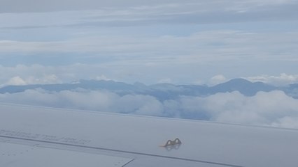
 Anamudi as seen from an aircraft. The peak is in the center of the image with a small white cloud seen behind its rounded summit
 -
 Anamudi, on the right, as seen on the descent towards Cochin International Airport from the Delhi-Kochi flight
 -
 Anamudi, on the right, as seen from the Munnar-Udumalpettai highway


See also edit
Citations edit
- ^ a b c "Anamudi". Kerala Tourism. Retrieved 26 November 2014.
- ^ a b c "Southern India Mountain Ultra-Prominence". Peaklist.org. Retrieved 14 December 2009.
- ^ a b "Anai Mudi, India". Peakbagger.com. Retrieved 14 December 2009.
- ^ a b Web Map Service (Map). Survey of India. Archived from the original on 1 May 2019. Retrieved 11 December 2017.
- ^ The Imperial Gazetteer of India, v. 5 1909, p. 334
- ^ "World Peaks with 300 km of Isolation". Peakbagger.com. Retrieved 12 November 2017.
- ^ "Up the Everest of the South - The New Indian Express". Retrieved 25 January 2018.[dead link]
- ^ Hoiberg, Dale; Ramchandani, Indu (2000). Dale Hoiberg (ed.). Students' Britannica India, Volumes 1-5. Popular Prakashan. p. 63. ISBN 0-85229-760-2.
- ^ a b The Imperial Gazetteer of India, v. 12 1909, p. 220
- ^ "Anamudi peak". Archived from the original on 3 May 2019. Retrieved 26 October 2015.
- ^ "Significance of Eravikulam National Park". Eravikulam National Park. Archived from the original on 3 October 2014. Retrieved 26 November 2014.
- ^ "New species of frog found in Eravikulam National Park". The Hindu. 5 May 2010. Retrieved 12 July 2019.
- ^ "Eravikulam National Park Management Plan". Eravikulam National Park. Archived from the original on 4 April 2010. Retrieved 14 December 2009.
- ^ Brandt, Sönke; Raith, Michael M.; Schenk, Volker; Sengupta, Pulak; Srikantappa, C.; Gerdes, Axel (31 January 2014). "Crustal evolution of the Southern Granulite Terrane, south India: New geochronological and geochemical data for felsic orthogneisses and granites". Precambrian Research. 246: 91–122. doi:10.1016/j.precamres.2014.01.007.
- ^ "Anamudi - Kerala". Vedanta Wake up!. Archived from the original on 5 December 2014. Retrieved 26 November 2014.
- ^ "Studies on the nature and chemistry of sediments and water of Periyar and Chalakudy Rivers, Kerala, India by Maya K." (PDF). Archived from the original (PDF) on 5 July 2017. Retrieved 1 March 2005.
- ^ a b "Climate: Munnar: Climate graph, Temperature graph, Climate table". Climate-Data.org. Retrieved 28 August 2013.
- ^ "Munnar Climate and Weather Averages, Kerala". Weather2Travel. Retrieved 28 August 2013.
References edit
- Hunter, William Wilson (2009), The Imperial Gazetteer of India, BiblioBazaar, LLC, ISBN 978-1-110-35940-0.
- Hunter, William Wilson; James Sutherland Cotton; Richard Burn; William Stevenson Meyer; Great Britain India Office (1909). The Imperial Gazetteer of India. Vol. 11. Clarendon Press. Archived from the original on 16 December 2008. Retrieved 7 January 2009.
External links edit
- Beautiful natural sound of flowing water on Anamudi slope near peak
- Highest peaks in Southern India