


Summary
The Anclote River, running for 29 miles (47 km)[1] near Tarpon Springs, Florida flows westward towards the Gulf of Mexico from its source of creeks and springs inland. The river is home to a variety of fish and wildlife. Anclote River is home to the sponging and fishing industries of Tarpon Springs (including a large shrimp industry). It is a major site for tourists of the area as it flows through the spongedocks of Tarpon Springs.
| Anclote River | |
|---|---|
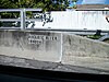
 Anclote River looking east from the Pinellas Avenue bridge. | |
| Location | |
| Country | United States |
| State | Florida |
| Counties | Pasco, Pinellas |
| District | SWFWMD |
| Physical characteristics | |
| Source | Starkey Wilderness Park |
| • location | Land o' Lakes, Florida |
| • coordinates | 28°16′44″N 82°30′48″W / 28.27889°N 82.51333°W |
| Mouth | St. Joseph Sound |
• location | Tarpon Springs, Florida |
• coordinates | 28°10′38″N 82°47′45″W / 28.17722°N 82.79583°W |
| Length | 29 mi (47 km) |
| Basin size | 98 sq mi (250 km2) |
| Basin features | |
| Tributaries | |
| • left | Tarpon Bayous |
An extension of the Pinellas Trail which crosses the Anclote River was dedicated on June 15, 2004.[2] The new extension is built along abandoned Atlantic Coast Line railroad grade, which once serviced industry on the north side of the river.
List of crossings edit
This list is incomplete; you can help by adding missing items. (August 2008) |
| Crossing | Carries | Image | Location | Coordinates |
|---|---|---|---|---|
| Headwaters | 28°16′44″N 82°30′48″W / 28.27889°N 82.51333°W | |||
| 140076 140077 |
Suncoast Parkway |
28°14′14″N 82°33′02″W / 28.23722°N 82.55056°W | ||
| Confluence with South Branch Anclote River | Starkey Wilderness Park | 28°13′20″N 82°36′34″W / 28.22222°N 82.60944°W | ||
| 144059 | Starkey Boulevard | New Port Richey | 28°13′29″N 82°38′33″W / 28.22472°N 82.64250°W | |
| 144051 | Little Road |

|
Trinity | 28°12′52″N 82°39′58″W / 28.21444°N 82.66611°W |
| Father Felix Ullrich Bridge 140067 |

|
Seven Springs | 28°12′53″N 82°40′56″W / 28.21472°N 82.68222°W | |
| 144024 | Seven Springs Boulevard |
|
Elfers | 28°12′56″N 82°41′32″W / 28.21556°N 82.69222°W |
| 144017 | Celtic Drive | Elfers | 28°12′57″N 82°41′56″W / 28.21583°N 82.69889°W | |
| 140034 | Perrine Ranch Road | Holiday | 28°11′39″N 82°43′07″W / 28.19417°N 82.71861°W | |
| Outflow of Salt Lake | 28°10′08″N 82°43′52″W / 28.16889°N 82.73111°W | |||
| 150235 | Tarpon Springs | 28°09′49″N 82°44′26″W / 28.16361°N 82.74056°W | ||
| Old ACL Bridge | Pinellas Trail Elfers Spur | Tarpon Springs | 28°09′34″N 82°44′51″W / 28.15944°N 82.74750°W | |
| 150006 | Tarpon Springs | 28°09′27″N 82°45′25″W / 28.15750°N 82.75694°W | ||
| Confluence with Tarpon Bayous | Tarpon Springs | 28°09′36″N 82°46′09″W / 28.16000°N 82.76917°W | ||
| Anclote Power Plant Inflow Canal | Tarpon Springs | 28°10′33″N 82°47′25″W / 28.17583°N 82.79028°W | ||
| Mouth | 28°10′38″N 82°47′45″W / 28.17722°N 82.79583°W | |||
Anclote River Park edit
The Anclote River Park has of a 300-foot sandy beach (91 m) facing the sandbars of the Anclote River. The back of the beach zone is dotted with big oak trees. The park includes an Indian Burial Mound with structures built over other burial grounds in the park.[3] The park has designated areas for swimming, boating and fishing. It is operational dawn to dusk 7 days a week. There are also changing rooms, bathrooms and outdoor showers nearby. Alcohol is not allowed and parking charges apply.[4]
Things To Do edit
Boating
The park boasts of a six-lane boat ramp that's ideal for boaters. For boat storage and rentals, Anclote Village Marina is right next doors.
Fishing
Except for boat ramp and beach area, fishing can be done anywhere around the park. Mullets and crabs are easily found in the channels that are shallow.
Picnics and Parties
The place is great for hosting small birthday parties or small barbeques. There are giant covered pavilions, picnic benches, children's playground, charcoal barbeque grills, horseshoe field, and a volleyball court to keep everyone busy.[5]
References edit
- ^ U.S. Geological Survey. National Hydrography Dataset high-resolution flowline data. The National Map Archived 2012-03-29 at the Wayback Machine, accessed April 18, 2011
- ^ Rondeaux, Candace (June 5, 2004). "Pinellas Trail extension work complete". St. Petersburg Times. Retrieved January 15, 2008.
- ^ Waxler, Erik (October 30, 2023). "Native American group doesn't want more mounds disturbed at Pasco park". ABC Action News Tampa Bay (WFTS). Retrieved November 1, 2023.
- ^ "Anclote River Park". October 7, 2021.
- ^ "Anclote River Park". October 7, 2021.
External links edit
- FDOT Florida Bridge Data 01-05-2010