


Summary
Angaur Airstrip (Japanese: アンガウル飛行場, Hepburn: Angauru hikōjō, (FAA LID: ANG[1])) is a small airstrip on Angaur, one of the islands of Palau. It also served as an airfield during World War II.
Angaur Airstrip | |||||||||||
|---|---|---|---|---|---|---|---|---|---|---|---|
 | |||||||||||
| Summary | |||||||||||
| Airport type | Public | ||||||||||
| Owner | Republic of Palau | ||||||||||
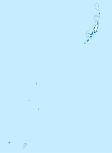
| Location | Angaur, Palau | ||||||||||
| Built | 1944 | ||||||||||
| Occupants | U.S. Army Air Forces Seventh Air Force (until 1945) | ||||||||||
| Elevation AMSL | 22 ft / 7 m | ||||||||||
| Coordinates | 06°54′23″N 134°08′42″E / 6.90639°N 134.14500°E | ||||||||||
| Map | |||||||||||
 Angaur Airstrip | |||||||||||
| Runways | |||||||||||
| |||||||||||
History edit
World War II edit
The day the island was declared secured on September 20, 1944, construction of the airfield began on the eastern edge of the island. As there was no existing airfield to build on, two Army engineering battalions had to clear jungle and level the terrain to create the airfield. On 19 October 1944 the airfield with its 7,000 feet (2,100 m) runway aligned NE/SW together with taxiways and hardstands for 120 aircraft were ready for use.[2][3]
The 494th Bombardment Group operating B-24J Liberator bombers arrived at Angaur on 16 October and commenced operations on 3 November. The Wing remained at Angaur until June 1945 when it moved to Yontan Airfield on Okinawa.
The 22nd Bombardment Group operating B-24s was based at Angaur from November 1944 until January 1945 when it moved to Guiuan Airfield in the Philippines.
Postwar edit
In April 2010 the Palau Senate passed a resolution asking the President to offer Angaur airstrip as a site for the relocation of Marine Corps Air Station Futenma on Okinawa.[4]
In 2020 a joint U.S. civil/military team carried out the Angaur Airfield Joint Improvement Project to improve the runway with the work completed by 27 August. The runway improvements give Palau a secondary airfield capable of handling cargo aircraft to back up to Roman Tmetuchl International Airport.[5]
Facilities and aircraft edit
The airport resides at an estimated elevation of 20 feet (6.1 m) above mean sea level. It has one runway designated 5/23 with a gravel surface measuring 7,000 feet (2,100 m) by 150 feet (46 m). For the 12-month period ending May 23, 1987, the airport had 1,500 air taxi aircraft operations, an average of 125 per month.[1]
Airlines and destinations edit
| Airlines | Destinations |
|---|---|
| Belau Air | Koror, Peleliu |
| Pacific Mission Aviation | Koror |
See also edit
References edit
- ^ a b c FAA Airport Form 5010 for ANG – Angaur Airstrip PDF, effective 2 July 2009.
- ^ Smith, Robert (1953). The approach to the Philippines. US Government Printing Office. p. 530.
- ^ Building the Navy's Bases in World War II History of the Bureau of Yards and Docks and the Civil Engineer Corps 1940-1946. US Government Printing Office. 1947. p. 331.
 This article incorporates text from this source, which is in the public domain.
- ^ "Senate bids Angaur airfield for US military use". Island Times. 26 April 2010. Retrieved 2 June 2013.
- ^ "U.S. Military lands C130 on newly renovated Angaur Airfield in Palau". U.S. Army Pacific Public Affairs Office. 5 September 2020. Retrieved 7 March 2021.
External links edit
- www.pacificwrecks.com
- Airport information for ANG – Angaur Airstrip at AirNav