


Summary
Appin Road is a New South Wales secondary highway linking Campbelltown and Sydney's western suburbs with Wollongong. It is named after Appin, which lies on its path.
Appin Road | |
|---|---|
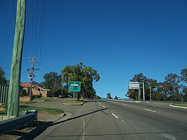 | |
| Heading south along Appin Road, Campbelltown | |
 North end South end | |
| Coordinates |
|
| General information | |
| Type | Road |
| Length | 31.6 km (20 mi)[1] |
| Gazetted | August 1928[2] |
| Route number(s) | |
| Former route number | |
| Major junctions | |
| North end | Oxley Street Campbelltown, Sydney |
| |
| South end | Bulli Tops, New South Wales |
| Location(s) | |
| Major suburbs | Gilead, Appin |
Route edit
Appin Road commences at the intersection with Oxley Street and Narellan Road in Campbelltown and heads in a southerly direction as a four-lane, dual-carriageway road, narrowing to a two-lane, single carriageway road at Rosemeadow, to Appin, before continuing in a south-easterly direction to the interchange with Princes Motorway at Bulli Tops, in the Illawarra region just north of Bulli.
History edit
The passing of the Main Roads Act of 1924[3] through the Parliament of New South Wales provided for the declaration of Main Roads, roads partially funded by the State government through the Main Roads Board (later the Department of Main Roads, and eventually Transport for NSW). Main Road No. 177 was declared along this road on 8 August 1928, from the intersection with Narellan Road in Campbelltown, via Appin to the intersection with Princes Highway near the top of Bull Pass (and continuing north along Campbelltown Road to the intersection with Hume Highway at Crossroads);[2] with the passing of the Main Roads (Amendment) Act of 1929[4] to provide for additional declarations of State Highways and Trunk Roads, this was amended to Main Road 177 on 8 April 1929.
The passing of the Roads Act of 1993[5] updated road classifications and the way they could be declared within New South Wales. Under this act, Appin Road retains its declaration as part of Main Road 177.[6]
The route was allocated State Route 69 in 1974. With the conversion to the newer alphanumeric system in 2013, this was replaced with route B69.[7]
Major intersections edit
| LGA | Location | km[1] | mi | Destinations | Notes |
|---|---|---|---|---|---|
| Campbelltown | Campbelltown–Bradbury boundary | 0.0 | 0.0 | Oxley Street (north) – Campbelltown, Leumeah, Casula | Northern terminus of road |
to | Route B69 continues west along Narellan Road | ||||
| The Parkway (east) – Bradbury | |||||
| Wollondilly | Appin | 14.7 | 9.1 | Wilton Road – Wilton, Picton | |
| Georges River | 15.9 | 9.9 | Kings Falls Bridge | ||
| Wollondilly | Bulli Tops | 31.6 | 19.6 | Southern terminus of road and route B69 | |
| |||||
See also edit
![]() Australian Roads portal
Australian Roads portal
References edit
- ^ a b Google (19 August 2022). "Appin Road" (Map). Google Maps. Google. Retrieved 19 August 2022.
- ^ a b "Main Roads Act, 1924-1927". Government Gazette of the State of New South Wales. No. 110. National Library of Australia. 17 August 1928. pp. 3814–20. Archived from the original on 3 August 2022. Retrieved 1 August 2022.
- ^ State of New South Wales, An Act to provide for the better construction, maintenance, and financing of main roads; to provide for developmental roads; to constitute a Main Roads Board Archived 11 August 2022 at the Wayback Machine 10 November 1924
- ^ State of New South Wales, An Act to amend the Main Roads Act, 1924-1927; to confer certain further powers upon the Main Roads Board; to amend the Local Government Act, 1919, and certain other Acts; to validate certain payments and other matters; and for purposes connected therewith. Archived 12 August 2022 at the Wayback Machine 8 April 1929
- ^ State of New South Wales, An Act to make provision with respect to the roads of New South Wales; to repeal the State Roads Act 1986, the Crown and Other Roads Act 1990 and certain other enactments; and for other purposes. Archived 11 August 2022 at the Wayback Machine 10 November 1924
- ^ Transport for NSW (August 2022). "Schedule of Classified Roads and Unclassified Regional Roads" (PDF). Government of New South Wales. Archived from the original (PDF) on 25 August 2022. Retrieved 1 August 2022.
- ^ "Road number and name changes in Southern NSW" (PDF). Roads & Maritime Services. Government of New South Wales. 2012. Archived from the original (PDF) on 9 April 2019. Retrieved 7 November 2016.