


Summary
Arguin (Arabic: أرغين, Portuguese: Arguim) is an island off the western coast of Mauritania in the Bay of Arguin. It is approximately 6 km × 2 km (3.7 mi × 1.2 mi) in size, with extensive and dangerous reefs around it.[1] The island is now part of the Banc d'Arguin National Park.[2]
Arguin
أرغين | |
|---|---|
 The Portuguese fort of Arguin | |
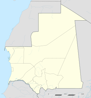 Arguin Location in Mauritania | |
| Coordinates: 20°36′00″N 16°27′00″W / 20.6000°N 16.4500°W | |
| Country | |
| Region | Dakhlet Nouadhibou Region |
| Elevation | 0 m (0 ft) |
History edit

The island changed hands frequently during the colonial era. The first European to visit the island was the Portuguese explorer Nuno Tristão, in 1443.[3] In 1445, Prince Henry the Navigator set up a trading post on the island, which acquired gum arabic and enslaved people for Portugal. By 1455, 800 enslaved people were shipped from Arguin to Portugal every year.[4]
In 1633, during its Dutch-Portuguese War, the Netherlands seized control of Arguin. It remained under Dutch rule until 1678, with a brief interruption by English rule in 1665. France took over the island in September 1678, but it was then abandoned until 1685.[5] Arguin's aridity and its lack of a good anchorage made long-term European settlement difficult.[1]

In 1685, Captain Cornelius Reers of the frigate Rother Löwe occupied the old Portuguese fort on the island. He successfully concluded a treaty with the native king in which Brandenburg was accepted as a protecting power. The treaty was ratified in 1687 and was renewed in 1698.[6] Arguin remained a colony of Brandenburg until 1721 when the French successfully assaulted the fort and then took control of the island. The Dutch took the fort and island from the French the following year only to lose it again in 1724 to the French. This period of French rule lasted four years; in 1728, it reverted to the control of indigenous peoples.[5] The island was included in the territory of the French colony of Mauritania, and it remained under Mauritanian rule when that country became independent in 1960.[2]
In July 1816, the French frigate Méduse, bound for Senegal, was wrecked off Arguin and 350 people died.[1]
Sources edit
- ^ a b c Chisholm, Hugh, ed. (1911). . Encyclopædia Britannica. Vol. 2 (11th ed.). Cambridge University Press. p. 482.
- ^ a b "Le Parc National du Banc d'Arguin". Archived from the original on 2017-06-07. Retrieved 2013-11-10.
- ^ Huish, John. "Travels of Richard and John Lander into the interior of Africa".
- ^ Slave Routes - Europe Portugal Archived November 10, 2013, at the Wayback Machine. New raw archival-sourced data regarding Arguin slave trade in the early sixteenth century have been released in Ivana Elbl, "Sand and Dreams: Daily Slave Purchases at the Portuguese Coastal Outpost of Arguim (Mauritania) (1519-1520) ~ Full Raw Serialized Data plus Archival Analysis Annotations,” Portuguese Studies Review 30 (1) (2022): 325-354. The data very simply supersedes other obsolete listings and / or previous unfounded speculations ("estimates"), for the period in question. Available on academia.edu.https://trentu.academia.edu/ivanaElbl Consulted 29 May 2023.
- ^ a b Cahoon, Ben. "Mauritania". www.worldstatesmen.org.
- ^ van der Heyden, Ulrich (1993). Rote Adler an Afrikas Küste: Die brandenburgisch-preußische Kolonie Großfriedrichsburg in Westafrika (second ed.). Berlin: Selignow. ISBN 3-933889-04-9.