


Summary
Aribinda Airport (IATA: XAR, ICAO: DFOY) is an airport serving the village of Aribinda in the Soum Province, part of the Sahel Region of Burkina Faso.
Aribinda Airport | |
|---|---|
| Summary | |
| Serves | Aribinda, Soum Province, Sahel Region, Burkina Faso |
| Location | |
| Coordinates | 14°13′00″N 00°53′00″W / 14.21667°N 0.88333°W |
| Maps | |
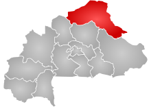 Sahel Region in Burkina Faso | |
 XAR Location of the airport in Burkina Faso | |
The airport is likely long abandoned. There is currently no paved or marked runway near any of six different coordinate pairs for Aribinda available on the internet. Neither is any historical or runway information posted at any web site with a page for Aribinda.[1][2][3][4][5][6] However, a listing for the airfield still appears in the official ASECNA Aeronautical Information Publication for Burkina Faso, quoting coordinates N14 13.0 W000 53.0.[7] Furthermore, the airport still has a valid 3-letter code allocated by IATA,[8] though a search of the ICAO database reveals no 4-letter ICAO location indicator code.[9]
References edit
- ^ "Google Maps". Google Maps. Retrieved 2018-08-20.
- ^ "Google Maps". Google Maps. Retrieved 2018-08-20.
- ^ "Google Maps". Google Maps. Retrieved 2018-08-20.
- ^ "Google Maps". Google Maps. Retrieved 2018-08-20.
- ^ "Google Maps". Google Maps. Retrieved 2018-08-20.
- ^ "Google Maps". Google Maps. Retrieved 2018-08-20.
- ^ "AIS ASECNA - Ad.2 : Aérodromes". www.ais-asecna.org. Archived from the original on 2018-08-20. Retrieved 2018-08-20.
- ^ IATA. "IATA - Codes - Airline and Airport Codes Search". www.iata.org. Retrieved 2018-08-20.
- ^ "API Data Service". www.icao.int. Retrieved 2018-08-20.
External links edit
- ASECNA AIP for Burkina Faso
- IATA location code search
- ICAO location indicator search
- OurAirports
- GCMap
- FallingRain
- Maplandia
- WorldAirportCodes