


Summary
The Arizona National Scenic Trail is a National Scenic Trail from Mexico to Utah that traverses the whole north–south length of the U.S. state of Arizona. The trail begins at the Coronado National Memorial near the US–Mexico border and moves north through parts of the Huachuca, Santa Rita, and Rincon Mountains. The trail continues through the Santa Catalina north of Tucson and the Mazatzal Mountains before ascending the Mogollon Rim north of Payson, and eventually leading to the higher elevations of Northern Arizona and the San Francisco Peaks. The trail then continues across the Coconino Plateau and in and out of the Grand Canyon. The Arizona Trail terminates near the Arizona–Utah border in the Kaibab Plateau region. The 800-mile (1,300 km) long Arizona Trail was completed on December 16, 2011. The trail is designed as a primitive trail for hiking, equestrians, mountain biking, and even cross country skiing, showcasing the wide variety of mountain ranges and ecosystems of Arizona.
| Arizona Trail | |
|---|---|
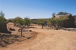 Kentucky Camp, along the Arizona Trail in the Santa Rita Mountains. | |
| Length | 800 mi (1,300 km) |
| Location | Arizona, United States |
| Designation | National Scenic Trail |
| Trailheads | Coronado National Memorial Arizona–Utah border |
| Use | Hiking, horseback riding, mountain biking, cross-country skiing |
| Highest point | San Francisco Peaks (This point is on a proposed section of the trail), 9,600 ft (2,900 m) |
| Lowest point | Gila River, 1,700 ft (520 m) |
| Difficulty | Easy to Strenuous |
| Season | Year-round at lower elevations, Summer and Fall at higher elevations |
| Sights | Santa Catalina Mountains, Mogollon Rim, San Francisco Peaks, Grand Canyon |
The idea for the trail was originally developed and promoted in 1985 by Dale Shewalter, a Flagstaff, Arizona, teacher.[1] The Arizona Trail was designated as a National Scenic Trail on March 30, 2009 by the Omnibus Public Land Management Act of 2009. It forms part of the shortened version of the 6,875-mile (11,064 km) Great Western Loop. This version includes the Grand Canyon National Park.

History edit
The Arizona Trail was created by interconnecting preexisting trails. In 1994, the Arizona Trail Association incorporated as a 501(c)(3) non-profit organization to bring volunteers and the necessary resources to create maps, identify water sources, build and maintain the trail, and help raise funds for the trail.[2]
Hiking edit
Map of the trail edit
The Arizona Trail is divided into 43 passages, and categorized into Southern, Central, and Northern sections.[3]
Trail finishers edit
Trail finishers are individuals who have reported completing the Arizona Trail. They receive a copper belt buckle (or pin/pendant) in celebration of their accomplishment. This list includes:[4]
- Thru-hikers and segment hikers
- Speed record ultra runners
- Yo-yo’s (those who do the trail in one direction, then turn around and do it in the other direction)
- Horseback riders
- Mountain bikers
- Those who used a variety of non-motorized modes to travel along every portion of the Arizona Trail
- Some pioneers who trekked overland long before the AZT was completely built.
Trail communities edit
The “AZT Gateway” provides community information (i.e., lodging, staple stores, access information, urgent care, etc.). There are many scenic communities that have fun areas of interest along the Arizona Trail.[5]
Mountain biking edit
Mountain biking is allowed but segments are off-limits due to wilderness restrictions. Preferred biking routes have been developed to retain a trail experience consistent with National Scenic Trail values.[6]
Animals edit
Some hikers enjoy the company of their canine companions when hiking the trail.[original research?] However, the rough terrain, venomous snakes, sharp vegetation, hot ground during the summer, and lack of water in many trail segments can make the Arizona Trail unsuitable for most dogs, and in some sections, they are not allowed. Hikers wanting to bring their dogs should check with the Arizona Trail Association,[7] which recommends that dog owners plan day trips in areas where dogs are allowed and when conditions (particularly heat and water) are suitable for them.
Pack goats are sometimes used as companions on the trail,[citation needed] and can help lessen the pain of carrying a heavy backpack. They are allowed on some parts of the Arizona Trail, but prohibited on other segments due to the possibility of diseases from domestic goats spreading to sensitive bighorn sheep populations. Pack goats are not allowed anywhere bighorn sheep live. Therefore, it's not possible to do a thru-hike with pack goats.[8]
Trail experiences edit
As of 2015, fewer than twenty people have ridden the entire trail. Some rode the trail all at once; others who rode the trail in segments, taking up to six years.[9]
In general, it takes approximately fifty days to hike the trail. The speed record for completing the trail is held by Jeff Garmire, who completed the Arizona trail in fifteen days, thirteen hours.[10]
A 21-mile section along the Arizona Trail provides views in the Grand Canyon region, particularly on the Kaibab Plateau. The trail connects the East Rim View and Murray trailheads.[11]
References edit
- ^ "Arizona Trail founder dies". Arizona Daily Sun. 2010-01-11. Retrieved 2010-02-08.
- ^ "History – Explore the Arizona Trail". Retrieved 2021-05-12.
- ^ "Map of the Trail – Explore the Arizona Trail". Retrieved 2021-05-12.
- ^ "Trail Finishers – Explore the Arizona Trail". Retrieved 2021-05-12.
- ^ "Gateway Communities – Explore the Arizona Trail". Retrieved 2021-05-12.
- ^ "Mountain Biking – Explore the Arizona Trail". Retrieved 2021-05-12.
- ^ "Dogs on the Trail – Explore the Arizona Trail". Retrieved 2021-05-12.
- ^ "Pack Goats – Explore the Arizona Trail". Retrieved 2021-05-12.
- ^ Drown, Jule (Jan–Feb 2015). "The Arizona trail". The Trail Rider. 27(1):22: 2 – via Gale General OneFile.
- ^ Fuchs, Jeremy (May 20, 2019). "Trail Blazer". Sports Illustrated. Vol. 130, no. 13. p. 31 – via Academic Search Complete.
- ^ "Arizona Trail : Find sweet views and breezes on the Kaibab Plateau". Backpacker. 33 (6). July–August 2005 – via Gale Academic OneFile.
External links edit
- Arizona Trail Association
- Arizona State Parks: Arizona Trail fact sheet
- Trail Segments – HikeArizona.COM
- Trailheads Map – HikeArizona.COM
- Arizona Trail Forum
- Arizona Trail Backpacking Journals
- U.S. Geological Survey Geographic Names Information System: Arizona Trail (Coconino County)
35°57′28″N 111°57′17″W / 35.95778°N 111.95472°W