


Summary
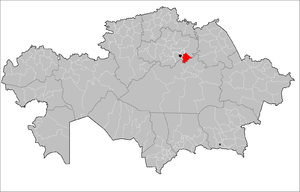
Arshaly District (Kazakh: Аршалы ауданы, Arşaly audany) is a district of Akmola Region in northern Kazakhstan. The administrative center of the district is the settlement of Arshaly. Population: 27,940 (2009 Census results);[3] 29,620 (1999 Census results).[3]
Arshaly | |
|---|---|
District | |
| Arşaly audany | |
 | |
| Country | |
| Region | Aqmola Region |
| Administrative center | Arshaly |
| Founded | 1930 |
| Government | |
| • Akim | Aidar Itemgenovich Baymanov[1] |
| Area | |
| • Total | 2,200 sq mi (5,800 km2) |
| Population (2013)[2] | |
| • Total | 27,119 |
| Time zone | UTC+6 (East) |
Geography edit
The district is located in the south-east of Akmola region,[4] on the Kazakh melkosopochnik. The area of the territory is 5.8 thousand km2,[5] which is 3.75% of the entire territory of the region (the 14th district in terms of territory size in the region). The length from west to east is 100 km, from south to north — 110 km.
Borders:
- with the districts of Akmola region:
- in the north-west with the Tselinograd district;
- in the northeast with the Yerementau district;
- with districts of Karaganda region:
- in the south with Osakarovsky district;
- in the southwest with the Nurinsky district.
The eastern part is occupied by the low southern spurs of the Yerementau Mountains. The climate is continental. Winter is cold, long-lasting; average temperature in January -17°C; summer is moderately hot, average temperature in July is 20°C. The average annual precipitation is 300-350 mm . The Ishim River flows through the territory of the district with tributaries of the Kyzylmol and Olenty. Most small rivers dry up in summer. Many lakes. The largest: Ulken and Kishi Saryoba, Balyktykol, Tanakol, Baidaly, Shalkar, Kyzylkol and others.[6]
History edit
The district was formed initially as Vishnevsky, by the Decree of the Presidium of the Karaganda Regional Executive Committee of February 10, 1935 as a result of the unbundling of the Akmola and Telman districts of the Karaganda region. The administrative center of the district was the village of Vishnevka (now the village of Arshaly).[7]
By the decree of the Presidium of the Supreme Soviet of the Kazakh SSR of October 14, 1939, Vishnevsky district was transferred to the newly formed Akmola region.[8]
By the Decree of the President of the Republic of Kazakhstan dated November 14, 1997 No. 3759 "On renaming certain administrative-territorial units of the Akmola region and changing their transcription" Vishnevsky district was renamed Arshalynsky district.[9]
Administrative division edit
Arshalynsky district — as a separate administrative unit of the 2nd level of Kazakhstan, includes 13 administrative-territorial entities of the 3rd level, including: 1 village administration and 12 rural districts.[10]
| № | Administrative division | Administrative center |
|---|---|---|
| 1 | Arshaly | Settlement of Arshaly |
| 2 | Akbulak Rural Okrug | Akbulak village |
| 3 | Arnasay Rural District | Arnasay village |
| 4 | Anar Rural District | Anar station |
| 5 | Bersuat Rural District | Bersuat village |
| 6 | Bulaksay Rural District | Bulaksai village |
| 7 | Volgodonovsky Rural District | Volgodonovka village |
| 8 | Zhibek Zholy Rural District | Zhibek Zholy village |
| 9 | Izhevsk Rural District | Izhevsk village |
| 10 | Konstantinovsky Rural District | Konstantinovka village |
| 11 | Mikhailovsky Rural District | Mikhailovka village |
| 12 | Saryobinsky Rural district | Saryoba village |
| 13 | Turgen Rural District | Turgen village |
References edit
- ^ "Айдар Байманов назначен акимом Аршалынского района". kokshetv.kz. 2021-02-17.
- ^ "Департамент статистики Акмолинской области". Archived from the original on 2011-05-28. Retrieved 2010-05-13.
- ^ a b "Население Республики Казахстан" [Population of the Republic of Kazakhstan] (in Russian). Департамент социальной и демографической статистики. Retrieved 8 December 2013.
- ^ "Аршалы: территория инноваций". apgazeta.kz (in Russian). 2016-09-28. Retrieved 2022-11-30.
- ^ "Большая перемена". vlast.kz (in Russian). 2015-08-24. Retrieved 2022-11-30.
- ^ "Аршалынский район". map.akmol.kz (in Russian). Retrieved 2022-11-30.
- ^ "История поселка Аршалы (Борисовка, Вишневка, Аршалы)". arshalytoday.wixsite.com (in Russian). Retrieved 2022-11-30.
- ^ "Статья «История Акмолы – Астаны в архивных документах»". obl-archive.akmo.gov.kz (in Russian). 2017-07-21. Retrieved 2022-11-30.
- ^ "О переименовании отдельных административно-территориальных единиц Акмолинской области и изменении их транскрипции". adilet.zan.kz (in Russian). 1997-11-14. Retrieved 2022-11-30.
- ^ "Об утверждении Межрегиональной схемы территориального развития Астанинской агломерации". zakon.uchet.kz (in Russian). 2022-01-16.
52°43′40″N 61°08′07″E / 52.72778°N 61.13528°E