
KNOWPIA
WELCOME TO KNOWPIA

Artolsheim 
Summary
Artolsheim is a commune in the Bas-Rhin department in Alsace in northeastern France.[3]
Artolsheim
Àrtelse | |
|---|---|
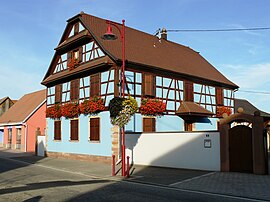 A half-timbered house in Artolsheim | |
 Coat of arms | |
Location of Artolsheim .mw-parser-output .locmap .od{position:absolute}.mw-parser-output .locmap .id{position:absolute;line-height:0}.mw-parser-output .locmap .l0{font-size:0;position:absolute}.mw-parser-output .locmap .pv{line-height:110%;position:absolute;text-align:center}.mw-parser-output .locmap .pl{line-height:110%;position:absolute;top:-0.75em;text-align:right}.mw-parser-output .locmap .pr{line-height:110%;position:absolute;top:-0.75em;text-align:left}.mw-parser-output .locmap .pv>div{display:inline;padding:1px}.mw-parser-output .locmap .pl>div{display:inline;padding:1px;float:right}.mw-parser-output .locmap .pr>div{display:inline;padding:1px;float:left}html.skin-theme-clientpref-night .mw-parser-output .od,html.skin-theme-clientpref-night .mw-parser-output .od .pv>div,html.skin-theme-clientpref-night .mw-parser-output .od .pl>div,html.skin-theme-clientpref-night .mw-parser-output .od .pr>div{background:#000;color:#fff}html.skin-theme-clientpref-night .mw-parser-output .locmap{filter:grayscale(0.6)}@media(prefers-color-scheme:dark){html.skin-theme-clientpref-os .mw-parser-output .locmap{filter:grayscale(0.6)}html.skin-theme-clientpref-os .mw-parser-output .od,html.skin-theme-clientpref-os .mw-parser-output .od .pv>div,html.skin-theme-clientpref-os .mw-parser-output .od .pl>div,html.skin-theme-clientpref-os .mw-parser-output .od .pr>div{background:#000;color:#fff}}  Artolsheim  Artolsheim | |
| Coordinates: 48°12′33″N 7°34′26″E / 48.2092°N 7.5739°E | |
| Country | France |
| Region | Grand Est |
| Department | Bas-Rhin |
| Arrondissement | Sélestat-Erstein |
| Canton | Sélestat |
| Intercommunality | CC Ried Marckolsheim |
| Government | |
| • Mayor (2023–2026) | Jean-Michel Voegeli[1] |
| Area 1 | 11.25 km2 (4.34 sq mi) |
| Population (2021)[2] | 992 |
| • Density | 88/km2 (230/sq mi) |
| Time zone | UTC+01:00 (CET) |
| • Summer (DST) | UTC+02:00 (CEST) |
| INSEE/Postal code | 67011 /67390 |
| Elevation | 168–174 m (551–571 ft) |
| 1 French Land Register data, which excludes lakes, ponds, glaciers > 1 km2 (0.386 sq mi or 247 acres) and river estuaries. | |
Geography edit
Artolsheim has the distinction of being further from the sea than any other place in France. The Gulf of Genoa and the mouth of the river Scheldt are both 430 km (267 mi) away.[4]
Population edit
| Year | Pop. | ±% p.a. |
|---|---|---|
| 1968 | 705 | — |
| 1975 | 630 | −1.59% |
| 1982 | 649 | +0.43% |
| 1990 | 643 | −0.12% |
| 1999 | 728 | +1.39% |
| 2009 | 910 | +2.26% |
| 2014 | 976 | +1.41% |
| 2020 | 989 | +0.22% |
| Source: INSEE[5] | ||
Economy edit
Employment opportunities in the village are limited. The traditional economic focus of the region is Sélestat some fifteen kilometres (ten miles) to the west. The river crossing of Marckolsheim with its associated locks and hydro-electric power station offer employment opportunities: many mostly low-paid seasonal jobs are also provided by the Europa-Park 'theme park'.
See also edit
References edit
- ^ "Répertoire national des élus: les maires" (in French). data.gouv.fr, Plateforme ouverte des données publiques françaises. 30 November 2023.
- ^ "Populations légales 2021". The National Institute of Statistics and Economic Studies. 28 December 2023.
- ^ INSEE commune file
- ^ IGN Magazine n°50, novembre-décembre 2008
- ^ Population en historique depuis 1968, INSEE
Wikimedia Commons has media related to Artolsheim.