
KNOWPIA
WELCOME TO KNOWPIA

Astove Island Airport 
Summary
Astove Island Airport (ICAO: FSSA) is an airstrip serving Astove Island in Seychelles. The island is 1,040 kilometres (650 mi) southwest of the Seychelles capital of Victoria on Mahé Island.
Astove Island Airport | |||||||||||
|---|---|---|---|---|---|---|---|---|---|---|---|
| Summary | |||||||||||
| Airport type | Public | ||||||||||
| Serves | Astove Island | ||||||||||
| Elevation AMSL | 10 ft / 3 m | ||||||||||
| Coordinates | 10°03′40″S 47°45′00″E / 10.06111°S 47.75000°E | ||||||||||
| Map | |||||||||||
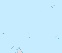 FSSA Location of the airport in Seychelles | |||||||||||
| Runways | |||||||||||
| |||||||||||
See also edit
 Aviation portal
- List of airports in Seychelles
- Transport in Seychelles
References edit
External links edit
- OpenStreetMap - Astove Island
- Accident history for Astove Island at Aviation Safety Network