
KNOWPIA
WELCOME TO KNOWPIA

Aubers 
Summary
Aubers (French pronunciation: [obɛʁ]) is a commune in the Nord department in northern France.[3] It is 15 km (9.3 mi) west of Lille. The parish church is dedicated to St Vaast.
Aubers | |
|---|---|
 The town hall in Aubers | |
 Coat of arms | |
Location of Aubers .mw-parser-output .locmap .od{position:absolute}.mw-parser-output .locmap .id{position:absolute;line-height:0}.mw-parser-output .locmap .l0{font-size:0;position:absolute}.mw-parser-output .locmap .pv{line-height:110%;position:absolute;text-align:center}.mw-parser-output .locmap .pl{line-height:110%;position:absolute;top:-0.75em;text-align:right}.mw-parser-output .locmap .pr{line-height:110%;position:absolute;top:-0.75em;text-align:left}.mw-parser-output .locmap .pv>div{display:inline;padding:1px}.mw-parser-output .locmap .pl>div{display:inline;padding:1px;float:right}.mw-parser-output .locmap .pr>div{display:inline;padding:1px;float:left}html.skin-theme-clientpref-night .mw-parser-output .od,html.skin-theme-clientpref-night .mw-parser-output .od .pv>div,html.skin-theme-clientpref-night .mw-parser-output .od .pl>div,html.skin-theme-clientpref-night .mw-parser-output .od .pr>div{background:#000;color:#fff}html.skin-theme-clientpref-night .mw-parser-output .locmap{filter:grayscale(0.6)}@media(prefers-color-scheme:dark){html.skin-theme-clientpref-os .mw-parser-output .locmap{filter:grayscale(0.6)}html.skin-theme-clientpref-os .mw-parser-output .od,html.skin-theme-clientpref-os .mw-parser-output .od .pv>div,html.skin-theme-clientpref-os .mw-parser-output .od .pl>div,html.skin-theme-clientpref-os .mw-parser-output .od .pr>div{background:#000;color:#fff}}  Aubers  Aubers | |
| Coordinates: 50°35′46″N 2°49′33″E / 50.5961°N 2.8258°E | |
| Country | France |
| Region | Hauts-de-France |
| Department | Nord |
| Arrondissement | Lille |
| Canton | Annœullin |
| Intercommunality | Métropole Européenne de Lille |
| Government | |
| • Mayor (2020–2026) | Alain Leclercq[1] |
| Area 1 | 10.14 km2 (3.92 sq mi) |
| Population (2021)[2] | 1,722 |
| • Density | 170/km2 (440/sq mi) |
| Time zone | UTC+01:00 (CET) |
| • Summer (DST) | UTC+02:00 (CEST) |
| INSEE/Postal code | 59025 /59249 |
| Elevation | 18–41 m (59–135 ft) (avg. 29 m or 95 ft) |
| 1 French Land Register data, which excludes lakes, ponds, glaciers > 1 km2 (0.386 sq mi or 247 acres) and river estuaries. | |
It was the site of a major World War I battle, the Battle of Aubers, during 1915.
Aubers is twinned with the English town of Wadhurst.
Population edit
| Year | Pop. | ±% p.a. |
|---|---|---|
| 1968 | 891 | — |
| 1975 | 908 | +0.27% |
| 1982 | 1,311 | +5.39% |
| 1990 | 1,571 | +2.29% |
| 1999 | 1,584 | +0.09% |
| 2009 | 1,521 | −0.41% |
| 2014 | 1,562 | +0.53% |
| 2020 | 1,698 | +1.40% |
| Source: INSEE[4] | ||
Heraldry edit
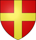 |
The arms of Aubers are blazoned : Gules, a cross Or.
|
See also edit
References edit
- ^ "Répertoire national des élus: les maires". data.gouv.fr, Plateforme ouverte des données publiques françaises (in French). 2 December 2020.
- ^ "Populations légales 2021". The National Institute of Statistics and Economic Studies. 28 December 2023.
- ^ INSEE commune file
- ^ Population en historique depuis 1968, INSEE
Wikimedia Commons has media related to Aubers.