
KNOWPIA
WELCOME TO KNOWPIA

Aubin-Saint-Vaast 
Summary
Aubin-Saint-Vaast is a commune in the Pas-de-Calais department in northern France.[3]
Aubin-Saint-Vaast | |
|---|---|
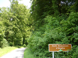 The entrance to the forest of Hesdin | |
 Coat of arms | |
Location of Aubin-Saint-Vaast .mw-parser-output .locmap .od{position:absolute}.mw-parser-output .locmap .id{position:absolute;line-height:0}.mw-parser-output .locmap .l0{font-size:0;position:absolute}.mw-parser-output .locmap .pv{line-height:110%;position:absolute;text-align:center}.mw-parser-output .locmap .pl{line-height:110%;position:absolute;top:-0.75em;text-align:right}.mw-parser-output .locmap .pr{line-height:110%;position:absolute;top:-0.75em;text-align:left}.mw-parser-output .locmap .pv>div{display:inline;padding:1px}.mw-parser-output .locmap .pl>div{display:inline;padding:1px;float:right}.mw-parser-output .locmap .pr>div{display:inline;padding:1px;float:left}html.skin-theme-clientpref-night .mw-parser-output .od,html.skin-theme-clientpref-night .mw-parser-output .od .pv>div,html.skin-theme-clientpref-night .mw-parser-output .od .pl>div,html.skin-theme-clientpref-night .mw-parser-output .od .pr>div{background:#000;color:#fff}html.skin-theme-clientpref-night .mw-parser-output .locmap{filter:grayscale(0.6)}@media(prefers-color-scheme:dark){html.skin-theme-clientpref-os .mw-parser-output .locmap{filter:grayscale(0.6)}html.skin-theme-clientpref-os .mw-parser-output .od,html.skin-theme-clientpref-os .mw-parser-output .od .pv>div,html.skin-theme-clientpref-os .mw-parser-output .od .pl>div,html.skin-theme-clientpref-os .mw-parser-output .od .pr>div{background:#000;color:#fff}}  Aubin-Saint-Vaast  Aubin-Saint-Vaast | |
| Coordinates: 50°23′46″N 1°58′26″E / 50.3961°N 1.974°E | |
| Country | France |
| Region | Hauts-de-France |
| Department | Pas-de-Calais |
| Arrondissement | Montreuil |
| Canton | Auxi-le-Château |
| Intercommunality | CC des 7 Vallées |
| Government | |
| • Mayor (2020–2026) | Steve Pringarbe[1] |
| Area 1 | 6.7 km2 (2.6 sq mi) |
| Population (2021)[2] | 734 |
| • Density | 110/km2 (280/sq mi) |
| Time zone | UTC+01:00 (CET) |
| • Summer (DST) | UTC+02:00 (CEST) |
| INSEE/Postal code | 62046 /62140 |
| Elevation | 17–119 m (56–390 ft) (avg. 24 m or 79 ft) |
| 1 French Land Register data, which excludes lakes, ponds, glaciers > 1 km2 (0.386 sq mi or 247 acres) and river estuaries. | |
Population edit
| Year | Pop. | ±% p.a. |
|---|---|---|
| 1968 | 678 | — |
| 1975 | 708 | +0.62% |
| 1982 | 735 | +0.54% |
| 1990 | 710 | −0.43% |
| 1999 | 756 | +0.70% |
| 2009 | 764 | +0.11% |
| 2014 | 762 | −0.05% |
| 2020 | 734 | −0.62% |
| Source: INSEE[4] | ||
Sights edit
- The church[citation needed]
See also edit
References edit
- ^ "Répertoire national des élus: les maires". data.gouv.fr, Plateforme ouverte des données publiques françaises (in French). 9 August 2021.
- ^ "Populations légales 2021". The National Institute of Statistics and Economic Studies. 28 December 2023.
- ^ INSEE commune file
- ^ Population en historique depuis 1968, INSEE
Wikimedia Commons has media related to Aubin-Saint-Vaast.