


Summary
Avonhead | |
|---|---|
 Staveley Reserve | |
 | |
| Coordinates: 43°30′36″S 172°33′25″E / 43.510°S 172.557°E | |
| Country | New Zealand |
| City | Christchurch |
| Local authority | Christchurch City Council |
| Electoral ward | Waimairi[1] |
| Community board | Waimāero Fendalton-Waimairi-Harewood |
| Area | |
| • Land | 425 ha (1,050 acres) |
| Population (June 2023)[3] | |
| • Total | 10,020 |
| Burnside | ||
| Russley |
|
Ilam |
| Sockburn | Upper Riccarton |

Avonhead is a suburb of the New Zealand city of Christchurch. It has two primary schools, a shopping centre and several parks.
Etymology edit
Engineer William Bayley Bray (1812–1885) arrived in Canterbury in January 1851 on the Duke of Bronte and built a homestead at the head of the Avon River in an area with many springs, and he thus called it Avonhead. The area itself was referred to as Avonwood in early records,[4] but Avonhead became the common term and this was formally adopted by the Waimairi County Council 1959.[5][6]
Demographics edit
Avonhead covers 4.25 km2 (1.64 sq mi).[2] It had an estimated population of 10,020 as of June 2023, with a population density of 2,358 people per km2.
| Year | Pop. | ±% p.a. |
|---|---|---|
| 2006 | 8,946 | — |
| 2013 | 8,763 | −0.29% |
| 2018 | 9,243 | +1.07% |
| Source: [7] | ||
Before the 2023 census, the suburb had a smaller boundary, covering 3.11 km2 (1.20 sq mi).[2] Using that boundary, Avonhead had a population of 9,243 at the 2018 New Zealand census, an increase of 480 people (5.5%) since the 2013 census, and an increase of 297 people (3.3%) since the 2006 census. There were 3,324 households, comprising 4,608 males and 4,641 females, giving a sex ratio of 0.99 males per female, with 1,605 people (17.4%) aged under 15 years, 1,950 (21.1%) aged 15 to 29, 4,056 (43.9%) aged 30 to 64, and 1,641 (17.8%) aged 65 or older.
Ethnicities were 67.0% European/Pākehā, 5.2% Māori, 2.6% Pasifika, 28.3% Asian, and 3.3% other ethnicities. People may identify with more than one ethnicity.
The percentage of people born overseas was 36.4, compared with 27.1% nationally.
Although some people chose not to answer the census's question about religious affiliation, 48.4% had no religion, 40.5% were Christian, 0.1% had Māori religious beliefs, 1.3% were Hindu, 1.3% were Muslim, 1.5% were Buddhist and 1.4% had other religions.
Of those at least 15 years old, 2,385 (31.2%) people had a bachelor's or higher degree, and 948 (12.4%) people had no formal qualifications. 1,338 people (17.5%) earned over $70,000 compared to 17.2% nationally. The employment status of those at least 15 was that 3,621 (47.4%) people were employed full-time, 1,179 (15.4%) were part-time, and 267 (3.5%) were unemployed.[7]
| Name | Area (km2) |
Population | Density (per km2) |
Households | Median age | Median income |
|---|---|---|---|---|---|---|
| Avonhead North | 0.63 | 1,413 | 2,084 | 534 | 44.5 years | $35,700[8] |
| Avonhead West | 0.61 | 1,833 | 3,005 | 663 | 46.6 years | $32,000[9] |
| Avonhead East | 0.84 | 2,778 | 3,307 | 930 | 36.7 years | $32,000[10] |
| Avonhead South | 1.03 | 3,219 | 3,125 | 1,197 | 37.4 years | $32,400[11] |
| New Zealand | 37.4 years | $31,800 |
Economy edit
Retail edit
Avonhead Mall opened in Avonhead in the 1960s. It covers an area of 3,876 m² and has 166 carparks.[12] There are 13 retailers, including a Countdown supermarket.[13]
Parks edit
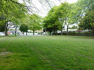
Major parks include Avonhead Park, Crosbie Park, Hyde Park, Ferrier Park and Burnside Park. There are various smaller reserves such as Stewarts Bush, Cricklewood Reserve, Westgrove Park, Staveley Reserve, Brigadoon Reserve, Bullock Reserve and Strathean Reserve.
Schools edit
Avonhead School edit
| Avonhead School | |
|---|---|
| Address | |
 | |
55 Avonhead Rd, Avonhead, Christchurch 8042, New Zealand | |
| Coordinates | 43°31′26.77″S 172°33′34.189″E / 43.5241028°S 172.55949694°E |
| Information | |
| Motto | Growing Excellence Together – Piki ake te tihi ngātahi[16] |
| Ministry of Education Institution no. | 3287 |
| Principal | Micah Hocquard[14] |
| School roll | 555 students as of February 2024[15] |
| Website | avonhead.school.nz |
Avonhead School is a full primary school (years 1–8, or ages 5–13) within Avonhead, located between Ferrier park to the West and Avonhead Road to the East. The school has 555 students as of February 2024.[15] Although located within Avonhead, the school zone also includes sections of the nearby suburbs of Ilam and Sockburn. Most students from Avonhead School go on to secondary schooling at Riccarton High School or Burnside High School. The school currently has 22 classrooms, a result of construction work undertaken to address issues of overcrowding which had been previously faced.[17] These were accompanied by additional work on school facilities, including the construction of a new school hall, basketball and netball courts, which had been made necessary by the construction of classrooms on the sites of previous courts.[18]
Between 2021 and 2022 the senior playground was demolished and replaced with a hockey court with a temporary playground being constructed on the north side of the HQ which was replaced by a permanent new senior playground in June 2022.[19] In the same year, there were also new crawling tunnels constructed near the junior playground replacing a birch tree.
Merrin School edit
Located next to the Avonhead Mall, Merrin School has a roll of 440 students as of February 2024.[15] Merrin is a full primary school, educating years 1 to 8. As the entirety of the school's zone is covered by Burnside High School, the majority of students go on to learn there. The school is in the planning stage of the Christchurch Schools Rebuild Programme.[20][21]
References edit
- ^ "Wards, Councillors and Community Boards map". Christchurch City Council. Retrieved 23 February 2020.
- ^ a b c "ArcGIS Web Application". statsnz.maps.arcgis.com. Retrieved 8 April 2024.
- ^ "Population estimate tables - NZ.Stat". Statistics New Zealand. Retrieved 25 October 2023.
- ^ Reed, A. W. (2010). Peter Dowling (ed.). Place Names of New Zealand. Rosedale, North Shore: Raupo. p. 35. ISBN 978-0-14-320410-7.
- ^ "Avonhead". Christchurch City Libraries. Retrieved 6 October 2011.
- ^ Harper, Margaret (July 2011). "Christchurch Place Names" (PDF). Christchurch City Libraries. p. 15. Retrieved 7 October 2011.
- ^ a b "Statistical area 1 dataset for 2018 Census". Statistics New Zealand. March 2020. Avonhead North (318500), Avonhead West (318900), Avonhead East (319500) and Avonhead South (319700).
- ^ 2018 Census place summary: Avonhead North
- ^ 2018 Census place summary: Avonhead West
- ^ 2018 Census place summary: Avonhead East
- ^ 2018 Census place summary: Avonhead South
- ^ Steeman, Marta (20 November 2018). "Christchurch richlister and family are selling the Avonhead Shopping Centre after 50 years of ownership". stuff.co.nz. Christchurch Press.
- ^ "Avonhead mall – Our stores". avonhead.co.nz. Colliers International.
- ^ "Staff & BOT 2022". Avonhead School. Retrieved 24 September 2022.
- ^ a b c "New Zealand Schools Directory". New Zealand Ministry of Education. Retrieved 14 March 2024.
- ^ "Avonhead School". Avonhead School. Avonhead School. Retrieved 24 September 2022.
- ^ O'Callaghan, Jody; Redmond, Adele; Small, Jamie (23 May 2017). "Hundreds of schools over capacity or at risk of overcrowding". Stuff.co.nz. Retrieved 23 May 2017.
- ^ "Our Vision". Avonhead School. Retrieved 6 October 2011.
- ^ Hocquard, Micah. "Message from the Principal". Avonhead School. Retrieved 21 August 2022.
- ^ "CSR Schools by Stage" (PDF).
- ^ "Merrin School". Merrin School. Archived from the original on 17 February 2012. Retrieved 6 October 2011.