


Summary
Babayevsky District (Russian: Баба́евский район) is an administrative[1] and municipal[7] district (raion), one of the twenty-six in Vologda Oblast, Russia. It is located in the west of the oblast and borders with Vytegorsky District in the north, Belozersky District in the east, Kaduysky District in the southeast, Ustyuzhensky District in the south, Chagodoshchensky District in the southeast, and with Boksitogorsky, Tikhvinsky, and Podporozhsky Districts of Leningrad Oblast in the west. The area of the district is 9,200 square kilometers (3,600 sq mi) (the size of Cyprus).[4] Its administrative center is the town of Babayevo.[3] Population: 21,944 (2010 Census);[9] 24,930 (2002 Census);[5] 29,535 (1989 Census).[10] The population of Babayevo accounts for 55.0% of the district's total population.[9]
Babayevsky District
Бабаевский район | |
|---|---|
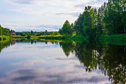 Kolp River, Babayevsky District | |
 Flag  Coat of arms | |
 Location of Babayevsky District in Vologda Oblast | |
| Coordinates: 59°23′N 35°57′E / 59.383°N 35.950°E | |
| Country | Russia |
| Federal subject | Vologda Oblast[1] |
| Established | August 1, 1927[2] |
| Administrative center | Babayevo[3] |
| Area | |
| • Total | 9,200 km2 (3,600 sq mi) |
| Population | |
| • Total | 21,944 |
| • Estimate (2018)[6] | 19,502 (−11.1%) |
| • Density | 2.4/km2 (6.2/sq mi) |
| • Urban | 55.0% |
| • Rural | 45.0 |
| Administrative structure | |
| • Administrative divisions | 1 Towns of district significance, 18 Selsoviets |
| • Inhabited localities[3] | 1 cities/towns, 276 rural localities |
| Municipal structure | |
| • Municipally incorporated as | Babayevsky Municipal District[7] |
| • Municipal divisions[7] | 1 urban settlements, 10 rural settlements |
| Time zone | UTC+3 (MSK |
| OKTMO ID | 19605000 |
| Website | http://www.babaevo-adm.ru/ |
Geography edit
The district is elongated from north to south. Almost the whole area of the district belongs to the basin of the Volga River and drains to the east. The main rivers within the district are the Shola (a tributary of Lake Beloye), the Suda and its major right tributary, the Kolp, a tributary of the Rybinsk Reservoir, and the Chagodoshcha, a left tributary of the Mologa. Minor areas in the northwest of the district belong to the basin of the Oyat River, a tributary of Lake Ladoga; and the Oyat itself has its source in the district. Thus, the divide between the basins of the Baltic Sea and the Caspian Sea crosses the district.
There are many lakes of glacial origin in the district, especially in the northwest. The biggest of them are Lake Linzhozero and Lake Pyazhozero, both located in the basin of the Suda, and Lake Sholskoye, the source of the Shola.
Rivers, lakes and swamps occupy a considerable part of the district's territory.[4]
History edit
Historically the area was sparsely populated by Finnic peoples, of whom the Vepsians, a few still living in the district, are the descendants. Although this area formally became a part of the Novgorod Republic and subsequently of the Principality of Beloozero, none of the villages located in the area were mentioned in any documents until the end of the 14th century.[11] The first historic reference to "Suda land" is in Dmitry Donskoy's testament.
In the course of the administrative reform carried out in 1708 by Peter the Great, the area was included into Ingermanland Governorate (known since 1710 as Saint Petersburg Governorate). In 1727, a separate Novgorod Governorate was split off. The current area of the district was split between Belozersky Uyezd (north of the Kolp) and Ustyuzhensky Uyezd (south of the Kolp). In 1776, the area was transferred to Novgorod Viceroyalty. In 1796, the viceroyalty was abolished, and both uyezds were transferred to Novgorod Governorate. Babayevo, then a village, developed as a settlement around an iron production plant in the 19th century. Important historic route - St.Petersburg-Tikhvin-Belozersk tract - runs via this district and crosses the Suda River at Borisovo-Sudskoye. Borisovo-Sudskoye become important trading and fair location in the 19th century. Khvalevskoye Manor is located here, a country seat of Russian noble family Kachalov.
After Bolshevik revolution, in June 1918 five uyezds of Novgorod Governorate, including Belozersky and Ustyuzhensky Uyezds, were split off to form Cherepovets Governorate, with the administrative center in Cherepovets. In 1925, Babayevo was granted town status. On August 1, 1927, Cherepovets Governorate was abolished, and its area became Cherepovets Okrug of Leningrad Oblast. Simultaneously, the uyezds were abolished and Babayevsky District was established. On September 23, 1937, Babayevsky District was transferred to newly established Vologda Oblast.[2]
On August 1, 1927, Borisovo-Sudsky District with the administrative center in the selo of Borisovo-Sudskoye[12] and Oshtinsky District with the administrative center in the selo of Oshta[13] were also established. Borisovo-Sudsky District was a part of Cherepoivets Okrug of Leningrad Oblast, whereas Oshtinsky District was a part of Lodeynoye Pole Okrug of Leningrad Oblast. In 1937, both were transferred from Leningrad Oblast to Vologda Oblast. On December 12, 1955, Oshtinsky District was abolished. The area of Oshtinsky District was split between Vytegorsky and Borisovo-Sudsky Districts. In 1959, Borisovo-Sudsky District was abolished as well and merged into Babayevsky District.[2]
Demographics edit
Babayevsky District is one of the areas traditionally populated by Vepsians, although now representing less than 1,000 people or less than 5% of total district's population according to the latest census. The Vepsians living in the district speak the central group of Veps dialects.[14]
Economy edit
Industry edit
The economy of the district is based on timber industry.[15] There is also food industry, including butter manufacturing.
Agriculture edit
Fourteen large- and mid-scale farms and a number of small farms operate in the district, producing mainly meat, milk, and linum.[16]
Transportation edit

The railroad connecting Vologda to Saint Petersburg via Cherepovets crosses the southern part of the district from east to west. The main railway station within the district is Babayevo.
Babayevo has an all-season road connection south to Ustyuzhna and north to Borisovo-Sudskoye. There are no all-season through roads to Vytegorsky District, Belozersky District, or to Leningrad Oblast.
Culture and recreation edit
The district contains one archaeological monument of federal significance which is a group of tumuli near the village of Stepanovo.[17]
The Babayevsky District Museum is located in Babayevo. The museum opened in 1978 mostly due to the efforts of Mariya Gorbunova, a local teacher and later the head of the local education department.[18] The museum is named after her.[19]
The historic site of Khvalevskoe Manor is located in the village of Borisovo-Sudskoye.
References edit
Notes edit
- ^ a b Law #371-OZ
- ^ a b c Справка об изменениях административно-территориального устройства и сети партийных и комсомольских органов на территории Вологодской области (1917–1991) (in Russian). Архивы России. Archived from the original on September 17, 2011. Retrieved December 5, 2011.
- ^ a b c Resolution #178
- ^ a b c Общие сведения о районе (in Russian). Бабаевский муниципальный район. Archived from the original on April 26, 2012. Retrieved December 5, 2011.
- ^ a b Russian Federal State Statistics Service (May 21, 2004). Численность населения России, субъектов Российской Федерации в составе федеральных округов, районов, городских поселений, сельских населённых пунктов – районных центров и сельских населённых пунктов с населением 3 тысячи и более человек [Population of Russia, Its Federal Districts, Federal Subjects, Districts, Urban Localities, Rural Localities—Administrative Centers, and Rural Localities with Population of Over 3,000] (XLS). Всероссийская перепись населения 2002 года [All-Russia Population Census of 2002] (in Russian).
- ^ "26. Численность постоянного населения Российской Федерации по муниципальным образованиям на 1 января 2018 года". Federal State Statistics Service. Retrieved January 23, 2019.
- ^ a b c Law #1105-OZ
- ^ "Об исчислении времени". Официальный интернет-портал правовой информации (in Russian). June 3, 2011. Retrieved January 19, 2019.
- ^ a b Russian Federal State Statistics Service (2011). Всероссийская перепись населения 2010 года. Том 1 [2010 All-Russian Population Census, vol. 1]. Всероссийская перепись населения 2010 года [2010 All-Russia Population Census] (in Russian). Federal State Statistics Service.
- ^ Всесоюзная перепись населения 1989 г. Численность наличного населения союзных и автономных республик, автономных областей и округов, краёв, областей, районов, городских поселений и сёл-райцентров [All Union Population Census of 1989: Present Population of Union and Autonomous Republics, Autonomous Oblasts and Okrugs, Krais, Oblasts, Districts, Urban Settlements, and Villages Serving as District Administrative Centers]. Всесоюзная перепись населения 1989 года [All-Union Population Census of 1989] (in Russian). Институт демографии Национального исследовательского университета: Высшая школа экономики [Institute of Demography at the National Research University: Higher School of Economics]. 1989 – via Demoscope Weekly.
- ^ Историческая справка (in Russian). Бабаевский муниципальный район. Archived from the original on April 26, 2012. Retrieved December 5, 2011.
- ^ Борисово – Судский район (авг. 1927 – сент. 1937) (in Russian). Система классификаторов исполнительных органов государственной власти Санкт-Петербурга. Archived from the original on March 4, 2016. Retrieved December 5, 2011.
- ^ Оштинский район (авг. 1927 – сент. 1937) (in Russian). Система классификаторов исполнительных органов государственной власти Санкт-Петербурга. Archived from the original on March 4, 2016. Retrieved December 5, 2011.
- ^ Hermann, Luc (April 15, 2011). "L'extinction d'un peuple finno-ougrien: les Vepses". Regard Sur l'Est (in French). Archived from the original on June 23, 2013. Retrieved December 5, 2011.
- ^ Промышленность (Лесопромышленный комплекс) (in Russian). Бабаевский муниципальный район. Archived from the original on April 26, 2012. Retrieved December 5, 2011.
- ^ Агропромышленный комплекс (in Russian). Бабаевский муниципальный район. Archived from the original on April 26, 2012. Retrieved December 5, 2011.
- ^ Курганы (сорок восемь) (in Russian). Russian Ministry of Culture. Archived from the original on August 18, 2016. Retrieved December 6, 2011.
- ^ Бабаево: К 70-летию города (in Russian). Babayevo. 1995. Retrieved December 6, 2011.
{{cite book}}: CS1 maint: location missing publisher (link) - ^ Бабаевский краеведческий музей им. М.В.Горбуновой (in Russian). Российская сеть культурного наследия. Archived from the original on September 15, 2013. Retrieved December 6, 2011.
Sources edit
- Законодательное Собрание Вологодской области. Закон №371-ОЗ от 4 июня 1999 г. «О вопросах административно-территориального устройства Вологодской области», в ред. Закона №2916-ОЗ от 7 декабря 2012 г. «О внесении изменений в Закон области "О вопросах административно-территориального устройства Вологодской области"». Вступил в силу со дня официального опубликования. Опубликован: "Красный Север", №124–125, 29 июля 1999 г. (Legislative Assembly of Vologda Oblast. Law #371-OZ of June 4, 1999 On the Matters of the Administrative-Territorial Structure of Vologda Oblast, as amended by the Law #2916-OZ of December 7, 2012 On Amending the Oblast Law "On the Matters of the Administrative-Territorial Structure of Vologda Oblast". Effective as of the day of the official publication.).
- Правительство Вологодской области. Постановление №178 от 1 марта 2010 г. «Об утверждении реестра административно-территориальных единиц Вологодской области», в ред. Постановления №686 от 25 июня 2012 г. «О внесении изменений в некоторые Постановления Правительства области». Вступил в силу 20 марта 2010 г. Опубликован: "Красный Север", №29, 20 марта 2010 г. (Government of Vologda Oblast. Resolution #178 of March 1, 2010 On Adopting the Registry of the Administrative-Territorial Units of Vologda Oblast, as amended by the Resolution #686 of June 25, 2012 On Amending Various Resolutions of the Oblast Government. Effective as of March 20, 2010.).
- Законодательное Собрание Вологодской области. Закон №1105-ОЗ от 6 декабря 2004 г. «Об установлении границ Бабаевского муниципального района, границах и статусе муниципальных образований, входящих в его состав», в ред. Закона №2809-ОЗ от 5 июля 2012 г. «О внесении изменений в отдельные Законы области, устанавливающие границы и статус муниципальных образований области». Вступил в силу через 10 дней со дня официального опубликования. Опубликован: "Красный Север", №242, 11 декабря 2004 г. (Legislative Assembly of Vologda Oblast. Law #1105-OZ of December 6, 2004 On Establishing the Borders of Babayevsky Municipal District, on the Borders and Status of the Municipal Formations It Comprises, as amended by the Law #2809-OZ of July 5, 2012 On Amending Various Laws of the Oblast, Establishing the Borders and the Status of the Municipal Formations of the Oblast. Effective as of after 10 days from the day of the official publication.).