
KNOWPIA
WELCOME TO KNOWPIA

Baby, Seine-et-Marne 
Summary
Baby (French pronunciation: [babi] ⓘ) is a commune in the Seine-et-Marne department in the Île-de-France region in north-central France.
Baby | |
|---|---|
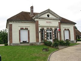 The town hall in Baby | |
Location of Baby .mw-parser-output .locmap .od{position:absolute}.mw-parser-output .locmap .id{position:absolute;line-height:0}.mw-parser-output .locmap .l0{font-size:0;position:absolute}.mw-parser-output .locmap .pv{line-height:110%;position:absolute;text-align:center}.mw-parser-output .locmap .pl{line-height:110%;position:absolute;top:-0.75em;text-align:right}.mw-parser-output .locmap .pr{line-height:110%;position:absolute;top:-0.75em;text-align:left}.mw-parser-output .locmap .pv>div{display:inline;padding:1px}.mw-parser-output .locmap .pl>div{display:inline;padding:1px;float:right}.mw-parser-output .locmap .pr>div{display:inline;padding:1px;float:left}html.skin-theme-clientpref-night .mw-parser-output .od,html.skin-theme-clientpref-night .mw-parser-output .od .pv>div,html.skin-theme-clientpref-night .mw-parser-output .od .pl>div,html.skin-theme-clientpref-night .mw-parser-output .od .pr>div{background:#fff;color:#000}html.skin-theme-clientpref-night .mw-parser-output .locmap{filter:grayscale(0.6)}@media(prefers-color-scheme:dark){html.skin-theme-clientpref-os .mw-parser-output .locmap{filter:grayscale(0.6)}html.skin-theme-clientpref-os .mw-parser-output .od,html.skin-theme-clientpref-os .mw-parser-output .od .pv>div,html.skin-theme-clientpref-os .mw-parser-output .od .pl>div,html.skin-theme-clientpref-os .mw-parser-output .od .pr>div{background:white;color:#000}}  Baby  Baby | |
| Coordinates: 48°23′50″N 3°20′31″E / 48.3972°N 3.3419°E | |
| Country | France |
| Region | Île-de-France |
| Department | Seine-et-Marne |
| Arrondissement | Provins |
| Canton | Provins |
| Intercommunality | Bassée-Montois |
| Government | |
| • Mayor (2020–2026) | Dominique Mirvault[1] |
| Area 1 | 4.12 km2 (1.59 sq mi) |
| Population (2021)[2] | 106 |
| • Density | 26/km2 (67/sq mi) |
| Time zone | UTC+01:00 (CET) |
| • Summer (DST) | UTC+02:00 (CEST) |
| INSEE/Postal code | 77015 /77480 |
| Elevation | 71–143 m (233–469 ft) |
| 1 French Land Register data, which excludes lakes, ponds, glaciers > 1 km2 (0.386 sq mi or 247 acres) and river estuaries. | |
Population edit
The inhabitants are called Bédoins.
| Year | Pop. | ±% p.a. |
|---|---|---|
| 1968 | 80 | — |
| 1975 | 69 | −2.09% |
| 1982 | 59 | −2.21% |
| 1990 | 80 | +3.88% |
| 1999 | 66 | −2.11% |
| 2007 | 69 | +0.56% |
| 2012 | 97 | +7.05% |
| 2017 | 95 | −0.42% |
| Source: INSEE[3] | ||
See also edit
References edit
- ^ "Répertoire national des élus: les maires" (in French). data.gouv.fr, Plateforme ouverte des données publiques françaises. 13 September 2022.
- ^ "Populations légales 2021". The National Institute of Statistics and Economic Studies. 28 December 2023.
- ^ Population en historique depuis 1968, INSEE
External links edit
Wikimedia Commons has media related to Baby (Seine-et-Marne).
- 1999 Land Use, from IAURIF (Institute for Urban Planning and Development of the Paris-Île-de-France région) (in English)