
KNOWPIA
WELCOME TO KNOWPIA

Bad Sulza 
Summary
Bad Sulza is a town in the Weimarer Land district, in Thuringia, Germany. It is situated on the river Ilm, 15 km southwest of Naumburg, and 18 km north of Jena.
Bad Sulza | |
|---|---|
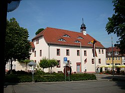 Town hall | |
 Coat of arms | |
Location of Bad Sulza within Weimarer Land district  | |
 Bad Sulza  Bad Sulza | |
| Coordinates: 51°5′15″N 11°37′20″E / 51.08750°N 11.62222°E | |
| Country | Germany |
| State | Thuringia |
| District | Weimarer Land |
| Government | |
| • Mayor (2018–24) | Dirk Schütze[1] |
| Area | |
| • Total | 94.10 km2 (36.33 sq mi) |
| Elevation | 140 m (460 ft) |
| Population (2022-12-31)[2] | |
| • Total | 8,037 |
| • Density | 85/km2 (220/sq mi) |
| Time zone | UTC+01:00 (CET) |
| • Summer (DST) | UTC+02:00 (CEST) |
| Postal codes | 99518, 99510 (Flurstedt, Gebstedt, Wickerstedt) |
| Dialling codes | 036461 |
| Vehicle registration | AP, APD |
| Website | www.bad-sulza.de |
History edit
Within the German Empire (1871-1918), Bad Sulza was part of the Grand Duchy of Saxe-Weimar-Eisenach. The former municipality Ködderitzsch was merged into Bad Sulza in January 2019, and Saaleplatte in December 2019. In January 2023 Bad Sulza absorbed the former municipality Rannstedt.[3]
Notable citizens edit
- Johann Agricola (1590-1668), superintendent of the salt plant from 1622 to 1631, used the healing power of Sulza brine for therapeutic purposes.
- Adolf Piltz (1855-1940), German mathematician notable for his work in number theory.
Associated with the city edit
- Thomas Naogeorgus (actually Kirchmair) (1508-1563), theologian, Neo-Latin poet and playwright
References edit
- ^ Gewählte Bürgermeister - aktuelle Landesübersicht, Freistaat Thüringen, accessed 14 July 2021.
- ^ "Bevölkerung der Gemeinden, erfüllenden Gemeinden und Verwaltungsgemeinschaften in Thüringen Gebietsstand: 31.12.2022" (in German). Thüringer Landesamt für Statistik. June 2023.
- ^ "Thüringer Gesetz- und Verordnungsblatt Nr. 26/2022" (PDF). 20 December 2022. p. 476.
External links edit
![]() Media related to Bad Sulza at Wikimedia Commons
Media related to Bad Sulza at Wikimedia Commons