


Summary
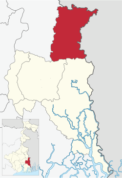
Bangaon subdivision is an administrative subdivision of the North 24 Parganas district in the Indian state of West Bengal.
Bangaon subdivision | |
|---|---|
Subdivision | |
 | |
| Coordinates: 23°04′N 88°49′E / 23.07°N 88.82°E | |
| Country | |
| State | West Bengal |
| District | North 24 Parganas |
| Headquarters | Bangaon |
| Government | |
| • MP | Shantanu Thakur (BJP) |
| • SDO | Prem Bibhas Kansari, WBCS (Exe) |
| • SP | Tarun Halder, IPS |
| Area | |
| • Total | 838.17 km2 (323.62 sq mi) |
| Population (2011) | |
| • Total | 1,063,028 |
| • Density | 1,300/km2 (3,300/sq mi) |
| Languages | |
| • Official | Bengali, English |
| Time zone | UTC+5:30 (IST) |
| PIN | 743232 (Bagdah) 743270 (Helencha) 743297 (Sindrani) 743235 (Bongaon) 743251 (Ganrapota) 743262 (Gopalnagar) 743701 (Palla) 743249 (Gaighata) 743245 (Chandpara) 743287 (Thakurnagar) 743290 (Nahata) 743710 (Mendia/Media Hat) |
| ISO 3166 code | IN-WB |
| Vehicle registration | WB |
| Website | wb |
History edit
In 1883 Bangaon subdivision was transferred from Nadia district to Jessore district.[1][2] At the time of Partition of Bengal (1947) the police station areas of Bangaon and Gaighata of Jessore district, forming Bangaon subdivision, were placed in India, and the rest of Jessore district in East Pakistan.[3]
Geography edit
Bangaon subdivision is part of the Ichhamati-Raimangal Plain, one of the three physiographic regions in the district located in the lower Ganges Delta. It contains soil of mature black or brownish loam to recent alluvium. The Ichhamati flows through the eastern part of the district.[4]
Subdivisions edit

North 24 Parganas district is divided into the following administrative subdivisions:[5][6]
| Subdivision | Headquarters | Area km2 |
Population (2011) |
Urban Population % (2011) |
Rural Population % (2011) |
|---|---|---|---|---|---|
| Bangaon | Bangaon | 838.17 | 1,063,028 | 16.33 | 83.67 |
| Barasat Sadar | Barasat | 1,002.48 | 2,789,611 | 54.67 | 45.33 |
| Barrackpore | Barrackpore | 334.51 | 3,668,653 | 96.02 | 3.98 |
| Bidhannagar | Bidhannagar | 33.50 | 216,609 | 100.00 | 0 |
| Basirhat | Basirhat | 1,777.02 | 2,271,880 | 12.96 | 87.04 |
| North 24 Parganas district | Barasat | 4,094.00 | 10,009,781 | 57.27 | 42.73 |
Religion edit
Given below is an overview of the religion-wise break-up of the population across the subdivisions of North 24 Parganas district, as per 2011 census:[7]
| Subdivision | Population (2011) |
Hindu % | Muslim % | Christian % | Others % |
|---|---|---|---|---|---|
| Bangaon | 1,063,028 | 85.63 | 13.73 | 0.26 | 0.38 |
| Barasat Sadar | 2,789,611 | 65.18 | 34.26 | 0.16 | 0.40 |
| Barrackpore | 3,668,653 | 88.61 | 10.32 | 0.35 | 0.71 |
| Bidhannagar | 216,609 | 95.26 | 2.56 | 0.45 | 1.73 |
| Basirhat | 2,271,880 | 51.37 | 48.37 | 0.14 | 0.13 |
| North 24 Parganas district | 10,009,781 | 73.45 | 25.82 | 0.24 | 0.48 |
North 24 Parganas district with 24.22% Muslims (in 2001) was identified as a minority concentrated district by the Ministry of Minority Affairs, Government of India. A baseline survey on religious minority population was carried out under the aegis of Indian Council of Social Science Research and funded by the Ministry of Minority Affairs.[8] For information on the survey see North 24 Parganas: minority concentrated district.
Population movement edit
North 24 Parganas district is densely populated, mainly because of the influx of refugees from East Pakistan (later Bangladesh). With a density of population of 2,182 per km2 in 1971, it was 3rd in terms of density per km2 in West Bengal after Kolkata and Howrah, and 20th in India.[9] According to the District Human Development Report: North 24 Parganas, “High density is also explained partly by the rapid growth of urbanization in the district. In 1991, the percentage of urban population in the district has been 51.23.”[10]
As per the Refugee Relief and Rehabilitation Department of the Government of West Bengal, the census figures show the number of refugees from East Pakistan in 1971 was nearly 6 million and in 1981, the number was assessed at 8 million.[11] A district-wise break-up in 1971, shows the main thrust of the refugee influx was on 24-Parganas (22.3% of the total refugees), Nadia (20.3%), Bankura (19.1%) and Kolkata (12.9%).[12]
The North 24 Paraganas district has a 352 km long international border with Bangladesh, out of which 160 km is land border and 192 km is riverine border.[13] Only a small portion of the border has been fenced and it is popularly referred to as a porous border. There are reports of Bangladeshi infiltrators.[14][15][16][17] The CD Block pages carry decadal population growth information.
An estimate in 2000 placed the total number of illegal Bangladeshi immigrants in India at 1.5 crore, with around 3 lakh entering every year. The thumb rule for such illegal immigrants is that for each illegal person caught four get through. While many immigrants have settled in the border areas, some have moved on, even to far way places such as Mumbai and Delhi. The border is guarded by the Border Security Force.[18] During the UPA government, Sriprakash Jaiswal, Union Minister of State for Home Affairs, had made a statement in Parliament on 14 July 2004, that there were 12 million illegal Bangladeshi infiltrators living in India, and West Bengal topped the list with 5.7 million Bangladeshis. More recently, Kiren Rijiju, Minister of State for Home Affairs in the NDA government has put the figure at around 20 million.[19]
Administrative units edit


3miles
Wildlife Sanctuary
M: municipal town, CT: census town, R: rural/ urban centre, T: place of tourist interest
Owing to space constraints in the small map, the actual locations in a larger map may vary slightly
Bangaon subdivision has 6 police stations including 1 women PS, 3 Community development blocks, 3 panchayat samitis, 38 gram panchayats, 363 mouzas, 355 inhabited villages, 1 municipality and 7 census towns. The municipality is at Bangaon. The census towns are: Chandpara, Chhekati, Sonatikiri, Dhakuria, Chikanpara, Shimulpur and Bara. The subdivision has its headquarters at Bangaon.[5][20]
Police stations edit
Bangaon being a border adjacent area, in May 2019,Government of West Bengal has formed Bangaon as a new Police district for better policing and administration, dividing it from Barasat police district. Tarun Halder, was appointed as the first SP of Bangaon.[21] Since its bifurcation, Bongaon is now the smallest Police district having only 6 police stations under its jurisdiction.[22]
Police stations in Bangaon subdivision have the following features and jurisdiction:[5][23]
| Police station | Area covered (km2) |
Border (km) | Municipal town/ city | Camp | CD Block |
|---|---|---|---|---|---|
| Bagadah | 233.055 | 58 | – | Baksa, Nataberia, Gadpukuria | Bagdah |
| Bangaon | 140.5 | 9.8 | Bangaon | PS Camp SAP, Ganrapota, Bongaon TOP | Bangaon partly |
| Gaighata | 248.64 | 21.72 | – | Sutia, Thakurbari | Gaighata |
| Gopalnagar | 154 | 0 | – | Champta (SAP), Nahata (SAP), Shimulia | Bangaon partly |
| Petrapole | 16.5 | 8.6 | – | – | Bangaon partly |
| Women PS (Bangaon) | same jurisdiction area of Bongaon PS |
Blocks edit

Community development blocks in Bangaon subdivision are:[5][6][20][7]
| CD Block | Headquarters | Area km2 |
Population (2011) |
SC % | ST % | Hindus % | Muslims % | Literacy Rate % |
Census Towns |
|---|---|---|---|---|---|---|---|---|---|
| Bagdah | Bagdah | 233.47 | 242,974 | 54.81 | 5.33 | 82.00 | 17.42 | 75.30 | - |
| Bangaon | Bangaon | 336.70 | 380,903 | 46.60 | 3.61 | 78.17 | 18.47 | 79.71 | - |
| Gaighata | Chandpara Bazar | 243.30 | 330,287 | 49.13 | 1.76 | 93.27 | 6.42 | 83.32 | 7 |
Gram panchayats edit
The subdivision contains 38 gram panchayats under 3 community development blocks:[24]
- Gram panchayats in Bagdah CD Block are: Asharu, Helencha, Malipota, Bagda, Koniara–I, Ranghat, Bayra, Koniara–II and Sindrani.
- Gram panchayats in Bangaon CD Block are: Akaipur, Chhaighoria, Gangrapota, Kalupur, Bairampur, Dharam Pukuria, Ghatbour, Palla, Chawberia–I, Dighari, Gopalnagar–I, Sundarpur, Chawberia–II, Ganganandapur, Gopalnagar–II and Tengra.
- Gram panchayats in Gaighata CD Block are Chandpara, Fulsara, Jaleswar–II, Sutia, Dharmapur–I, Ichapur–I, Jhaudanga, Dharmapur–II, Ichapur–II, Ramnagar, Duma, Jaleswar–I and Shimulpur.
Municipal towns/ cities edit
An overview of the only municipal city in Bangaon subdivision is given below.[7][25]
| Municipal town/city | Area (km2) | Population (2011) |
Hindus % | Muslims % | Slum population % |
BPL Households % (2006) |
Literacy% (2001) |
|---|---|---|---|---|---|---|---|
| Bangaon | 15.57 | 108,864 | 96.66 | 2.85 | 14.53 | 37.45 | 84.16 |
Education edit
North 24 Parganas district had a literacy rate of 84.06% (for population of 7 years and above) as per the census of India 2011. Bangaon subdivision had a literacy rate of 80.57%, Barasat Sadar subdivision 84.90%, Barrackpur subdivision 89.09%, Bidhannagar subdivision 89.16% and Basirhat subdivision 75.67%.[26]
Given in the table below (data in numbers) is a comprehensive picture of the education scenario in North 24 Parganas district for the year 2012-13:[26]
| Subdivision | Primary School |
Middle School |
High School |
Higher Secondary School |
General College, Univ |
Technical / Professional Instt |
Non-formal Education | |||||||
|---|---|---|---|---|---|---|---|---|---|---|---|---|---|---|
| Institution |
Student |
Institution |
Student |
Institution |
Student |
Institution |
Student |
Institution |
Student |
Institution | Student |
Institution |
Student | |
| Bangaon | 533 | 54,361 | 1 | 36 | 31 | 14,654 | 83 | 107,745 | 4 | 11,031 | 1 | 95 | 1,594 | 54,016 |
| Barasat Sadar | 920 | 120,670 | 19 | 2,734 | 93 | 63,707 | 171 | 246,098 | 14 | 40,466 | 23 | 6,190 | 2,887 | 130,522 |
| Barrackpore | 948 | 126,453 | 29 | 5,716 | 193 | 165,924 | 205 | 215,713 | 25 | 44,818 | 20 | 6,345 | 2,483 | 160,236 |
| Bidhannagar | 20 | 12,317 | - | - | 1 | 900 | 17 | 22,536 | 1 | 865 | 15 | 5,432 | 1 | 552 |
| Basirhat | 1,256 | 139,737 | 25 | 10,165 | 124 | 101,536 | 118 | 105,724 | 5 | 15,248 | - | - | 3,800 | 164,833 |
| North 24 Parganas district | 3,677 | 453,538 | 74 | 18,651 | 442 | 346,721 | 594 | 697,816 | 49 | 112,428 | 59 | 18,062 | 10,765 | 439,560 |
Note: Primary schools include junior basic schools; middle schools, high schools and higher secondary schools include madrasahs; technical schools include junior technical schools, junior government polytechnics, industrial technical institutes, industrial training centres, nursing training institutes etc.; technical and professional colleges include engineering colleges, medical colleges, para-medical institutes, management colleges, teachers training and nursing training colleges, law colleges, art colleges, music colleges etc. Special and non-formal education centres include sishu siksha kendras, madhyamik siksha kendras, centres of Rabindra mukta vidyalaya, recognised Sanskrit tols, institutions for the blind and other handicapped persons, Anganwadi centres, reformatory schools etc.[26]
The following institutions are located in Bangaon subdivision:
| College Name | Place | Established | Ref |
|---|---|---|---|
| Dr. B. R. Ambedkar Satabarshiki Mahavidyalaya | Helencha | 2005 | [27] |
| Dinabandhu Mahavidyalay | Bangaon | 1947 | [28][29] |
| Gobardanga Hindu College | Gobardanga | 1947 | [30][31] |
| Nahata Jogendranath Mandal Smriti Mahavidyalaya | Nahata | 1985 | [32][33] |
| P. R. Thakur Government College | Thakurnagar | 2013 | [34][35] |
| Harichand Guruchand University | Thakurnagar | 2019 | [36] |
Healthcare edit
The table below (all data in numbers) presents an overview of the medical facilities available and patients treated in the hospitals, health centres and sub-centres in 2013 in North 24 Parganas district.[37]
| Subdivision | Health & Family Welfare Deptt, WB | Other State Govt Deptts** |
Local bodies** |
Central Govt Deptts / PSUs** |
NGO / Private Nursing Homes** |
Total | Total Number of Beds |
Total Number of Doctors* |
Indoor Patients |
Outdoor Patients | |||
|---|---|---|---|---|---|---|---|---|---|---|---|---|---|
| Hospitals |
Rural Hospitals |
Block Primary Health Centres |
Primary Health Centres | ||||||||||
| Bangaon | 1 | 1 | 2 | 10 | - | - | - | - | 14 | 417 | 24 | 11,587 | 650,349 |
| Barasat Sadar | 3 | 1 | 6 | 15 | - | - | - | - | 25 | 1,084 | 45 | 125,000 | 1,397,574 |
| Barrackpore | 7 | - | 2 | 2 | - | - | - | - | 11 | 1,081 | 8 | 94,042 | 1,010,820 |
| Bidhannagar | 1 | - | - | - | - | - | - | ` | 1 | 100 | - | 6,567 | 117,136 |
| Basirhat | 1 | 5 | 5 | 23 | - | - | - | - | 34 | 703 | 77 | 69,034 | 897,725 |
| North 24 Parganas district | 13 | 7 | 15 | 50 | 6 | 27 | 3 | 233 | 354 | 3,385 | 154 | 306,230 | 4,073,604 |
.* Excluding nursing homes.
** Subdivision-wise break up for certain items not available.
Medical facilities available in Bangaon subdivision are as follows:
Hospitals: (Name, location, beds)[38]
Dr. Jiban Ratan Dhar Subdivisional Hospital, Bangaon, 250 beds
Bangaon Railway Hospital, Bangaon, 4 beds
Male Vagrants Home (Petrapole), Bangaon, 10 beds
Rural Hospitals: (Name, block, location, beds)[38]
Bagdah Rural Hospital, Bagda, 30 beds
Chandpara Rural Hospital, at Thakurnagar, 30 beds
Block Primary Health Centres: (Name, block, location, beds)[38]
Sundarpur BPHC, Palla, 15 beds
Primary Health Centres: (CD Block-wise)(CD Block, PHC location, beds)[38]
Bagdah CD Block: Nataberia PHC, Mangalganj (6), Sindrani PHC (10), Koniera PHC, Bena (6)
Bangaon CD Block: Akaipur PHC, Garibpur (6), Chowberia PHC (6)
Gaighata CD Block: Gaighata PHC (6), Dharampur PHC (6), Baduria PHC, Ramchandrapur (10), Dr. B.R.Roy PHC, Ghonja (6)
Electoral constituencies edit
Lok Sabha (parliamentary) and Vidhan Sabha (state assembly) constituencies in Bangaon subdivision were as follows:[39]
| Vidhan Sabha constituency | Reservation | Sub-division | CD Block and/or Gram panchayats and/or municipal areas |
|---|---|---|---|
| Bagdah | Reserved for SC | Bangaon | Bagdah CD Block, and Gangrapota, Sundarpur and Tengra GPs of Bangaon CD Block |
| Bangaon Uttar | Bangaon municipality, and Akaipur, Chhaigheria, Dharma Pukuria, Ganganandapur, Ghatbore, Gopalnagar I and Gopalnagar II GPs of Bangaon CD Block | ||
| Bangaon Dakshin | Bairampur, Chauberia I, Chauberia II, Dighari, Kalupur and Palla GPs of Bangaon CD Block, and Chandpara, Dooma, Fulsara, Jaleswar II, Jhaudanga, Ramnagar GPs of Gaighata CD Block | ||
| Gaighata | Gobardanga municipality, Dharmapur I, Dharmapur II, Ichapur I, Ichapur II, Jaleswar I, Shimulpur and Sutia GPs of Gaighata CD Block, and Bergum I, Bergum II and Machhalandpur I GPs of Habra I CD Block | ||
| Other assembly segments outside Bangaon subdivision | |||
| Vidhan Sabha Constituency | Reservation | Sub-division | CD Block and/or Gram panchayats and/or municipal areas |
| Kalyani | Reserved for SC | Kalyani | |
| Haringhata | |||
| Swarupnagar | Basirhat | ||
References edit
- ^ "Bengal District Gazetteers, Jessore by L.S.S. O'Malley". Chapter II: History, Page/ Section 44. Bengal Secretariat Book Depot, 1912. Retrieved 11 May 2018.
- ^ "District Gazetteer" (PDF). Chapter IX: General Administration, Page 150. Egiye Bangla. Retrieved 11 May 2018.
- ^ "Jessore District Information". Khujbo.com. Archived from the original on 16 May 2018. Retrieved 11 May 2018.
- ^ "District Census Handbook North Twenty Four Parganas, Census of India 2011, Series 20, Part XII A" (PDF). Page 13. Directorate of Census Operations, West Bengal. Retrieved 16 April 2018.
- ^ a b c d "District Statistical Handbook". North 24 Parganas 2013, Tables 2.1, 2.2, 2.4b. Department of Statistics and Programme Implementation, Government of West Bengal. Archived from the original on 2019-01-21. Retrieved 2 May 2018.
- ^ a b "District Census Handbook North Twenty Four Parganas, Census of India 2011, Series 20, Part XII A" (PDF). Map of North Twenty Four Parganas with CD Block HQs and Police Stations (on the fifth page). Directorate of Census Operations, West Bengal. Retrieved 2 May 2018.
- ^ a b c "Population by Religious Community". West Bengal - North 24 Parganas. Registrar General and Census Commissioner, Government of India. Retrieved 22 May 2018.
- ^ "Minority Concentration District Project: North 24 Parganas, West Bengal" (PDF). Centre for Studies in Social Sciences, Calcutta. Archived from the original (PDF) on 27 March 2016. Retrieved 20 May 2018.
- ^ "District Human Development Report: North 24 Parganas" (PDF). Intro P 6. Development & Planning Department, Government of West Bengal, 2010. Archived from the original (PDF) on 5 February 2018. Retrieved 20 April 2018.
- ^ "District Human Development Report: North 24 Parganas" (PDF). Page 259, Table 11.2.2. Development & Planning Department, Government of West Bengal, 2010. Archived from the original (PDF) on 5 February 2018. Retrieved 20 April 2018.
- ^ "Refugee Relief and Rehabilitation". Government. Egiye Bangla. Retrieved 20 April 2018.
- ^ Dasgupta, Abhijit. "The Puzzling Numbers: The Politics of Counting Refugees in West Bengal" (PDF). Table 1.2, Page 66. South Asian Refgees Watch, Vol. 2, No. 2, December 2000. Retrieved 20 April 2018.
- ^ "North 24 Parganas Police". District at a Glance. WB Police. Retrieved 20 April 2018.
- ^ "Why BSF wants 81.7 km of Indo-Bangla border fenced urgently". Rediff.com. 21 August 2016. Retrieved 20 April 2018.
- ^ Mishra, Abhinandan. "Laskar helped fan Basirhat tension". Sunday Guardian, 8 July 2017. Retrieved 20 April 2018.
- ^ "Infiltrating porous Bangladesh-India border". Al Jazeera. Retrieved 20 April 2018.
- ^ "Bangladeshi Infiltrators – the Reality Check". The Pioneer, 27 June 2015. Retrieved 20 April 2018.
- ^ Jamwal, N.S. (January–March 2004). "Border Management: Dilemma of Guarding the India-Bangladesh border" (PDF). Strategic Analysis. Retrieved 22 May 2018.
- ^ "Two crore illegal Bangladeshi living in India: Govt". Business Standard / Press Trust of India. 16 November 2016. Retrieved 22 May 2018.
- ^ a b "C.D. Block Wise Primary Census Abstract Data(PCA)". West Bengal – District-wise CD Blocks. Registrar General and Census Commissioner, India. Retrieved 10 March 2015.
- ^ "নতুন পুলিশ জেলা বনগাঁ, কটাক্ষ বিরোধীদের". Anandabazar Patrika. Retrieved 30 May 2019.
- ^ "বনগাঁ পুলিশ জেলার নতুন কার্যালয়ের সূচনা". Aaj Kaal. Retrieved 25 September 2019.
- ^ "North 24 Parganas Dist. Police". Know Your Police Station. District Police. Archived from the original on 7 June 2018. Retrieved 2 May 2018.
- ^ "Directory of District, Subdivision, Panchayat Samiti/ Block and Gram Panchayats in West Bengal". North Twentyfour Parganas - Revised in March 2008. Panchayats and Rural Development Department, Government of West Bengal. Retrieved 2 May 2018.
- ^ "District Human Development Report: North 24 Parganas" (PDF). (1)Table 3.3.2: Population densist and other features of municipalities in North 24 Parganas, Pages 42-43 (2) Table 3.3.8: Slum population, slum children and literacy rates in slum, Page 51 (3) Table 3.3.10: Distriution of BPL households in uraban North 24 Parganas and (4) Table 3.3.7 Literacy rates in urban North 24 Parganas, Page 49. Development & Planning Department, Government of West Bengal, 2010. Archived from the original (PDF) on 5 February 2018. Retrieved 23 May 2018.
- ^ a b c "District Statistical Handbook". North 24 Parganas 2013, Basic data: Table 4.4, 4.5, Clarifications: other related tables. Department of Statistics and Programme Implementation, Government of West Bengal. Archived from the original on 2019-01-21. Retrieved 6 May 2018.
- ^ "Dr. B.R.Ambedkar Satabarshiki Mahavidyalaya". College Admission. Retrieved 8 May 2018.
- ^ "Dinabandhu Mahavidyalaya". DM. Retrieved 8 May 2018.
- ^ "Dinabandhu Mahavidyalaya". College Admission. Retrieved 8 May 2018.
- ^ "Gobardanga Hindu College". GHC. Retrieved 8 May 2018.
- ^ "Gobardanga Hindu College". College Admission. Retrieved 8 May 2018.
- ^ "Nahata Jogendranath Mandal Smriti Mahavidyalaya". NJMSM. Retrieved 8 May 2018.
- ^ "Nahta Jogendranath Mandal Smriti Mahavidyalaya". Retrieved 8 May 2018.
- ^ "P.R.Thakur Government College". PRTGC. Archived from the original on 22 June 2018. Retrieved 8 May 2018.
- ^ "P.R.Thakur Government College". Target Admission. Retrieved 8 May 2018.
- ^ "Harichand Guruchand University". Retrieved 23 November 2021.
- ^ "District Statistical Handbook". North 24 Parganas 2013, Table 3.1, 3.3. Department of Statistics and Programme Implementation, Government of West Bengal. Archived from the original on 2019-01-21. Retrieved 6 May 2018.
- ^ a b c d "Health & Family Welfare Department". Health Statistics. Government of West Bengal. Archived from the original on 28 October 2021. Retrieved 7 May 2018.
- ^ "Delimitation Commission Order No. 18, 15 February 2006" (PDF). West Bengal. Election Commission of India. Retrieved 2 May 2018.