


Summary
Baraga (/ˈbɛərəɡə/ BAIR-ə-gə) is a village in Baraga County in the U.S. state of Michigan. The population was 1,883 at the 2020 census.[4] The village is named after Bishop Frederic Baraga.
Baraga, Michigan | |
|---|---|
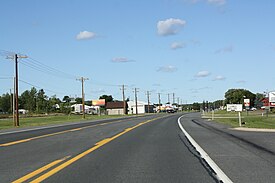 Downtown Baraga along U.S. Route 41 | |
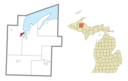 Location within Baraga County | |
 Baraga Location within the state of Michigan  Baraga Location within the United States | |
| Coordinates: 46°46′36″N 88°29′46″W / 46.77667°N 88.49611°W | |
| Country | |
| State | |
| County | |
| Township | Baraga |
| Area | |
| • Total | 2.17 sq mi (5.63 km2) |
| • Land | 2.13 sq mi (5.51 km2) |
| • Water | 0.05 sq mi (0.12 km2) |
| Elevation | 630 ft (192 m) |
| Population (2020) | |
| • Total | 1,883 |
| • Density | 885.70/sq mi (341.92/km2) |
| Time zone | UTC-5 (Eastern (EST)) |
| • Summer (DST) | UTC-4 (EDT) |
| ZIP code | 49908 |
| Area code | 906 |
| FIPS code | 26-05320[2] |
| GNIS feature ID | 2398031[3] |
| Website | Official website |
The village is located in Baraga Township on the Keweenaw Bay on Lake Superior at the junction of US 41 and M-38. It is entirely within the boundaries of the L'Anse Indian Reservation.[5] The Baraga ZIP code 49908 also serves areas of northern and northwestern Baraga Township.[6]
History edit
Baraga began with the establishment of the Holy Name Mission at this site by Rev. Frederic Baraga in 1843.[7]
The post office opened with the name Bristol on June 29, 1869 and changed to Baraga on May 11, 1870.[8]
In 1993, the Baraga Correctional Facility was opened in the town.
On 30 May 2022, a consortium including Finnish technology giant Wärtsilä, the Electric Power Research Institute (EPRI), and Burns & McDonnell unveiled a contract with Milwaukee-based WEC Energy’s subsidiary Upper Michigan Energy Resources for a fuel testing pilot.[9]
Geography edit
According to the United States Census Bureau, the village has a total area of 2.18 square miles (5.65 km2), of which 2.12 square miles (5.49 km2) is land and 0.06 square miles (0.16 km2) is water.[10]
Demographics edit
| Census | Pop. | Note | %± |
|---|---|---|---|
| 1900 | 1,185 | — | |
| 1910 | 1,071 | −9.6% | |
| 1920 | 942 | −12.0% | |
| 1930 | 1,045 | 10.9% | |
| 1940 | 1,110 | 6.2% | |
| 1950 | 942 | −15.1% | |
| 1960 | 991 | 5.2% | |
| 1970 | 1,116 | 12.6% | |
| 1980 | 1,055 | −5.5% | |
| 1990 | 1,231 | 16.7% | |
| 2000 | 1,285 | 4.4% | |
| 2010 | 2,053 | 59.8% | |
| 2020 | 1,883 | −8.3% | |
| U.S. Decennial Census[11] | |||
2020 census edit
As of the census of 2020,[4] the population was 1,883. The population density was 885.7 inhabitants per square mile (342.0/km2). There were 617 housing units at an average density of 290.2 per square mile (112.0/km2). The racial makeup of the village was 37.2% White, 31.4% Black or African American, 22.8% Native American, 0.1% Asian, 0.9% from other races, and 7.5% from two or more races. Ethnically, the population was 1.2% Hispanic or Latino of any race.
2010 census edit
As of the census[12] of 2010, there were 2,053 people, 527 households, and 310 families residing in the village. The population density was 968.4 inhabitants per square mile (373.9/km2). There were 580 housing units at an average density of 273.6 per square mile (105.6/km2). The racial makeup of the village was 44.9% White, 29.4% African American, 22.0% Native American, 0.1% Asian, 0.1% from other races, and 3.6% from two or more races. Hispanic or Latino residents of any race were 1.0% of the population.
There were 527 households, of which 33.0% had children under the age of 18 living with them, 34.0% were married couples living together, 18.4% had a female householder with no husband present, 6.5% had a male householder with no wife present, and 41.2% were non-families. 37.0% of all households were made up of individuals, and 16.3% had someone living alone who was 65 years of age or older. The average household size was 2.26 and the average family size was 2.90.
The median age in the village was 35.7 years. 15.8% of residents were under the age of 18; 10.5% were between the ages of 18 and 24; 40.9% were from 25 to 44; 22.6% were from 45 to 64; and 10% were 65 years of age or older. The gender makeup of the village was 68.8% male and 31.2% female.
2000 census edit
As of the census[2] of 2000, there were 1,285 people, 544 households, and 326 families residing in the village. The population density was 569.6 inhabitants per square mile (219.9/km2). There were 605 housing units at an average density of 268.2 per square mile (103.6/km2). The racial makeup of the village was 68.79% White, 0.16% African American, 23.97% Native American, 0.62% Asian, 0.31% from other races, and 6.15% from two or more races. Hispanic or Latino residents of any race were 0.86% of the population. 25.5% were of Finnish, 9.9% French, 9.2% German, and 6.3% French-Canadian ancestry according to Census 2000.
There were 544 households, out of which 31.3% had children under the age of 18 living with them, 40.6% were married couples living together, 15.6% had a female householder with no husband present, and 39.9% were non-families. 36.2% of all households were made up of individuals, and 17.1% had someone living alone who was 65 years of age or older. The average household size was 2.34 and the average family size was 3.03.
In the village, 27.2% of the population was under the age of 18, 7.8% was from 18 to 24, 26.3% from 25 to 44, 22.0% from 45 to 64, and 16.7% was 65 years of age or older. The median age was 37 years. For every 100 females, there were 87.6 males. For every 100 females age 18 and over, there were 81.4 males.
The median income for a household in the village was $26,290, and the median income for a family was $33,906. Males had a median income of $31,838 versus $21,333 for females. The per capita income for the village was $14,795. About 9.8% of families and 15.6% of the population were below the poverty line, including 14.2% of those under age 18 and 20.1% of those age 65 or over.
Transportation edit
Indian Trails bus lines operates daily intercity bus service between Hancock and Milwaukee with a stop in Baraga Township, just outside Baraga.[13]
Gallery edit
-
 Post office
 -
 Welcome sign
 -
 Baraga State Park entrance
 -
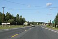
 M-38 east terminus
 -
 Panorama over Lake Superior
 -
 Baraga County Historical Museum


References edit
Notes edit
- ^ "2020 U.S. Gazetteer Files". United States Census Bureau. Retrieved May 21, 2022.
- ^ a b "U.S. Census website". United States Census Bureau. Retrieved January 31, 2008.
- ^ U.S. Geological Survey Geographic Names Information System: Baraga, Michigan
- ^ a b "2020 Decennial Census: Baraga village, Michigan". data.census.gov. U.S. Census Bureau. Retrieved July 24, 2022.
- ^ "About Us - Natural Resource Department". nrd.kbic-nsn.gov. Keweenaw Bay Indian Community. Retrieved July 24, 2022.
- ^ 49908 5-Digit ZCTA, 499 3-Digit ZCTA - Reference Map - American FactFinder[permanent dead link], U.S. Census Bureau, 2000 census
- ^ Romig 1986, p. 42.
- ^ U.S. Geological Survey Geographic Names Information System: Baraga Post Office
- ^ "Much-Watched Reciprocating Engine Hydrogen Pilot Kicks off at Michigan Power Plant". June 2022.
- ^ "US Gazetteer files 2010". United States Census Bureau. Archived from the original on January 12, 2012. Retrieved November 25, 2012.
- ^ "Census of Population and Housing". Census.gov. Retrieved June 4, 2015.
- ^ "U.S. Census website". United States Census Bureau. Retrieved November 25, 2012.
- ^ "HANCOCK-MARQUETTE-GREEN BAY-MILWAUKEE" (PDF). Owosso, Michigan: indiantrails.com. January 4, 2022. Archived (PDF) from the original on January 15, 2022. Retrieved January 15, 2022.
Sources edit
- Romig, Walter (October 1, 1986) [1973]. Michigan Place Names: The History of the Founding and the Naming of More Than Five Thousand Past and Present Michigan Communities (Paperback). Great Lakes Books Series. Detroit, Michigan: Wayne State University Press. ISBN 081431838X.
External links edit
- Baraga County Historical Museum
- The L'Anse Sentinel
- Ojibwa Tribe
- Copper Country