
KNOWPIA
WELCOME TO KNOWPIA

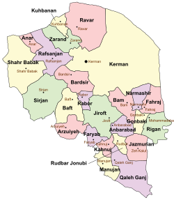
Bardsir County 
Summary
Bardsir County (Persian: شهرستان بردسیر) is in Kerman province, Iran. Its capital is the city of Bardsir.[3]
Bardsir County
Persian: شهرستان بردسیر | |
|---|---|
County | |
 Location of Bardsir County in Kerman province (center left, pink) | |
 Location of Kerman province in Iran | |
| Coordinates: 29°48′N 56°40′E / 29.800°N 56.667°E[1] | |
| Country | |
| Province | Kerman |
| Capital | Bardsir |
| Districts | Central, Golzar, Lalehzar, Negar |
| Population (2016)[2] | |
| • Total | 81,983 |
| Time zone | UTC+3:30 (IRST) |
| Website | web |
| Bardsir County can be found at GEOnet Names Server, at this link, by opening the Advanced Search box, entering "9206654" in the "Unique Feature Id" form, and clicking on "Search Database". | |
At the 2006 census, the county's population was 84,543 in 18,650 households.[4] The following census in 2011 counted 73,738 people in 19,632 households.[5] At the 2016 census, the county's population was 81,983 in 25,315 households.[2]
Administrative divisions edit
The population history and structural changes of Bardsir County's administrative divisions over three consecutive censuses are shown in the following table. The latest census shows four districts, eight rural districts, and five cities.[2]
| Administrative Divisions | 2006[4] | 2011[5] | 2016[2] |
|---|---|---|---|
| Central District | 75,070 | 51,880 | 42,238 |
| Golzar RD | 3,242 | ||
| Kuh Panj RD | 2,898 | 2,459 | 6,040 |
| Mashiz RD | 18,900 | 8,409 | 7,812 |
| Negar RD | 2,807 | ||
| Bardsir (city) | 31,801 | 31,870 | 25,152 |
| Dashtkar (city) | 3,234 | ||
| Golzar (city) | 6,131 | 3,411 | |
| Negar (city) | 9,291 | 5,731 | |
| Golzar District | 2,473 | 8,271 | |
| Golzar RD | 837 | 677 | |
| Shirinak RD | 1,636 | 2,149 | |
| Golzar (city) | 5,445 | ||
| Lalehzar District | 9,473 | 8,762 | 13,407 |
| Lalehzar RD | 5,543 | 2,673 | 3,239 |
| Qaleh-ye Asgar RD | 3,930 | 3,144 | 5,739 |
| Lalehzar (city) | 2,945 | 4,429 | |
| Negar District | 8,509 | 17,171 | |
| Narp RD | 6,100 | 6,112 | |
| Negar RD | 2,409 | 3,459 | |
| Negar (city) | 7,600 | ||
| Total | 84,543 | 73,738 | 81,983 |
| RD: Rural District | |||
Wikimedia Commons has media related to Bardsir County.
References edit
- ^ OpenStreetMap contributors (26 June 2023). "Bardsir County" (Map). OpenStreetMap. Retrieved 26 June 2023.
- ^ a b c d "Census of the Islamic Republic of Iran, 1395 (2016)". AMAR (in Persian). The Statistical Center of Iran. p. 08. Archived from the original (Excel) on 20 October 2020. Retrieved 19 December 2022.
- ^ Habibi, Hassan (21 June 1369). "Approval of the organization and chain of citizenship of the elements and units of the national divisions of Kerman province, centered in the city of Kerman". Lamtakam (in Persian). Ministry of Interior, Defense Political Commission of the Government Council. Archived from the original on 30 January 2024. Retrieved 30 January 2024.
- ^ a b "Census of the Islamic Republic of Iran, 1385 (2006)". AMAR (in Persian). The Statistical Center of Iran. p. 08. Archived from the original (Excel) on 20 September 2011. Retrieved 25 September 2022.
- ^ a b "Census of the Islamic Republic of Iran, 1390 (2011)". Syracuse University (in Persian). The Statistical Center of Iran. p. 08. Archived from the original (Excel) on 29 March 2023. Retrieved 19 December 2022.