


Summary
Barenton-Bugny (French pronunciation: [baʁɑ̃tɔ̃ byɲi]) is a commune in the department of Aisne in the Hauts-de-France region of northern France.
Barenton-Bugny | |
|---|---|
Commune | |
 | |
Location of Barenton-Bugny .mw-parser-output .locmap .od{position:absolute}.mw-parser-output .locmap .id{position:absolute;line-height:0}.mw-parser-output .locmap .l0{font-size:0;position:absolute}.mw-parser-output .locmap .pv{line-height:110%;position:absolute;text-align:center}.mw-parser-output .locmap .pl{line-height:110%;position:absolute;top:-0.75em;text-align:right}.mw-parser-output .locmap .pr{line-height:110%;position:absolute;top:-0.75em;text-align:left}.mw-parser-output .locmap .pv>div{display:inline;padding:1px}.mw-parser-output .locmap .pl>div{display:inline;padding:1px;float:right}.mw-parser-output .locmap .pr>div{display:inline;padding:1px;float:left}html.skin-theme-clientpref-night .mw-parser-output .od,html.skin-theme-clientpref-night .mw-parser-output .od .pv>div,html.skin-theme-clientpref-night .mw-parser-output .od .pl>div,html.skin-theme-clientpref-night .mw-parser-output .od .pr>div{background:#000;color:#fff}html.skin-theme-clientpref-night .mw-parser-output .locmap{filter:grayscale(0.6)}@media(prefers-color-scheme:dark){html.skin-theme-clientpref-os .mw-parser-output .locmap{filter:grayscale(0.6)}html.skin-theme-clientpref-os .mw-parser-output .od,html.skin-theme-clientpref-os .mw-parser-output .od .pv>div,html.skin-theme-clientpref-os .mw-parser-output .od .pl>div,html.skin-theme-clientpref-os .mw-parser-output .od .pr>div{background:#000;color:#fff}}  Barenton-Bugny  Barenton-Bugny | |
| Coordinates: 49°38′02″N 3°39′08″E / 49.6339°N 3.6522°E | |
| Country | France |
| Region | Hauts-de-France |
| Department | Aisne |
| Arrondissement | Laon |
| Canton | Marle |
| Intercommunality | Pays de la Serre |
| Government | |
| • Mayor (2020–2026) | Eric Beviere[1] |
| Area 1 | 11.38 km2 (4.39 sq mi) |
| Population (2021)[2] | 557 |
| • Density | 49/km2 (130/sq mi) |
| Time zone | UTC+01:00 (CET) |
| • Summer (DST) | UTC+02:00 (CEST) |
| INSEE/Postal code | 02046 /02000 |
| Elevation | 64–96 m (210–315 ft) |
| 1 French Land Register data, which excludes lakes, ponds, glaciers > 1 km2 (0.386 sq mi or 247 acres) and river estuaries. | |
Geography edit
Barenton-Bugny is located some 5 km north by northwest of Laon and 8 km south of Crecy-sur-Serre. The Autoroute des Anglais (A26 autoroute) passes through the commune, and there is an exit just south of the commune to National Highway N2 which passes north-east through the commune. From National Highway N2 the commune can be accessed on road D546 going north to the village then continuing northwest to intersect the D545 going north to Barenton-Cel. The D513 also goes east from the village to Monceau-le-Waast. There is also the D967 road which passes north–south through the western edge of the commune. Apart from the village and a few patches of forest the commune is entirely farmland with no other villages or hamlets.[3]
The northwestern border of the commune is delineated by the Ruisseau de Longedeau which flows into the Ru des Barentons and continues north changing its name a few times before joining the Souche river.[3]
Neighbouring communes and villages edit
Administration edit

This list is incomplete; you can help by adding missing items. (April 2021) |
List of Successive Mayors of Barenton-Bugny[4]
| From | To | Name | Party |
|---|---|---|---|
| 2001 | 2014 | Michel Batteux | DVG |
| 2014 | 2020 | Gérard Bourez | |
| 2020 | Present | Eric Beviere |
Population edit
| Year | Pop. | ±% p.a. |
|---|---|---|
| 1968 | 519 | — |
| 1975 | 489 | −0.85% |
| 1982 | 527 | +1.07% |
| 1990 | 578 | +1.16% |
| 1999 | 533 | −0.90% |
| 2007 | 575 | +0.95% |
| 2012 | 567 | −0.28% |
| 2017 | 555 | −0.43% |
| Source: INSEE[5] | ||

Sites and Monuments edit

- The Church of Saint Martin (12th century)
 is registered as an historical monument.[6]
- Picture Gallery
-
 Barenton-Bugny Railway Station
 -
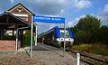 A train at Barenton-Bugny Railway Station


Notable People linked to the commune edit
- René Blondelle, Senator for Aisne and one of the largest postwar farmers in Barenton-Bugny.
See also edit
References edit
- ^ "Répertoire national des élus: les maires". data.gouv.fr, Plateforme ouverte des données publiques françaises (in French). 2 December 2020.
- ^ "Populations légales 2021". The National Institute of Statistics and Economic Studies. 28 December 2023.
- ^ a b c Google Maps
- ^ List of Mayors of France (in French)
- ^ Population en historique depuis 1968, INSEE
- ^ Ministry of Culture, Mérimée PA00115517 Church of Saint Martin (in French)
External links edit
- Barenton-Bugny on the old IGN website (in French)
- Bell Towers website (in French)
- 40000 Bell Towers website (in French)
- Barenton-Bugny on Géoportail, National Geographic Institute (IGN) website (in French)
- Baranton Bugny on the 1750 Cassini Map