


Summary
Baryatinsky District (Russian: Барятинский райо́н) is an administrative[1] and municipal[6] district (raion), one of the twenty-four in Kaluga Oblast, Russia. It is located in the west of the oblast. The area of the district is 1,110.3 square kilometers (428.7 sq mi).[3] Its administrative center is the rural locality (a selo) of Baryatino.[8] Population: 5,383 (2021 Census);[9] 6,340 (2010 Census);[4] 6,614 (2002 Census);[10] 8,097 (1989 Census).[11] The population of Baryatino accounts for 43.3% of the district's total population.[4][2]
Baryatinsky District
Барятинский район | |
|---|---|
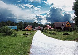 Kitezh Community for Foster Children, Baryatinsky District | |
 Flag  Coat of arms | |
 Location of Baryatinsky District in Kaluga Oblast | |
| Coordinates: 54°43′28″N 36°50′12″E / 54.72444°N 36.83667°E | |
| Country | Russia |
| Federal subject | Kaluga Oblast[1] |
| Established | 1 October 1929 |
| Administrative center | Baryatino[2] |
| Area | |
| • Total | 1,110.3 km2 (428.7 sq mi) |
| Population | |
| • Total | 6,340 |
| • Estimate (2018)[5] | 6,032 (−4.9%) |
| • Density | 5.7/km2 (15/sq mi) |
| • Urban | 0% |
| • Rural | 100% |
| Administrative structure | |
| • Inhabited localities | 103 rural localities |
| Municipal structure | |
| • Municipally incorporated as | Baryatinsky Municipal District[6] |
| • Municipal divisions[6] | 0 urban settlements, 5 rural settlements |
| Time zone | UTC+3 (MSK |
| OKTMO ID | 29604000 |
| Website | http://baryatino40.ru/ |
Geography edit
Baryatinsky District is located in the western region of Kaluga Oblast, on the Baryatinsky-Suhinichskoy plain.[3] Most of the district is on karst terrain, with plains covering most of the south, and ridges up to 279 meters in the north on the border with Smolensk Oblast. About 40 percent of the region is deciduous forest (birch, aspen, spruce, pine). The divide between the Dnieper River basin and the Volga River basin runs through the district, with rivers in the south of the district flowing south to the Dnieper. The district is 100 km west of the city of Kaluga, and about 240 km southwest of Moscow The area measures 40 km (north-south), and 40 km (west-east). The administrative center is the town of Baryatino.[3]
The district is bordered on the north by Mosalsky District, on the east by Sukhinichsky District, on the south by Kirovsky District, and on the west by Spas-Demensky District. A small portion borders Smolensk Oblast on the north.
References edit
Notes edit
- ^ a b Charter of Kaluga Oblast
- ^ a b "Our District". Official website: Baryatinsky District. Baryatinsky District. Retrieved 17 November 2016.
- ^ a b c d "Baryatinsky District - About the Area". Kaluga. Legislative Assembly of Kaluga Region. Retrieved 17 November 2016.
- ^ a b c Russian Federal State Statistics Service (2011). Всероссийская перепись населения 2010 года. Том 1 [2010 All-Russian Population Census, vol. 1]. Всероссийская перепись населения 2010 года [2010 All-Russia Population Census] (in Russian). Federal State Statistics Service.
- ^ "26. Численность постоянного населения Российской Федерации по муниципальным образованиям на 1 января 2018 года". Federal State Statistics Service. Retrieved 23 January 2019.
- ^ a b c Law #354-OZ
- ^ "Об исчислении времени". Официальный интернет-портал правовой информации (in Russian). 3 June 2011. Retrieved 19 January 2019.
- ^ "General Information" (in Russian). Baryatinsky District. Retrieved August 31, 2016.
- ^ Russian Federal State Statistics Service. Всероссийская перепись населения 2020 года. Том 1 [2020 All-Russian Population Census, vol. 1] (XLS) (in Russian). Federal State Statistics Service.
- ^ Russian Federal State Statistics Service (21 May 2004). Численность населения России, субъектов Российской Федерации в составе федеральных округов, районов, городских поселений, сельских населённых пунктов – районных центров и сельских населённых пунктов с населением 3 тысячи и более человек [Population of Russia, Its Federal Districts, Federal Subjects, Districts, Urban Localities, Rural Localities—Administrative Centers, and Rural Localities with Population of Over 3,000] (XLS). Всероссийская перепись населения 2002 года [All-Russia Population Census of 2002] (in Russian).
- ^ Всесоюзная перепись населения 1989 г. Численность наличного населения союзных и автономных республик, автономных областей и округов, краёв, областей, районов, городских поселений и сёл-райцентров [All Union Population Census of 1989: Present Population of Union and Autonomous Republics, Autonomous Oblasts and Okrugs, Krais, Oblasts, Districts, Urban Settlements, and Villages Serving as District Administrative Centers]. Всесоюзная перепись населения 1989 года [All-Union Population Census of 1989] (in Russian). Институт демографии Национального исследовательского университета: Высшая школа экономики [Institute of Demography at the National Research University: Higher School of Economics]. 1989 – via Demoscope Weekly.
Sources edit
- Законодательное Собрание Калужской области. №473 27 марта 1996 г. «Устав Калужской области», в ред. Закона №681-ОЗ от 27 февраля 2015 г. «О внесении изменений в Устав Калужской области». Опубликован: "Весть", №79, 9 апреля 1996 г. (Legislative Assembly of Kaluga Oblast. #473 March 27, 1996 Charter of Kaluga Oblast, as amended by the Law #681-OZ of February 27, 2015 On Amending the Charter of Kaluga Oblast. ).
- Законодательное Собрание Калужской области. Закон №354-ОЗ от 4 октября 2004 г. «Об установлении границ муниципальных образований, расположенных на территории административно-территориальных единиц "Барятинский район", "Куйбышевский район", "Людиновский район", "Мещовский район", "Спас-Деменский район", "Ульяновский район" и наделении их статусом городского поселения, сельского поселения, муниципального района», в ред. Закона №694-ОЗ от 27 февраля 2015 г. «О внесении изменений в Закон Калужской области "Об установлении границ муниципальных образований, расположенных на территории административно-территориальных единиц "Барятинский район", "Куйбышевский район", "Людиновский район", "Мещовский район", "Спас-Деменский район", "Ульяновский район" и наделении их статусом городского поселения, сельского поселения, муниципального района"». Вступил в силу после вступления в силу Закона Калужской области "Об изменении статуса посёлков, расположенных на территории административно-территориальных единиц "Барятинский район", "Куйбышевский район", "Людиновский район", "Мещовский район", "Спас-Деменский район", "Ульяновский район" Калужской области", но не ранее чем через десять дней после официального опубликования. Опубликован: "Весть", №229–300, 9 октября 2004 г. (Legislative Assembly of Kaluga Oblast. Law #354-OZ of October 4, 2004 On Establishing the Borders of the Municipal Formations Located on the Territory of the Administrative-Territorial Units of "Baryatinsky District", "Kuybyshevsky District", "Lyudinovsky District", "Meshchovsky District", "Spas-Demensky District", "Ulyanovsky District", and on Granting Them the Status of an Urban Settlement, Rural Settlement, Municipal District, as amended by the Law #694-OZ of February 27, 2015 On Amending the Law of Kaluga Oblast "On Establishing the Borders of the Municipal Formations Located on the Territory of the Administrative-Territorial Units of "Baryatinsky District", "Kuybyshevsky District", "Lyudinovsky District", "Meshchovsky District", "Spas-Demensky District", "Ulyanovsky District", and on Granting Them the Status of an Urban Settlement, Rural Settlement, Municipal District". Effective as of after the Law of Kaluga Oblast "On Changing the Status of the Settlements Located on the Territory of the Administrative-Territorial Units of "Baryatinsky District", "Kuybyshevsky District", "Lyudinovsky District", "Meshchovsky District", "Spas-Demensky District", "Ulyanovsky District" of Kaluga Oblast" takes effect, but no earlier than after ten days since the official publication have passed.).
External links edit
- Baryatinsky District on Google Maps
- Baryatinsky District on OpenStreetMap