


Summary
Basel SBB railway station (German: Bahnhof Basel SBB, or in earlier times Centralbahnhof or Schweizer Bahnhof) is the central railway station in the city of Basel, Switzerland. Opened in 1854, and completely rebuilt in 1900–1907, it is Europe's busiest international border station. Basel SBB is owned by the Swiss Federal Railways (SBB CFF FFS). The other major railway station is Basel Badischer Bahnhof, operated by the German railway company Deutsche Bahn, on the north side of the Rhine from the city centre.
Basel SBB Bâle CFF | |
|---|---|
| Central pass-through railway station | |
 Main north entrance | |
| General information | |
| Location | Centralbahnplatz Basel Switzerland |
| Coordinates | 47°32′49″N 7°35′24″E / 47.54694°N 7.59000°E |
| Elevation | 276 m (906 ft) |
| Owned by | Swiss Federal Railways |
| Line(s) | |
| Platforms | 9 |
| Tracks | 22 (German: Gleise: 12 pass-through (3 non-stop), 7 SBB terminal, 3 SNCF terminal) |
| Connections |
|
| Construction | |
| Structure type | At-grade |
| Architect |
|
| Other information | |
| Fare zone | |
| Website | Bahnhof Basel SBB |
| History | |
| Opened | 19 December 1854 |
| Rebuilt |
|
| Previous names |
|
| Key dates | |
| 1902-03 | Demolition of the first non-wooden station |
| 1902-07 | Provisional railway station in place |
| Passengers | |
| 2018 | 111,000 per working day[4] |
| Location | |
 | |
Trains operated by SBB CFF FFS use Basel SBB to link Basel with destinations within Switzerland and Italy, as do Deutsche Bahn Intercity-Express (ICE) trains to and from Germany, Zürich and Interlaken, most SNCF TGV trains to and from Paris, and some regional trains to and from Alsace. Additionally, the station is served by three lines of the Basel S-Bahn.
The 1907 neo-baroque station building is a heritage site of national significance.[5] It also contains Bâle SNCF (shown in SBB CFF FFS online timetables as Basel SBB Gl. 30–35, and in other online timetables as Basel SNCF), which is located through a border crossing and is used by other trains to and from France. Directly outside the station building is the Centralbahnplatz, which is a major hub of the Basel tramway network, and the Basel terminus of a direct bus service to the EuroAirport.
Location edit
The station area is situated at the southern side of the city centre, in an elongated area between the Zoological Garden to the west and the Brüglinger Ebene to the east.
The borders of four of Basel's districts come together at the station area. However, the area is, according to the Statistical Office, divided between only two districts: the station itself is located in Gundeldingen, while most of the tracks on the eastern side of the station (including the goods station), along with the Centralbahnplatz in front of the station (including the BIS Tower), are attributed to the St. Alban quarter.
The Elisabethenanlage in front of the Centralbahnplatz belongs to Vorstädte, while the Markthalle opposite Basel SNCF is part of the Am Ring district.
History edit
Beginnings edit
The first railway to reach Basel, the Chemin de fer Strasbourg Bâle (StB; Strasbourg Basel Railway), arrived there in 1844. The following year, 1845, the Elsässerbahn (Alsatian Railway) built the first station in the Basel metropolitan area, within the city walls. Basel thereby became the first Swiss city to be connected to the new means of transport.[6]
After the arrival of the railway, there was a passionate debate in Basel about the pros and cons of the railway and its possible continuation towards Lucerne and from there through the Gotthard towards Italy.[6]
Meanwhile, the Rheintalbahn from Mannheim and Karlsruhe also approached Basel from the north; in 1851 it reached Haltingen (a district of Weil am Rhein), on the Swiss border.
In 1853, the Schweizerische Centralbahn railway company (SCB) was founded in Basel. Its purpose was the establishment of a link between the city of Basel and the economic centres of the Mittelland cantons, and perhaps even also the expansion of the transport corridor from Lucerne to the Gotthard.
The Viaduktstrasse in Basel – including the Birsig Viaduct, which is adjacent to the Zoo Basel parking lot – was also the formation of the Elsässerbahn until 1902. Today, the viaduct serves tram lines 1 and 8, as well as motor vehicle traffic, and a plaque on the bridge railing recalls its earlier role as a rail bridge.
Provisional station edit
In 1854, construction on the future Hauenstein railway line began. Right up until the opening of the first section of the route from Basel to Liestal, the controversial question of the site and design of the Basel railway station remained unresolved.
However, to accommodate the commencement of railway operations on 19 December 1854, the Centralbahn built a simple temporary timber structure, according to plans developed by chief architect Ludwig Maring. By the opening day, all of the temporary station buildings had been completed, including a timber train shed.
This modest provisional station, equipped with makeshift facilities, was made up of individual detached buildings and was used only for just under six years. The station site consisted of the station building, a goods shed, a carriage and locomotive shed and a turntable at the railhead. As the station building stood on the northeastern side of the station, alongside the station yard, the station was not configured as a terminus.
The provisional station served only as the starting point of the SCB lines, and had no connection with either the French station or the Badischer Bahnhof, which was opened in 1855 as the terminus of the Rheintalbahn.
Centralbahnhof edit
On 29 June 1857, the Grand Council of Basel-Stadt agreed to the construction of a link between the French line and the Centralbahn and the erection of a through station in the field in front of the Elisabethen-Bollwerk. The city bore the cost of the land purchase.
At the start of 1859, the SCB began construction work on the site of the new station, to a design by Maring. In addition to a passenger station, the new station yard featured a goods station relocated to the Gundeldingen district, and two new locomotive sheds, one of them for the SCB, and the other for the Chemins de fer de l'Est, which had taken over the StB in 1854.
On 4 June 1860, railway operations began at the new Basel Centralbahnhof. However, it was not until May 1861 that all the new facilities were completed.
The Centralbahnhof was a joint station, with the northern facade of its station building facing the newly created Centralbahnplatz. On each side of the station building were the boarding halls, each with two tracks – on the eastern side for the Swiss trains and on the western side and for the French trains. To the south of the station building were the goods shed and two large warehouses, with an access road from the Güterstrasse.
In subsequent years, modifications were made to the Centralbahnhof to enable it to deal with its substantially increasing traffic, including trains entering and leaving Basel along a number of new lines:
- The connecting line between Basel Badischer Bahnhof and the Centralbahnhof, which was handed over to traffic on 3 November 1873.
- The Bözberg railway line, which was opened on 2 August 1875; built by the Bötzberg Railway, a joint venture of the SCB and the Schweizerische Nordostbahn, it linked Basel with Zürich via Pratteln and Rheinfelden.
- The Jura Railway, which, from 25 September 1875, formed a connection from Basel into western Switzerland and the Franche Comté, via its junction at Delémont and branches to Biel/Bienne and Delle, respectively.
However, the Centralbahnhof eventually ran out of capacity to handle any further additional traffic.
In 1875, as a first measure of relief, the marshalling of freight trains was relocated to a makeshift yard to the east of the station, on an open field known as "auf dem Wolf". At around that time, discussions began with the aim of lowering the tracks and replacing the troublesome urban level crossings on the Elsässerbahn and at the Centralbahnhof. In 1874, provisional timber pedestrian bridges had already been built at Margarethenstrasse und Heumattstrasse; they were later replaced by iron structures. From 1879, the Pfeffingerstrasse passed underneath the station in a tunnel near the present location of the Peter Merian Bridge.
Finally, in 1898, following the referendum on the nationalisation of Switzerland's railways, the Swiss Federal Council decided to go ahead with the following:
- construction of a new Centralbahnhof on the existing site;
- lowering of the whole station area by 2.7 metres (8 ft 10 in);
- relocation of the Elsässerbahn to a cutting, in a wide arc around the city;
- relocation of the entire freight and warehouse facility to the provisional marshalling yard at "auf den Wolf".
Provisional new Centralbahnhof edit
The definitive project for a new Centralbahnhof in Basel was developed in 1899. On 16 March 1900, the Federal Council gave approval to the plans.
The lowering of the whole station area and the access lines required careful planning. The first step was the relocation of goods traffic to the Wolf station, and on 12 May 1901 the Alsace line was reopened in its new lower position and wide arc.
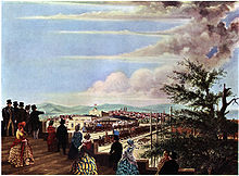
On the vacated, lowered, area south of the original Centralbahnhof, the provisional station was built, and on 2 June 1902 it went into operation.
Access to the provisional station was also from the south, via Güterstrasse. To facilitate access, various streets were extended, as were two tram lines. The provisional station remained in operation until 24 June 1907. The provisional facilities and access roads were then dismantled and the two tram lines laid into Güterstrasse. A station underpass to Gundeldingen was built roughly in the location of the provisional access road.
In 1902–1903, the old station was torn down.
Basel SBB station edit
In 1902, the Schweizerische Centralbahn was absorbed by the newly formed Swiss Federal Railways (SBB CFF FFS). The new station, which from then onwards was referred to as Schweizer Bundesbahnhof or Basel SBB, was one of the new Federal Railways' first large building projects. Designed by Emil Faesch and Emmanuel La Roche, the new station was inaugurated on 24 June 1907.

The Basel SBB station building is characterized by its extraordinary length: Basel SNCF, with its customs facility for the international transit traffic, is "attached" to its western side. The asymmetrical layout of the station creates an external appearance representative of the federal buildings of the time. The station building is aligned to the centre line of the Centralbahnplatz, and features a huge glazed tudor arch window between two clock towers under curved domes.

Behind the facade, one might suspect a terminus, but that is not the case in Basel. Through the entrances in the clock towers, travellers reach the ticket hall under a timber-lined steel-arch structure. Like the rest of the interior, the ticket hall is broad and high. Large murals dating from the 1920s advertise tourist destinations in Switzerland. The ticket and currency exchange offices are embedded in the side wall. The baggage check-in and hand luggage storage facilities were formerly also located here, but today they are in the basement, and accessed by means of an escalator and stairs.

In the eastern part of the station, the baggage claim was formerly to be found where the travel centre is now located. The first/second class restaurants (now Migros) and the third class facility (now a brasserie/kiosk) were in the north west wing. The station was previously known for its station buffets, but these were gradually closed down in the 1990s. The high rooms, their walls decorated with murals, now house other commercial uses together with the sole remaining specialty restaurant.
A separate entrance, on the Centralbahnstrasse west of the Centralbahnplatz, leads to the Alsace-bound trains at Basel SNCF.

Initially, the platform allocation at Basel SBB corresponded to the private railway age, because the platforms were separated according to the direction of travel. The station originally had 10 tracks, of which the three bay platforms 1 to 3 were previously reserved for local traffic. Tracks 1 to 10 are spanned by a five aisle train shed, which was created in 1905 by Albert Buss & Cie. of Pratteln in Basel. The train shed is 93 m (305 ft) wide, and has a length of 120 m (390 ft) (tracks 1/2), 230 m (750 ft) (tracks 3/4) and 200 m (660 ft) (tracks 5–10). Track 4 goes through to Basel SNCF, where it becomes track 30 and the catenary can be switched from the Swiss operating current of 15 kV 16.7 Hz AC to its French equivalent, 25 kV 50 Hz AC.
On the southern side of the station, a double track line, located at a lower level, connects the Basel and Muttenz marshalling yards with the line to France, and is devoted mainly to through freight trains.

Due to the lowering of the tracks at the time of rebuilding, it was difficult to extend the station with additional tracks. On the South side, the platform system has nevertheless been augmented several times: tracks 11 and 12 have been added, the pedestrian underpass has been extended to Gundeldingen, and, in 2003, the new Passerelle was constructed to the new tracks 14 and 15. These changes, together with the introduction of a clock-face timetable in 1982 and the Rail 2000 project, achieved an increase in the station's capacity. Finally, in June 2008, the new tracks 16 and 17 went into operation.
The Passerelle is an element of the new SBB CFF FFS commercial concept known as RailCity. Designed by architects Cruz and Ortiz, it runs over the tracks from the ticket hall at the western end of the train shed to the district of Gundeldingen, and links the platforms with each other. A walkway with shopping opportunities, it is 185 m (607 ft) long, 30 m (98 ft) wide, and replaced the pedestrian underpass. Today, the former underpass is used for operational and logistical purposes.
With the construction of the Passerelle, the RailCenter and the information display were relocated from the ticket hall to the former luggage hall. Additionally, the 1987-built customer service ticket pavilion in the ticket hall was removed, and since then the ticket hall has been able to unfold its ambience to its fullest extent.
Meanwhile, in 1998 and 1999, a new signal box was constructed on behalf of the SBB CFF FFS. The architects of this striking building were Herzog & de Meuron.
Connections edit
Overview edit

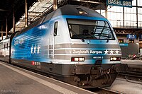
About 1,000 trains depart from the station daily. Nearly every 90 seconds, a passenger train leaves or stops at the station. Additionally, freight trains still use the through tracks, and post office trains enter and exit the underground postal station.
International long-distance trains edit
An ICE departs from Basel SBB every hour to Berlin or Hamburg and a number of other German cities. There is also a daily ICE International connection to Amsterdam. Several times a day, EuroCitys run to Milan, and TGVs to Paris. Night connections exist with Berlin, and Hamburg. There used to be a direct connection to Moscow but as of 2014 this has been discontinued.
National long-distance trains edit
Several times hourly, InterCity trains run to Zürich HB, Bern and Olten. At least hourly, Zürich–Chur, Olten–Lucerne–Bellinzona–Lugano, Olten–Bern–Interlaken/Visp–Brig, and Delémont–Biel/Bienne–Neuchâtel–Lausanne/Geneva can be reached.
Trinational regional trains edit
As a border station, Basel SBB is also aligned with regional services to Germany, France, and Switzerland. The Basel Regional S-Bahn network ranges from Frick/Laufenburg in the east, Olten in the south, and Porrentruy in the west to Mulhouse in the north west and Zell im Wiesental in the north east.
Services edit

As of the December 2022 timetable change,[update] the following services stop at Basel SBB:[7]
- TGV Lyria / InterCity: half-hourly service to Zürich Hauptbahnhof, service every two hours or better to Chur, and every two hours to Paris-Lyon.
- Intercity Express:
- service every two hours to Cologne Hauptbahnhof.
- two round-trips per day between Hamburg-Altona and Chur.
- EuroCity / InterCity / ICE: half-hourly service to Spiez. Most northbound trains terminate in Basel; a single EuroCity continues to Hamburg-Altona, another to Frankfurt (Main) Hauptbahnhof, and two ICEs continue to Berlin Ostbahnhof. Most southbound trains continue to Interlaken Ost; one train every two hours continues to Brig. Four EuroCity trains continue from Brig to Milano Centrale.
- EuroCity / InterCity / InterRegio: hourly service to Bellinzona and every two hours to Locarno or Lugano; two trains per day continue from Lugano to Milano Centrale.
- Nightjet: overnight service between Zürich Hauptbahnhof and Berlin Hauptbahnhof or Hamburg Hauptbahnhof.
- InterCity:
- hourly service to Biel/Bienne.
- InterRegio:
- three trains per hour to Zürich Hauptbahnhof and hourly service to Zürich Airport.
- hourly service to Lucerne.
- Transport express régional (TER): half-hourly service to Strasbourg-Ville and Mulhouse-Ville in addition to some omnibus trains to Mulhouse-Ville.
- Basel trinational S-Bahn:
- S1: half-hourly service to Stein-Säckingen and hourly service from there to Frick or Laufenburg.
- S3: half-hourly service between Olten and Laufen and hourly service from Laufen to Porrentruy.
- S6: half-hourly service to Zell (Wiesental).
Trams edit
- 1: Dreirosenbrücke – Bahnhof St. Johann Basel – Kannenfeldplatz – Schützenhaus – Bahnhof SBB/SNCF (– Kunstmuseum – Messeplatz – Bad. Bahnhof Basel)
- 2: Binningen Kronenplatz – Margarethen – Bahnhof SBB/SNCF – Kunstmuseum – Messeplatz – Bad. Bahnhof Basel – Eglisee (– Riehen)
- 8: Neuweilerstrasse – Schützenhaus – Bahnhof SBB/SNCF – Aeschenplatz – Barfüsserplatz – Schifflände – Claraplatz – Feldbergstrasse – Kleinhüningen – Weil am Rhein (D)
- 10: Dornach Bahnhof – Arlesheim Dorf – Münchenstein Dorf – Neue Welt – Dreispitz – Bahnhof SBB/SNCF – Aeschenplatz – Theater – Zoo – Binningen Schloss – Bottmingen – Therwil – Ettingen – Witterswil – Bättwil – Flüh (– Leymen (F) – Rodersdorf) (longest tramway line of Europe)
- 11: Aesch Dorf – Reinach Dorf – Gartenstadt Münchenstein – Dreispitz – Bahnhof SBB/SNCF – Aeschenplatz – Barfüsserplatz – Schifflände – Volteplatz – St. Louis Grenze
- 16: Bruderholz – Jakobsberg – Heiliggeistkirche – Bahnhof SBB/SNCF Bahnhofeingang Gundeldingen – Heuwaage – Barfüsserplatz – Schifflände
Buses edit
Buses at Basel SBB serve the station on Centralbahnhofstrasse:[8]
- 30 Bahnhof SBB/SNCF – Spalentor – UKBB – Feldbergstrasse – Bad. Bahnhof Basel (– Wettsteinallee – Tinguely Museum – Hoffmann La Roche – Wettsteinallee – Bad. Bahnhof Basel)
- 42 Bahnhof SBB/SNCF – Tinguely Museum – (Hoffmann La Roche –) Wettsteinallee – Bahnhof Niederholz – Bettingen Dorf
- 48 Bahnhof SBB/SNCF – Schützenhaus – Gartenstrasse– Bachgraben
- 50 Bahnhof SBB/SNCF – Brausebad – Kannenfeldplatz – EuroAirport
In popular culture edit
The station entrance and a platform is seen in the film The Cassandra Crossing (1976) which passes as the "Geneva railway station".[9]
See also edit
References edit
Notes edit
Citations edit
- ^ "Liniennetz: Basel und Umgebung" (PDF). Tarifverbund Nordwestschweiz. 13 December 2020. Retrieved 9 January 2021.
- ^ "RVL Tarifzonenplan" (in German). Regio Verkehrsverbund Lörrach. Retrieved 9 January 2021.
- ^ "Zonen- und Linienplan" (PDF) (in German). Tarifverbund Nordwestschweiz. 13 December 2020. Retrieved 9 January 2021.
- ^ "Passagierfrequenz (2018)". Berne, Switzerland: SBB CFF FFS. 7 October 2019. Retrieved 2019-11-06 – via data.sbb.ch – SBB DATA PORTAL.
- ^ Swiss inventory of cultural property of national and regional significance (1995), p. 79.
- ^ a b Burckhardt, Paul (1942). Geschichte der Stadt Basel von der Zeit der Reformation bis zur Gegenwart. Basel: Helbing & Lichtenhahn. p. 263.
- ^ "Abfahrt: Bahnhof Basel SBB" (PDF) (in German). Swiss Federal Railways. 11 December 2022. Retrieved 11 December 2022.
- ^ Swiss Federal Railways (December 2023). "Basel SBB" (PDF) (in German). Retrieved 13 January 2024.
- ^ "Travelling in Switzerland." myswissalps.com. Retrieved 3 February 2012.
Further reading edit
- Huber, Dorothee (2004). Bahnhof Basel SBB [Basel SBB Railway Station]. Schweizerische Kunstführer, Serie 76, Nr. 754 (in German). Bern: Gesellschaft für Schweizerische Kunstgeschichte. ISBN 3-85782-754-8.
- Kunz, Fritz (1990). Der Bahnhof Europas [Europe's Railway Station]. Basler Schriften, 29 (in German) (2nd ed.). Basel: Pharos-Verlag, H. Schwabe. ISBN 3723002218.
- Scholz, Roland W.; Krütli, Pius; Bügl, Robert; Loukopoulos, Peter; Bösch, Sandro (2005). Bahnhöfe in der Stadt Basel: Nachhaltige Bahnhofs- und Stadtentwicklung in der trinationalen Agglomeration [Railway Stations in the City of Basel: sustainable station and urban development in the tri-national agglomeration]. UNS-Fallstudie (in German). Zürich: Rüegger. ISBN 978-3-7253-0831-6.
- Stutz, Werner (1983). Bahnhöfe der Schweiz: Von den Anfangen bis zum Ersten Weltkrieg [The Railway Stations of Switzerland: from the beginning to World War I] (in German) (revised ed.). Zürich: Orell Füssli. ISBN 3-280-01405-0.
External links edit
- Basel SBB railway station – SBB
- Interactive station plan (Basel SBB)
- Station plan (Basel SBB) (PDF, 1.9 MB)