


Summary
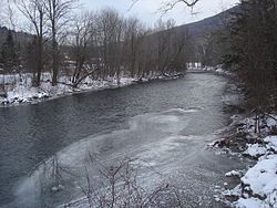
The Batten Kill, Battenkill, or Battenkill River is a 59.4-mile-long (95.6 km)[1] river rising in Vermont that flows into New York and is a tributary of the Hudson River. It is the longest Hudson tributary on that river's east. As "kill" means a creek, the name "Battenkill River" is pleonastic.[2]
| Batten Kill Battenkill River | |
|---|---|
 | |
 Batten Kill and tributaries | |
| Native name | Dionoondehowee |
| Location | |
| Country | United States |
| State | Vermont, New York |
| County | Bennington, Washington |
| Physical characteristics | |
| Source | |
| • location | East Dorset, Bennington County, Vermont; Green Mountains, Taconic Mountains |
| • coordinates | 43°14′53″N 73°00′16″W / 43.24806°N 73.00444°W |
| Mouth | Hudson River |
• location | Easton, New York |
• coordinates | 43°06′34″N 73°34′30″W / 43.10944°N 73.57500°W |
• elevation | 82 ft (25 m) |
| Length | 59 mi (95 km) |
| Basin size | 407 sq mi (1,050 km2) |
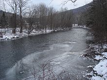
The mouth of the Batten Kill is in Easton, New York, and the source of the river is in East Dorset, Vermont.
The river is known for its fishing, as it has a prominent trout population. The Shushan Covered Bridge crosses it at one point, and the headquarters of the Orvis Corporation are also located along its course.
The Batten Kill valley is home to the Tour of the Battenkill, the largest road cycling race in North America.[citation needed]
The Native American name for the river is either Dionoondehowee[3] or Ondawa.[4]
Tributaries edit
- Mad Tom Brook
- Bourn Brook
- Lye Brook
- Mill Brook
- Warm Brook
- Green River
- Camden Creek
- Black Creek
- Whittaker Brook
- Hartshorn Brook
Course edit
The Batten Kill rises in East Dorset, Vermont, and flows south, with Mad Tom Brook soon joining it from the southern slope of Mount Tabor. It flows in a southwesterly direction to Arlington and then in a westerly direction, entering New York. The river continues west, forming the boundary between the towns of Jackson and Salem, turning north at the hamlet of Shushan. Turning west again at Greenwich Junction, the river becomes the boundary between Jackson and the town of Greenwich, passing the hamlets of East Greenwich, Battenville and Center Falls before reaching the village of Greenwich. The Batten Kill continues as the boundary between Greenwich and the town of Easton, past the hamlet of Middle Falls and ends at the Hudson River, at a point one mile (1.6 km) north of Schuylerville.
From source to mouth following the major windings, the river measures 59.4 miles (95.6 km). The length of the river in Vermont is approximately 28 miles (45 km).[1]
Watershed edit
The Vermont portion of the Batten Kill watershed drains much of the northern portion of Bennington County and includes an area of approximately 200 square miles (520 km2). The New York portion of the watershed covers 207 square miles (540 km2).
The Vermont portion of the Batten Kill watershed is mountainous, steep and heavily forested. The tributaries are, for the most part, wooded, steep and narrow. National Forest Service land in this watershed is almost 44,000 acres (180 km2). The average yearly rainfall over the entire basin area is 42.9 inches (1,090 mm). The following river and tributary descriptions for the Vermont portion of the basin were taken in part from the United States Geological Survey publication Surface Waters of Vermont.
Mad Tom Brook rises on the southern slope of Mount Tabor in the northwestern part of the town of Peru at an altitude of 2,900 feet (880 m) above sea level. It flows southward and south-westward to East Dorset where it joins the beginning of the Batten Kill from the north. Its length is about 5.5 miles (8.9 km), and its fall is about 2,100 feet (640 m).
The West Branch rises on the northern slope of Bear Mountain in the southeastern part of the town of Rupert at an altitude of about 2,500 feet (760 m) above sea level. It flows eastward about 2 miles (3.2 km), then turns and flows southeastward to near Manchester Center. The West Branch has a length of about 9 miles (14 km) and a fall of 1,800 feet (550 m), of which 1,600 feet (490 m) occurs in the first 2 miles (3.2 km).
Bourn Brook rises in Bourn Pond in the northeastern part of the town of Sunderland at an altitude of 2,500 feet (760 m) above sea level. It flows somewhat east of north for about 2 miles (3.2 km) and then takes a northwesterly course to its junction with the Batten Kill half a mile south of Manchester Center. Its length is about 6 miles (9.7 km) and fall about 1,800 feet (550 m) of which 1,300 feet (400 m) of drop occurs within 1.5 miles (2.4 km) in the middle of its course.
Lye Brook rises in Lye Brook Meadows in the northeastern part of Sunderland at an elevation of 2,640 feet (800 m) above sea level. It flows in a northerly direction about 5 miles (8.0 km), then turns abruptly and flows southwestward to its junction with the Batten Kill. Its length is 6.2 miles (10.0 km), and its fall is 1,900 feet (580 m), of which 1,800 feet (550 m) occurs in the northward flowing stretch.
Mill Brook rises near the center of Sunderland at an altitude of 2,550 feet (780 m) above sea level and flows southwestward, westward and northwestward to its junction with the Batten Kill at Sunderland. Its length is approximately 4.5 miles (7.2 km) and its fall about 1,920 feet (590 m), of which 1,600 feet (490 m) occurs within 2.5 miles (4.0 km) of the head of the stream.[5]
The Green River flows generally southward from its source, west of Manchester, passing through Sandgate, 814 feet (248 m) above sea level and winding to its junction with the Batten Kill on the south side of State Route 313 at West Arlington.
Camden Creek flows south to southwest from its source, just east of the New York state line, near West Sandgate. A little less than one mile south of its source, it is joined by Terry Brook, which flows in from the east. The creek runs south-southwest through the Camden Valley, crossing into Washington County, New York. It is joined by West Camden Creek from the north about one quarter mile from its junction with the Batten Kill on the north side of NY State Route 313, east of the hamlet of Shushan.
Covered bridges edit
The Batten Kill is crossed by four covered bridges, three of which are still in use today: West Arlington Bridge, Vermont (1852), Eagleville Bridge, New York (1858), Shushan Covered Bridge, New York (1858–1962), and Rexleigh Covered Bridge, New York (1874). The Shushan Covered Bridge is now a seasonal museum.
Agriculture edit
- Sheldon Farms (1845)
Battle of Saratoga edit
The Batten Kill was supposed to be a fallback point for the British General Burgoyne's forces, but was never used and thus did not play a significant role in the battle.[6]
See also edit
References edit
- ^ a b U.S. Geological Survey. National Hydrography Dataset high-resolution flowline data. The National Map Archived 2012-03-29 at the Wayback Machine, accessed October 3, 2011
- ^ "Kill – definition and More from the Free Merriam-Webster Dictionary". Retrieved 2013-08-25.
- ^ Vasiliev, Ren. From Abbotts to Zurich: New York State Placenames. Syracuse, NY: Syracuse University Press, 2004.
- ^ Meeks, Harold A. Time and Change in Vermont, A Human Geography. Chester, Connecticut, The Globe Pequot Press, 1986. ".. mainly a historical geography, but with a modern component..arranged by subject and time rather than by geographic regions." p77
- ^ Basin 1 - Batten Kill, Walloomsac River & Hoosic River Watersheds, Water Quality and Aquatic Habitat Assessment Report, August 2002 Archived August 29, 2007, at the Wayback Machine
- ^ "The Battle of Saratoga". Worcester Polytechnic Institute Department of Military Science. Worcester Polytechnic Institute. Retrieved 16 November 2011.
External links edit
- "Batten Kill". Geographic Names Information System. United States Geological Survey, United States Department of the Interior. Retrieved 2009-05-04.
- Fly fishing the Battenkill River, at FlyfishingConnection
- Batten Kill River — Trout Fishing Profile, at GORP
- The Batten Kill Watershed Alliance