


Summary
The Bay of Mecklenburg (German: Mecklenburger Bucht or Mecklenburgische Bucht; Danish: Mecklenburg Bugt), also known as the Mecklenburg Bay or Mecklenburg Bight, is a long narrow basin making up the southwestern finger-like arm of the Baltic Sea, between the shores of Germany to the south and the Danish islands of Lolland, Falster, and Møn to the north, the shores of Jutland to the west, and joining the largest part of the Baltic to the east.
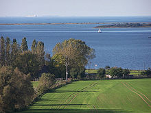

The Bay of Mecklenburg, which includes the Bay of Wismar and the Bay of Lübeck, connects to the Bay of Kiel in the northwest. Notable ports in the bay are Lübeck, Rostock and Wismar.
The Blinkerwall edit
In 2024, a 971-metre (3,186 ft) wall was discovered on the seabed at a depth of 21 metres (69 ft), 10 kilometres (6 mi) off the coast. Named "the Blinkerwall" by its discoverers, the wall is around 1 metre (3 ft) high. Its direction changes when it meets a series of larger boulders (too heavy to be moved by humans). This suggests that the smaller stones were positioned intentionally to link them together. In total, the wall's stones weigh more than 142 tonnes. It is thought to be Europe's oldest megastructure (around 10,000 years old) and may have been used by hunter-gatherers as a driving lane for pursuit of herds of reindeer.[1][2]
The wall was constructed on land (perhaps beside a lake shore) in the period after the Weichselian glaciation, when the southern Baltic area was above ground. In the millennia following this, post-glacial rebound caused the land to sink, and the waters of the Baltic inundated the site.[2] This process preserves some Stone Age artifacts, which are more likely to have been erased had they remained above water.[2] Stone age structures have also been discovered in the inundated lands west of Denmark, the area known as Doggerland.
See also edit
References edit
- ^ Sample, Ian (12 February 2024). "Stone age wall found at bottom of Baltic Sea 'may be Europe's oldest megastructure'". The Guardian. ISSN 0261-3077. Archived from the original on 12 February 2024. Retrieved 12 February 2024.
- ^ a b c Geersen, Jacob; Bradtmöller, Marcel; Schneider von Deimling, Jens; Feldens, Peter; Auer, Jens; Held, Philipp; Lohrberg, Arne; Supka, Ruth; Hoffmann, Jasper Justus Lutz; Eriksen, Berit Valentin; Rabbel, Wolfgang; Karlsen, Hans-Jörg; Krastel, Sebastian; Brandt, David; Heuskin, David (2024-02-20). "A submerged Stone Age hunting architecture from the Western Baltic Sea". Proceedings of the National Academy of Sciences. 121 (8). doi:10.1073/pnas.2312008121. ISSN 0027-8424. PMC 10895374.
External links edit
![]() Media related to Bay of Mecklenburg at Wikimedia Commons
Media related to Bay of Mecklenburg at Wikimedia Commons
54°20′N 11°40′E / 54.333°N 11.667°E