
KNOWPIA
WELCOME TO KNOWPIA

Bellicourt 
Summary
Bellicourt (French pronunciation: [bɛlikuʁ]) is a commune in the department of Aisne in Hauts-de-France in northern France. It lies on the N44 road between Cambrai and Saint-Quentin and over the principal tunnel of the St. Quentin Canal. It was the site of numerous intense combat actions and battles during World War I.
Bellicourt | |
|---|---|
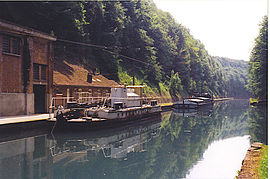 St. Quentin Canal | |
Location of Bellicourt .mw-parser-output .locmap .od{position:absolute}.mw-parser-output .locmap .id{position:absolute;line-height:0}.mw-parser-output .locmap .l0{font-size:0;position:absolute}.mw-parser-output .locmap .pv{line-height:110%;position:absolute;text-align:center}.mw-parser-output .locmap .pl{line-height:110%;position:absolute;top:-0.75em;text-align:right}.mw-parser-output .locmap .pr{line-height:110%;position:absolute;top:-0.75em;text-align:left}.mw-parser-output .locmap .pv>div{display:inline;padding:1px}.mw-parser-output .locmap .pl>div{display:inline;padding:1px;float:right}.mw-parser-output .locmap .pr>div{display:inline;padding:1px;float:left}html.skin-theme-clientpref-night .mw-parser-output .od,html.skin-theme-clientpref-night .mw-parser-output .od .pv>div,html.skin-theme-clientpref-night .mw-parser-output .od .pl>div,html.skin-theme-clientpref-night .mw-parser-output .od .pr>div{background:#000;color:#fff}html.skin-theme-clientpref-night .mw-parser-output .locmap{filter:grayscale(0.6)}@media(prefers-color-scheme:dark){html.skin-theme-clientpref-os .mw-parser-output .locmap{filter:grayscale(0.6)}html.skin-theme-clientpref-os .mw-parser-output .od,html.skin-theme-clientpref-os .mw-parser-output .od .pv>div,html.skin-theme-clientpref-os .mw-parser-output .od .pl>div,html.skin-theme-clientpref-os .mw-parser-output .od .pr>div{background:#000;color:#fff}}  Bellicourt  Bellicourt | |
| Coordinates: 49°57′42″N 3°14′12″E / 49.9617°N 3.2367°E | |
| Country | France |
| Region | Hauts-de-France |
| Department | Aisne |
| Arrondissement | Saint-Quentin |
| Canton | Bohain-en-Vermandois |
| Intercommunality | Pays du Vermandois |
| Government | |
| • Mayor (2020–2026) | Marcel Leclère[1] |
| Area 1 | 9.77 km2 (3.77 sq mi) |
| Population (2021)[2] | 574 |
| • Density | 59/km2 (150/sq mi) |
| Time zone | UTC+01:00 (CET) |
| • Summer (DST) | UTC+02:00 (CEST) |
| INSEE/Postal code | 02065 /02420 |
| Elevation | 94–194 m (308–636 ft) (avg. 132 m or 433 ft) |
| 1 French Land Register data, which excludes lakes, ponds, glaciers > 1 km2 (0.386 sq mi or 247 acres) and river estuaries. | |
Population edit
| Year | Pop. | ±% p.a. |
|---|---|---|
| 1968 | 624 | — |
| 1975 | 607 | −0.39% |
| 1982 | 640 | +0.76% |
| 1990 | 664 | +0.46% |
| 1999 | 680 | +0.26% |
| 2007 | 644 | −0.68% |
| 2012 | 632 | −0.38% |
| 2017 | 602 | −0.97% |
| Source: INSEE[3] | ||
See also edit
References edit
- ^ "Répertoire national des élus: les maires". data.gouv.fr, Plateforme ouverte des données publiques françaises (in French). 2 December 2020.
- ^ "Populations légales 2021". The National Institute of Statistics and Economic Studies. 28 December 2023.
- ^ Population en historique depuis 1968, INSEE
Wikimedia Commons has media related to Bellicourt.