


Summary
Belushya Guba (Russian: Белу́шья Губа́, lit. beluga whale bay), also Belushye (Белушье),[8] is a work settlement and the administrative center of Novaya Zemlya District of Arkhangelsk Oblast, Russia, located on the Gusinaya Zemlya peninsula of the Yuzhny Island of the Novaya Zemlya arctic archipelago.[2] Its population was reported as 1,972 (2010 Census),[4] a decline of more than 20% from 2,622 (2002 Census).[9] It is the largest settlement on the island.
Belushya Guba
Бeлyшья Гyбa | |
|---|---|
Work settlement[1] | |
 Belushya Guba shown on a map of Novaya Zemlya | |
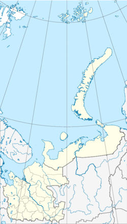
Location of Belushya Guba  | |
 Belushya Guba Location of Belushya Guba  Belushya Guba Belushya Guba (Russia) | |
| Coordinates: 71°32′44″N 52°19′13″E / 71.54556°N 52.32028°E | |
| Country | Russia |
| Federal subject | Arkhangelsk Oblast |
| Administrative district | Novaya Zemlya District[2] |
| Founded | 1897[3] |
| Urban-type settlement status since | March 2005[1] |
| Elevation | 7 m (23 ft) |
| Population | |
| • Total | 1,972 |
| • Urban okrug | Novaya Zemlya Urban Okrug[5] |
| Time zone | UTC+3 (MSK |
| Postal code(s)[7] | 163055 |
| OKTMO ID | 11712000051 |
| Year | Pop. | ±% |
|---|---|---|
| 2002 | 2,622 | — |
| 2010 | 1,972 | −24.8% |
| 2021 | 1,972 | +0.0% |
| Source: Census data | ||
It is the main permanent settlement of the island territory of Novaya Zemlya. A large proportion of its population is made up of military personnel associated with the nuclear test sites located on the island.
The whole Novaya Zemlya archipelago, including Belushya Guba, is an area of restricted access (formally, as part of border security zone), and a special permit is needed to visit the archipelago.
About 9 kilometers (5.6 mi) northeast of Belushya Guba is the settlement of Rogachevo, the second largest in the archipelago, along with the Rogachevo air base.
History edit
Upon visiting Novaya Zemlya in 1894, Arkhangelsk Governor Aleksandr Engelgardt decided to create a new encampment. In 1896, an expedition conducted a survey of the west coast of Novaya Zemlya. The following year Belushya Guba was founded.[3]
During World War II, Belushya Guba was a focus of both German and Soviet attention. German U-boats used Belushya Bay as a resting area in 1941. The German military contemplated establishing a weather station or other land-based facilities nearby, but increasing Soviet military presence in the area prevented that. On July 27, 1942, German submarine U-601 shelled Malye Karmakuly near Belushia Bay, damaging seaplanes, living huts, and storage huts. U-601 torpedoed and sank the Soviet merchant ship Krestianin, carrying coal, as it neared Belushya Guba. On August 19, U-209 tried to enter Belushya Guba, but was detected and attacked by a motor boat and two Soviet minesweepers. U-209 departed when a Soviet coast guard ship and icebreaker SKR-18 (formerly Fedor Litke) approached from Belushuya Guba. Belushya Guba was used as an anchorage by Russian convoys between the Barents Sea and Archangelsk. A Soviet naval base was established in Belushya Guba in 1944.[10]
The settlement started to flourish in 1954, when Novaya Zemlya became established as a nuclear test site. In 1956, the whole indigenous population of Novaya Zemlya, mostly Nenets, were evicted from the islands and then resettled.
Geography and climate edit

Belushya Guba is located on a deep bay with the same name, within a geographical area that is influenced by warm ocean currents. The natural conditions allow year-round sailing of all types and classes of vessels with minimal cost for icebreaking support. The bay is well protected from high surf and drifting ice.[11]
The temperature in Belushya Guba ranges from −12 °C (10 °F) to +10 °C (50 °F) in the summer months.[citation needed]
The area of the southern island of Novaya Zemlya experiences from eight to ten cyclones per month during the winter, with the main direction of the cyclone trajectories from the west and south-west to north-east.[12] The "midnight sun" is above the horizon from 10 May to 3 August (86 days), and the period of continuous night is slightly shorter at 66 days. The polar night runs from 19 November to 23 January.[citation needed]
Economy edit
Belushya Guba has schools, apartment buildings, three hotels, a cashpoint ATM, a television station, a 200-bed Naval Hospital, a polyclinic, military officers' center with a base sailor's club, 25-meter pool, recreational center, and an Orthodox church.[13]
Transportation edit
There are two regular flights weekly from Arkhangelsk to Rogachevo Airport, located 9 kilometres (5.6 mi) north-east of the settlement (in the time-tables, Rogachyovo is designated as Amderma-2, though the settlement of Amderma is not even located on Novaya Zemlya).[14] There is no regular passenger navigation.
References edit
- ^ a b Архангельское областное Собрание депутатов. Постановление №69 от 3 марта 2005 г. «О преобразовании сельского населённого пункта Белушья Губа архипелага Новая Земля Архангельской области». Вступил в силу со дня официального опубликования. (Arkhangelsk Oblast Assembly of Deputies. Resolution #69 of March 3, 2005 On the Transformation of the Rural Locality of Belushya Guba of the Novaya Zemlya Archipelago of Arkhangelsk Oblast. Effective as of the day of the official publication.).
- ^ a b c Государственный комитет Российской Федерации по статистике. Комитет Российской Федерации по стандартизации, метрологии и сертификации. №ОК 019-95 1 января 1997 г. «Общероссийский классификатор объектов административно-территориального деления. Код 11 243 551 003», в ред. изменения №278/2015 от 1 января 2016 г.. (State Statistics Committee of the Russian Federation. Committee of the Russian Federation on Standardization, Metrology, and Certification. #OK 019-95 January 1, 1997 Russian Classification of Objects of Administrative Division (OKATO). Code 11 243 551 003, as amended by the Amendment #278/2015 of January 1, 2016. ).
- ^ a b "Белушья Губа". Архангельская область. arhangelskobl.ru. Archived from the original on June 22, 2011. Retrieved April 5, 2011.
- ^ a b Russian Federal State Statistics Service (2011). Всероссийская перепись населения 2010 года. Том 1 [2010 All-Russian Population Census, vol. 1]. Всероссийская перепись населения 2010 года [2010 All-Russia Population Census] (in Russian). Federal State Statistics Service.
- ^ Архангельское областное Собрание депутатов. Областной закон №258-внеоч.-ОЗ от 23 сентября 2004 г. «О статусе и границах территорий муниципальных образований в Архангельской области», в ред. Областного закона №224-13-ОЗ от 16 декабря 2014 г. «Об упразднении отдельных населённых пунктов Соловецкого района Архангельской области и о внесении изменения в статью 46 Областного закона "О статусе и границах территорий муниципальных образований в Архангельской области"». Вступил в силу со дня официального опубликования. Опубликован: "Волна", №38, 8 октября 2004 г. (Arkhangelsk Oblast Council of Deputies. Oblast Law #258-vneoch.-OZ of September 23, 2004 On the Status and Borders of the Territories of the Municipal Formations in Arkhangelsk Oblast, as amended by the Oblast Law #224-13-OZ of December 16, 2014 On Abolishing Several Inhabited Localities in Solovetsky District of Arkhangelsk Oblast and on Amending Article 46 of the Oblast Law "On the Status and Borders of the Territories of the Municipal Formations in Arkhangelsk Oblast". Effective as of the day of the official publication.).
- ^ "Об исчислении времени". Официальный интернет-портал правовой информации (in Russian). June 3, 2011. Retrieved January 19, 2019.
- ^ Почта России. Информационно-вычислительный центр ОАСУ РПО. (Russian Post). Поиск объектов почтовой связи (Postal Objects Search) (in Russian)
- ^ "Belushye: Russia". Geographical Names. National Geospatial-Intelligence Agency via Geographic.org. Retrieved April 4, 2011.
- ^ Russian Federal State Statistics Service (May 21, 2004). Численность населения России, субъектов Российской Федерации в составе федеральных округов, районов, городских поселений, сельских населённых пунктов – районных центров и сельских населённых пунктов с населением 3 тысячи и более человек [Population of Russia, Its Federal Districts, Federal Subjects, Districts, Urban Localities, Rural Localities—Administrative Centers, and Rural Localities with Population of Over 3,000] (XLS). Всероссийская перепись населения 2002 года [All-Russia Population Census of 2002] (in Russian).
- ^ "Operation Wunderland, August 1942". www.allworldwars.com. Retrieved August 28, 2018.
- ^ Каким должен быть морской порт?
- ^ "Климат Новой Земли". www.belushka.narod.ru. Retrieved August 28, 2018.
- ^ "Ядерный полигон и новейшая история Новой земли". www.belushka.narod.ru. Retrieved August 28, 2018.
- ^ Табло аэропорта Талаги. Отправление. (in Russian). Yandex. Retrieved August 16, 2011.