
KNOWPIA
WELCOME TO KNOWPIA

Bertincourt 
Summary
Bertincourt (French pronunciation: [bɛʁtɛ̃kuʁ]) is a commune in the Pas-de-Calais department in the Hauts-de-France region in northern France.[3]
Bertincourt | |
|---|---|
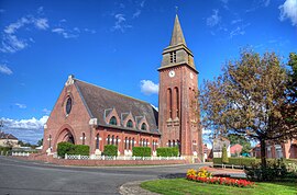 The church of Bertincourt | |
 Coat of arms | |
Location of Bertincourt .mw-parser-output .locmap .od{position:absolute}.mw-parser-output .locmap .id{position:absolute;line-height:0}.mw-parser-output .locmap .l0{font-size:0;position:absolute}.mw-parser-output .locmap .pv{line-height:110%;position:absolute;text-align:center}.mw-parser-output .locmap .pl{line-height:110%;position:absolute;top:-0.75em;text-align:right}.mw-parser-output .locmap .pr{line-height:110%;position:absolute;top:-0.75em;text-align:left}.mw-parser-output .locmap .pv>div{display:inline;padding:1px}.mw-parser-output .locmap .pl>div{display:inline;padding:1px;float:right}.mw-parser-output .locmap .pr>div{display:inline;padding:1px;float:left}html.skin-theme-clientpref-night .mw-parser-output .od,html.skin-theme-clientpref-night .mw-parser-output .od .pv>div,html.skin-theme-clientpref-night .mw-parser-output .od .pl>div,html.skin-theme-clientpref-night .mw-parser-output .od .pr>div{background:#000;color:#fff}html.skin-theme-clientpref-night .mw-parser-output .locmap{filter:grayscale(0.6)}@media(prefers-color-scheme:dark){html.skin-theme-clientpref-os .mw-parser-output .locmap{filter:grayscale(0.6)}html.skin-theme-clientpref-os .mw-parser-output .od,html.skin-theme-clientpref-os .mw-parser-output .od .pv>div,html.skin-theme-clientpref-os .mw-parser-output .od .pl>div,html.skin-theme-clientpref-os .mw-parser-output .od .pr>div{background:#000;color:#fff}}  Bertincourt  Bertincourt | |
| Coordinates: 50°05′11″N 2°58′52″E / 50.0864°N 2.9811°E | |
| Country | France |
| Region | Hauts-de-France |
| Department | Pas-de-Calais |
| Arrondissement | Arras |
| Canton | Bapaume |
| Intercommunality | CC du Sud-Artois |
| Government | |
| • Mayor (2020–2026) | Bernard Bronniart[1] |
| Area 1 | 7.58 km2 (2.93 sq mi) |
| Population (2021)[2] | 915 |
| • Density | 120/km2 (310/sq mi) |
| Time zone | UTC+01:00 (CET) |
| • Summer (DST) | UTC+02:00 (CEST) |
| INSEE/Postal code | 62117 /62124 |
| Elevation | 92–133 m (302–436 ft) (avg. 126 m or 413 ft) |
| 1 French Land Register data, which excludes lakes, ponds, glaciers > 1 km2 (0.386 sq mi or 247 acres) and river estuaries. | |
Geography edit
Bertincourt is a farming village located 22 miles (36 km) southeast of Arras at the junction of the D7, D18 and D19 roads.
Population edit
| Year | Pop. | ±% p.a. |
|---|---|---|
| 1968 | 836 | — |
| 1975 | 841 | +0.09% |
| 1982 | 856 | +0.25% |
| 1990 | 821 | −0.52% |
| 1999 | 886 | +0.85% |
| 2009 | 946 | +0.66% |
| 2014 | 928 | −0.38% |
| 2020 | 913 | −0.27% |
| Source: INSEE[4] | ||
Sights edit
- The church of Notre-Dame, rebuilt, like most of the village, after the ravages of World War I.
- The World War I cemetery.
See also edit
References edit
- ^ "Répertoire national des élus: les maires". data.gouv.fr, Plateforme ouverte des données publiques françaises (in French). 2 December 2020.
- ^ "Populations légales 2021". The National Institute of Statistics and Economic Studies. 28 December 2023.
- ^ INSEE commune file
- ^ Population en historique depuis 1968, INSEE
External links edit
Wikimedia Commons has media related to Bertincourt.
- Bertincourt CWGC cemetery